Category:Maps of Avon, England
Jump to navigation
Jump to search
Subcategories
This category has the following 2 subcategories, out of 2 total.
Media in category "Maps of Avon, England"
The following 9 files are in this category, out of 9 total.
-
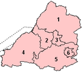 Avon 1974 Numbered.png 200 × 175; 4 KB
-
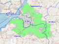 Avon Green Belt.svg 2,601 × 1,951; 5.39 MB
-
 Avon UK constituency map (blank).svg 1,425 × 1,241; 1.13 MB
-
 Avon UK district map (blank).svg 1,425 × 1,241; 1,003 KB
-
 Avon UK parish map (blank).svg 1,425 × 1,241; 1.91 MB
-
 Avon UK ward map (blank).svg 1,425 × 1,241; 1.85 MB
-
 Bristol UK ward map 2024.svg 799 × 897; 386 KB
-
 EnglandAvon.png 200 × 247; 24 KB
-
 EnglandPoliceAvonSomerset.png 2,165 × 2,670; 88 KB


.svg)
.svg)
.svg)
.svg)