Category:Maps of Arles-sur-Tech
Jump to navigation
Jump to search
Wikimedia category | |||||
| Upload media | |||||
| Instance of | |||||
|---|---|---|---|---|---|
| Category combines topics | |||||
| Arles-sur-Tech | |||||
commune in Pyrénées-Orientales, France  .svg)  | |||||
| Instance of | |||||
| Location | |||||
| Head of government |
| ||||
| Population |
| ||||
| Area |
| ||||
| official website | |||||
 | |||||
Subcategories
This category has the following 4 subcategories, out of 4 total.
E
T
Media in category "Maps of Arles-sur-Tech"
The following 11 files are in this category, out of 11 total.
-
 66009 in dept66.svg 1,000 × 547; 83 KB
-
 66009-Arles-sur-Tech-argile.png 4,076 × 3,307; 7.93 MB
-
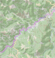
 66009-Arles-sur-Tech-Routes-Hydro.png 3,507 × 2,480; 990 KB
-
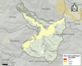
 66009-Arles-sur-Tech-Sols.png 3,270 × 2,598; 2.32 MB
-
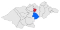
 Arles-sur-Tech location map.png 699 × 740; 1.08 MB
-
 Arles-sur-Tech OSM 01.png 533 × 587; 257 KB
-
 Els Banys d'Arles sol 01.png 483 × 244; 26 KB
-
 Els Banys d'Arles sol 02.png 483 × 244; 24 KB
-
 Els Banys d'Arles sol 03.png 483 × 244; 24 KB
-
 Localització d'Arles respecte del Vallespir.svg 483 × 244; 138 KB
-
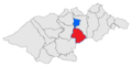
 Map commune FR insee code 66009.png 756 × 605; 57 KB


