Category:Maps of Anglo-Saxon England
Jump to navigation
Jump to search
English: See also Category:Maps of the history of Denmark for related migratory origins.
Media in category "Maps of Anglo-Saxon England"
The following 200 files are in this category, out of 260 total.
(previous page) (next page)-

-
 AA EastEngla.jpg 1,033 × 867; 326 KB
-
 AADerenRice.jpg 1,152 × 1,160; 460 KB
-
 AALindisfaran.jpg 650 × 734; 168 KB
-
 Aelfgifu-will-map.jpg 1,158 × 797; 142 KB
-
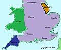
 Aethelflaed map.jpg 2,338 × 1,700; 1.11 MB
-
 Aethelwold of East Anglia map.svg 659 × 843; 936 KB
-
 Aldfrith bishoprics and monasteries.png 528 × 384; 126 KB
-
 All Heptarchie 800.png 544 × 711; 19 KB
-
 Angelrucu 800 gear on russlendisc.svg 672 × 1,190; 65 KB
-
 Angelsaksiske-jarldommer de.svg 398 × 475; 14 KB
-
 Angelsaksiske-jarldommer.jpg 1,000 × 1,191; 137 KB
-
 Angelsaksiske-jarldommer.svg 398 × 475; 15 KB
-
 Angleterre 871.png 377 × 335; 27 KB
-
 Angleterre 886.png 377 × 334; 27 KB
-
 Angleterre 897.png 377 × 350; 25 KB
-
 Anglia w roku878.svg 874 × 1,142; 1.31 MB
-
 Anglo saxon jute 575ad.jpg 960 × 720; 74 KB
-
 Anglo-Saxon burhs.svg 942 × 680; 423 KB
-
 Anglo-Saxon England 2.svg 900 × 1,100; 574 KB
-
 Anglo-Saxon Homelands and Settlements ar.png 3,500 × 3,500; 2.32 MB
-
 Anglo-Saxon Homelands and Settlements Blank.png 3,500 × 3,500; 2.11 MB
-
 Anglo-Saxon Homelands and Settlements.svg 2,000 × 2,000; 2.06 MB
-
 Anglo-Saxon Wessex.svg 2,899 × 1,497; 1.62 MB
-
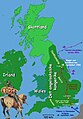
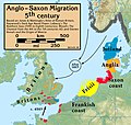 Anglo.Saxon.migration.5th.cen.jpg 1,800 × 1,703; 875 KB
-
 AS kingdoms.svg 659 × 843; 657 KB
-
 ASC 905.svg 924 × 630; 1.44 MB
-
 ASC.svg 990 × 1,043; 1.6 MB
-
 Asser map.svg 1,210 × 586; 1.42 MB
-
 Battle of Hastings map.jpg 535 × 768; 114 KB
-
 Beonna coins map.svg 540 × 620; 417 KB
-
 Britain 802 de.svg 759 × 842; 158 KB
-
 Britain 802 es.svg 759 × 842; 710 KB
-
 Britain 802.jpg 1,241 × 1,755; 456 KB
-
 Britain 802.pdf 1,239 × 1,754; 73 KB
-
 Britain 886.jpg 1,241 × 1,755; 474 KB
-
 Britain peoples circa 600 de.svg 578 × 772; 1.78 MB
-
 Britain peoples circa 600 ru.svg 994 × 1,233; 1.32 MB
-
 Britain peoples circa 600 zh-hans.svg 994 × 1,233; 1.33 MB
-
 Britain peoples circa 600-es.svg 994 × 1,233; 3.44 MB
-
 Britain peoples circa 600-fr.svg 994 × 1,233; 1.45 MB
-
 Britain peoples circa 600-hu.svg 994 × 1,233; 1.65 MB
-
 Britain peoples circa 600-ko.svg 994 × 1,233; 1.33 MB
-
 Britain peoples circa 600-pt.svg 994 × 1,233; 1.33 MB
-
 Britain peoples circa 600-v2-es.svg 994 × 1,233; 338 KB
-
 Britain peoples circa 600.png 944 × 1,104; 60 KB
-
 Britain peoples circa 600.svg 994 × 1,233; 1.88 MB
-
 Britain.5th.cen.AS.cemeteries.jpg 2,982 × 3,302; 918 KB
-
 Britain.Anglo.Saxon.homelands.settlements.400.500.jpg 2,100 × 2,369; 783 KB
-
 Britain.circa.540.jpg 2,046 × 2,814; 675 KB
-
 Britain.early.6th.century.nascent.kingdoms.jpg 2,292 × 2,777; 896 KB
-
 British 7th Century.png 1,000 × 1,320; 1.59 MB
-
 British Isles 10th century-es.svg 990 × 1,569; 1.78 MB
-
 British Isles 10th century.svg 990 × 1,569; 1.78 MB
-
 British kingdoms c 800-es.svg 1,141 × 2,000; 144 KB
-
 British kingdoms c 800-fr.svg 672 × 1,190; 197 KB
-
 British kingdoms c 800-pt.svg 672 × 1,190; 205 KB
-
 British kingdoms c 800.png 1,000 × 1,320; 1.59 MB
-
 British kingdoms c 800.svg 672 × 1,190; 279 KB
-
 British seventh century kingdoms-es.svg 1,042 × 1,364; 2.23 MB
-
 British seventh century kingdoms-pt.svg 976 × 1,279; 1.32 MB
-
 British seventh century kingdoms.svg 976 × 1,279; 1.59 MB
-
 Brytania 400-500.svg 700 × 794; 1.03 MB
-
 CantawareD.jpg 1,013 × 779; 214 KB
-
 Canute.PNG 1,295 × 801; 41 KB
-
 Carte anglo-sax 800.gif 637 × 670; 80 KB
-
 Ceawlin map.png 605 × 419; 89 KB
-
 Coenwulf map.png 1,116 × 884; 521 KB
-
 Coenwulf.svg 952 × 712; 1.8 MB
-
 Danelaw 889.png 393 × 224; 5 KB
-
 Deal -55.gif 644 × 550; 43 KB
-
 Dialekty języka staroangielskiego.png 720 × 960; 122 KB
-
 Eadwald coins.svg 547 × 616; 1.12 MB
-
 Ealdred map-fr.svg 962 × 1,113; 1.39 MB
-
 Eardwulf locations.gif 643 × 858; 270 KB
-
 Earldoms of Anglo-Saxon England (hy).png 785 × 939; 77 KB
-
 Earldoms of Anglo-Saxon England-es.svg 398 × 475; 52 KB
-
 Earldoms of Anglo-Saxon England-pt.svg 398 × 475; 17 KB
-
 Earldoms of Anglo-Saxon England.svg 398 × 475; 17 KB
-
 Eastengla rice on Pendan ylde.svg 645 × 645; 313 KB
-
 Eastseaxna.jpg 1,364 × 888; 446 KB
-
 Egbert of Wessex map.jpg 702 × 733; 136 KB
-
 England 878 de.svg 988 × 1,229; 1.63 MB
-
 England 878 hu.svg 988 × 1,229; 1.36 MB
-
 England 878 pl.svg 988 × 1,229; 1.55 MB
-
 England 878-cy.svg 988 × 1,229; 1.38 MB
-
 England 878-es.svg 988 × 1,229; 337 KB
-
 England 878-fr.svg 988 × 1,229; 1.43 MB
-
 England 878-nl.svg 988 × 1,229; 1.53 MB
-
 England 878.svg 988 × 1,229; 1.54 MB
-
 England Aethelred 910 EN.svg 1,000 × 1,328; 1.7 MB
-
 England diocese map Offa.svg 957 × 787; 390 KB
-
 England diocese map post 950.svg 962 × 1,113; 1.92 MB
-
 England diocese map pre-925.svg 942 × 1,096; 1.95 MB
-
 England Great Army map de.svg 998 × 1,114; 548 KB
-
 England Great Army map.svg 998 × 1,114; 776 KB
-
 England green top 2.svg 960 × 1,204; 1.6 MB
-
 England green top 4.svg 574 × 897; 1.6 MB
-
 England green top-es.svg 963 × 1,210; 376 KB
-
 England green top-pt.svg 963 × 1,210; 1.33 MB
-
 England green top-ru.svg 1,069 × 1,419; 1.33 MB
-
 England Grosses Heer 865.jpg 848 × 868; 144 KB
-
 England Grosses Heer 865.png 848 × 868; 711 KB
-
 England Grosses Heer 892.jpg 848 × 868; 146 KB
-
 England-878ad.jpg 735 × 935; 127 KB
-
 English kingdoms 600 - 2.png 651 × 897; 372 KB
-
 English kingdoms 600.png 651 × 897; 255 KB
-
 English kingdoms.svg 678 × 845; 434 KB
-
 Eroberung des Danelags.jpg 848 × 868; 165 KB
-
 Essex 2.svg 1,420 × 975; 748 KB
-
 Essex Heptarchie 800.png 544 × 711; 14 KB
-
 Est-Anglie Heptarchie 800.png 544 × 711; 14 KB
-
 Europe in 814AD.png 1,218 × 888; 115 KB
-
 Great Heathen Army-es.svg 551 × 551; 454 KB
-
 Great Heathen Army-fr.svg 551 × 551; 172 KB
-
 Great Heathen Army-pt.svg 551 × 551; 496 KB
-
 GreatBritain802.png 323 × 480; 31 KB
-
 Heptarchie 800.png 544 × 711; 15 KB
-
 Heptarchy Blank.png 1,104 × 1,138; 484 KB
-
 Heptarchy He.png 1,725 × 1,779; 1.29 MB
-
 Heptarchy with capitals.png 586 × 608; 141 KB
-
 HeptarquiaEssex-es.svg 991 × 820; 200 KB
-
 HeptarquiaEstanglia-es.svg 991 × 820; 191 KB
-
 HeptarquiaEstanglia.jpg 414 × 339; 17 KB
-
 HeptarquiaKent-es.svg 991 × 820; 191 KB
-
 HeptarquiaLindsey.jpg 414 × 339; 17 KB
-
 HeptarquiaSussex-es.svg 991 × 820; 191 KB
-
 Hwicce kingdom (estimate).svg 79 × 66; 68 KB
-
 Hwicce kingdom.png 397 × 485; 19 KB
-
 Hwicce-es.svg 1,638 × 2,000; 122 KB
-
 Hwicce.gif 371 × 464; 7 KB
-
 Hwicce.svg 595 × 729; 171 KB
-
 Illas Britanicas (vèrs la fin dau sègle IX).png 801 × 956; 244 KB
-
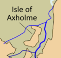 Isle of Axholme cropped.png 213 × 205; 21 KB
-
 Itinerary of Æthelstan-fr.svg 898 × 410; 1.33 MB
-
 Kart Slagene ved Hasting&Stamford-bro.jpg 696 × 1,000; 466 KB
-
 Kent Heptarchie 800.png 544 × 711; 14 KB
-
 KentAtTheComingOfTheSaxons.svg 385 × 306; 4.13 MB
-
 Kingdom of Bernicia 550.png 393 × 224; 5 KB
-
 Kingdom of Deira 550.png 393 × 224; 5 KB
-
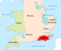
 Kingdom of East Anglia 803.png 393 × 224; 5 KB
-
 Kingdom of Essex 803.png 393 × 224; 5 KB
-
 Kingdom of Kent 803.png 393 × 224; 5 KB
-
 Kingdom of Kent.svg 1,295 × 976; 6.6 MB
-
 Kingdom of Mercia 803.png 393 × 224; 5 KB
-
 Kingdom of Mercia-es.svg 1,198 × 1,287; 155 KB
-
 Kingdom of Mercia-pt.svg 1,198 × 1,287; 137 KB
-
 Kingdom of Mercia.png 1,278 × 1,373; 124 KB
-
 Kingdom of Northumbria 803.png 393 × 224; 5 KB
-
 Kingdom of Northumbria in AD 802.jpg 784 × 968; 130 KB
-
 Kingdom of Northumbria.png 347 × 348; 63 KB
-
 Kingdom of Sussex 803.png 393 × 224; 5 KB
-
 Kingdom of Wessex 803.png 393 × 224; 5 KB
-
 Kingdom of Wessex Map c.879.png 1,985 × 1,686; 153 KB
-
 Kingdoms in England and Wales about 600 AD ru.svg 1,001 × 1,331; 1.33 MB
-
 Kingdoms in England and Wales about 600 AD.svg 963 × 1,210; 1.94 MB
-
 Knutrike.png 1,295 × 801; 37 KB
-
 Lindsey.svg 928 × 874; 449 KB
-
 Ludy Brytanii ok. 600.svg 994 × 1,233; 1.47 MB
-
 Magonsaetan 2.svg 665 × 872; 919 KB
-
 Map Caedwalla-fr.svg 946 × 372; 1.32 MB
-
 Map Coenwulf-fr.svg 952 × 712; 1.72 MB
-
 Map Eadred-fr.svg 960 × 1,304; 1.32 MB
-
 Map Eadwig-fr.svg 960 × 1,304; 1.32 MB
-
 Map Eardwulf-fr.svg 658 × 686; 1.31 MB
-
 Map Eardwulf-pt.svg 658 × 686; 1.31 MB
-
 Map Edgar-fr.svg 960 × 1,304; 1.33 MB
-
 Map Edmund I-fr.svg 929 × 793; 1.33 MB
-
 Map Edward the Martyr-fr.svg 929 × 793; 1.32 MB
-
 Map Edwin of Northumbria-fr.svg 963 × 1,210; 1.42 MB
-
 Map Egbert of Wessex-fr.svg 952 × 712; 1.32 MB
-
 Map Egbert of Wessex.svg 952 × 712; 1.32 MB
-
 Map Ina of Wessex-fr.svg 946 × 372; 1.32 MB
-
 Map Ina of Wessex-pt.svg 946 × 372; 1.32 MB
-
 Map of England under Æthelstan-fr.svg 960 × 1,304; 1.33 MB
-

-
 Map of the Kingdom of Northumbria around 700 AD ang.svg 586 × 594; 800 KB
-
 Map of the Kingdom of Northumbria around 700 AD-es.svg 586 × 594; 338 KB
-
 Map of the Kingdom of Northumbria around 700 AD.svg 586 × 594; 800 KB
-
 Map of the Location of the Kingdom of Northumbria.png 518 × 614; 22 KB
-
 Map of Wessex in 879.png 988 × 1,229; 115 KB
-
 Map of Wessex in 900.png 723 × 899; 67 KB
-
 Map of Wessex in 945.png 988 × 1,229; 115 KB
-
 Map Offa-fr.svg 494 × 313; 1.32 MB
-
 Map Olaf Guthfrithson-es.svg 1,109 × 771; 2.13 MB
-
 Map Olaf Guthfrithson-fr.svg 1,109 × 771; 2.02 MB
-
 Map Siward-fr.svg 963 × 1,210; 1.32 MB
-
 Map Wiglaf of Mercia-fr.svg 952 × 712; 1.31 MB
-
 Map Wilfrid.svg 963 × 1,210; 1.43 MB
-
 Map Wulfhere of Mercia-fr.svg 952 × 712; 1.32 MB
-
 Map Æthelbald of Wessex-fr.svg 946 × 372; 1.31 MB
-
 Map Æthelberht of Wessex-fr.svg 946 × 372; 1.32 MB
-
 Map Æthelred of Mercia-fr.svg 952 × 712; 1.32 MB
-
 Map Æthelred of Wessex-fr.svg 946 × 372; 1.32 MB
-
 Map-Craven-Wapentakes 1000.png 705 × 548; 92 KB
-
 Mappa Eptarchia Anglosassone.png 544 × 711; 64 KB
-
 Mercia map.svg 1,945 × 2,115; 1.87 MB
-
 Mercian Supremacy x 4 alt-es.svg 991 × 820; 286 KB
-
 Mercian Supremacy x 4-es.svg 2,108 × 1,746; 439 KB
-
 Mercian Supremacy x 4.svg 2,108 × 1,746; 606 KB
.jpg)


.png)


.svg)


.png)


