Category:Maps of Anduze
Jump to navigation
Jump to search
Wikimedia category | |||||
| Upload media | |||||
| Instance of | |||||
|---|---|---|---|---|---|
| Category combines topics | |||||
| Anduze | |||||
commune in Gard, France  .svg)  | |||||
| Instance of | |||||
| Location |
| ||||
| Located in or next to body of water | |||||
| Head of government |
| ||||
| Population |
| ||||
| Area |
| ||||
| Elevation above sea level |
| ||||
| official website | |||||
 | |||||
Media in category "Maps of Anduze"
The following 12 files are in this category, out of 12 total.
-
 30010-Anduze-argile.png 3,057 × 2,480; 4.53 MB
-
 30010-Anduze-Natura2000.png 5,846 × 4,133; 8.56 MB
-
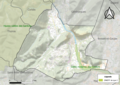
 30010-Anduze-Routes-Hydro.png 3,507 × 2,480; 2.56 MB
-
 30010-Anduze-Sols.png 3,270 × 2,598; 2.53 MB
-
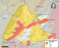
 30010-Anduze-ZNIEFF1.png 3,057 × 2,480; 5.52 MB
-
 30010-Anduze-ZNIEFF2.png 3,519 × 2,480; 6.14 MB
-
 Anduze 1657 Zeiller 15226.jpg 2,192 × 1,664; 2.46 MB
-
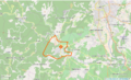 Anduze Limite communale.png 957 × 579; 324 KB
-
 Gouvernement d'Anduze and Sauve - btv1b10661149k.jpg 2,142 × 1,588; 573 KB
-
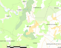 Map commune FR insee code 30010.png 756 × 605; 54 KB
-
 Map of the fortifications of Anduze dept. du Gard BWB 22.tiff 2,271 × 1,806; 11.74 MB
-
 Vue d'Anduze, Gravure par Tassin 1634.jpg 4,736 × 3,424; 5.41 MB


