Category:Maps of Amazon Basin
Jump to navigation
Jump to search
Wikimedia category | |||||
| Upload media | |||||
| Instance of | |||||
|---|---|---|---|---|---|
| Category combines topics | |||||
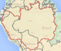
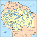
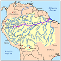
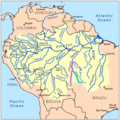
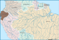
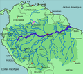
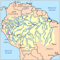
| Amazon basin | |||||
drainage basin in South America drained via the Amazon River into the Atlantic Ocean  Амазонська низовина  | |||||
| Instance of | |||||
| Part of | |||||
| Named after | |||||
| Located in or next to body of water | |||||
| Area |
| ||||
| Drainage basin | |||||
| Basin country |
| ||||
| Different from | |||||
 | |||||
Media in category "Maps of Amazon Basin"
The following 71 files are in this category, out of 71 total.
-
 MapaPerú.Sanson2.JPG 2,044 × 1,512; 2.77 MB
-
 177 of 'Les Artères du globe ... Illustré de ... gravures et cartes' (11193647786).jpg 1,740 × 1,780; 541 KB
-

-
 4 Amazon River 4.png 549 × 460; 320 KB
-
 A Putumayo folyó térképe.png 999 × 1,001; 506 KB
-

-

-

-
 Acrerivermap.png 1,000 × 1,000; 537 KB
-
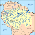
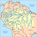
 Amazon basin.png 434 × 366; 120 KB
-
 Amazon River (PSF).png 2,787 × 1,921; 1.37 MB
-
 Amazon.png 1,061 × 787; 957 KB
-
 Amazona baseno.png 300 × 253; 8 KB
-
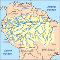
 Amazonas medence.png 868 × 732; 229 KB
-
 Amazonase jõgikond.png 1,500 × 1,500; 843 KB
-
 Amazonia basin.jpg 1,456 × 940; 254 KB
-
 Amazonin allas.png 6,633 × 5,154; 7.34 MB
-
 Amazonriverbasin basemap.png 1,473 × 1,475; 917 KB
-
 Amazonrivermap.png 1,000 × 1,000; 551 KB
-
 Amazonrivermap.svg 1,000 × 1,000; 839 KB
-
 Apurimaci jõgi.png 1,500 × 1,500; 843 KB
-
 Apurimacrivermap.png 1,000 × 1,000; 450 KB
-
 ArinosJuruenarivermap.png 1,000 × 1,000; 551 KB
-
 Az Amazonas folyó térképe.png 999 × 1,001; 575 KB
-
 Bcamazonica-es.svg 2,280 × 1,557; 5.46 MB
-
 Bcamazonica.jpg 800 × 578; 260 KB
-
 BcamazonicaSimplificado-es.svg 2,280 × 1,557; 5.46 MB
-
 Beni jõgi.png 1,500 × 1,500; 843 KB
-
 Benirivermap.png 1,000 × 1,000; 539 KB
-
 Carte hydrographique du fleuve Amazone - 1745.jpg 1,536 × 802; 374 KB
-
 Casiquiarerivermap fr.png 1,992 × 1,784; 901 KB
-
 Casiquiarerivermap.png 1,500 × 1,500; 974 KB
-
 Cetacea range map Amazon River Dolphin-ar.png 2,044 × 2,095; 1.52 MB
-
 Cetacea range map Amazon River Dolphin.PNG 2,044 × 2,095; 628 KB
-
 Distribution of Mico munduruku sp. n. and records of M. leucippe.png 3,250 × 2,807; 1.42 MB
-
 El-Rio-de-las-Amazonas.jpg 5,656 × 1,981; 3.34 MB
-
 Guaporerivermap.png 1,000 × 1,000; 539 KB
-
 Huallagarivermap.png 1,000 × 1,000; 540 KB
-
 Iriririvermap.png 1,000 × 1,000; 540 KB
-
 Isolates of Amazonia.png 916 × 628; 40 KB
-
 Japurarivermap.png 1,000 × 1,000; 543 KB
-
 Jari rivermap.PNG 600 × 600; 263 KB
-
 Javaryrivermap.png 1,000 × 1,000; 498 KB
-
 Juruarivermap.png 1,000 × 1,000; 543 KB
-
 Juruenarivermap.png 1,000 × 1,000; 539 KB
-
 Karte-Naturschutzkomplex-Zentralamazonien.jpg 1,060 × 560; 519 KB
-
 Madeira jõgi.png 1,500 × 1,500; 842 KB
-
 Madeirarivermap.png 1,000 × 1,000; 543 KB
-
 Madredediosrivermap.png 1,000 × 1,000; 538 KB
-
 Mamorerivermap.png 1,000 × 1,000; 538 KB
-
 Mapa do Recife Amazonas.jpg 856 × 836; 487 KB
-
 Maranonrivermap.png 1,000 × 1,000; 541 KB
-
 Meyers b1 s0444 b1.png 390 × 348; 64 KB
-
 Naporivermap.png 1,000 × 1,000; 451 KB
-
 Naturalist on the River Amazons Map.png 3,462 × 1,197; 761 KB
-
 Negroamazonrivermap-br.png 1,000 × 1,000; 501 KB
-
 Negroamazonrivermap.png 1,000 × 1,000; 542 KB
-
 Paru dе Este rivermap.png 600 × 600; 340 KB
-
 Purusrivermap.png 1,000 × 1,000; 545 KB
-
 Putumayorivermap.png 1,000 × 1,000; 539 KB
-
 Rio Branco.png 1,500 × 1,500; 844 KB
-
 Riograndeboliviarivermap.png 1,000 × 1,000; 540 KB
-
 Río de la Paz map.png 1,500 × 1,500; 836 KB
-
 RíoAmazonas(1).JPG 624 × 467; 96 KB
-
 Tapajosrivermap.png 1,000 × 1,000; 539 KB
-
 Trombetas rivermap.png 600 × 600; 340 KB
-
 Trombetasrivermap.png 1,000 × 1,000; 451 KB
-
 Ucayalirivermap.png 1,000 × 1,000; 502 KB
-
 Urubambarivermap.png 1,000 × 1,000; 501 KB
-
 Xingurivermap.png 980 × 980; 486 KB
-
 Yapacaniboliviarivermap.png 1,500 × 1,500; 836 KB

.jpg)
.jpg)


.png)


.JPG)


