Category:Maps of Ain by Chabe01
Jump to navigation
Jump to search
Subcategories
This category has the following 2 subcategories, out of 2 total.
P
- Maps of Pérouges by Chabe01 (84 F)
S
Media in category "Maps of Ain by Chabe01"
The following 200 files are in this category, out of 404 total.
(previous page) (next page)-
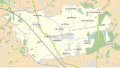
 Ain (communes).svg 984 × 902; 206 KB
-
 Anciennes communes Chézery-Forens.svg 1,245 × 1,680; 360 KB
-
 Anciennes communes Corveissiat.svg 625 × 875; 256 KB
-
 Anciennes communes Hauteville Lompnes partie cédée.svg 1,336 × 1,346; 264 KB
-
 Anciennes communes Hauteville Lompnes.svg 1,336 × 1,346; 259 KB
-
 Arrondissements Ain avant 1926.svg 802 × 729; 3.39 MB
-
 Artemare-Talissieu (1800).svg 800 × 590; 49 KB
-
 Artemare-Talissieu (1863).svg 800 × 590; 36 KB
-
 Artemare-Talissieu (1886).svg 800 × 590; 43 KB
-
 Asnières Sâone - Ain - Replonges.svg 984 × 902; 389 KB
-
 Asnières-sur-Saône - Carte.svg 1,300 × 1,750; 153 KB
-
 Asnières-sur-Saône - Routes.svg 1,300 × 1,750; 401 KB
-
 Asnières-sur-Saône - Territoire.svg 1,300 × 1,750; 11 KB
-
 Bey - Ain - Vonnas.svg 984 × 902; 393 KB
-
 Bey Ain - Territoire.svg 785 × 955; 35 KB
-
 Biziat - Ain - Vonnas.svg 984 × 902; 393 KB
-
 Biziat - Carte.svg 1,425 × 1,685; 2.25 MB
-
 Biziat - Routes.svg 1,425 × 1,685; 2 MB
-
 Biziat - Territoire.svg 1,425 × 1,685; 26 KB
-
 Bourg-en-Bresse (Axes communication).svg 1,254 × 1,111; 1.2 MB
-
 Bourg-en-Bresse Carte.svg 1,015 × 965; 1.26 MB
-
 Bâgé Châtel - Ain - Replonges.svg 984 × 902; 389 KB
-
 Bâgé Ville - Ain - Replonges.svg 984 × 902; 389 KB
-
 Bâgé Ville - Territoire.svg 716 × 780; 171 KB
-
 Bâgé Ville Carte.svg 716 × 780; 7.78 MB
-
 Bâgé Ville Routes.svg 716 × 780; 893 KB
-
 Bâgé-Dommartin - Ain - Replonges.svg 984 × 902; 389 KB
-
 Bâgé-Dommartin - Routes.svg 1,740 × 1,640; 923 KB
-
 Bâgé-Dommartin - Territoire (frontières).svg 1,740 × 1,640; 72 KB
-
 Bâgé-Dommartin - Territoire.svg 1,740 × 1,640; 67 KB
-
 Bâgé-le-Châtel - Territoire.svg 836 × 724; 445 KB
-
 Bâgé-le-Châtel Géolocalisation.svg 836 × 724; 1.59 MB
-
 Bâgé-le-Châtel.svg 836 × 724; 1.33 MB
-
 Canton Bourg-en-Bresse-1.svg 1,300 × 1,600; 41 KB
-
 Canton Bourg-en-Bresse-2.svg 1,300 × 1,600; 43 KB
-
 Canton Bâgé Châtel 1790.svg 976 × 761; 524 KB
-
 Canton Bâgé Châtel.svg 875 × 761; 522 KB
-
 Canton de Pont-de-Veyle.svg 984 × 902; 204 KB
-
 Canton Vonnas.svg 1,430 × 1,046; 661 KB
-
 Carte Arrondissement Belley dans Ain 2017.svg 600 × 546; 334 KB
-
 Carte Arrondissement Nantua dans Ain 2017.svg 600 × 546; 334 KB
-
 Carte Bey.svg 785 × 955; 603 KB
-
 Carte Canal Contournement St Laurent Saône.svg 700 × 950; 24 KB
-
 Carte commune Boz Limites communales.svg 1,100 × 1,050; 13 KB
-
 Carte commune Boz Routes.svg 1,100 × 1,050; 268 KB
-
 Carte commune Boz Territoire.svg 1,100 × 1,050; 286 KB
-
 Carte communes Ain 1827.svg 802 × 729; 3.34 MB
-
 Carte communes Ain 1829.svg 802 × 729; 3.35 MB
-
 Carte communes Ain 1833.svg 802 × 729; 3.36 MB
-
 Carte communes Ain 1835.svg 802 × 729; 3.36 MB
-
 Carte communes Ain 1837.svg 802 × 729; 3.35 MB
-
 Carte communes Ain 1845.svg 802 × 729; 3.36 MB
-
 Carte communes Ain 1846.svg 802 × 729; 3.38 MB
-
 Carte communes Ain 1855.svg 802 × 729; 3.37 MB
-
 Carte communes Ain 1857.svg 802 × 729; 3.38 MB
-
 Carte communes Ain 1858.svg 802 × 729; 3.39 MB
-
 Carte communes Ain 1863.svg 802 × 729; 3.39 MB
-
 Carte communes Ain 1865.svg 802 × 729; 3.36 MB
-
 Carte communes Ain 1867.svg 802 × 729; 3.37 MB
-
 Carte communes Ain 1872.svg 802 × 729; 3.37 MB
-
 Carte communes Ain 1873.svg 802 × 729; 3.4 MB
-
 Carte communes Ain 1883.svg 802 × 729; 3.38 MB
-
 Carte communes Ain 1897.svg 802 × 729; 3.39 MB
-
 Carte communes Ain 1900.svg 802 × 729; 3.39 MB
-
 Carte communes Ain 1908.svg 802 × 729; 3.39 MB
-
 Carte communes Ain 1910.svg 802 × 729; 3.4 MB
-
 Carte communes Ain 1927.svg 802 × 729; 3.4 MB
-
 Carte communes Ain 1930.svg 802 × 729; 3.4 MB
-
 Carte communes Ain 1942.svg 802 × 729; 3.4 MB
-
 Carte communes Ain 1943.svg 802 × 729; 3.39 MB
-
 Carte communes Ain 1962.svg 802 × 729; 3.4 MB
-
 Carte communes Ain 1964.svg 802 × 729; 3.37 MB
-
 Carte communes Ain 1965.svg 802 × 729; 3.35 MB
-
 Carte communes Ain 1966.svg 802 × 729; 3.35 MB
-
 Carte communes Ain 1967.svg 802 × 729; 3.31 MB
-
 Carte communes Ain 1971.svg 802 × 729; 3.3 MB
-
 Carte communes Ain 1972.svg 802 × 729; 3.3 MB
-
 Carte communes Ain 1973.svg 802 × 729; 3.25 MB
-
 Carte communes Ain 1974.svg 802 × 729; 3.2 MB
-
 Carte communes Ain 1975.svg 802 × 729; 3.2 MB
-
 Carte communes Ain 2016.svg 802 × 729; 3.15 MB
-
 Carte communes Ain 2017.svg 802 × 729; 3.14 MB
-
 Carte communes Ain 2018.svg 802 × 729; 3.13 MB
-
 Carte Feillens.svg 1,424 × 1,250; 1.87 MB
-
 Carte Parcours Tour de l'Ain 2013.svg 715 × 635; 202 KB
-
 Carte Parcours Tour de l'Ain 2015.svg 715 × 635; 180 KB
-
 Carte Parcours Tour de l'Ain 2016.svg 715 × 635; 200 KB
-
 Carte Parcours Tour de l'Ain 2017.svg 715 × 635; 199 KB
-
 Carte Parcours Tour de l'Ain 2018.svg 715 × 635; 204 KB
-
 Carte Parcours Tour de l'Ain 2019.svg 715 × 635; 173 KB
-
 Carte Parcours Tour de l'Ain 2020.svg 715 × 635; 148 KB
-
 Carte Parcours Tour de l'Ain 2021.svg 715 × 635; 167 KB
-
 Carte Parcours Tour de l'Ain 2022.svg 715 × 635; 167 KB
-
 Carte Perrex.svg 1,663 × 930; 3.2 MB
-
 Carte Replonges.svg 859 × 665; 2.75 MB
-
 Carte Routes Chevroux Ain.svg 1,100 × 1,500; 670 KB
-
 Carte St Genis Menthon.svg 696 × 1,009; 2.73 MB
-
 Carte Territoire Chevroux Ain.svg 1,100 × 1,500; 527 KB
-
 Carte Vonnas.svg 1,000 × 1,045; 2.62 MB
-
 CC Bords de Veyle.svg 925 × 756; 418 KB
-
 CC Pays Bâgé.svg 844 × 761; 522 KB
-
 CC Pt-de-Veyle.svg 1,145 × 750; 658 KB
-
 CC Veyle.svg 1,430 × 1,046; 661 KB
-
 Chanoz-Châtenay - Ain - Vonnas.svg 984 × 902; 393 KB
-
 Chanoz-Châtenay - Carte.svg 1,125 × 1,279; 1.65 MB
-
 Chanoz-Châtenay - Routes.svg 1,125 × 1,279; 1.13 MB
-
 Chanoz-Châtenay - Territoire.svg 1,125 × 1,279; 176 KB
-
 Charnay-lès-Mâcon - Routes.svg 915 × 893; 1.59 MB
-
 Charnay-lès-Mâcon - Territoire.svg 915 × 893; 247 KB
-
 Chatillon Chalaronne 1800.svg 580 × 520; 260 KB
-
 Chatillon Chalaronne 1802.svg 580 × 520; 256 KB
-
 Chatillon Chalaronne 1808.svg 580 × 520; 260 KB
-
 Chatillon Chalaronne 1809.svg 580 × 520; 271 KB
-
 Chatillon Chalaronne 1837.svg 580 × 520; 273 KB
-
 Chatillon Chalaronne 1846.svg 580 × 520; 275 KB
-
 Chatillon Chalaronne 1857.svg 580 × 520; 280 KB
-
 Chaveyriat - Ain - Vonnas.svg 984 × 902; 393 KB
-
 Chaveyriat - Carte.svg 1,274 × 1,174; 2.13 MB
-
 Chaveyriat - Routes.svg 1,274 × 1,174; 1.52 MB
-
 Chaveyriat - Territoire.svg 1,274 × 1,174; 191 KB
-
 Châtillon-sur-Chalaronne - Châtillon-sur-Chalaronne - Ain.svg 801 × 728; 2.35 MB
-
 Commune Cordieux avant 1973.svg 725 × 550; 72 KB
-
 Commune Montluel (1829-1973).svg 400 × 460; 186 KB
-
 Commune Montluel 1973.svg 400 × 460; 190 KB
-
 Commune Montluel avant 1829.svg 400 × 460; 181 KB
-
 Communes Aire ubaine Macon.svg 520 × 530; 881 KB
-
 Condeissiat - Châtillon-sur-Chalaronne - Ain.svg 801 × 728; 2.35 MB
-
 Confrançon - Ain - Attignat.svg 984 × 902; 393 KB
-
 Confrançon - Carte.svg 913 × 796; 2.41 MB
-
 Confrançon - Routes.svg 913 × 796; 2.08 MB
-
 Confrançon - Territoire.svg 913 × 796; 284 KB
-
 Cormoranche Saône- Ain - Vonnas.svg 984 × 902; 393 KB
-
 Cormoranche-sur-Saône - Territoire.svg 2,536 × 2,315; 1.4 MB
-
 Crottet - Ain - Vonnas.svg 984 × 902; 393 KB
-
 Crottet - Carte.svg 1,830 × 1,240; 2.65 MB
-
 Crottet - Territoire.svg 1,830 × 1,240; 1.61 MB
-
 Cruzilles-lès-Mépillat - Carte.svg 1,211 × 1,514; 1.83 MB
-
 Cruzilles-lès-Mépillat - Routes.svg 1,211 × 1,514; 1.75 MB
-
 Cruzilles-lès-Mépillat 1865.svg 1,211 × 1,514; 604 KB
-
 Cruzilles-Mépillat - Ain - Vonnas.svg 984 × 902; 393 KB
-
 Dommartin (Ain) - Carte.svg 1,070 × 943; 2.06 MB
-
 Dommartin (Ain) - Routes.svg 1,070 × 943; 1.59 MB
-
 Dommartin (Ain) - Territoire.svg 1,070 × 943; 103 KB
-
 Dommartin - Ain - Replonges.svg 984 × 902; 389 KB
-
 Dompierre-sur-Chalaronne - Châtillon-sur-Chalaronne - Ain.svg 801 × 728; 2.35 MB
-
 Feillens - Ain - Replonges.svg 984 × 902; 389 KB
-
 Feillens - Territoire.svg 1,424 × 1,250; 213 KB
-
 Garnerans - Carte.svg 1,020 × 810; 1.19 MB
-
 Garnerans - Châtillon-sur-Chalaronne - Ain.svg 801 × 728; 2.35 MB
-
 Garnerans - Routes.svg 1,020 × 810; 1.07 MB
-
 Garnerans - Territoire.svg 1,020 × 810; 60 KB
-
 Grièges - Ain - Vonnas.svg 984 × 902; 393 KB
-
 Grièges - Routes.svg 730 × 1,089; 4.97 MB
-
 Géolocalisation Belley.svg 939 × 1,158; 277 KB
-
 Géolocalisation Trévoux.svg 780 × 710; 70 KB
-
 Illiat - Châtillon-sur-Chalaronne - Ain.svg 801 × 728; 2.35 MB
-
 Intercommunalités Ain.svg 1,002 × 798; 49 KB
-
 L'Abergement-Clémenciat - Ain - Châtillon-sur-Chalaronne.svg 984 × 902; 393 KB
-
 L'Abergement-Clémenciat - Carte.svg 831 × 1,279; 1.56 MB
-
 L'Abergement-Clémenciat - Routes.svg 831 × 1,279; 1.15 MB
-
 L'Abergement-Clémenciat - Territoire.svg 831 × 1,279; 119 KB
-
 Laiz - Ain - Vonnas.svg 984 × 902; 393 KB
-
 Laiz - Carte.svg 1,629 × 955; 1.52 MB
-
 Laiz - Routes.svg 1,629 × 955; 1.41 MB
-
 Laiz - Territoire.svg 1,629 × 955; 644 KB
-
 Limite Cantons Bourg-en-Bresse.svg 1,050 × 1,050; 20 KB
-
 Limites commune Chevroux Ain.svg 1,100 × 1,500; 16 KB
-
 Localisation Arrondissement Bourg-en-Bresse dans Ain 2017.svg 600 × 546; 334 KB
-
 Localisation Arrondissement Gex dans Ain 2017.svg 600 × 546; 334 KB
-
 Localisation EPCI Bugey Sud dans l'Ain, France, 2017.svg 1,000 × 908; 192 KB
-
 Localisation EPCI de la Dombes dans l'Ain, France.svg 1,000 × 908; 192 KB
-
 Localisation EPCI de la plaine de l'Ain dans l'Ain, France, 2017.svg 1,000 × 908; 192 KB
-
 Localisation EPCI de la Veyle dans l'Ain, France.svg 1,000 × 908; 192 KB
-
 Localisation EPCI du Bassin de Bourg-en-Bresse dans l'Ain, France.svg 1,000 × 908; 192 KB
-
 Localisation EPCI du canton de Pont-de-Veyle dans l'Ain, France.svg 1,000 × 908; 161 KB
-
 Localisation EPCI du Pays Bâgé et de Pont-de-Vaux dans l'Ain, France.svg 1,000 × 908; 192 KB
-
 Localisation EPCI du plateau d'Hauteville dans l'Ain, France, 2017.svg 1,000 × 908; 192 KB
-
 Localisation EPCI Haut Bugey Agglomération dans l'Ain, 2019, France.svg 1,000 × 908; 181 KB
-
 Localisation EPCI Val-de-Saône Centre.svg 1,000 × 908; 192 KB
-
 Localisation Mâconnais Beaujolais Agglomération en Saône-et-Loire, France.svg 1,000 × 790; 271 KB
-
 Localisation Rivière Menthon.svg 531 × 461; 5.36 MB
-
 Localisation Rivière Veyle.svg 780 × 638; 5.49 MB
-
 Longecombe Chaley (après 1883).svg 785 × 785; 229 KB
-
 Longecombe Chaley (avant 1883).svg 785 × 785; 225 KB
-
 Longecombe Chaley (territoire cédé).svg 785 × 785; 242 KB
-
 Manziat - Ain - Replonges.svg 984 × 902; 389 KB
-
 Manziat - Carte.svg 900 × 848; 2.42 MB
-
 Manziat - Routes.svg 900 × 848; 2.13 MB
-
 Manziat - Territoire.svg 900 × 848; 150 KB
-
 Map of Ain Department, France, Cantons 2015 Ambérieu-en-Bugey.svg 1,000 × 908; 43 KB
-
 Map of Ain Department, France, Cantons 2015 Bellegarde-sur-Valserine.svg 1,000 × 908; 43 KB
-
 Map of Ain Department, France, Cantons 2015 Belley.svg 1,000 × 908; 43 KB
-
 Map of Ain Department, France, Cantons 2015 Bourg-1.svg 1,000 × 908; 43 KB
-
 Map of Ain Department, France, Cantons 2015 Bourg-2.svg 1,000 × 908; 43 KB
-
 Map of Ain Department, France, Cantons 2015 Ceyzériat.svg 1,000 × 908; 43 KB
-
 Map of Ain Department, France, Cantons 2015 Gex.svg 1,000 × 908; 43 KB
-
 Map of Ain Department, France, Cantons 2015 Hauteville-Lompnès.svg 1,000 × 908; 43 KB
-
 Map of Ain Department, France, Cantons 2015 Lagnieu.svg 1,000 × 908; 43 KB
-
 Map of Ain Department, France, Cantons 2015 Meximieux.svg 1,000 × 908; 43 KB
-
 Map of Ain Department, France, Cantons 2015 Miribel.svg 1,000 × 908; 43 KB
.svg)


.svg)
.svg)
.svg)


.svg)


.svg)


.svg)


_-_Carte.svg)
_-_Routes.svg)
_-_Territoire.svg)


.svg)
.svg)
.svg)


