Category:Maps of Aden Protectorate
Jump to navigation
Jump to search
Media in category "Maps of Aden Protectorate"
The following 17 files are in this category, out of 17 total.
-
 Aden Protectorate Map.jpg 740 × 537; 38 KB
-
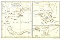 Map shewing British Dependencies of Aden and Perim (1888).jpg 1,887 × 1,239; 1.14 MB
-
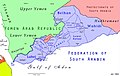 FederationOfSouthArabiaMap.jpg 2,282 × 1,443; 361 KB
-
 Aden Colony dependencies.png 515 × 507; 143 KB
-
 Aden map War Office 1948 (cropped).jpg 265 × 195; 33 KB
-
 Aden map War Office 1948.jpg 1,000 × 526; 136 KB
-
 Aden Protectorate (British).jpg 740 × 537; 86 KB
-
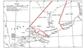
 Aden Protectorate map (1946).jpg 1,469 × 920; 281 KB
-
 Aden Protectorate.png 12,835 × 9,132; 174.63 MB
-
 Aden Yemen on the globe (South Yemen centered orthographic projection).svg 845 × 845; 3.01 MB
-
 Kolonie Aden.PNG 413 × 208; 8 KB
-
 Map showing tribes and new boundary of the Aden Protectorate.png 6,276 × 5,250; 24.42 MB
-
 Perim Aden.jpg 835 × 171; 167 KB
-
 Perim and Bab-el-Mandeb Peninsula.png 650 × 501; 388 KB
-
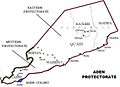
 QuaitiState.png 623 × 359; 133 KB
-
 South Yemen location map خريطة موقع الجنوب العربي محافظات اليمن الجنوبي.svg 1,524 × 995; 109 KB
-
 Yemen1908.jpg 960 × 643; 284 KB

.jpg)


.jpg)

.jpg)
.jpg)

.svg)


