Category:Maps of 8th-century England
Jump to navigation
Jump to search
Constituent countries of the United Kingdom: England
Media in category "Maps of 8th-century England"
The following 15 files are in this category, out of 15 total.
-
 865-870 v2.0.jpg 672 × 786; 246 KB
-
 Ancient Essex 750.png 578 × 557; 20 KB
-
 Angelrucu 800 gear on russlendisc.svg 672 × 1,190; 65 KB
-
 British kingdoms c 800-es.svg 1,141 × 2,000; 144 KB
-
 British kingdoms c 800-pt.svg 672 × 1,190; 205 KB
-
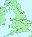
 British kingdoms c 800.svg 672 × 1,190; 279 KB
-
 Carte anglo-sax 800.gif 637 × 670; 80 KB
-

-
 Map Eardwulf-fr.svg 658 × 686; 1.31 MB
-
 Map Eardwulf-pt.svg 658 × 686; 1.31 MB
-
 Map Ina of Wessex-fr.svg 946 × 372; 1.32 MB
-
 Map Ina of Wessex-pt.svg 946 × 372; 1.32 MB
-
 Map Offa-fr.svg 494 × 313; 1.32 MB
-
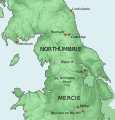
 Northumbria c8th map.png 280 × 357; 45 KB
-
 Wessex 800AD.jpg 960 × 720; 31 KB


_(14594373470).jpg)


