Category:Maps of 3rd-century BC Iberian Peninsula
Jump to navigation
Jump to search
| Preceded by: Maps of 4th-century BC Iberian Peninsula |
Maps of 3rd-century BC Iberian Peninsula 300 BC-201 BC |
Succeeded by: Maps of 2nd-century BC Iberian Peninsula |
Subcategories
This category has only the following subcategory.
Media in category "Maps of 3rd-century BC Iberian Peninsula"
The following 20 files are in this category, out of 20 total.
-
 Coaliciones y acciones militares celtíberas (221-182 a.C.).svg 707 × 559; 88 KB
-
 Iberia 218-217BC-fr.svg 940 × 850; 1.02 MB
-
 Iberia 218-217BC-hu.svg 940 × 850; 425 KB
-
 Iberia 218-217BC-pt.svg 940 × 850; 416 KB
-
 Iberia 237-206BC-fr.svg 940 × 850; 1.62 MB
-
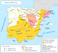
 Iberia 237-206BC.svg 924 × 762; 357 KB
-
 Iberia 237-218BC-it.png 940 × 850; 278 KB
-
 Iberia 300BC-en.svg 924 × 762; 772 KB
-
 Iberia 300BC-es.svg 986 × 813; 1.8 MB
-
 Iberia 300BC-fr.svg 924 × 762; 266 KB
-
 Iberia 300BC-pt.svg 924 × 762; 764 KB
-
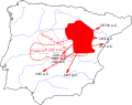
 Iter Scipionis ab Tarraco ad Novam Carthago 209 aC.png 539 × 951; 851 KB
-
 Iter Scipionis Hispania 210 aC.png 695 × 716; 879 KB
-
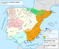
 Part 2 of Roman Hispania 218-215 aC.jpg 1,024 × 1,024; 638 KB
-
 Part 3 of Roman Hispania 218-215 aC.jpg 800 × 800; 486 KB
-
 Part 4 of Roman Hispania 218-215 aC (Baetica).jpg 960 × 720; 611 KB
-
 Part of Roman Hispania 218-215 aC - Dertosa.jpg 582 × 600; 174 KB
-
 Part of Roman Hispania 218-215 aC.jpg 695 × 716; 229 KB
-
 Península Ibérica c. 300 a.C.svg 924 × 762; 770 KB
-
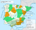
 Punic conquest of Iberia before the second Punic war-es.svg 3,565 × 2,925; 401 KB
.svg)


.jpg)


