Category:Maps of 19th-century Africa
Jump to navigation
Jump to search
English: Modern maps showing the history of Africa. Not to be confused with genuinely old 19th-century maps of Africa
Subcategories
This category has the following 5 subcategories, out of 5 total.
M
- Maps of French Tunisia (4 F)
- Maps of the Sokoto Caliphate (11 F)
Media in category "Maps of 19th-century Africa"
The following 17 files are in this category, out of 17 total.
-
 Senussi Map3.png 2,881 × 2,929; 3.58 MB
-
 Sultanate of zanzibar 1883.png 3,000 × 2,309; 1.9 MB
-
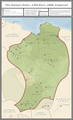
 Rabih Azzubair Dominions.png 1,806 × 1,155; 1.09 MB
-
 Africa Australa - Colonizacion vèrs 1898.png 1,062 × 876; 234 KB
-
 Africa de l'Oèst en 1875-es.svg 1,588 × 771; 750 KB
-
 Africa en 1875.png 675 × 728; 200 KB
-
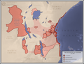
 Africa1850s.png 640 × 620; 170 KB
-
 Croisettes en hun handelsroutes tijdens de 19de eeuw.png 797 × 565; 401 KB
-
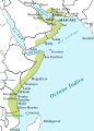
 Empire of Oman.png 2,700 × 3,264; 3.79 MB
-
 Empire of Oman2-es.svg 959 × 1,340; 443 KB
-
 Etat-emir-abdel-kader.jpg 601 × 434; 54 KB
-
 Map of the Sultanate of Zanzibar.svg 1,240 × 918; 189 KB
-
 Muhemet Ali Empire 1805 - 1953 (AD).png 821 × 440; 36 KB
-
 Nigèria - Situacion politica vèrs 1875.png 867 × 527; 144 KB
-
 Senussi Map.png 2,308 × 3,788; 637 KB
-
 Sud d'Africa vèrs 1820-1840.png 702 × 525; 96 KB
-
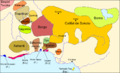
 Sultanat de Zanzibar vèrs 1875.png 842 × 761; 195 KB


.png)


