Category:Maps of 18th-century Europe
Jump to navigation
Jump to search
| Preceded by: Maps of 17th-century Europe |
Maps of 16th-century Europe 1701 AD-1800 AD |
Succeeded by: Maps of 19th-century Europe |
Subcategories
This category has the following 6 subcategories, out of 6 total.
1
- Maps of Europe in 1789 (19 F)
F
G
I
- Maps of 18th-century Italy (62 F)
M
- Maps of 18th-century Prussia (11 F)
- Maps of the Battle of Poltava (24 F)
Media in category "Maps of 18th-century Europe"
The following 150 files are in this category, out of 150 total.
-
 007 Ukrainian Cossack Hetmanate and Russian Empire 1751-ar.jpg 1,012 × 1,256; 465 KB
-
 007 Ukrainian Cossack Hetmanate and Russian Empire 1751.jpg 767 × 952; 414 KB
-
 421 of 'England under Stuart Rule, etc' (11245018734).jpg 1,904 × 1,267; 612 KB
-
 419 of 'Britain and her Rivals in the eighteenth century, 1713-1789' (11233442156).jpg 2,523 × 2,308; 872 KB
-
 Map of Europe (1714).png 998 × 801; 353 KB
-
 Poland-Lithuania 1714.svg 450 × 456; 880 KB
-

-
 Europe 1740.jpg 2,292 × 1,867; 785 KB
-
 Europe in 1740.jpg 797 × 552; 753 KB
-
 Historical atlas of modern Europe 1903 (135895389).jpg 9,165 × 7,123; 65.99 MB
-
 Modern history; Europe (1904) (14742800856).jpg 2,912 × 1,988; 1.57 MB
-

-
 1750 literacy Europe.png 1,036 × 810; 243 KB
-
 Europe en 1750.pdf 1,752 × 1,239; 464 KB
-
 Spilsbury jigsaw - John Spilsbury, 1766 - BL.jpg 1,434 × 1,342; 996 KB
-
-
 Administrative division of the Polish-Lithuanian Commonwealth in 1789.PNG 2,981 × 3,103; 1.56 MB
-
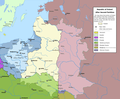
 Polish-Lithuanian Commonwealth 1789-1792.PNG 1,989 × 1,554; 733 KB
-
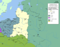
 Polish-Lithuanian Commonwealth1773-1789.png 1,992 × 1,554; 848 KB
-
 BlankMap-Europe-1791.png 470 × 486; 17 KB
-
 PolishRuswar 1792.JPG 2,000 × 1,568; 415 KB
-
 PolRuswar 1792.JPG 2,000 × 1,568; 335 KB
-
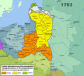 Rpon1793wojew.png 1,524 × 1,372; 513 KB
-
 Rzeczpospolita Rozbiory 2.png 1,902 × 1,568; 296 KB
-
 Разделы-Польши2.png 2,000 × 1,568; 104 KB
-
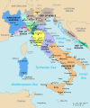
 Napoleonic northern Italy circa 1795–1801.jpg 861 × 635; 196 KB
-
 1Westfalen1800.png 2,962 × 2,353; 1.78 MB
-
 459 of '(Histoire de la Belgique.)' (11108497415).jpg 2,560 × 1,541; 814 KB
-
 Alliances in Europe 1725-1730-es.svg 1,391 × 978; 1.12 MB
-
 Alliances in Europe 1725-1730.png 3,872 × 2,761; 1.19 MB
-
 Alliances in Europe 1740.png 3,872 × 2,761; 1.37 MB
-
 Alliances in Europe 1748-1766.png 3,872 × 2,761; 1.38 MB
-
 AtHistEur1750.jpg 1,306 × 1,434; 397 KB
-
 Austrian Netherlands map-es.svg 3,912 × 2,872; 470 KB
-
 Austrian Netherlands map-fr.svg 3,912 × 2,872; 457 KB
-
 Bilboko itsasadarra 1731ean.jpg 1,600 × 1,380; 567 KB
-
 Blank map of Europe 1714.svg 450 × 456; 893 KB
-
 BradfordMap CrossDetail HAGAM.jpg 2,212 × 3,913; 8.54 MB
-
 BradfordMap CrossLocation HAGAM.jpg 4,288 × 2,848; 7.31 MB
-
 BradfordMap HAGAM.jpg 4,058 × 2,848; 6.57 MB
-
 Brandenburg-Preussen-1701-1806 ohne Westen.png 1,020 × 831; 80 KB
-
 Brandenburg-preussen-1701-1806.png 1,020 × 831; 245 KB
-
 Burggrafschaft Friedberg.png 1,387 × 660; 269 KB
-
 Central europe 1786.jpg 2,319 × 1,871; 829 KB
-
 Dobrava 1744.jpg 567 × 393; 137 KB
-
 Esseratsweiler um 1700.jpg 1,024 × 768; 147 KB
-
 Europa 17 u. 18 Jh.jpg 5,536 × 4,336; 10.3 MB
-
 Europa 1701-es.svg 1,357 × 1,357; 1.03 MB
-
 Europa 1701.svg 1,357 × 1,357; 688 KB
-
 Europa 1721-es.svg 1,357 × 1,357; 1.01 MB
-
 Europa 1721.svg 1,357 × 1,357; 680 KB
-
 Europa em 1792.jpg 2,025 × 1,458; 1.65 MB
-
 Europa1717.jpg 2,155 × 1,503; 1.3 MB
-
 Europako hiri nagusien populazioa (XVI-XVIII).png 675 × 885; 419 KB
-
 Europe 1714.png 1,550 × 1,118; 1.01 MB
-
 Europe 1740 blank.png 3,872 × 2,761; 975 KB
-
 Europe 1740 lt.png 5,163 × 3,682; 1.7 MB
-
 Europe 1748-1766 it.jpg 3,872 × 2,761; 2.28 MB
-
 Europe 1783-1792 blank.png 3,872 × 2,761; 966 KB
-
 Europe 1783-1792 lt.png 5,163 × 3,682; 1.68 MB
-
 Europe c. 1700.png 1,550 × 1,118; 1.02 MB
-
 Europe, 1700—1714 (cropped, Italy).png 393 × 453; 159 KB
-
 Europe, 1700—1714 hu.png 1,590 × 1,086; 1.18 MB
-
 Europe, 1700—1714.png 1,590 × 1,086; 1.07 MB
-
 Europe, 1714.png 1,590 × 1,086; 986 KB
-
 Frieden von Nystad, Stockholm und Fredericksborg-es.svg 1,127 × 933; 1.01 MB
-
 Frieden von Nystad, Stockholm und Fredericksborg-hu.svg 1,127 × 933; 703 KB
-
 Frieden von Nystad, Stockholm und Fredericksborg.svg 1,127 × 933; 684 KB
-
 Galicja i Nowa Galicja - cyrkuły 1805.png 696 × 661; 55 KB
-
 Giurisdizioni bresciane in epoca veneta (Luca Giarelli).png 1,367 × 2,000; 273 KB
-
 Guerra Primeira Coligação - primeiras acções 1792.jpg 708 × 583; 162 KB
-
 Habsburg Monarchy 1714.svg 450 × 456; 915 KB
-
 Helmholt - Western Europe early 18th century.jpg 2,998 × 2,482; 2.69 MB
-
 Helvetische Revolution.png 2,500 × 1,590; 1.33 MB
-
 Historical map of the Saarland 1793.gif 995 × 540; 38 KB
-
 History of Russia, 1682-1762.jpg 1,330 × 1,650; 597 KB
-
 History of Russia, XVIII c.jpg 2,552 × 3,432; 1.97 MB
-
 Italia 1796-es.svg 3,500 × 4,200; 1.13 MB
-
 Italy 1796 de.svg 896 × 1,060; 1.66 MB
-
 Italy 1796 it.svg 3,662 × 4,309; 573 KB
-
 Italy 1796 ko.svg 3,662 × 4,309; 594 KB
-
 Italy 1796-hu.svg 3,500 × 4,200; 986 KB
-
 Italy 1796.svg 3,500 × 4,200; 1.16 MB
-
 Kaart Expeditie Schelde 1793.jpg 752 × 536; 121 KB
-
 Karte 13 Alte Orte.png 2,500 × 1,652; 512 KB
-
 Karte der zum Kloster Heiligkreuztal gehörigen Waldungen 1700.jpg 2,683 × 1,982; 1,004 KB
-
 Karte Gemeine-Herrschaften.png 2,000 × 1,268; 245 KB
-
 Karte Helvetik 1-fr.svg 2,478 × 1,549; 584 KB
-
 Karte Helvetik 1.png 2,500 × 1,561; 1.19 MB
-
 Karte Helvetik 2.png 3,000 × 2,186; 1.21 MB
-
 Karte Helvetik 3-EN.png 2,500 × 1,570; 743 KB
-
 Karte Helvetik 3-FR.png 2,500 × 1,570; 738 KB
-
 Karte Helvetik 3-fr.svg 2,478 × 1,549; 585 KB
-
 Karte Helvetik 3.png 2,500 × 1,577; 806 KB
-
 Karte Helvetik 3b.png 2,500 × 1,623; 369 KB
-
 Karte Reise eines Buergers.png 826 × 628; 689 KB
-
 Karte Zugewandte Orte.png 1,200 × 761; 211 KB
-
 Kingdom of Prussia 1714.svg 450 × 456; 893 KB
-
 Królestwo Galicji.png 490 × 480; 101 KB
-
 Kurzemes un Zemgales Hercogiste 1740.png 2,387 × 2,100; 606 KB
-
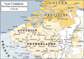 Low Countries 1740.png 813 × 575; 225 KB
-
 Map around Vesuvius 1770 plate6 from William Hamilton.jpg 3,000 × 3,201; 989 KB
-
 Map Austria and the spartitions of Poland 1928-1940 - Touring Club Italiano CART-TRC-60.jpg 6,290 × 6,846; 4.53 MB
-
 Map Austria in the napoleonic age 1928-1940 - Touring Club Italiano CART-TRC-61.jpg 5,056 × 6,579; 3.63 MB
-
 Map europe 1700 to 1715 changes.gif 333 × 333; 66 KB
-
 Map of Russia and Poland 1730.jpg 12,048 × 7,509; 32.78 MB
-
 Map of the Battle of Fontenoy 1745.png 569 × 741; 533 KB
-
 Map-italy-old.jpg 551 × 554; 45 KB
-
 March to the Danube May June 1704.png 1,040 × 944; 504 KB
-
 Norditalien 1796.png 3,785 × 3,023; 1.47 MB
-
 NystatIngria.png 247 × 261; 7 KB
-
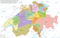
 Old Confederacy 18th centur.png 2,500 × 1,585; 560 KB
-
 Peace of Basel and Campo-Formio.png 998 × 1,637; 2.8 MB
-
 Places de la Barrière des Pays-Bas autrichiens contre la France en 1715-fr.svg 3,903 × 2,869; 518 KB
-
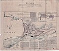
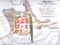 Plan Iławy z 1753 roku.PNG 1,645 × 1,247; 3.59 MB
-
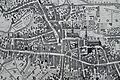
 Plan of Leipzig 18 century.jpg 4,492 × 4,613; 7.81 MB
-
 Polen-Litauen BV044859943.jpg 3,768 × 4,500; 2.79 MB
-
 PolishRuswar1792.PNG 2,000 × 1,568; 921 KB
-
 PolskaXVIIwieku.gif 355 × 353; 9 KB
-
 Principati1786.jpg 6,272 × 4,704; 5.05 MB
-
 Péninsule ibérique en 1700.png 2,000 × 1,500; 693 KB
-
 Péninsule ibérique en 1705.png 2,000 × 1,500; 771 KB
-
 Péninsule ibérique en 1706.png 2,000 × 1,500; 713 KB
-
 Péninsule ibérique en 1709.png 2,000 × 1,500; 764 KB
-
 Péninsule ibérique en 1715.png 2,000 × 1,500; 694 KB
-
 Péninsule ibérique en 1750.png 2,000 × 1,500; 640 KB
-
 Péninsule ibérique en 1788.png 2,000 × 1,500; 638 KB
-
 Regno di Morea de.svg 1,785 × 1,398; 1.12 MB
-
 Regno di Morea.svg 1,785 × 1,398; 1.73 MB
-
 Regno di MoreaV1Make.svg 6,479 × 5,113; 2.05 MB
-
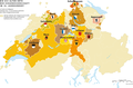
 Religion map of Switzerland in 1700 - en.png 3,000 × 1,862; 800 KB
-
 Religion map of Switzerland in 1700 - fr.png 3,000 × 1,862; 1.04 MB
-
 Repubblica bresciana suddivisione cantoni.png 1,200 × 1,800; 76 KB
-
 Republic of Ragusa.svg 512 × 519; 1.09 MB
-
 RP 1701.JPG 1,996 × 1,568; 560 KB
-
 Russian map of 18th century war in Moldova.jpg 1,098 × 1,478; 218 KB
-
 Rzeszów mapa 1762 p6.jpg 3,188 × 2,036; 2.17 MB
-
 Sección-mapa-1745-Rosellón.png 629 × 269; 379 KB
-
 Señoríos del Reino de Córdoba.svg 588 × 783; 544 KB
-
 Señoríos del Reino de Jaén.svg 913 × 520; 671 KB
-
 Señoríos del Reino de Sevilla.svg 1,144 × 1,041; 1.88 MB
-
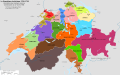
 Struktur Eidgenossenschaft.png 2,500 × 1,585; 576 KB
-
 The story of the map of Europe, its making and its changing (1916) (14778369165).jpg 2,016 × 2,820; 665 KB
-
 Verenigde Nederlandse Staten 1790.jpg 1,215 × 1,230; 310 KB
-
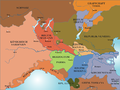
 Western Europe 1700.jpg 1,677 × 1,311; 412 KB
-
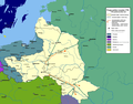
 Wielki Gościniec Litewski.png 1,347 × 1,218; 392 KB
-
 WKL wojewodztwa 1771.png 991 × 854; 119 KB
-
 Professor G. Droysens Allgemeiner historischer Handatlas 1886 (134037838).jpg 6,552 × 10,351; 74.28 MB
-
 The Collegiate Atlas 1876 (73060505).jpg 6,752 × 5,233; 5.17 MB
-
 Суворовские каналы.png 260 × 433; 66 KB


.jpg)
.jpg)
.png)

)%27_(11154436706).jpg)


.jpg)
_(14742800856).jpg)
_(14594431308).jpg)


%27_(11108497415).jpg)


.png)


.png)


.png)


_(14778369165).jpg)


.jpg)
.jpg)
