Category:Maps of 13th-century England
Jump to navigation
Jump to search
Constituent countries of the United Kingdom: England
Media in category "Maps of 13th-century England"
The following 6 files are in this category, out of 6 total.
-
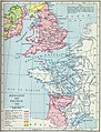 England and France 1259.jpg 1,669 × 2,191; 1.34 MB
-
-
 King Edward I's itinerary.gif 1,479 × 1,246; 1.11 MB
-
 Northwales2.JPG 960 × 720; 67 KB
-
 Plantagenet England.png 436 × 658; 8 KB
-
 Tardieu, Invasions of England and Ireland, 1798, Cornell CUL PJM 1028 01.jpg 9,621 × 7,764; 12.21 MB

.jpg)


