Category:Maps made in the 19th century
Jump to navigation
Jump to search
Subcategories
This category has the following 51 subcategories, out of 51 total.
*
-
- 19th-century fortress plans (40 F)
1
A
B
C
H
- Hispanoasia (4 F)
M
- Maps by F. S. Weller (3 F)
- Maps by Pál Gönczy (63 F)
- Maps by Thomas Moule (4 F)
- Maps of March Revolution (12 F)
O
- Ordnance Survey Drawings (432 F)
R
S
T
É
Media in category "Maps made in the 19th century"
The following 200 files are in this category, out of 238 total.
(previous page) (next page)-
 'The Mysterious Island' by Jules Férat 054.jpg 483 × 750; 96 KB
-
 002osd000000003u00162000.jpg 3,917 × 4,000; 5.76 MB
-
 002osd000000018u00007000.jpg 4,000 × 2,612; 2.86 MB
-
 002osd000000018u00025000.jpg 4,000 × 2,591; 3.43 MB
-
 002osd000000018u00026000.jpg 4,000 × 3,015; 2.4 MB
-
 002osd000000019u00027000.jpg 4,000 × 2,672; 2.61 MB
-
 002osd000000020u00083000.jpg 4,000 × 2,809; 5.19 MB
-
 002osd000000020u00104000.jpg 4,000 × 2,410; 3.46 MB
-
 002osd000000020u00116000.jpg 4,000 × 2,470; 3.47 MB
-
 002osd000000020u00117000.jpg 4,000 × 2,697; 3.5 MB
-
 002osd000000020u00119000.jpg 4,000 × 2,134; 1.87 MB
-
 002osd000000020u00120000.jpg 4,000 × 2,134; 2.29 MB
-
 002osd000000023u00205000.jpg 4,000 × 2,967; 3.36 MB
-
 002osd000000023u00211000.jpg 4,000 × 2,448; 2.97 MB
-
 002osd000000026u00276000.jpg 4,000 × 2,774; 3.64 MB
-
 002osd000000026u00277000.jpg 4,075 × 3,420; 1.46 MB
-
 002osd000000026u00278000.jpg 4,075 × 3,420; 1.92 MB
-
 002osd000000026u00279000.jpg 4,000 × 2,784; 2.07 MB
-
 002osd000000026u00280000.jpg 3,415 × 5,845; 3.67 MB
-
 002osd000000026u00308000.jpg 4,000 × 2,428; 2.06 MB
-
 002osd000000026u00309000.jpg 4,000 × 3,588; 3.98 MB
-
 002osd00000027au00428000.jpg 4,000 × 2,695; 5.47 MB
-
 002osd00000027au00429000.jpg 2,934 × 4,000; 4.3 MB
-
 002osd00000027au00430000.jpg 4,000 × 2,692; 5.34 MB
-
 002osd00000027au00431000.jpg 3,885 × 4,000; 7.16 MB
-
 002osd00000027bu00432000.jpg 4,000 × 2,669; 3.5 MB
-
 002osd00000027bu00433000.jpg 3,794 × 4,000; 4.45 MB
-
 002osd00000027bu00434000.jpg 4,000 × 3,694; 4.67 MB
-
 002osd00000027bu00439000.jpg 4,000 × 2,667; 4.19 MB
-
 002osd00000027bu00446000.jpg 4,000 × 2,702; 3.36 MB
-
 002osd00000027bu00447000.jpg 4,000 × 2,702; 2.11 MB
-
 002osd00000027bu00448000.jpg 4,000 × 2,907; 2.06 MB
-
 002osd00000027bu00449000.jpg 2,773 × 4,000; 2.66 MB
-
 01879 Trzcinica.jpg 654 × 453; 100 KB
-

-

-
 1858 БОхт перевоз.jpg 1,174 × 463; 312 KB
-
 1858 МОхт перевоз.jpg 1,187 × 462; 365 KB
-
 1880 Abbott Map of Minneapolis.png 2,736 × 1,432; 1.87 MB
-
 1895-6 實測台灣新地圖 Map of Taiwan by Japanese.jpg 436 × 617; 38 KB
-

-

-

-
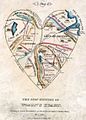
 A Map of the Open Country of Woman's Heart.jpg 2,412 × 3,218; 10.01 MB
-

-
 A map of the state of Pennsylvania (4583423629).jpg 2,000 × 1,339; 2.53 MB
-
 A map of the town of Providence from actual survey (4231922514).jpg 10,284 × 7,213; 6.15 MB
-
 A map of the Town of Shrewsbury, Mass. (3719858383).jpg 858 × 1,024; 702 KB
-
 A map of the United States of North America (8767917455).jpg 800 × 697; 117 KB
-

-
 A Map of Womans Heart.jpg 893 × 1,242; 430 KB
-

-
-
 A new & complete map of the city of Boston... (2675351454).jpg 1,707 × 2,000; 3.29 MB
-
-
 A new map of the United States including part of Louisiana (2674601938).jpg 2,000 × 1,576; 2.93 MB
-
 A plan of Boston, from actual survey (2674408541).jpg 1,252 × 2,000; 2 MB
-
 A plan of Hatfield (3855461445).jpg 2,000 × 1,769; 3.12 MB
-

-

-
 A plan of the compact part of the town of Exeter... (2675810572).jpg 3,372 × 3,996; 1.76 MB
-

-
 A topographical map of Essex County, Massachusetts (2675644422).jpg 2,000 × 1,943; 3.67 MB
-

-
 Adams, Mass. (7557392920).jpg 5,362 × 3,780; 21.9 MB
-
 Alt und Neu Lönnewitz Karte.jpg 1,147 × 714; 298 KB
-
 America settle. (2674652981).jpg 1,301 × 2,000; 2.26 MB
-
 Amsterdam, N.Y. (2674282915).jpg 2,000 × 1,518; 2.37 MB
-
 Amérique du Nord (3856250056).jpg 2,000 × 1,462; 2.61 MB
-
 Amérique du Sud (3856250278).jpg 1,469 × 2,000; 2.45 MB
-
 An improved map of the United States (4231930226).jpg 2,000 × 1,780; 3.76 MB
-

-

-
 Aqueduc de Fréjus rapport de Louis Just (1839)50.jpg 2,048 × 1,536; 440 KB
-
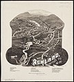 Ashland, Grafton Co., N.H. 1883 (2675805478).jpg 1,803 × 2,000; 2.78 MB
-
 Auburn, Rhode Island (2675913876).jpg 2,000 × 1,533; 2.49 MB
-
 Balloon view, Cape Ann to Boston (2675150823).jpg 2,000 × 1,021; 1.95 MB
-
 Balloon view--Boston Harbor (2675149981).jpg 2,000 × 1,025; 1.7 MB
-
 Balloon view--Provincetown to Boston (2675011406).jpg 2,000 × 1,253; 2.2 MB
-
 Base-map of the United States (8345526961).jpg 799 × 628; 123 KB
-
 Bath, Penn. (2675140164).jpg 2,000 × 1,548; 2.01 MB
-
 BattleOfChantillyMap.jpg 4,016 × 3,118; 1.8 MB
-
 Becon.Etat-Major.jpg 642 × 331; 74 KB
-
 Berkley Co. W. Va. (4231923094).jpg 1,989 × 2,000; 3.14 MB
-
 Bethel, Vt. (2675060343).jpg 2,000 × 1,413; 1.95 MB
-
 Birds eye view of Appleton, Wis. (2675138001).jpg 2,000 × 1,322; 2.73 MB
-
 Birds eye view of Asbury Park, N.J. (2674308677).jpg 2,000 × 1,228; 1.99 MB
-
 Birds eye view of Bar Harbor, Mount Desert Island, Hancock Co., Maine, 1886 (2675087653).jpg 2,000 × 1,199; 2.07 MB
-
 Birds eye view of Blackstone, Mass. (2673634045).jpg 2,000 × 1,670; 2.49 MB
-
 Birds eye view of Boston (2674985480).jpg 2,000 × 1,392; 1.84 MB
-
 Birds eye view of Boston (2675947188).jpg 2,000 × 1,474; 2.46 MB
-
 Birds eye view of Bristol, R.I. (2675914702).jpg 2,000 × 1,492; 2.64 MB
-
 Birds eye view of Carbondale, Pa. (2674310723).jpg 2,000 × 1,656; 3.75 MB
-
 Birds eye view of Carlinville, Macoupin County Ill. (2674657848).jpg 2,000 × 1,608; 3.63 MB
-
 Birds eye view of Clinton, Mass. (2674460994).jpg 2,000 × 1,526; 2.88 MB
-
 Birds eye view of Concord, N.H. (2674989107).jpg 2,000 × 1,376; 2.48 MB
-
 Birds eye view of Eastport, Washington Co., Maine (2675078661).jpg 2,000 × 1,454; 2.37 MB
-
 Birds eye view of Fitchburg, Mass. (2674485454).jpg 2,000 × 1,440; 2.94 MB
-
 Birds eye view of Fort Edward, New York (2675847312).jpg 2,000 × 1,562; 2.91 MB
-
 Birds eye view of Hudson, Mass. (2674475570).jpg 2,000 × 1,562; 2.75 MB
-
 Birds eye view of Laconia, Belknap County, N.H. (2675001703).jpg 2,000 × 1,551; 2.41 MB
-
 Birds eye view of Lake Village, Belknap County, N.H. (2675821028).jpg 2,000 × 1,314; 1.84 MB
-
 Birds eye view of Morristown, Morris Co., New Jersey (2674245355).jpg 2,000 × 1,411; 2.82 MB
-
 Birds eye view of Neenah, Wis. (2675968610).jpg 2,000 × 1,634; 3.15 MB
-
 Birds eye view of Orange, Massachusetts (2673708391).jpg 2,000 × 1,548; 2.43 MB
-
 Birds eye view of part of Maryland, Distr of Columbia and part of Virginia (2675386400).jpg 2,000 × 1,467; 2.71 MB
-
 Birds eye view of Plainville, Conn. (2673812191).jpg 2,000 × 1,585; 2.24 MB
-
 Birds eye view of Port Townsend, Puget Sound, Washington Territory (2675963832).jpg 2,000 × 1,286; 2.11 MB
-
 Birds eye view of Portsmouth, Rockingham Co., New Hampshire (2674737585).jpg 2,000 × 1,591; 3.11 MB
-
 Birds eye view of Rochester, Strafford County, New Hampshire, 1877 (2675835672).jpg 2,000 × 1,635; 2.85 MB
-
 Birds eye view of the city of Olympia... (2675152617).jpg 2,000 × 1,341; 1.93 MB
-
 Birds eye view of the town of Holbrook (2673669083).jpg 2,000 × 1,109; 1.65 MB
-

-
 Birds eye view of the town of Nantucket, State of Massachusetts (2675002280).jpg 2,000 × 1,399; 2.33 MB
-
 Birds eye view of the town of Rockland, Plymouth County, Mass. (2675632758).jpg 2,000 × 1,568; 2.98 MB
-
 Birds eye view of the town of South Abington, Plymouth Co., Mass. (2673618519).jpg 2,000 × 1,596; 2.5 MB
-
 Birds eye view of the village of Wiscasset, Lincoln Co., Maine, 1878 (4584054514).jpg 2,000 × 1,475; 2.53 MB
-
 Birds eye view of Waterloo (2675051175).jpg 2,000 × 1,602; 3.03 MB
-
 Birds eye view of Waterville, Kennebec Co. Maine (2675086849).jpg 2,000 × 1,409; 2.36 MB
-
 Birds-eye view of Boston and its environs (2674610650).jpg 2,000 × 1,400; 2.9 MB
-
 Birds-eye view of Boston and vicinity (2675553678).jpg 2,000 × 1,489; 3.72 MB
-
 Birds-eye view of Boston, showing the burned district (2676005156).jpg 2,000 × 1,456; 2.89 MB
-
 Birmingham, Conn. (2675144497).jpg 2,000 × 1,664; 3.07 MB
-
 Blackinton, Mass. (2673694603).jpg 2,000 × 1,459; 2.02 MB
-
 Blairstown, New Jersey (2674316961).jpg 2,000 × 1,561; 2.1 MB
-
 Boston (2674948511).jpg 2,000 × 1,609; 2.72 MB
-
 Boston (2675948260).jpg 2,000 × 1,406; 1.63 MB
-
 Boston and adjacent cities (2675713424).jpg 1,697 × 2,000; 2.53 MB
-
 Boston and its suburban drives (2675020716).jpg 1,439 × 2,000; 3.23 MB
-
 Boston and surroundings (5376151768).jpg 718 × 1,024; 730 KB
-
 Boston and vicinity (2674155827).jpg 1,657 × 2,000; 2.71 MB
-
 Boston and vicinity (2675024798).jpg 1,699 × 2,000; 2.87 MB
-
 Boston Bay and approaches (2674868729).jpg 2,000 × 1,557; 1.62 MB
-
 Boston Harbor (3120131485).jpg 2,000 × 1,710; 2.98 MB
-

-
 Boston Harbor, Massachusetts (2674866519).jpg 2,000 × 1,644; 2.31 MB
-
 Boston Harbor, Massachusetts (2674867251).jpg 2,000 × 1,627; 2.29 MB
-
 Boston Harbor, Massachusetts (2675687070).jpg 2,000 × 1,617; 2.17 MB
-
 Boston Highlands, Massachusetts (2674955113).jpg 2,000 × 1,422; 2.99 MB
-
 Boston water works (2675015140).jpg 1,317 × 2,000; 1.86 MB
-
 Boston with Charlestown and Roxbury (2674842073).jpg 1,681 × 2,000; 2.43 MB
-
 Boston with Charlestown and Roxbury (2674947173).jpg 1,677 × 2,000; 2.51 MB
-
 Boston with Charlestown and Roxbury (3121050542).jpg 1,659 × 2,000; 2.95 MB
-
 Boston, 1838 (2675250002).jpg 1,267 × 2,000; 2.44 MB
-
 Brattleboro, Vt. (2675061669).jpg 2,000 × 1,562; 3.36 MB
-
 Brattleboro, Vt. (2675062385).jpg 2,000 × 1,343; 1.9 MB
-
 Bridgewater, Massachusetts (2674449146).jpg 2,000 × 1,317; 2.31 MB
-
 Bridgton, Maine (2675072311).jpg 2,000 × 1,430; 2.49 MB
-
 Brodhead, Wis. (2675952230).jpg 2,000 × 1,524; 3.08 MB
-
 Brooke Co. West Virginia (4231923202).jpg 1,239 × 2,000; 2.04 MB
-

-
-
 Cambridge City, Ind. (2673834139).jpg 2,000 × 1,630; 3.16 MB
-
 Camp at Framingham (2674490424).jpg 2,000 × 1,540; 2.71 MB
-

-

-
 Carte de la Baye de Baston (2674881289).jpg 1,525 × 2,000; 2.27 MB
-
 Carte du nouveau continent (2674651935).jpg 1,268 × 2,000; 1.79 MB
-

-
 Chapmans Quarries (2674241513).jpg 2,000 × 1,582; 2.32 MB
-
 Chart of Boston Harbor (2675545708).jpg 2,000 × 1,804; 2.74 MB
-
 Chart of Boston Harbor and Massachusetts Bay (2675005772).jpg 1,492 × 2,000; 2.93 MB
-
 Chart of Boston Harbour, surveyed in 1817 (8250561082).jpg 2,000 × 1,736; 2.31 MB
-
 Chart of Boston Harbour, surveyed in 1817 (8346434308).jpg 800 × 694; 97 KB
-

-
 Connecticut. NYPL1401777.tiff 5,475 × 4,848; 75.96 MB
-
 Eggeby Spånga Rinkeby 1844-1892.jpg 1,478 × 884; 523 KB
-
 Endeavour track chart.jpg 1,642 × 618; 180 KB
-
 Essex County, Massachusetts (2675640060).jpg 2,000 × 1,781; 2.19 MB
-
 Federico Tonetti, Mappa della Valsesia (VC) - 1891.jpg 3,156 × 2,796; 7.55 MB
-
 Floßgraben Elsterwerda 2.jpg 4,276 × 4,310; 8.59 MB
-
 Floßgraben Elsterwerda.jpg 3,673 × 2,952; 4.67 MB
-
 Franzius Unterweser r90.jpg 2,160 × 1,407; 2.23 MB
-
 Franzius Unterweser.jpg 2,160 × 1,407; 2.36 MB
-

-

-
 Geognostische Karte der Umgebungen von Carlsbad, Franzensbad und Marienbad (retuschiert).jpg 2,848 × 2,448; 7.78 MB
-
 Geognostische Karte der Umgebungen von Carlsbad, Franzensbad und Marienbad.jpg 2,876 × 2,472; 1.78 MB
-
 Geological map of part of Jamaica (2675473578).jpg 2,000 × 1,286; 2.16 MB
-
 Geometrical plan of the principal harbour in the island of Porto (sic) Rico -.jpg 1,903 × 1,453; 542 KB
-
 Gyeongjoobudo.jpg 2,548 × 1,932; 10.13 MB
-
 Heidaer Heide Karte.jpg 1,242 × 963; 1.25 MB
-
 Hermann Berghaus, Palaestina (FL199985092 2368356).jpg 3,748 × 4,674; 13.05 MB
-
 Hästa Akalla Husby Granby 1844-1892.jpg 1,450 × 884; 541 KB
-
 IAN 0944 Heather 1802 Corfu.jpg 4,639 × 3,759; 9.94 MB
-
 IAN 0945 Heather 1802 Valona.jpg 4,591 × 3,711; 9.69 MB
-
 Ile Mysterieuse 03.jpg 1,443 × 2,208; 751 KB
-
 Isla de Lincoln.jpg 2,935 × 4,360; 1.4 MB
-
 Island129x1024.jpg 1,024 × 803; 143 KB
-
 Jerusalem (FL184621666 2369400).jpg 5,064 × 4,122; 22.32 MB
-
 Johnson, A.J. Europe. 1864.L.jpg 1,007 × 683; 236 KB
-
 Kaart van Aken en omgeving Aachen und umgegend (titel op object), RP-P-2018-963.jpg 4,376 × 5,222; 4.44 MB
-
 KaartNederlandsekolonien.jpg 1,584 × 1,300; 2.39 MB
-
 Karte Elsterwerda Grödel Floßkanal.jpg 1,813 × 2,040; 1.39 MB
-
 Koenigreich beider Sizilien.jpg 428 × 374; 43 KB
-
 Kreis Liebenwerda.jpg 8,275 × 7,190; 17.47 MB
-
 LA NACION 03 diciembre 1905 Los Andes.jpg 2,304 × 3,072; 1.75 MB
-
 La Plata 1812.jpg 1,200 × 1,655; 565 KB
-
 Lake Powderhorn-1880 Abbott Map of Minneapolis 01.png 802 × 1,180; 1,014 KB
-
 Landkreis Liebenwerda 1860.jpg 4,408 × 3,240; 13.09 MB


%27_(11003184165).jpg)
.jpg)


.jpg)
.jpg)
.jpg)

.jpg)
.jpg)
.jpg)
.jpg)
.jpg)
.jpg)

.jpg)
.jpg)
.jpg)
.jpg)
.jpg)
.jpg)
.jpg)
.jpg)
.jpg)
.jpg)
.jpg)
.jpg)

.jpg)

.jpg)
.jpg)
.jpg)
.jpg)
.jpg)
.jpg)
.jpg)
50.jpg)
.jpg)
.jpg)
.jpg)
.jpg)
.jpg)
.jpg)
.jpg)


.jpg)
.jpg)
.jpg)
.jpg)
.jpg)
.jpg)
.jpg)
.jpg)
.jpg)
.jpg)
.jpg)
.jpg)
.jpg)
.jpg)
.jpg)
.jpg)
.jpg)
.jpg)
.jpg)
.jpg)
.jpg)
.jpg)
.jpg)
.jpg)
.jpg)
.jpg)
.jpg)
.jpg)
.jpg)
.jpg)
.jpg)
.jpg)
.jpg)
.jpg)
.jpg)
.jpg)
.jpg)
.jpg)
.jpg)
.jpg)
.jpg)
.jpg)
.jpg)
.jpg)
.jpg)
.jpg)
.jpg)
.jpg)
.jpg)
.jpg)
.jpg)
.jpg)
.jpg)
.jpg)
.jpg)
.jpg)
.jpg)
.jpg)
.jpg)
.jpg)
.jpg)
.jpg)
.jpg)
.jpg)
.jpg)
.jpg)
.jpg)


.jpg)
.jpg)
.jpg)
.jpg)
.jpg)
.jpg)
.jpg)
.jpg)
.jpg)
.jpg)
.jpg)
.jpg)

.jpg)
_-_1891.jpg)


.jpg)
.jpg)
.jpg)

.jpg)
_Rico_-.jpg)


.jpg)


.jpg)

,_RP-P-2018-963.jpg)


.jpg)