Category:Maps in the National Library of Australia
Jump to navigation
Jump to search
Subcategories
This category has the following 13 subcategories, out of 13 total.
Media in category "Maps in the National Library of Australia"
The following 200 files are in this category, out of 467 total.
(previous page) (next page)-
 1507 Waldseemüller map.tif 19,660 × 11,200; 630 MB
-
 1516 map of the world by Martin Waldseemüller.tif 19,696 × 11,145; 628.05 MB
-

-
 1544 Ptolemaic world map by Sebastian Münster.tif 6,288 × 4,674; 84.11 MB
-
 1570 map of Asia by Abraham Ortelius.tif 6,286 × 4,668; 83.98 MB
-
 1572 map of the world - Descrittione del mappamondo (cropped).tif 1,685 × 862; 5.56 MB
-
 1572 map of the world - Descrittione del mappamondo.tif 2,296 × 3,297; 21.68 MB
-
 1572 map of the world by Benito Arias Montano.tif 6,555 × 5,081; 95.31 MB
-
 1575 bird's-eye map of the city of Alexandria.tif 14,037 × 10,388; 417.21 MB
-
 1598 Ptolemaic map of the ancient world by Giovanni Antonio Magini (cropped).tif 2,131 × 1,621; 9.9 MB
-
 1598 Ptolemaic map of the ancient world by Giovanni Antonio Magini.tif 2,548 × 3,618; 26.39 MB
-
 1652 map of the world by Claes Jansz. Visscher (II).tif 6,668 × 4,992; 190.49 MB
-
 1665 map of the Caspian Sea by Nicholaus Witsen.tif 18,376 × 13,352; 701.99 MB
-
 1677 map of London.tif 13,928 × 10,457; 416.71 MB
-
 16th century map of Africa by Heinrich Bünting.tif 6,276 × 4,676; 83.98 MB
-
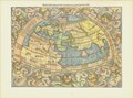
 16th century map of the world - Mappemonde cordiforme d'Oronce.tif 5,269 × 4,512; 68.04 MB
-
 1780s map of Warsaw by P.F. Tardieu.tif 17,181 × 13,438; 660.57 MB
-

-

-
 17th-century map of the Black Sea area by Nicolas Sanson.tif 6,264 × 4,677; 83.84 MB
-
 1820s map - Plan géométrique de la ville de Paris.jpg 12,960 × 9,853; 57.78 MB
-
 1820s map - Plan géométrique de la ville de Paris.tif 12,960 × 9,853; 365.36 MB
-
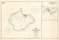
 Admiralty Chart No 1113 Pitcairn Island, Published 1829.jpg 9,820 × 7,450; 15.77 MB
-
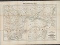
 1839 map of the countries lying between Turkey & Birmah by James Wyld.tif 25,922 × 18,936; 1.37 GB
-
 1840s Map of Kirribilli Point.jpg 760 × 604; 106 KB
-
 1846 map - The Protestant missionary map of the world.tif 10,588 × 6,601; 200 MB
-
 1854 map of the Caucasus - drawn from the latest documents of the Russian Imperial General Staff.tif 16,850 × 12,780; 616.12 MB
-
 1854 Map of the frontier provinces of Turkey, Russia & Austria, the Black Sea, &c.tif 8,044 × 5,964; 137.28 MB
-
 1861 map - The pictorial missionary map of the world.tif 8,744 × 5,789; 144.84 MB
-

-

-
 1884 map - The graphic map of European possessions in Africa by E.G. Ravenstein.tif 6,826 × 9,428; 184.14 MB
-
 1889 map of the world - British Imperial Federation map of the world.tif 5,832 × 4,385; 73.18 MB
-
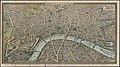 1890s pictorial map of London - London towards the close of the 19th century.jpg 5,000 × 2,792; 12.82 MB
-
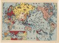
 1899 satirical map of Europe - Angling in troubled waters - by Fred W. rose.tiff 9,704 × 7,238; 200.98 MB
-
 1900s French game board map - Les troubles en Chine - Game instructions.jpg 1,185 × 1,736; 1.25 MB
-
 1900s French game board map - Les troubles en Chine.tif 4,455 × 2,874; 36.66 MB
-

-
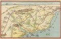
 1915 Australian map of the Sea of Marmara (cropped).jpg 4,826 × 3,580; 10.73 MB
-
 1915 Australian maps of Gallipolli, the Dardanelles and the Sea of Marmara.jpg 5,000 × 6,783; 21.18 MB
-
 1915 Australian maps of Gallipolli, the Dardanelles and the Sea of Marmara.tif 11,837 × 16,058; 543.84 MB
-
 1915 French map of the Turkish Straits and the Sea of Marmara.jpg 5,000 × 3,753; 11.78 MB
-
 1915 French map of the Turkish Straits and the Sea of Marmara.tif 6,648 × 4,991; 94.95 MB
-
 1915 Map of the Dardanelles, Sea of Marmara and Bosporus.jpg 5,000 × 3,336; 11.45 MB
-
 1915 Map of the Dardanelles, Sea of Marmara and Bosporus.tif 18,144 × 12,104; 628.34 MB
-
 1916 Sketch map of Turkey in Asia.tif 10,266 × 7,256; 213.14 MB
-
 1920 map of Asia Minor, Syria and Mesopotamia.tif 7,140 × 5,249; 107.25 MB
-
 1920 Map of Dardanelles, Sea of Marmara, Bosporus.tif 6,390 × 8,463; 155 MB
-
 1922 Japanese map of Pyongyang, Korea.tif 12,974 × 18,768; 696.67 MB
-
 1932 Japanese pictorial map of the world - verso.tif 26,014 × 18,782; 1.37 GB
-
 1932 Japanese pictorial map of the world.tif 25,986 × 18,797; 1.36 GB
-
 1936 Japanese anti Communist propaganda map of East Asia.tif 10,951 × 14,792; 463.47 MB
-
 1937 Japanese pictorial map of East Asia during the Second Sino-Japanese War - verso.tif 9,400 × 12,851; 345.63 MB
-
 1937 Japanese pictorial map of East Asia during the Second Sino-Japanese War.tif 9,457 × 12,888; 348.73 MB
-
 1938 Index to Admiralty charts of Australia nla.obj-574968257.jpg 11,143 × 8,263; 15.41 MB
-
 1938 Index to Admiralty charts of central Pacific Islands nla.obj-574968533.jpg 8,209 × 11,173; 20.52 MB
-
 1938 Index to Admiralty charts of China and Korea, Formosa to Korean Gulf nla.obj-574968299.jpg 11,166 × 8,237; 20.16 MB
-

-

-
-

-

-
-
 1938 Index to Admiralty charts of New Zealand nla.obj-574968413.jpg 11,176 × 8,212; 12.86 MB
-
 1938 Index to Admiralty charts of parts of Chile and Magellan Strait nla.obj-574968193.jpg 8,292 × 11,194; 19.32 MB
-
 1938 Index to Admiralty charts of parts of England, Ireland and France nla.obj-574968358.jpg 11,146 × 8,229; 14.79 MB
-

-

-
 1938 Index to Admiralty charts of South America (southern part) nla.obj-574968178.jpg 8,203 × 11,162; 16.16 MB
-
 1938 Index to Admiralty charts of South America nla.obj-574968110.jpg 8,171 × 11,143; 18.7 MB
-

-
 1938 Index to Admiralty charts of the Eastern Archipelago and China Sea nla.obj-574968374.jpg 8,195 × 11,192; 22.63 MB
-
 1938 Index to Admiralty charts of the eastern Indian Ocean nla.obj-574968511.jpg 8,209 × 11,176; 16.59 MB
-
 1938 Index to Admiralty charts of the West Indies and Central America nla.obj-574968236.jpg 11,160 × 8,238; 17.32 MB
-

-

-
 1938 Index to Admiralty charts of Western Pacific Islands and New Guinea nla.obj-574968330.jpg 11,166 × 8,240; 15.08 MB
-
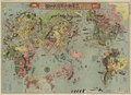
 1938 Japanese pictorial map of the world.tif 18,047 × 12,320; 636.21 MB
-
 1941 map of the The Near and Middle East.tif 12,324 × 8,986; 316.86 MB
-
 1941 Town Plan of Beyrouth by the British Army.tif 9,725 × 7,775; 216.61 MB
-
 1942 Japanese map of the Mediterranean during World War II.tif 10,588 × 4,343; 131.58 MB
-
 1942 Japanese map of the world during World War II verso.tif 8,853 × 6,396; 162.03 MB
-
 1942 Japanese map of the world during World War II.tif 8,808 × 6,369; 160.53 MB
-
 1942 Japanese pictorial map of Singapore.tif 16,162 × 12,337; 570.56 MB
-
 1942 Japanese pictorial map of the Indian Ocean during World War II.tif 8,800 × 6,316; 159.05 MB
-
 1942 Japanese pictorial map of the Middle East and South Asia during World War II.tif 8,752 × 6,343; 158.85 MB
-
 1942 Japanese pictorial map of the world during World War II.tif 10,592 × 4,451; 134.91 MB
-
 1946 Air map of the world centred on Delhi.tif 20,931 × 22,550; 1.32 GB
-
 1949 Plan of Tientsin.tif 11,498 × 16,800; 552.68 MB
-
 1952 geological map of East Africa.tif 17,989 × 24,626; 1.24 GB
-
 1956 map of Hainan Island, People's Republic of China (cropped).jpg 3,663 × 3,510; 2.43 MB
-
 1961 map of Beyrouth by the British War Office.tif 12,575 × 9,157; 329.73 MB
-
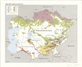 1992 map of major ethnic groups in Central Asia.tif 10,272 × 8,437; 247.97 MB
-
 A Map of the world 1506.tif 5,137 × 7,652; 112.48 MB
-
 A new map of Turkey in Europe.tif 3,944 × 4,668; 52.69 MB
-
 A plan of Cambridge Gulf, on the north west coast of Australia, Published 1826.jpg 5,703 × 7,529; 9.6 MB
-
 A plan of Exmouth Gulf, on the north west coast of Australia, Published 1826.jpg 9,648 × 7,296; 17.99 MB
-
 Admiralty Chart 1674 Australia East coast Queensland Brisbane River, Published 1875.jpg 8,028 × 11,706; 27.67 MB
-
 Admiralty Chart Bass's Strait, Published 1803.jpg 5,912 × 3,980; 6.04 MB
-
 Admiralty Chart No 1 British Islands to the Mediterranean Sea, Published 1884.jpg 8,151 × 12,101; 26.85 MB
-
 Admiralty Chart No 1015 South coast of Australia from Guichen Bay to Glenelg River, Published 1872.jpg 16,458 × 12,007; 64.72 MB
-
 Admiralty Chart No 1016 South coast of Australia Corner Inlet to Gabo Island, Published 1872.jpg 21,792 × 11,709; 81.68 MB
-
 Admiralty Chart No 1017 Gabo Island to Montagu Island, New South Wales, Published 1870.jpg 11,406 × 18,615; 67.35 MB
-

-
 Admiralty Chart No 1020 Jervis Bay to Port Jackson (Sydney Harbour), New South Wales, Published 1869.jpg 11,385 × 19,431; 67.69 MB
-
 Admiralty Chart No 1021 Port Jackson (Sydney Harbour) to Port Stephen, Published 1868.jpg 8,220 × 12,239; 33.57 MB
-

-
 Admiralty Chart No 1024 Port Stephens to Tacking Point, New South Wales, Published 1865.jpg 11,320 × 16,538; 62.38 MB
-
 Admiralty Chart No 1025 Tacking Point to Coffs Islands, New South Wales, Published 1865.jpg 11,095 × 16,273; 67.6 MB
-
 Admiralty Chart No 1026 The Solitary Islands and adjacent coast, New South Wales, Published 1865.jpg 11,399 × 16,136; 64.73 MB
-
 Admiralty Chart No 1027 Coffs Islands to Evans Head, New South Wales, Published 1866.jpg 11,170 × 16,329; 61.96 MB
-
 Admiralty Chart No 1028 Evans Head to Danger Pt., New South Wales, Published1866.jpg 11,143 × 16,345; 56.06 MB
-
 Admiralty Chart No 1029 Danger Pt. to Cape Moreton, Queensland, Published 1869.jpg 11,125 × 16,281; 65.92 MB
-

-
 Admiralty Chart No 1031 Northern portion of Great Sandy Strait, Queensland, Published 1865.jpg 8,108 × 11,884; 20.36 MB
-

-

-
 Admiralty Chart No 1042 General chart of Terra Australis or Australia, Published 1843.jpg 11,596 × 7,884; 40.36 MB
-

-
 Admiralty Chart No 1044 North Coast of Australia Sheet IV, Published 1825.jpg 11,599 × 7,884; 36.87 MB
-

-
 Admiralty Chart No 1047 N.W. coast of Australia. Sheet V, Published 1825.jpg 11,686 × 7,974; 41.47 MB
-
 Admiralty Chart No 1048 N.W. coast of Australia Sheet VI, Published 1825.jpg 10,023 × 7,550; 34.59 MB
-
-
 Admiralty Chart No 105 Tasmania, River Derwent, Port Hobart, Published 1863.jpg 7,944 × 11,669; 25.69 MB
-

-
 Admiralty Chart No 1050 Central America - West Coast. San Jose to Port Angeles, Published 1887.jpg 11,988 × 8,361; 23.03 MB
-
-

-
 Admiralty Chart No 1053 Dampier's Archipelago, Published 1826.jpg 4,893 × 3,915; 8.2 MB
-
-
 Admiralty Chart No 1055 N.W. and West Coasts of Australia. Sheet VII, Published 1825.jpg 10,009 × 7,418; 37.97 MB
-
 Admiralty Chart No 1056 West Coast of Australia. Sheet VIII, Published 1835.jpg 7,520 × 9,848; 53.58 MB
-

-
 Admiralty Chart No 1059 Chart of Terra Australis. Sheet I South coast, Published 1814.jpg 11,631 × 7,899; 40.02 MB
-

-

-
 Admiralty Chart No 1060 Chart of Terra Australis South coast, sheet II, Published 1814.jpg 11,723 × 7,898; 38.72 MB
-
 Admiralty Chart No 1061 C. Catastrophe to the Great Australian Bight, Published 1875.jpg 10,522 × 11,906; 14.74 MB
-
 Admiralty Chart No 1061 Chart of Terra Australis. Sheet III South coast, Published 1814.jpg 11,613 × 7,897; 45.75 MB
-

-
 Admiralty Chart No 1062 South coast of Australia Glenelg River to Cape Otway, Published 1873.jpg 11,700 × 7,941; 30.94 MB
-

-
 Admiralty Chart No 1066 Chart of Terra Australis. sheet 1 East coast, Published 1814.jpg 5,842 × 7,878; 19.97 MB
-
 Admiralty Chart No 1067 Chart of Terra Australis. Sheet II, East coast, Published 1814.jpg 5,758 × 7,842; 19.01 MB
-
 Admiralty Chart No 1068 Chart of Terra Australis. Sheet III East coast, Published 1814.jpg 11,582 × 7,916; 40.15 MB
-
 Admiralty Chart No 1070 Australia East Coast Port Stephens, Published 1847.jpg 7,809 × 5,882; 19.63 MB
-
 Admiralty Chart No 1070 Port Stephens New South Wales, Published 1847.jpg 7,728 × 2,892; 11.21 MB
-
 Admiralty Chart No 1071 Three plans on the East Coast of Australia, Published 1831.jpg 4,087 × 3,042; 2.85 MB
-
 Admiralty Chart No 1072 Mahé Island and approaches, Seychelles Group, Published 1892.jpg 16,369 × 11,141; 42.84 MB
-

-
 Admiralty Chart No 1075 Chart of part of the N.E. coast of Australia. Sheet 1, Published 1824.jpg 11,653 × 7,898; 23.33 MB
-
 Admiralty Chart No 1079 Tasmania, formerly Van Diemen Land, Australia, Published 1860.jpg 16,377 × 11,312; 67.13 MB
-

-
 Admiralty Chart No 1083 Burnett Harbour and Port Arthur, Published 1830.jpg 4,702 × 3,310; 3.25 MB
-
 Admiralty Chart No 1088 Arafura Sea, Published 1837.jpg 15,285 × 8,644; 39.86 MB
-

-
 Admiralty Chart No 1090 New Zealand, (North Isle). Bay of Islands, Published 1836.jpg 7,704 × 5,781; 9.34 MB
-
 Admiralty Chart No 1090 Plans on the north coast of North Island, New Zealand, Published 1942.jpg 11,240 × 16,430; 69.76 MB
-
 Admiralty Chart No 1102 Australia - East coast Queensland, Cleveland Bay, Published 1892.jpg 10,136 × 8,090; 23.09 MB
-
 Admiralty Chart No 1110 Pacific Ocean. Norfolk and Philip Islands, Published 1856.jpg 5,934 × 8,016; 10.4 MB
-

-
 Admiralty Chart No 1171 Australia South Coast Port Phillip, Published 1856.jpg 7,932 × 5,964; 27.57 MB
-
 Admiralty Chart No 1174 Suvarov Islands, South Pacific Ocean, Published 1922.jpg 16,273 × 11,125; 39.89 MB
-

-

-
 Admiralty Chart No 1240 South Polar Chart, Published 1839.jpg 9,527 × 7,604; 15.69 MB
-
 Admiralty Chart No 1243 Cape Londonderry to Cape Voltaire, Australia, Published 1954.jpg 16,428 × 11,264; 51.07 MB
-
 Admiralty Chart No 1250 South Pacific. Fiji or Viti Group. Makongai & Wakaya Is., Published 1865.jpg 7,997 × 11,932; 18.74 MB
-

-
 Admiralty Chart No 1256 China, east coast Yellow Sea and Gulf of Pe-chili, Published 1840.jpg 7,466 × 5,815; 15.37 MB
-
 Admiralty Chart No 1266 Western Australia Peel Harbour and Warnbro Sound, Published 1840.jpg 7,706 × 5,813; 22.75 MB
-
 Admiralty Chart No 1270 The China Sea, Published 1840.jpg 5,934 × 7,585; 17.58 MB
-

-
 Admiralty Chart No 1314 Ports and anchorages on the coast of Chile, Published 1924.jpg 11,320 × 16,538; 53.44 MB
-
 Admiralty Chart No 1333 Australia Port Essington, Published 1840.jpg 5,888 × 7,897; 21.39 MB
-

-
 Admiralty Chart No 1386 Easter Island, or, Rapa Nui, Published 1876.jpg 8,040 × 5,862; 8.84 MB
-
 Admiralty Chart No 1437 Australia - North West coast Port Hedland, Published 1897.jpg 8,026 × 11,752; 48.88 MB
-
 Admiralty Chart No 1475 Tasmania - South Coast. Port Arthur, Published 1893.jpg 6,046 × 8,083; 22.4 MB
-
 Admiralty Chart No 1510 Hawaiian or Sandwich Islands, North Pacific Ocean, Published 1881.jpg 24,516 × 16,656; 94.94 MB
-
 Admiralty Chart No 1629 Tasmania Macquarie Harbour, Surveyed 1819-1822.jpg 7,370 × 5,817; 7.44 MB
-
 Admiralty Chart No 1637 South Pacific Ocean. New Hebrides, Published 1892.jpg 8,529 × 12,512; 27.89 MB
-
 Admiralty Chart No 1660 Suva Harbour (Tomba ko Suva), Fiji Islands, Published 1898.jpg 13,780 × 11,363; 69.31 MB
-
 Admiralty Chart No 167 Kandavu Island and Passage Fiji, Published 1878.jpg 11,143 × 16,321; 45.29 MB
-
 Admiralty Chart No 1670 Australia East Coast Moreton Bay, Published 1848.jpg 5,853 × 7,873; 8.57 MB
-
 Admiralty Chart No 1670a Moreton Bay, Surveyed 1865-1868.jpg 11,712 × 9,562; 57.86 MB
-
-
 Admiralty Chart No 1695a Australia Bass Strait Sheet 1, Corrections to 1889.jpg 7,911 × 11,649; 44.05 MB
-
 Admiralty Chart No 1695b Bass Strait. Western sheet, Published 1868.jpg 8,288 × 12,058; 16.73 MB
-
 Admiralty Chart No 17 South West Pacific Santa Cruz Is., Published 1870.jpg 5,936 × 7,959; 11.83 MB
-
 Admiralty Chart No 1700 Western Australia Swan River and Rottnest Island, Published 1845.jpg 10,931 × 7,476; 36.09 MB
-
 Admiralty Chart No 1703 Australia, Bass Strait, Corner Inlet, Surveyed 1842.jpg 5,758 × 7,796; 19.87 MB
-
 Admiralty Chart No 1705 Australia N.W. Coast the Victoria River, Published 1845.jpg 7,837 × 5,886; 19.56 MB
-
 Admiralty Chart No 1706 Australia Bass Strait Banks Strait, Published 1845.jpg 5,830 × 7,834; 19.96 MB
-
 Admiralty Chart No 1707 Australia, Bass Strait, Port Western, Published 1845.jpg 7,869 × 5,872; 19.93 MB
-
 Admiralty Chart No 1708 Australia Gulf of Carpentaria the Albert River, Published 1845.jpg 7,868 × 5,854; 18.59 MB
-
 Admiralty Chart No 1730 Samoa or Navigator Islands, South Pacific Ocean, Published 1886.jpg 16,281 × 11,168; 53.59 MB
-
 Admiralty Chart No 1731 Australia South Coast Portland Bay, Published 1845.jpg 7,775 × 5,854; 18.52 MB
-


.jpg)


_nla.obj-574968178.jpg)


.jpg)


,_New_South_Wales,_Published_1869.jpg)
_to_Port_Stephen,_Published_1868.jpg)


._Bay_of_Islands,_Published_1836.jpg)


,_Published_1831.jpg)


_Harbours_and_anchorages_on_the_north_coast_of_Tahiti,_Published_1880.jpg)


,_Fiji_Islands,_Published_1898.jpg)


