Category:Maps in the Bayerische Staatsbibliothek
Jump to navigation
Jump to search
Subcategories
This category has the following 2 subcategories, out of 2 total.
Media in category "Maps in the Bayerische Staatsbibliothek"
The following 20 files are in this category, out of 20 total.
-

-

-
 1846 map - Europa nach seinen kirchlichen Verhältnissen.jpg 7,014 × 5,836; 16.75 MB
-

-
 1855 map - Carte du Théâtre de la Guerre.jpg 10,800 × 7,500; 24.31 MB
-
 1890 map of Turkey in Europe in Ottoman Turkish.jpg 19,650 × 13,696; 126.24 MB
-
 1895 map - Asiatische Türkei von Heinrich Kiepert.jpg 15,290 × 12,516; 63.56 MB
-
 1895 map of the Sea of Marmara.jpg 2,864 × 1,681; 2.01 MB
-
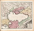 18th century map of the Black Sea and the adjacent parts of Russia and Turkey.jpg 7,311 × 6,663; 29.4 MB
-

-
 1918 map - Artaria's Eisenbahnkarte von Österreich-Ungarn und den Balkanländern.jpg 18,624 × 14,270; 159.14 MB
-
 Ammer-Fluss von dem Ammer-See bis in die Isar 1806.jpg 6,144 × 3,840; 6.87 MB
-
 Bavariae Circulus Et Electorat 1742.jpg 8,704 × 12,288; 18.23 MB
-
 Donaumoos Karte - Adrian von Riedl - 1804-1805.jpg 2,475 × 1,265; 1.29 MB
-
 Karte - Nürnberger Reichswälder - HW - 1559.jpg 11,671 × 11,428; 31.31 MB
-
 Karte - Plan Der Freyen Reichs-Stadt Regenspurg Burgfried - um 1800.jpg 12,457 × 8,789; 18.35 MB
-
 Karte - Prospectus Peissenbergensis - BSB Cod.icon. 177.jpg 2,609 × 3,206; 5.76 MB
-
 Karte des Deutschen Reiches 1 zu 100 000 (1889) - Blatt 564 - Neumarkt.jpg 11,351 × 9,680; 72.26 MB
-

-
 Walchensee und Kochelsee Karte Adrian von Riedl 1806.jpg 6,731 × 4,936; 10.58 MB


_-_Blatt_564_-_Neumarkt.jpg)

