Category:Maps from the Collection d'Anville
Jump to navigation
Jump to search
Media in category "Maps from the Collection d'Anville"
The following 14 files are in this category, out of 14 total.
-
 Plan de Paris 1383 BNF07710748.png 1,984 × 1,616; 4.75 MB
-
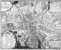
 Plan de Paris 1589-1643 BNF07710699.png 3,868 × 3,169; 15.75 MB
-
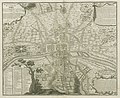
 Plan de Paris 1705 BNF07710700.png 3,890 × 3,158; 15.89 MB
-
 Plan de Paris 1180 BNF07710746.png 1,932 × 1,568; 4.38 MB
-
 Plan de Paris 1223 BNF07710747 - Gallica.jpg 8,568 × 7,069; 49.93 MB
-
 Plan de Paris 1223 BNF07710747.png 1,964 × 1,616; 2.5 MB
-
 Plan de Paris 1422 1589 BNF07710749.png 2,016 × 1,676; 5.25 MB
-
 Plan de Paris Lutece - La boite verte.png 2,577 × 2,048; 5.77 MB
-
 Plan de Paris Lutece BNF07710744.png 2,064 × 1,684; 5.01 MB
-
 Plan de Paris Lutece2 BNF07710745.png 2,020 × 1,656; 4.98 MB
-
 Plan manuscrit du domaine de Versailles et de ses environs - Gallica 2013 (adjusted).jpg 20,502 × 18,299; 39.74 MB
-
 Plan manuscrit du domaine de Versailles et de ses environs - Gallica 2013.jpg 21,084 × 18,609; 71.3 MB
-
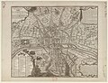 Quatrième plan de la ville de Paris - Gallica 1.jpg 10,447 × 8,014; 27.63 MB
-
 Quatrième plan de la ville de Paris - Gallica 2.jpg 6,644 × 5,444; 6.31 MB


.jpg)


