Category:Maps by Samuel de Champlain
Jump to navigation
Jump to search
Media in category "Maps by Samuel de Champlain"
The following 23 files are in this category, out of 23 total.
-
-
 Baie des Chaleurs 1612.PNG 507 × 310; 295 KB
-
 Carte de la Nouuelle France... (2675698194).jpg 2,000 × 1,265; 2.2 MB
-
 Carte de la Nouvelle France (29876584890).jpg 1,920 × 1,207; 820 KB
-
 Carte de Nouvelle-France par Champlain (1612).tif 10,142 × 5,786; 56.01 MB
-
 Champ1632 82.jpg 1,845 × 1,009; 936 KB
-
 Champlain Montreal 1612.JPG 1,551 × 902; 263 KB
-
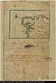
 Champlain's Map of Plymouth Harbor.jpg 530 × 382; 124 KB
-
 ChamplainNausetHarbor.jpg 1,000 × 778; 232 KB
-
 Descripsion des costs, pts., rades, illes de la Nouuele France.jpg 2,221 × 1,517; 1.04 MB
-

-
 Fragment d'une carte manuscrite de Champlain 1607.jpg 4,895 × 3,219; 2.05 MB
-

-
 Mapa da costa de Galiza de Samuel de Champlain (c. 1602).jpg 3,919 × 5,834; 3.15 MB
-

-
 Champlain's map of New France 1632 (NYPL b20643233-5476419).jpg 9,409 × 6,158; 51.55 MB
-
 Champlain's map of New France 1632 (NYPL b20643233-5476419).tiff 10,328 × 7,760, 2 pages; 229.61 MB
-
 Port de Tadoussac.png 2,000 × 2,004; 5.42 MB
-
 Port Fortuné, altercation.tif 2,893 × 1,901; 15.91 MB
-
 PortRoyal par Champlain.tif 2,973 × 2,421; 20.8 MB
-
 Quebec 1608 Champlain.PNG 1,500 × 929; 1.09 MB
-
 Samuel de Champlain Carte geographique de la Nouvelle France.jpg 10,173 × 5,834; 16.05 MB
-
 Section of Champlain's Map.png 1,068 × 760; 1.02 MB


.jpg)
.jpg)


_by_Samuel_de_Champlain,_from_Les_Voyages,_Paris,_1613_-_Cape_Ann_Museum_-_Gloucester,_MA_-_DSC01073.jpg)
.jpg)
.jpg)
.jpg)


