Category:Maps by Royal Bavarian Land Survey
Jump to navigation
Jump to search
English: Maps created for Royal Bavarian Land Land Survey.
Deutsch: Urpositionsblätter 1:25000 der Landvermessung im Königreich Bayern.
Media in category "Maps by Royal Bavarian Land Survey"
The following 31 files are in this category, out of 31 total.
-
 Blatt 229 Hemhofen 1856 001.jpg 1,303 × 1,294; 611 KB
-
 Blatt 230 Baiersdorf 1854 001.jpg 1,238 × 1,237; 533 KB
-
 Blatt 250 Herzogenaurach 1860 001.jpg 1,287 × 1,283; 587 KB
-
 Blatt 251 Erlangen 1860-61 001.jpg 1,243 × 1,235; 477 KB
-
 Blatt 272 Fürth 1863 001.JPG 1,246 × 1,238; 537 KB
-
 Blatt 273 Nürnberg 1862 001.JPG 1,278 × 1,276; 547 KB
-
 Donauleiten-Löwenwand.jpg 776 × 336; 264 KB
-
 PasingArea1855.jpg 1,249 × 1,243; 329 KB
-
 Landvermessung in Bayern - Urpositionsblatt 692 (München).jpg 2,200 × 2,198; 2.93 MB
-
 Urpositionsblaetter Bayern blatt 695.jpg 1,386 × 1,394; 501 KB
-
 Blatt 713 Baierbrunn 1863 a.jpg 1,037 × 1,039; 473 KB
-
 Blatt 713 Baierbrunn 1863.jpg 1,247 × 1,247; 563 KB
-
 Blatt 714 Grünwald 1864 a.jpg 1,036 × 1,040; 511 KB
-
 Blatt 714 Grünwald 1864.jpg 1,244 × 1,244; 599 KB
-
 Blatt 736 Schäftlarn 1856 a.jpg 1,041 × 1,039; 602 KB
-
 Blatt 736 Schäftlarn 1856.jpg 1,241 × 1,241; 707 KB
-
 Blatt 738 Peiss.jpg 1,361 × 1,394; 453 KB
-
 Tegernsee 1862 blatt 812.jpg 1,394 × 1,394; 479 KB
-
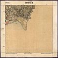 Lindau 2-Blatt 852.jpg 1,256 × 1,260; 362 KB
-
 Blatt 866.jpg 1,394 × 1,394; 528 KB
-
 Blatt 866-2.jpg 2,281 × 1,240; 2.73 MB
-
 Karte des Gebiets des heutigen Sylvensteinspeichers.jpg 2,277 × 1,246; 754 KB
-
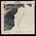
 Noch lange nicht überflutetes Überflutungsgebiet des Sylvensteinspeichers.jpg 1,847 × 1,112; 914 KB
-
 Überflutungsgebiet des Sylvensteinspeichers.jpg 1,847 × 1,112; 916 KB
-
 Blatt 867.jpg 1,377 × 1,394; 412 KB
-
 Echelsbacher Ammerfurt.jpg 1,112 × 806; 787 KB
-
 Forstenrieder Park Lage 1877.jpg 2,398 × 2,824; 6.96 MB
-
 Kirchstätt (Sankt Wolfgang) um 1850 - Urkataster.jpg 3,281 × 3,821; 9.34 MB
-
 Mrkt Indersdorf Urpositionsblaetter Blatt 611.jpg 350 × 350; 65 KB
-
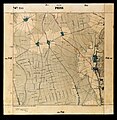
 Neuburg a.d. Kamlach und Umgebung im Jahre 1865 Blatt 631.jpg 1,394 × 1,394; 618 KB
-
 Passau mit Kräutelstein Urpositionsblatt.jpg 1,742 × 813; 1.25 MB


.jpg)


_um_1850_-_Urkataster.jpg)


