Category:Maps by John Rapkin
Jump to navigation
Jump to search
Media in category "Maps by John Rapkin"
The following 28 files are in this category, out of 28 total.
-

-
 1850 Tallis - Rapkin Map of the United States - Geographicus - USA-tlls-1850.jpg 2,737 × 2,045; 1.5 MB
-

-
 1850 Tallis Map of the Cape Colony.png 1,988 × 1,590; 6.99 MB
-
-
 1850 Tallis Map of the Western Hemisphere - Geographicus - HemiWest-tallis-1850.jpg 4,000 × 2,940; 2.05 MB
-
-
-
 Rapkin & Tallis Western Africa 1851 UTA.jpg 8,672 × 6,287; 14.06 MB
-

-

-
 1851 Tallis map of British Possessions in the Mediterranean (engraved by John Rapkin).jpg 1,587 × 2,187; 1.63 MB
-
 1851 Tallis map of Malta (engraved by John Rapkin).jpg 1,049 × 1,089; 607 KB
-

-
 Dubai2 082.jpg 2,304 × 1,728; 1.47 MB
-
 Egypt and Arabia Petraea (1851).png 1,024 × 1,452; 2.83 MB
-
 Egypt and Arabia Petraea WDL84.png 1,024 × 1,452; 2.85 MB
-
 Egypt and Arabia petræa. LOC 99446218.jpg 2,990 × 4,241; 2.35 MB
-
 Historical Map of Arabia (1850).jpg 12,500 × 9,014; 35.16 MB
-
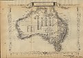 Historical Map of Australia (1860).jpg 4,625 × 3,292; 7.12 MB
-
 Historical Map of Brazil (1851).png 1,016 × 1,316; 2.82 MB
-
 John-Tallis-1851-Tibet-Mongolia-and-Manchuria-33621.jpg 4,030 × 3,102; 12.64 MB
-
 John-Tallis-1851-Tibet-Mongolia-and-Manchuria-NE.jpg 2,100 × 1,400; 2.34 MB
-
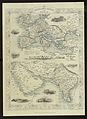
 Map of Arabia, 1851 by Tallis & Rapkin.jpg 900 × 600; 130 KB
-
 Persian Gulf, detail from Old Map of Arabia 1851 by Tallis & Rapkin.jpg 900 × 797; 180 KB
-
 Persian-gulf-dubai-mus.JPG 1,254 × 813; 116 KB
-
 Route to India by John Rapkin 1845 G NS 018.jpg 3,232 × 4,432; 3.13 MB
-
 San Juan Island on Tallis Map.jpg 380 × 344; 115 KB


_-_Geographicus_-_UnitedStates-tallis-1850.jpg)

_-_Geographicus_-_WestCanada-tallis-1850_(cropped).jpg)
_-_Geographicus_-_WestCanada-tallis-1850.jpg)

_-_Geographicus_-_IndepndentTartary-tallis-1851.jpg)

.jpg)
.jpg)


.png)


.jpg)
.jpg)
.png)


