Category:Maps by Johannes Bussemacher
Jump to navigation
Jump to search
Media in category "Maps by Johannes Bussemacher"
The following 60 files are in this category, out of 60 total.
-
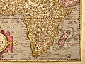
 Bussemacher-Quad Aphrica 1600 UTA.jpg 7,620 × 5,478; 14.94 MB
-
 Africa from Geographisch Handtbuch (south east).jpg 800 × 600; 229 KB
-
 Africa from Geographisch Handtbuch (south west).jpg 800 × 600; 208 KB
-
 Africa from Geographisch Handtbuch.jpg 800 × 600; 218 KB
-
 Artesia.jpg 1,600 × 1,180; 2.62 MB
-
 Asia from the Geographisch Handtbuch (north east).jpg 800 × 600; 208 KB
-
 Asia from the Geographisch Handtbuch (north west).jpg 800 × 600; 215 KB
-
 Asia from the Geographisch Handtbuch (small).jpg 800 × 600; 274 KB
-
 Asia from the Geographisch Handtbuch (south east).jpg 800 × 600; 221 KB
-
 Asia from the Geographisch Handtbuch (south west).jpg 800 × 600; 215 KB
-
 Asia from the Geographisch Handtbuch.jpg 800 × 600; 219 KB
-
 Basic cartouche in a Prussia map by Bussemacher.jpg 791 × 1,148; 373 KB
-
 Belgium, 1608.jpg 3,725 × 2,710; 4.58 MB
-
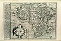 Bodleian Libraries, Map of Africa as Matthias Quaden's Aphrica.jpg 1,000 × 675; 240 KB
-

-

-

-

-

-
 France from Geographisch Handtbuch (north waet).jpg 800 × 600; 194 KB
-
 France from Geographisch Handtbuch (south east).jpg 800 × 600; 198 KB
-
 France from Geographisch Handtbuch (south west).jpg 800 × 600; 174 KB
-
 France from Geographisch Handtbuch north east).jpg 800 × 600; 175 KB
-
 France from Geographisch Handtbuch.jpg 800 × 600; 180 KB
-
 LASB K Hellwig 0091.jpg 8,270 × 6,570; 4.33 MB
-
 LASB K Hellwig 0710.jpg 4,367 × 3,225; 3.09 MB
-
 LASB K Hellwig 0753.jpg 4,296 × 3,210; 3.6 MB
-
 LASB K Hellwig 0760.jpg 4,383 × 3,258; 3.51 MB
-
 LASB K Hellwig 0866.jpg 3,438 × 2,424; 2.72 MB
-
 Matthias quad per johannes bussemacher, corsica, colonia 1596.jpg 4,146 × 3,132; 8.14 MB
-
 Moskovia Bussemacher.jpg 920 × 700; 422 KB
-
 North america from Geographisch Handtbuch (north east).jpg 800 × 600; 208 KB
-
 North america from Geographisch Handtbuch (north west).jpg 800 × 600; 199 KB
-
 North america from Geographisch Handtbuch (south east).jpg 800 × 600; 220 KB
-
 North america from Geographisch Handtbuch (south west).jpg 800 × 600; 244 KB
-
 North america from Geographisch Handtbuch.jpg 800 × 600; 209 KB
-
 Oberpfalz - Palatinatus Bavariae - Johann Bussemacher 1596.jpg 2,201 × 1,647; 621 KB
-
 Persia, from 'Geographisch Handtbuch (north east).jpg 800 × 600; 155 KB
-
 Persia, from 'Geographisch Handtbuch (north west).jpg 800 × 600; 167 KB
-
 Persia, from 'Geographisch Handtbuch (south east).jpg 800 × 600; 169 KB
-
 Persia, from 'Geographisch Handtbuch (south west).jpg 800 × 600; 171 KB
-
 Persia, from 'Geographisch Handtbuch.jpg 800 × 600; 182 KB
-
 Prussiae Descriptio.jpg 3,139 × 2,246; 2.89 MB
-
 Quad Flandria detail.jpg 2,528 × 1,204; 3.12 MB
-
 Quad Flandria.jpg 3,345 × 2,498; 7.53 MB
-
 South america from Geographisch Handtbuch (north east).jpg 800 × 600; 196 KB
-
 South america from Geographisch Handtbuch (north west).jpg 800 × 600; 209 KB
-
 South america from Geographisch Handtbuch (south east).jpg 800 × 600; 186 KB
-
 South america from Geographisch Handtbuch (south west).jpg 800 × 600; 176 KB
-
 South america from Geographisch Handtbuch.jpg 800 × 600; 204 KB
-
 Spain and Portugal (northwest) from Geographisch Handtbuch, 1600.jpg 800 × 600; 215 KB
-
 Spain and Portugal from Geographisch Handtbuch (north east).jpg 800 × 600; 215 KB
-
 Spain and Portugal from Geographisch Handtbuch (south east).jpg 800 × 600; 223 KB
-
 Spain and Portugal from Geographisch Handtbuch (south west).jpg 800 × 600; 232 KB
-
 Spain and Portugal from Geographisch Handtbuch.jpg 800 × 600; 204 KB
-
 The world from from Geographisch Handtbuch (north east).jpg 800 × 600; 205 KB
-
 The world from from Geographisch Handtbuch (north west).jpg 800 × 600; 183 KB
-
 The world from from Geographisch Handtbuch (south east).jpg 800 × 600; 207 KB
-
 The world from from Geographisch Handtbuch(north west).jpg 800 × 600; 200 KB
-
 The world from from Geographisch Handtbuch.jpg 800 × 600; 197 KB

.jpg)
.jpg)


.jpg)
.jpg)
.jpg)
.jpg)
.jpg)


.jpg)
.jpg)
.jpg)

.jpg)
.jpg)
.jpg)
.jpg)
.jpg)


.jpg)
.jpg)
.jpg)
.jpg)


.jpg)
.jpg)
.jpg)
.jpg)


.jpg)
.jpg)
.jpg)
.jpg)

_from_Geographisch_Handtbuch,_1600.jpg)
.jpg)
.jpg)
.jpg)

.jpg)
.jpg)
.jpg)
.jpg)
