Category:Maps by Henry Schenck Tanner
Jump to navigation
Jump to search
Subcategories
This category has only the following subcategory.
Media in category "Maps by Henry Schenck Tanner"
The following 23 files are in this category, out of 23 total.
-
 1802 map of Africa by Aaron Arrowsmith, published in 1842.jpg 17,733 × 15,086; 43.96 MB
-
 1817 map of Turkey in Asia by Henry Schenk Tanner.jpg 9,426 × 7,687; 14.36 MB
-
 1823 map of Africa.jpg 14,468 × 13,125; 28.68 MB
-
 1823 Map of Alabama and Georgia counties.jpeg 5,732 × 4,442; 2.49 MB
-
 1831 Judda map Africa by Tanner BPL m0612002 detail.png 1,062 × 748; 1.41 MB
-

-
 Austin & Tanner Map of Texas with Parts of the Adjoining States 1836 UTA.jpg 7,003 × 8,786; 13.33 MB
-
 Tanner A Map of the United States of Mexico 1846 UTA.jpg 3,353 × 2,688; 1.76 MB
-
 Tanner Africa 1847 UTA.jpg 4,689 × 3,850; 7.11 MB
-

-

-
 Madagascar detail of a 1823 map of Africa.jpg 2,905 × 2,926; 2.17 MB
-
 Map of Texas with parts of the adjoining states (NBY 18211).jpg 3,085 × 3,600; 1.69 MB
-
 New York, 1842.jpg 1,004 × 1,236; 396 KB
-
 New-York. NYPL433880.tiff 4,107 × 3,735; 43.89 MB
-
 New-York. NYPL433883.tiff 3,553 × 3,286; 33.41 MB
-
 New-York. NYPL434689.tiff 3,588 × 3,251; 33.38 MB
-
 Persia, Arabia, et cetera by Henry Schenck Tanner - WDL - LOC.png 1,300 × 1,024; 2.31 MB
-
 Russia in Asia And Tartary.jpg 9,620 × 7,840; 15.12 MB
-
 Stephen F. Austin’s Cornerstone Map of Texas, 1836.jpg 3,761 × 4,649; 2.95 MB
-
 Tanner map part J1.jpg 1,489 × 1,765; 1.34 MB
-
 Turkey in Asia.jpg 8,995 × 7,277; 13.85 MB
-
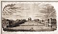 University of Virginia Lawn 1826.jpg 628 × 368; 60 KB


.jpg)


.jpg)
_Indian_territory_map_within_the_1823_Map_of_Alabama_and_Georgia_counties_(cropped).jpeg)

.jpg)


