Category:Maps by David H. Burr
Jump to navigation
Jump to search
Subcategories
This category has only the following subcategory.
Media in category "Maps by David H. Burr"
The following 27 files are in this category, out of 27 total.
-
 1832 Erie Canal.jpg 4,205 × 938; 774 KB
-
 1835 David Burr Map of New York City - Geographicus - NewYorkCity-burr-1836.jpg 4,000 × 4,877; 3.53 MB
-

-
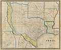 Burr The State of Texas, 1835-1845 1846 UTA.jpg 3,218 × 2,688; 1.54 MB
-

-
 Albany-1829-b.jpg 370 × 465; 34 KB
-
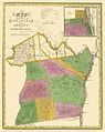
 AlbanyCounty1839.jpg 603 × 760; 103 KB
-
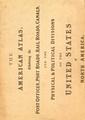 The American Atlas WDL9562.pdf 2,650 × 3,750, 15 pages; 11.16 MB
-
 Chile.1835.djvu 4,906 × 5,696; 3.56 MB
-
 Illman-1833 det1.jpg 707 × 470; 336 KB
-
 Kingston-road-1839-tn1.gif 534 × 286; 96 KB
-
 Loudon-map-1839-tn1.gif 465 × 348; 103 KB
-
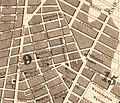 Map of City of New York published in 1834 (crop 1).jpg 1,031 × 881; 461 KB
-
 Map of City of New York published in 1834 (cropped).jpg 687 × 682; 246 KB
-
 Map of City of New York published in 1834.jpg 5,604 × 6,905; 14.08 MB
-
 Map of Kentucky and Tennessee by David H Burr - WDL.png 1,375 × 1,024; 2.2 MB
-
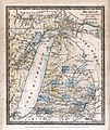 Map of Michigan (1831) DH Burr.jpg 3,511 × 4,158; 4.8 MB
-
 Map of the United States of North America with Parts of the Adjacent Countries.png 1,375 × 1,024; 2.46 MB
-

-

-

-
 Rensselaer County 1829 Restored.jpg 3,964 × 5,857; 16.51 MB
-
 Rensselaer County 1829.jpg 5,759 × 7,102; 5.76 MB
-

-
 The World, on Mercator's Projection by David H. Burr.jpg 8,000 × 6,356; 11.94 MB
-
 Ticonderoga and Schroon Turnpike.jpg 1,241 × 416; 481 KB
-
 WestchesterCountyNY1839.jpg 518 × 760; 67 KB

_-_Geographicus_-_UnitedStates-burr-1839.jpg)

_-_Geographicus_-_NYCHarlemHeights3-rogers-1868.jpg)


.jpg)
.jpg)


_DH_Burr.jpg)


_1837;_containing_a_general_description_of_the_city_of_New-York,_list_of_officers,_public_institutions,_and_other_useful_information_(1833)_(14760825516).jpg)
_1837;_containing_a_general_description_of_the_city_of_New-York,_list_of_officers,_public_institutions,_and_other_useful_information_(1833)_(14781464764).jpg)


