Category:Maps by Daniel Stoopendaal
Jump to navigation
Jump to search
Media in category "Maps by Daniel Stoopendaal"
The following 11 files are in this category, out of 11 total.
-
 1690s map of Jerusalem by Daniel Stoopendaal.jpg 11,133 × 7,366; 21.1 MB
-
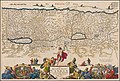
 1695 Dutch map of the Eastern Mediterranean showing the travels of St. Paul.jpg 11,249 × 8,607; 23.48 MB
-
 1695 map of the Eastern Mediterranean showing the travels of St. Paul.jpg 11,123 × 7,287; 17.9 MB
-

-
 Ca. 1690 map of Jerusalem by Daniel Stoopendaal.jpg 11,113 × 8,653; 27.81 MB
-
 Ca. 1690 map of the Holy Land by Daniel Stoopendaal.jpg 11,144 × 7,500; 16.8 MB
-
 Ca. 1695 Dutch map - De Beschryvingh Van de Reysen Pauli en Van de Andere Apostelen.png 3,653 × 2,494; 22.01 MB
-
 Figurative Cartouche on the 1702 Israel Map by Visscher Stoopendaal.jpg 1,161 × 514; 229 KB
-
 Kaart van Amsterdam en omliggende gebieden (Daniël Stopendael).jpg 4,846 × 4,426; 4.11 MB
-
 Kaart van Amsterdam met Huis Kostverloren aan de Amstel (ca.1700).jpg 2,710 × 2,174; 1.07 MB
-
 Kaart Vechtstreek door Daniël Stoopendaal in De Zegepralende Vecht 1719.jpg 1,381 × 2,682; 2.89 MB


.jpg)
.jpg)
