Category:Maps by Antonio Zatta in the British Museum (twelve small maps series)
Jump to navigation
Jump to search
English: These maps from the British Museum are assumed to have been created by Antonio Zatta (?) and published by Pietro Zancon (?)
Media in category "Maps by Antonio Zatta in the British Museum (twelve small maps series)"
The following 14 files are in this category, out of 14 total.
-
 Il Giapone (Antonio Zatta 1794, twelve small maps).jpg 571 × 371; 72 KB
-
 Il Messico (Antonio Zatta 1794, twelve small maps).jpg 552 × 350; 73 KB
-
 Il Peru (Antonio Zatta 1794, twelve small maps).jpg 378 × 551; 75 KB
-
 L'America Settentrionale(Antonio Zatta 1794, twelve small maps).jpg 556 × 375; 80 KB
-
 L'Indie (Antonio Zatta 1794, twelve small maps).jpg 532 × 367; 77 KB
-
 La China (Antonio Zatta 1794, twelve small maps).jpg 556 × 366; 76 KB
-
 La Guinea occidentale (Antonio Zatta 1794, twelve small maps).jpg 374 × 569; 75 KB
-
 La Guinea orientale (Antonio Zatta 1794, twelve small maps).jpg 378 × 559; 80 KB
-
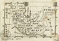 La Persia (Antonio Zatta 1794, twelve small maps).jpg 542 × 374; 80 KB
-
 Le Coste di Barbaria (Antonio Zatta 1794, twelve small maps).jpg 556 × 379; 83 KB
-
 Regno di Prussia (Antonio Zatta 1794, twelve small maps).jpg 541 × 378; 78 KB
-
 Sardegna (Antonio Zatta 1794, twelve small maps).jpg 370 × 554; 88 KB
-
 Print, map (BM C,2.1805-1816 1).jpg 1,476 × 2,500; 730 KB
-
 Print, map (BM C,2.1805-1816).jpg 1,608 × 2,500; 446 KB
.jpg)
.jpg)
.jpg)
.jpg)
.jpg)
.jpg)
.jpg)
.jpg)
.jpg)
.jpg)
.jpg)
.jpg)
.jpg)
.jpg)