Category:Maps by Alexander von Humboldt
Jump to navigation
Jump to search
Media in category "Maps by Alexander von Humboldt"
The following 17 files are in this category, out of 17 total.
-

-
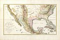
 Humboldt A Map of New Spain 1803 (1810) UTA.jpg 3,500 × 5,058; 2.96 MB
-
 Pike & Nau A Sketch of the Vice Royalty...of New Spain 1810 UTA.jpg 4,820 × 3,935; 6.42 MB
-
-

-
 Alexander Humboldt y Aime Bonpland.jpg 1,800 × 2,728; 5.21 MB
-
 Alexander von Humboldt (1769-1859) Baron Wellcome L0031820.jpg 1,808 × 1,116; 851 KB
-
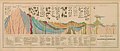
 Alexander von Humboldt - 1841 - Diagram of a cross-section of the earth's crust.jpg 20,639 × 9,058; 58.79 MB
-
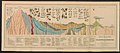
 Alexander von Humboldt - 1850 - Geographical Distribution of Plants - Crop.jpg 8,206 × 2,577; 6.06 MB
-
 Alexander von Humboldt - 1850 - Geographical Distribution of Plants.jpg 12,677 × 8,875; 13.18 MB
-
 Alexander von Humboldt - Diagram of a cross-section of the earth's crust - rectified.jpg 20,182 × 8,501; 43.07 MB
-
 Carte du Mexique et des pays limitrophes situés au nord et à lest (5120558449).jpg 2,000 × 1,252; 2.41 MB
-

-
 Humboldt reisetagebuch VIIab 220.png 1,304 × 2,108; 3.36 MB
-
 Meyer‘s Zeitungsatlas 060 – Erdkarte.jpg 6,974 × 5,301; 11.45 MB
-
 Viage á las regiones equinocciales del nuevo continente BHL45797172.jpg 3,350 × 2,348; 1.65 MB
-
 Canal do Cassiquiare.jpg 1,308 × 2,011; 297 KB
.jpg)
_UTA.jpg)


_Baron_Wellcome_L0031820.jpg)


.jpg)


