Category:Maps (NARA)
Jump to navigation
Jump to search
Media in category "Maps (NARA)"
The following 200 files are in this category, out of 1,419 total.
(previous page) (next page)-
 Maof LH Reserve - NARA - 77415432.jpg 3,128 × 3,673; 2.8 MB
-
 Map & Profile of 86th Mile from Winston-Salem - NARA - 118818293.jpg 16,679 × 7,200; 14.58 MB
-
 Map & Profile of 87th Mile from Winston-Salem - NARA - 118818295.jpg 16,683 × 7,232; 10.3 MB
-
 Map & Profile of 88th Mile from Winston-Salem - NARA - 118818297 (page 1).jpg 16,693 × 7,296; 16.45 MB
-
 Map & Profile of 88th Mile from Winston-Salem - NARA - 118818297 (page 2).jpg 17,118 × 7,488; 22.35 MB
-
 Map ' A' Of Round Island And Shoals - NARA - 100298420.jpg 9,696 × 8,307; 2.89 MB
-
 Map (Plat) Of Four Islands (Copy) - NARA - 100298422.jpg 5,724 × 7,211; 1.41 MB
-
 Map (Plat) Of Horn Island (Copy) - NARA - 100298372.jpg 8,073 × 2,864; 896 KB
-
 Map (Plat) Of Horn Island Light Station - NARA - 100298382.jpg 4,120 × 5,708; 1.26 MB
-
 Map (Plat) Of Island 1827, Site Of Lh - NARA - 100298046.jpg 7,300 × 5,739; 2.28 MB
-
 Map (Plat) Of LH Depot (Blueline Print) - NARA - 85967657.jpg 8,817 × 6,024; 5.66 MB
-
 Map (Plat) of Rancho Punt Del Ano ... - NARA - 77415902.jpg 5,084 × 7,218; 9.9 MB
-
 Map (Plat) Of Township Reserved For LH - NARA - 116763553.jpg 7,280 × 5,634; 1.24 MB
-
 Map (Plat) Of Township Reserved For LH - NARA - 116763555.jpg 7,280 × 5,529; 1.26 MB
-
 Map (Plat) Of Township Reserved For LH - NARA - 116763557.jpg 7,292 × 5,782; 1.51 MB
-
 Map (Plat), Horn & Petit Bois I. (Tracing) - NARA - 100298370.jpg 8,948 × 5,697; 2.34 MB
-
 Map (Sketch) Of Mount Desert Rock - NARA - 85967907.jpg 5,780 × 6,752; 1.18 MB
-
 Map 1 Govt.Land-LH, S.Morris I. - NARA - 87201111.jpg 11,469 × 8,392; 9.6 MB
-
 Map 1 Govt.Land-LH, S.Morris I. - NARA - 87201113.jpg 11,496 × 7,308; 9.68 MB
-
 Map 1 illustrating the Military Operations of the Atlanta Campaign - NARA - 102279425.jpg 9,543 × 16,093; 43.42 MB
-
 Map 1 Racine Breakwater Location - NARA - 87202281.jpg 2,860 × 4,218; 452 KB
-
 Map Accompanying Colonel Price's Dispatch of 18 April 1847 - NARA - 78117318.jpg 2,848 × 3,652; 734 KB
-

-

-

-

-
-

-
-

-

-

-

-

-

-
 Map comprising parts of Oregon, Idaho, California, and Nevada - NARA - 93193331.jpg 11,287 × 10,416; 6.3 MB
-
 Map Eastern Oregon and Western Idaho - NARA - 93193210.jpg 8,888 × 4,539; 2.12 MB
-

-

-

-

-

-

-

-

-

-
-

-

-

-

-

-
 Map Fort Myer, Virginia - NARA - 137930506.jpg 9,456 × 7,381; 3.32 MB
-
 Map From California to New Mexico - NARA - 93193240.jpg 4,848 × 6,185; 1.61 MB
-
 Map from Sacramento to Virginia Cities and adjoining Northern country - NARA - 93193222.jpg 6,892 × 3,420; 1.45 MB
-
 Map from Whipple's Route and King's Explorations - NARA - 93193258.jpg 6,272 × 4,714; 1.65 MB
-
 Map I, East Half - NARA - 93193093.jpg 7,168 × 9,742; 5.03 MB
-
 Map I, West Half, North Platte River - NARA - 93193097.jpg 7,008 × 9,420; 4.68 MB
-
 Map II, East Half, Green River - NARA - 93193101.jpg 7,136 × 10,407; 4.79 MB
-
 Map II, West Half, Green River - NARA - 93193103.jpg 7,168 × 10,390; 5.21 MB
-
 Map III, East Half, Bear River - NARA - 93193107.jpg 7,136 × 9,685; 6.56 MB
-
 Map III, West Half, Great Salt Lake - NARA - 93193111.jpg 7,136 × 9,644; 4.48 MB
-
 Map Illustrating the Battle of Bentonsville, N.C. - NARA - 140696214.jpg 10,816 × 6,604; 9.07 MB
-

-

-
 Map Illustrating the Fourth Epoch of the Atlanta Campaign - NARA - 102279422 (page 1).jpg 11,144 × 7,286; 12.17 MB
-
 Map Illustrating the Fourth Epoch of the Atlanta Campaign - NARA - 102279422 (page 2).jpg 11,249 × 6,920; 16.85 MB
-

-

-

-
 Map Illustrating the Second Epoch of the Atlanta Campaign - NARA - 102279417.jpg 12,792 × 18,007; 23.56 MB
-
 Map Illustrating the Third Epoch of the Atlanta Campaign - NARA - 102279419 (page 1).jpg 6,927 × 9,712; 9.59 MB
-
 Map Illustrating the Third Epoch of the Atlanta Campaign - NARA - 102279419 (page 2).jpg 6,886 × 9,748; 13.64 MB
-
 Map Illustrating Various Channels -Near the Louisville Wharf - NARA - 122668562.jpg 9,112 × 10,868; 2.82 MB
-

-
 Map IV, East Half, Showing the Central Pacific Railroad - NARA - 93193115.jpg 7,072 × 9,646; 4.95 MB
-
 Map IV, West Half, Humboldt River - NARA - 93193119.jpg 7,008 × 9,625; 5.34 MB
-
 Map made by Ioway Chief Non-chi-ning-ga - NARA - 102278806.jpg 10,909 × 15,024; 11.33 MB
-
-

-

-

-

-

-

-
-

-

-
 Map No. I, East Half - NARA - 93193095.jpg 7,168 × 9,750; 4.95 MB
-
 Map No. I, West Half, North Platte River - NARA - 93193099.jpg 7,616 × 9,399; 4.94 MB
-
 Map No. II, West Half, Green River - NARA - 93193105.jpg 7,168 × 9,693; 5.01 MB
-
 Map No. III, East Half, Weber River - NARA - 93193109.jpg 7,104 × 9,801; 6.84 MB
-
 Map No. III, West Half, Great Salt Lake - NARA - 93193113.jpg 7,104 × 9,653; 3.98 MB
-
 Map No. IV, East Half - NARA - 93193117.jpg 7,136 × 9,665; 4.64 MB
-
 Map No. V, West Half - NARA - 93193091.jpg 7,072 × 9,619; 5.25 MB
-
 Map of "The Seat of War" in Virginia - NARA - 70653215 (page 1).jpg 16,655 × 10,485; 16.79 MB
-
 Map of "The Seat of War" in Virginia - NARA - 70653215 (page 2).jpg 11,882 × 7,275; 5.08 MB
-

-
 Map of a part of Orange County, Virginia - NARA - 86455663.jpg 12,253 × 5,408; 7.28 MB
-

-

-

-
 Map of a Part of Washington Territory - NARA - 93193181.jpg 9,420 × 11,100; 5.31 MB
-
 Map of a Portion of Orange County, Virginia - NARA - 86455654.jpg 6,016 × 4,293; 1.8 MB
-
 Map of a Portion of Portage Lake - NARA - 122668576.jpg 9,064 × 6,883; 2.27 MB
-

-

-
 Map of a Portion of the City of San Marino, California - NARA - 103396526.jpg 6,976 × 8,259; 4.07 MB
-

-

-
 Map of a Reconnaissance of the Black Hills - NARA - 139308964.jpg 7,724 × 8,863; 3.38 MB
-

-
 Map of a Survey from Old Point Comfort up to the Borough of Norfolk - NARA - 109182825.jpg 21,248 × 15,827; 8.12 MB
-
 Map Of Adjacent Bays, Proposed Work - NARA - 100297436.jpg 4,868 × 3,715; 916 KB
-
 Map of Agency Buildings at Soda Springs - NARA - 50926134.jpg 3,872 × 4,997; 1.2 MB
-
 Map of Ahnepee Harbor and River, Wisconsin - NARA - 128215855.jpg 10,200 × 5,719; 2.49 MB
-
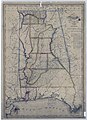
 Map of Alabama and West Florida - NARA - 78117754 (page 1).jpg 8,438 × 10,128; 17.73 MB
-
 Map of Alabama and West Florida - NARA - 78117754 (page 2).jpg 8,489 × 10,079; 18.56 MB
-
 Map of Alabama and West Florida - NARA - 78117754 (page 3).jpg 8,434 × 10,115; 16.86 MB
-
 Map of Alabama and West Florida - NARA - 78117754 (page 4).jpg 8,479 × 10,096; 17.03 MB
-

-
-
 Map of Antietam, Sharpsburg, and Vicinity - NARA - 109182883.jpg 2,816 × 3,756; 1,013 KB
-
 Map of Approaches to Little Rock, Arkansas - NARA - 70652889 (page 1).jpg 10,671 × 8,208; 8.58 MB
-
 Map of Approaches to Little Rock, Arkansas - NARA - 70652889 (page 2).jpg 10,612 × 7,937; 5.59 MB
-
 Map of Arcadia Rifle Range Reserve and Jefferson Barracks, Missouri - NARA - 137929361.jpg 9,830 × 7,544; 6.56 MB
-

-

-
 Map of Area Near Alamo - NARA - 109182164.jpg 10,816 × 9,681; 5.8 MB
-
 Map of area near Craig Oil Co. - NARA - 134379190.jpg 22,895 × 9,984; 17.31 MB
-
 Map of Area Near Klamath Lake - NARA - 50926282.jpg 11,561 × 6,144; 10.11 MB
-
 Map of area near Navajo Reservation - NARA - 84786348.jpg 13,536 × 8,903; 15.29 MB
-
 Map of area near Provincia de Nueva Ecija - NARA - 109182885 (page 1).jpg 10,331 × 9,184; 11.55 MB
-
 Map of area near Provincia de Nueva Ecija - NARA - 109182885 (page 2).jpg 10,152 × 9,408; 12.51 MB
-
 Map of Area of Northern Virginia (untitled) - NARA - 137930547 (page 1).jpg 12,926 × 9,824; 7.04 MB
-
 Map of Area of Northern Virginia (untitled) - NARA - 137930547 (page 2).jpg 3,236 × 9,864; 1.33 MB
-
 Map of Area of Northern Virginia (untitled) - NARA - 137930547 (page 3).jpg 9,580 × 3,526; 1.57 MB
-
 Map of Arizona and -New Mexico - NARA - 86455529.jpg 5,856 × 4,490; 2.71 MB
-
 Map of Arkansas - NARA - 109186516.jpg 9,364 × 5,573; 3.33 MB
-
 Map of Artesian wells and Springs - NARA - 76028683.jpg 11,168 × 8,211; 2.43 MB
-
 Map of Ashland Harbor, Wisconsin - NARA - 7369118 (page 1).jpg 10,208 × 6,421; 4.75 MB
-
 Map of Ashland Harbor, Wisconsin - NARA - 7369118 (page 2).pdf 5,102 × 3,210; 2.93 MB
-
 Map of Bad and White Rivers - NARA - 84786028.jpg 17,167 × 11,776; 17.94 MB
-
 Map of Bad River Indian Reservation - NARA - 84786022.jpg 4,864 × 6,432; 3.26 MB
-

-
 Map of Battlefield of Antietam - NARA - 137929252.jpg 8,232 × 9,825; 4.67 MB
-
 Map of Battlefield of Big Black River Bridge Mississippi - NARA - 139309063.jpg 6,260 × 7,166; 2.86 MB
-
 Map of Battlefield of Chickamauga - NARA - 70652911 (page 1).jpg 4,445 × 5,887; 2.81 MB
-
 Map of Battlefield of Chickamauga - NARA - 70652911 (page 2).jpg 4,490 × 5,700; 1.74 MB
-
 Map of Battlefield of Mechanicsville and Cold Harbor - NARA - 122206846.jpg 3,028 × 3,418; 635 KB
-
 Map Of Beacon Location, As Moved - NARA - 86454714.jpg 2,876 × 4,258; 636 KB
-

-
 Map of Blakely- Its Environs, Approaches, and Defenses - NARA - 70652877 (page 1).jpg 13,482 × 8,298; 11.45 MB
-
 Map of Blakely- Its Environs, Approaches, and Defenses - NARA - 70652877 (page 2).jpg 8,309 × 13,130; 8.68 MB
-
 Map of Bonn - NARA - 100384386 (page 1).jpg 6,628 × 8,667; 3.94 MB
-
 Map of Buffalo City, Wisconsin - NARA - 100306115.jpg 8,377 × 6,960; 3.89 MB
-
 Map of C.T.H. "EE" Right-of-Way - NARA - 84786008.jpg 17,440 × 6,692; 8.39 MB
-
 Map of California and Nevada with Parts of Arizona and Utah - NARA - 23812267.pdf 5,200 × 6,237, 4 pages; 48.14 MB
-
 Map of Camp Glenburnie, Maryland by 604th Engineers - NARA - 137929290.jpg 6,600 × 9,767; 3.61 MB
-
 Map of Camp Mackenzie and Vicinity of Augusta, Georgia - NARA - 103396675.jpg 7,296 × 7,603; 6.16 MB
-
 Map of Camp Merritt, Montana - NARA - 137929388 (page 1).jpg 9,128 × 6,860; 4.96 MB
-
 Map of Camp Merritt, Montana - NARA - 137929388 (page 2).jpg 9,344 × 7,408; 2.96 MB
-
 Map of Camp Merritt, Montana - NARA - 137929388 (page 3).jpg 9,221 × 7,388; 10.92 MB
-
 Map of Camp Wikoff, Montauk, New York - NARA - 137929764.jpg 11,019 × 9,304; 15.92 MB
-
 Map of Camp Wright, Round Ballet and Vicinity - NARA - 50926104.jpg 7,072 × 8,309; 5.31 MB
-
 Map of Camp Wright, Round Valley, and Vicinity - NARA - 109186429.jpg 7,308 × 8,778; 6.07 MB
-

-

-

-
 Map of Chain Bridge Position - NARA - 122207862.jpg 7,620 × 8,906; 4.17 MB
-

-
 Map Of Chandeleur Station, Proposed - NARA - 116764311.jpg 4,316 × 6,007; 2.26 MB
-
 Map Of Channels, Visibility Of LH - NARA - 116763395.jpg 4,284 × 2,809; 455 KB
-
 Map of Charleston and its Defences - NARA - 131043685.jpg 17,312 × 13,816; 21.18 MB
-
 Map of Charleston, South Carolina Showing Defenses - NARA - 6861818.jpg 3,150 × 2,507; 3.31 MB
-
 Map of Chatham County, North Carolina by Captain Ramsey - NARA - 137929461.jpg 6,280 × 5,308; 3.22 MB
-
 Map of Cherokee Lands in South Carolina - NARA - 140696202.jpg 5,536 × 4,435; 2.49 MB
-
 Map of Chicago Harbor, Illinois - NARA - 122206806.jpg 5,612 × 7,282; 1.4 MB
-
 Map of Chicago Harbor, Illinois - NARA - 128215800.jpg 9,288 × 8,578; 4.27 MB
-
 Map of Chippeway Lands along Lake Superior - NARA - 84786060.jpg 15,562 × 6,816; 3.02 MB
-
 Map of Church's Cove - NARA - 131043671.jpg 11,876 × 8,128; 18.64 MB
-
 Map of Claim of P. Thomas - NARA - 109182853.jpg 7,424 × 6,296; 2.28 MB
-

-

-
 Map Of Coast Guard Station - NARA - 86454492.jpg 4,960 × 5,976; 1.92 MB
-
 Map of Cockspur Island, Savannah River - NARA - 109182188 (page 1).jpg 12,580 × 10,816; 9.75 MB
-
 Map of Cockspur Island, Savannah River - NARA - 109182188 (page 2).jpg 12,571 × 10,720; 8.94 MB
-
 Map of Cold Harbor, Virginia - NARA - 137930665.jpg 6,052 × 7,901; 4.73 MB
-
 Map of Cold Springs and Live Oak Tunnel - NARA - 93193309.jpg 2,824 × 4,177; 559 KB
-
 Map of Colonel Sanford's Expedition to Sombrero Butte - NARA - 103396422.jpg 6,376 × 4,746; 1.91 MB
-
 Map of Colorado del Norte From Mouth Up - NARA - 93193244.jpg 2,700 × 14,204; 4.79 MB
-
 Map of Country around Beaufort City - NARA - 117090780.jpg 10,423 × 10,912; 4.6 MB
-
 Map of Country around Port Royal River - NARA - 117090782.jpg 14,688 × 10,486; 5.69 MB
-
 Map of Country Comprising Forts Meade, Custer, Keogh, and McKinney - NARA - 137929367.jpg 11,206 × 9,592; 16.61 MB
-

-
 Map of Craney Island - NARA - 7369125.jpg 6,560 × 5,324; 2.46 MB
-

-

-
 Map of Cumberland and Franklin, Tennessee - NARA - 70653091 (page 1).jpg 6,179 × 3,357; 1.83 MB
-
 Map of Cumberland and Franklin, Tennessee - NARA - 70653091 (page 2).jpg 5,820 × 3,088; 1.27 MB


.jpg)
.jpg)

_Of_Four_Islands_(Copy)_-_NARA_-_100298422.jpg)
_Of_Horn_Island_Light_Station_-_NARA_-_100298382.jpg)
_Of_Island_1827,_Site_Of_Lh_-_NARA_-_100298046.jpg)
_Of_LH_Depot_(Blueline_Print)_-_NARA_-_85967657.jpg)
_of_Rancho_Punt_Del_Ano_..._-_NARA_-_77415902.jpg)
_Of_Township_Reserved_For_LH_-_NARA_-_116763553.jpg)
_Of_Township_Reserved_For_LH_-_NARA_-_116763555.jpg)
_Of_Township_Reserved_For_LH_-_NARA_-_116763557.jpg)
,_Horn_%26_Petit_Bois_I._(Tracing)_-_NARA_-_100298370.jpg)
_Of_Mount_Desert_Rock_-_NARA_-_85967907.jpg)


.jpg)
.jpg)
.jpg)
.jpg)
.jpg)
.jpg)
.jpg)
.jpg)
.jpg)
.jpg)


.jpg)
.jpg)
.jpg)
_-_NARA_-_102278691_(page_1).jpg)
_-_NARA_-_102278691_(page_2).jpg)
_-_NARA_-_102278691_(page_3).jpg)
.jpg)
.jpg)
.jpg)


_-_NARA_-_305615.jpg)
_-_NARA_-_305652.jpg)
.jpg)
.jpg)


.jpg)
.jpg)


_-_NARA_-_305567.jpg)


.jpg)
.jpg)


.jpg)
.jpg)


.jpg)
.jpg)
.jpg)
.jpg)
.jpg)
.jpg)

.jpg)
.jpg)

.jpg)
.jpg)


.jpg)
.jpg)
_-_NARA_-_137930547_(page_1).jpg)


.jpg)


.jpg)
.jpg)


.jpg)
.jpg)
.jpg)


.jpg)
.jpg)
.jpg)


.jpg)
.jpg)


.jpg)
.jpg)
.jpg)
.jpg)
&filefrom=Map+of+Cumberland-Gap+and+Vicinity+laid+down+from+Surveys%2C+made+by+Capt.+Sidney+S.+Lyon%2C+acting+Topographical+Engineer%2C+under+Order+of+Genl.+G.+W.+Morgan%2C+commd%27g.+7th+Div.%2C+Army+of+the+Ohio.+Showing+the+location+o%28...%29+-+NARA+-+305682.jpg#mw-category-media)
_Of_Horn_Island_(Copy)_-_NARA_-_100298372.jpg)
_-_NARA_-_137930547_(page_2).jpg)
_-_NARA_-_137930547_(page_3).jpg)