Category:Manorcunningham
Jump to navigation
Jump to search
English: Manorcunningham , is a small village in County Donegal, Ireland. It is located 7 kilometers from Letterkenny on the main road to Derry.
village in Ulster, Ireland  | |||||
| Upload media | |||||
| Instance of | |||||
|---|---|---|---|---|---|
| Location | County Donegal, Ulster, Ireland | ||||
 | |||||
Media in category "Manorcunningham"
The following 30 files are in this category, out of 30 total.
-
 A narrow house, Manorcunningham - geograph.org.uk - 2875322.jpg 640 × 480; 51 KB
-
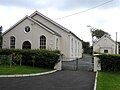 First Ray Presbyterian Church - geograph.org.uk - 1007202.jpg 640 × 479; 48 KB
-
 Ivan Browne, Manorcunningham - geograph.org.uk - 2875321.jpg 640 × 480; 46 KB
-

-
 Lagan Inn, Manorcunningham - geograph.org.uk - 2875337.jpg 640 × 480; 41 KB
-
 Lifford Bridge over the Foyle River - geograph.org.uk - 4203858.jpg 640 × 480; 117 KB
-
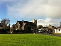
 Main Street, Manorcunningham - geograph.org.uk - 1007197.jpg 640 × 479; 40 KB
-
 Main Street, Manorcunningham - geograph.org.uk - 2875327.jpg 640 × 480; 41 KB
-
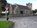
 Manorchurch.jpg 1,216 × 927; 210 KB
-

-
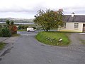
 Manorcunningham, County Donegal - geograph.org.uk - 1007196.jpg 640 × 479; 51 KB
-
 Manorcunningham, County Donegal - geograph.org.uk - 2875312.jpg 640 × 480; 42 KB
-
 Manorcunningham, County Donegal - geograph.org.uk - 2875313.jpg 640 × 480; 42 KB
-
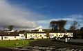 Manorhousing.jpg 1,293 × 796; 171 KB
-
 McFadden's Bar, Manorcunningham - geograph.org.uk - 2875314.jpg 640 × 480; 41 KB
-
 Ray Cottages Road, Manorcunningham - geograph.org.uk - 2875326.jpg 640 × 480; 48 KB
-
-

-
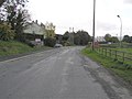 Road at Manorcunningham - geograph.org.uk - 1007189.jpg 640 × 479; 44 KB
-
 Road at Manorcunningham - geograph.org.uk - 1007192.jpg 640 × 267; 27 KB
-
 Road at Manorcunningham - geograph.org.uk - 1007194.jpg 640 × 479; 49 KB
-
 Road at Tullybogley - geograph.org.uk - 1007033.jpg 640 × 479; 55 KB
-
 Road at Veagh - geograph.org.uk - 1018083.jpg 640 × 479; 58 KB
-
 Roadside picnic place on N13, Co Donegal - geograph.org.uk - 460629.jpg 640 × 427; 112 KB
-
 Second Ray Presbyterian Church - geograph.org.uk - 1007206.jpg 640 × 479; 55 KB
-
 Takeaway, Manorcunningham - geograph.org.uk - 2875317.jpg 640 × 480; 45 KB
-
 The N13 at Manorcunningham - geograph.org.uk - 4780977.jpg 1,200 × 799; 234 KB
-
 The Shamrock Pub, Manorcunningham - geograph.org.uk - 2875318.jpg 640 × 480; 39 KB
-
 Tullybogley Townland - geograph.org.uk - 1007032.jpg 640 × 479; 74 KB
-
 Veagh Townland - geograph.org.uk - 1018077.jpg 640 × 479; 71 KB


