Category:Manchester, Bolton and Bury Canal, Kearsley
Jump to navigation
Jump to search
Media in category "Manchester, Bolton and Bury Canal, Kearsley"
The following 52 files are in this category, out of 52 total.
-
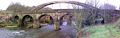
 Appleyard Bridge - geograph.org.uk - 2163876.jpg 800 × 600; 355 KB
-
 Bulrushes at the canal side - geograph.org.uk - 4358306.jpg 4,592 × 3,056; 7.37 MB
-
 Canal at Prestolee - geograph.org.uk - 4212580.jpg 2,500 × 1,797; 4.75 MB
-
 Canal crossing underneath fold road at ringley village.jpg 1,496 × 1,988; 581 KB
-
 Canal passing red rock lane.jpg 2,083 × 1,120; 350 KB
-
 Dickies bridge manchester bolton bury canal.jpg 640 × 408; 136 KB
-
 Footpath at Ringley - geograph.org.uk - 2969155.jpg 640 × 480; 623 KB
-
 Kearsley - canal towpath above River Irwell - geograph.org.uk - 2957570.jpg 1,600 × 1,200; 923 KB
-
 Kearsley - canal west of Ringley Bridge - geograph.org.uk - 2957558.jpg 1,600 × 1,200; 792 KB
-
 Kearsley road where canal crosses under.jpg 2,118 × 1,118; 289 KB
-
 Manchester Bolton and Bury canal Red Rock Lane.jpg 2,048 × 1,536; 956 KB
-
 Manchester Bolton and Bury canal Ringley Top Lock.jpg 1,536 × 2,048; 1,024 KB
-
 Manchester bolton and bury canal ringley village looking north of folds road.jpg 2,409 × 1,425; 593 KB
-
 Manchester Bolton and Bury canal Stoneclough.jpg 2,048 × 1,536; 892 KB
-
 Manchester Bolton ^ Bury Canal - Salford arm - geograph.org.uk - 4678903.jpg 1,600 × 900; 478 KB
-
 Manchester Bolton ^ Bury Canal near Kearsley - geograph.org.uk - 4390644.jpg 1,600 × 1,200; 797 KB
-
 Manchester Bolton ^ Bury Canal pathway - geograph.org.uk - 4343245.jpg 1,600 × 900; 495 KB
-

-

-

-

-

-

-

-

-

-

-
 Manchester, Bolton ^ Bury Canal - geograph.org.uk - 2163553.jpg 800 × 600; 335 KB
-
 Manchester, Bolton ^ Bury Canal - geograph.org.uk - 2163725.jpg 800 × 600; 288 KB
-
 Manchester, Bolton ^ Bury Canal - geograph.org.uk - 2163767.jpg 800 × 600; 312 KB
-
 Manchester, Bolton ^ Bury Canal above Prestolee - geograph.org.uk - 6014805.jpg 5,184 × 2,920; 7.41 MB
-
 Manchester, Bolton ^ Bury Canal towpath N of Prestolee - geograph.org.uk - 6014815.jpg 5,184 × 2,920; 7.15 MB
-

-

-
-

-

-

-
 Manchester, Bolton ^ Bury Canal, Prestolee Aqueduct - geograph.org.uk - 2711997.jpg 1,280 × 960; 1.34 MB
-
 Mbb canal past prestolee aqueduct.jpg 2,048 × 1,536; 730 KB
-
 Mbb canal ringley village heading to giants seat lock.jpg 2,899 × 1,041; 611 KB
-
 MBB Canal-bridge.jpg 350 × 255; 16 KB
-

-
 Pack horse bridge stoneclough.jpg 3,040 × 960; 530 KB
-
 Prestolee Aqueduct - geograph.org.uk - 2163717.jpg 800 × 600; 341 KB
-
 Prestolee Aqueduct - geograph.org.uk - 2937368.jpg 640 × 481; 560 KB
-

-
 Site of Ringley Upper Lock Manchester Bolton and Bury Canal.jpg 640 × 414; 127 KB
-
 The Bolton Canal - geograph.org.uk - 4356245.jpg 4,592 × 3,056; 7.69 MB
-
 The Bolton canal is somewhat overgrown - geograph.org.uk - 4356210.jpg 4,592 × 3,056; 7.4 MB
-
 The canal near Prestolee Bridge - geograph.org.uk - 4414597.jpg 1,024 × 768; 210 KB
-
 The End of the Canal at Ringley - geograph.org.uk - 2969142.jpg 640 × 480; 641 KB


_Locks_-_geograph.org.uk_-_3313222.jpg)


.jpg)


,_Manchester,Bolton_and_Bury_Canal_-_geograph.org.uk_-_2937357.jpg)


