Category:Malpas, Cheshire
Jump to navigation
Jump to search
English: Malpas is a large village which used to be a market town, and it is also a civil parish in the unitary authority of Cheshire West and Chester and the ceremonial county of Cheshire, England. The parish lies on the border with Shropshire and Wales. The name 'Malpas' means 'bad passage' from the Old French mal passe.
village and civil parish in Cheshire West and Chester, Cheshire, England  | |||||
| Upload media | |||||
| Instance of | |||||
|---|---|---|---|---|---|
| Location | Cheshire West and Chester, Cheshire, North West England, England | ||||
 | |||||
Subcategories
This category has the following 14 subcategories, out of 14 total.
B
- Bradley, Cheshire (17 F)
C
- Church View, Malpas (2 F)
E
G
- Glebe Farmhouse, Malpas (3 F)
H
- Hampton, Cheshire (1 F)
K
M
- Malpas Cross (4 F)
N
- Newton by Malpas (1 F)
O
- Oldcastle, Cheshire (3 F)
P
- Prospect House, Malpas (1 F)
S
- Stockton, Cheshire (3 F)
W
Media in category "Malpas, Cheshire"
The following 200 files are in this category, out of 203 total.
(previous page) (next page)-
 "The Bolling", Church Street, Malpas - geograph.org.uk - 2358440.jpg 2,176 × 1,679; 696 KB
-
 1 Church Street Malpas.JPG 2,048 × 1,536; 1,013 KB
-
 2 Church Street Malpas.JPG 2,048 × 1,536; 1.04 MB
-
 A green lane off Tilston Road - geograph.org.uk - 2726372.jpg 800 × 600; 206 KB
-
 A green lane to Kidnal Hill - geograph.org.uk - 2726370.jpg 800 × 600; 313 KB
-
 Alport House, High Street, Malpas - geograph.org.uk - 2361861.jpg 2,794 × 1,871; 1.23 MB
-
 Artist's Winter Sky - geograph.org.uk - 1126538.jpg 640 × 427; 50 KB
-
 Bales and Shed at Ebnal Farm - geograph.org.uk - 3723488.jpg 5,184 × 3,456; 2.43 MB
-
 Band of woodland and stream, Bradley Lane - geograph.org.uk - 330175.jpg 509 × 640; 175 KB
-
 Beeches Villas on Tilston Road - geograph.org.uk - 2726355.jpg 800 × 600; 326 KB
-
 Bishop Heber School Malpas - geograph.org.uk - 3929010.jpg 640 × 439; 54 KB
-
 Bradley Bridge at Bradley Brook - geograph.org.uk - 4143370.jpg 4,000 × 3,000; 3.6 MB
-
 Bradley Brook Lane - geograph.org.uk - 4143232.jpg 4,000 × 3,000; 4.4 MB
-
 Bridge over Wych Brook - geograph.org.uk - 2362167.jpg 640 × 480; 92 KB
-
 Brookside Farm - geograph.org.uk - 1244346.jpg 640 × 426; 43 KB
-
 Byway to Kidnal Hill - geograph.org.uk - 3637926.jpg 5,184 × 3,456; 3.43 MB
-
 Castle Hill, Malpas, Cheshire.jpg 3,456 × 2,304; 2.44 MB
-
 Chester Road out of Malpas - geograph.org.uk - 3929001.jpg 640 × 514; 81 KB
-
 Chester Villa, Malpas.jpg 4,000 × 3,000; 999 KB
-
 Chorlton Villas on the B5395 - geograph.org.uk - 2726341.jpg 800 × 600; 205 KB
-
 Confusing Road Sign - geograph.org.uk - 1126545.jpg 427 × 640; 77 KB
-
 Conservatory, Malpas (1) - geograph.org.uk - 2360059.jpg 2,765 × 1,852; 1.35 MB
-
 Conservatory, Malpas (2) - geograph.org.uk - 2360072.jpg 2,289 × 1,611; 1 MB
-
 Converted Wesleyan chapel, Wrexham Road, Malpas - geograph.org.uk - 2358539.jpg 1,385 × 1,790; 416 KB
-
 Corbels, Church Street, Malpas - geograph.org.uk - 653941.jpg 465 × 640; 79 KB
-
 Cross o' th' Hill, Malpas - geograph.org.uk - 4141673.jpg 4,000 × 3,000; 3.21 MB
-
 Daffodils beside Mastiff Lane - geograph.org.uk - 4420931.jpg 3,184 × 2,123; 1.18 MB
-

-
 Dismantled Whitchurch and Tattenhall Railway at Ebnal - geograph.org.uk - 3723497.jpg 5,184 × 3,456; 4.41 MB
-
 Dog Lane near Oldcastle Heath - geograph.org.uk - 3723542.jpg 5,184 × 3,456; 3.69 MB
-
 Dog Lane near Oldcastle Heath - geograph.org.uk - 3723547.jpg 5,184 × 3,456; 3.3 MB
-
 Ebnal Lane - geograph.org.uk - 3723444.jpg 5,184 × 3,456; 3.95 MB
-
 Ebnal Lane - geograph.org.uk - 3723450.jpg 5,184 × 3,456; 4.62 MB
-

-
 England on the left, Wales on the right - geograph.org.uk - 4421100.jpg 3,184 × 2,123; 1.93 MB
-
 Entering Lower Wych - geograph.org.uk - 4421074.jpg 3,184 × 2,123; 1.67 MB
-
 Entering Malpas at Mount View - geograph.org.uk - 3928833.jpg 640 × 389; 52 KB
-
 Entering Malpas by Castle Hill - geograph.org.uk - 3928882.jpg 640 × 378; 71 KB
-
 Entering Malpas on the B5395 - geograph.org.uk - 2726346.jpg 800 × 600; 309 KB
-
 Entrance to Hill Farm - geograph.org.uk - 4420947.jpg 3,184 × 2,123; 1.82 MB
-
 Entrance to Manor Farm, Wychough - geograph.org.uk - 4395587.jpg 2,500 × 1,875; 1.92 MB
-
 Farm at Ebnal - geograph.org.uk - 232627.jpg 640 × 480; 106 KB
-
 Farm at Ebnal - geograph.org.uk - 3929244.jpg 640 × 431; 80 KB
-
 Farm Gate at Ebnal Farm - geograph.org.uk - 3723473.jpg 5,184 × 3,456; 4.12 MB
-
 Field and Hedge near Malpas - geograph.org.uk - 4143322.jpg 4,000 × 3,000; 2.26 MB
-
 Footpath at Lower Wych - geograph.org.uk - 4421055.jpg 3,184 × 2,123; 2.44 MB
-
 Footpath at Oldcastle Heath - geograph.org.uk - 4394779.jpg 2,500 × 1,875; 2.28 MB
-
 Footpath leaving Malpas - geograph.org.uk - 5224740.jpg 4,000 × 3,000; 4.63 MB
-
 Footpath to Ebnal - geograph.org.uk - 3638196.jpg 5,184 × 3,456; 5.8 MB
-
 Footpath to Kidnal Hill - geograph.org.uk - 3637570.jpg 5,184 × 3,456; 5.63 MB
-
 Footpath to Malpas - geograph.org.uk - 3638050.jpg 5,183 × 3,455; 4.12 MB
-
 Footpath to Malpas - geograph.org.uk - 4143208.jpg 4,000 × 3,000; 2.6 MB
-
 Footpath to Malpas - geograph.org.uk - 4395222.jpg 2,500 × 1,875; 1.36 MB
-
 Footpath to Malpas at Wychough - geograph.org.uk - 4395549.jpg 2,500 × 1,875; 1.71 MB
-
 Footpath to Millmoor Farm - geograph.org.uk - 4141757.jpg 4,000 × 3,000; 3.49 MB
-
 Footpath to Overton Scar - geograph.org.uk - 3637422.jpg 5,184 × 3,456; 4.02 MB
-
 Gameswood Cottage.jpg 3,456 × 2,304; 2.79 MB
-
 Giant shop front, Malpas - geograph.org.uk - 59649.jpg 640 × 460; 59 KB
-
 Gothic windows, High Street, Malpas - geograph.org.uk - 2359553.jpg 1,854 × 736; 373 KB
-
 Heated driveway 2.jpg 3,120 × 4,160; 4.55 MB
-
 Heated driveway 3.jpg 3,120 × 4,160; 5.14 MB
-
 Heated driveway.jpg 3,120 × 4,160; 4.72 MB
-
 High Street Malpas - geograph.org.uk - 3928989.jpg 640 × 480; 73 KB
-
 High Street, Malpas - geograph.org.uk - 2359543.jpg 2,777 × 1,679; 1.04 MB
-
 Huxley's, Malpas.jpg 4,000 × 3,000; 862 KB
-
 Kissing Gate on Mastiff Lane - geograph.org.uk - 4395331.jpg 2,500 × 1,875; 1.89 MB
-
 Landscape at Kidnal - geograph.org.uk - 3637616.jpg 5,184 × 3,456; 3.51 MB
-

-
 Lane Junction at Bawbrook - geograph.org.uk - 4141742.jpg 4,000 × 3,000; 2.92 MB
-
 Lane junction near Oldcastle Heath - geograph.org.uk - 2362102.jpg 640 × 480; 73 KB
-
 Lane junction near Scar Farm - geograph.org.uk - 2362002.jpg 640 × 480; 92 KB
-
 Lloyds TSB, Church Street, Malpas - geograph.org.uk - 2287346.jpg 480 × 640; 128 KB
-
 Love Lane (Overton Heath Lane) at Overton Heath - geograph.org.uk - 3637936.jpg 5,184 × 3,456; 4.3 MB
-
 Malpas and District Sports Club - geograph.org.uk - 4392091.jpg 2,500 × 1,875; 1.47 MB
-
 Malpas Fire Station, B5069, Malpas - geograph.org.uk - 306650.jpg 640 × 480; 70 KB
-
 Malpas Garage - geograph.org.uk - 4396539.jpg 2,500 × 1,875; 1.13 MB
-
 Malpas Railway Station (geograph 3638325).jpg 5,184 × 3,456; 3.19 MB
-

-
 Malpas Station ^ Chester signpost - geograph.org.uk - 4340986.jpg 481 × 640; 237 KB
-
 Malpas, Cheshire - geograph.org.uk - 724826.jpg 640 × 480; 73 KB
-
 Malpas, Cholmondeley Terrace - geograph.org.uk - 5775806.jpg 6,969 × 4,651; 5.48 MB
-
 Malpas, Georgian House - geograph.org.uk - 5775803.jpg 5,299 × 3,536; 3.71 MB
-
 Malpas, Glebe Cottage - geograph.org.uk - 5775801.jpg 6,613 × 4,414; 4.6 MB
-

-
 Malpas, St. Oswald's Church, Octagonal c15th font - geograph.org.uk - 5775812.jpg 7,174 × 4,787; 5.97 MB
-
 Malpas, St. Oswald's Church, The nave - geograph.org.uk - 5775813.jpg 7,360 × 4,912; 6.57 MB
-
 Malpas, St. Oswald's Church, The nave roof - geograph.org.uk - 5775814.jpg 7,360 × 4,912; 6.59 MB
-
 Malpas, The Old Glebe Farmhouse - geograph.org.uk - 5775799.jpg 6,084 × 4,060; 4.17 MB
-
 Market house, malpas.jpg 4,000 × 3,650; 1.01 MB
-
 Mastiff Lane and Bishop Bennet Way - geograph.org.uk - 4395278.jpg 2,500 × 1,875; 1.58 MB
-
 Mastiff Lane looking south - geograph.org.uk - 2362132.jpg 640 × 480; 48 KB
-
 Meredith's Coaches, Malpas - geograph.org.uk - 232646.jpg 640 × 480; 64 KB
-
 New Build at Cross o' th' Hill - geograph.org.uk - 4141689.jpg 4,000 × 3,000; 3.42 MB
-
 New uni-sex toilet block - geograph.org.uk - 3928993.jpg 640 × 480; 118 KB
-
 No 2 Market Place, Malpas - geograph.org.uk - 2361880.jpg 2,542 × 1,789; 1.11 MB
-
 Oathill turning off Chester Road - geograph.org.uk - 3929006.jpg 640 × 366; 63 KB
-
-

-
 Oldhall Street, Malpas - geograph.org.uk - 2726349.jpg 800 × 600; 210 KB
-
 Ordnance Survey Cut Mark - geograph.org.uk - 5224747.jpg 4,000 × 3,000; 3.66 MB
-
 Over the Hedge. - geograph.org.uk - 1126343.jpg 640 × 427; 54 KB
-
 Overton Scar - geograph.org.uk - 1244381.jpg 640 × 426; 75 KB
-
 Overton Scar - geograph.org.uk - 3637693.jpg 5,184 × 3,456; 5.58 MB
-
 Overton Scar Water Pumping Station - geograph.org.uk - 3637650.jpg 4,848 × 3,312; 3.04 MB
-
 Overton Scar Water Pumping Station - geograph.org.uk - 3637658.jpg 4,728 × 3,312; 3.1 MB
-
 Part of the High Street, Malpas - geograph.org.uk - 2959464.jpg 640 × 480; 58 KB
-
 Plaque, Cholmondeley Almshouses, Church Street, Malpas - geograph.org.uk - 2358479.jpg 1,809 × 2,701; 990 KB
-
 Pond at Ebnal - geograph.org.uk - 3723456.jpg 5,184 × 3,456; 2.53 MB
-
 Prohibitive notice, Malpas Recreation Ground - geograph.org.uk - 2359547.jpg 2,794 × 1,871; 1.48 MB
-
 Public car park, Malpas - geograph.org.uk - 3928990.jpg 640 × 480; 66 KB
-
 Public Footpath at Ebnal Farm - geograph.org.uk - 3723462.jpg 5,184 × 3,456; 6.87 MB
-
 Reflections in mere at Bradley Common - geograph.org.uk - 329204.jpg 640 × 484; 133 KB
-
 Road sign, Malpas - geograph.org.uk - 2358516.jpg 1,698 × 1,024; 395 KB
-
 Rock House, Malpas.jpg 4,000 × 3,000; 946 KB
-
 Roman Road to Malpas - geograph.org.uk - 3638074.jpg 5,183 × 3,455; 3.63 MB
-
 Sandstone cutting on Kidnal Hill - geograph.org.uk - 1244367.jpg 640 × 426; 73 KB
-
 Sandstone quarry, Kidnal Hill - geograph.org.uk - 1244369.jpg 640 × 426; 77 KB
-
 Shetland Pony says hello at Oldcastle Heath - geograph.org.uk - 4394795.jpg 2,880 × 2,460; 2.14 MB
-
 St Joseph's Church, Malpas - geograph.org.uk - 2360097.jpg 2,149 × 1,741; 950 KB
-
 St Oswald's church, Malpas - geograph.org.uk - 4600234.jpg 640 × 423; 387 KB
-
 St Oswald's Church, Malpas - geograph.org.uk - 6263606.jpg 3,661 × 4,885; 3.09 MB
-

-

-

-

-

-

-

-
-
 Straw Man at Broselake Farm - geograph.org.uk - 4141636.jpg 4,000 × 3,000; 2.75 MB
-
 Taylor's Almshouses, Malpas - geograph.org.uk - 2360118.jpg 2,658 × 1,588; 1.1 MB
-
 The B5069 (Chester Road) at Ebnal - geograph.org.uk - 3638222.jpg 5,184 × 3,456; 3.15 MB
-
 The B5069 (Chester Road) at Ebnal - geograph.org.uk - 3638229.jpg 5,184 × 3,456; 3.64 MB
-
 The B5395 (Oldhall Street) near The Hough - geograph.org.uk - 4143362.jpg 4,000 × 3,000; 3.03 MB
-
 The B5395 approaching Malpas - geograph.org.uk - 4143312.jpg 4,000 × 3,000; 2.3 MB
-
 The B5395 at Roman Road to Wigland - geograph.org.uk - 2726338.jpg 800 × 600; 194 KB
-
 The Bishop Bennet Way - geograph.org.uk - 3637685.jpg 5,183 × 3,455; 6 MB
-
 The Bishop Bennet Way - geograph.org.uk - 4420949.jpg 3,184 × 2,123; 1,004 KB
-
 The Bishop Bennet Way - geograph.org.uk - 4420986.jpg 3,184 × 2,123; 2.12 MB
-
 The Bishop Bennet Way - geograph.org.uk - 4421061.jpg 3,184 × 2,123; 2.09 MB
-
 The Bishop Bennet Way at Hill Farm - geograph.org.uk - 4420938.jpg 3,184 × 2,123; 2.11 MB
-
 The Bishop Bennet Way at Oldcastle Heath - geograph.org.uk - 4394788.jpg 2,000 × 1,500; 1.36 MB
-
 The Bishop Bennet Way at Oldcastle Heath - geograph.org.uk - 4395020.jpg 2,500 × 1,875; 1.72 MB
-
 The Bishop Bennet Way at Oldcastle Heath - geograph.org.uk - 4395033.jpg 2,500 × 1,875; 1.5 MB
-
 The Bishop Bennet Way at Overton Heath - geograph.org.uk - 3638037.jpg 5,184 × 3,456; 5.11 MB
-
 The Bishop Bennet Way at Wychough - geograph.org.uk - 4395382.jpg 2,500 × 1,875; 1.38 MB
-
 The Church of St Oswald at Malpas - geograph.org.uk - 5224736.jpg 4,000 × 3,000; 2.83 MB
-
 The Nest, Malpas - geograph.org.uk - 4396541.jpg 4,000 × 3,000; 3.01 MB
-
 The Old Fire Station, Malpas - geograph.org.uk - 306661.jpg 640 × 480; 83 KB
-
 The Rectory, Malpas.jpg 4,000 × 3,000; 1.27 MB
-
 The Red Lion Hotel, Malpas - geograph.org.uk - 4426315.jpg 3,500 × 2,333; 1.91 MB
-
 The sign at Ashtons Cross - geograph.org.uk - 533032.jpg 640 × 482; 98 KB
-
 Tilston Road at Lowcross Hill - geograph.org.uk - 3637345.jpg 5,184 × 3,456; 7.78 MB
-
 Tilston Road at Yew Bank Cottages - geograph.org.uk - 2726359.jpg 800 × 600; 185 KB
-
 Timber framed houses in Malpas - geograph.org.uk - 232655.jpg 640 × 480; 88 KB
-
 Timbered framed building in Malpas - geograph.org.uk - 4426291.jpg 4,900 × 3,216; 3.02 MB
-
 Tithe barn, Church Street, Malpas - geograph.org.uk - 2358457.jpg 2,499 × 1,736; 1.12 MB
-
 Town Centre, Malpas - geograph.org.uk - 724815.jpg 640 × 480; 83 KB
-
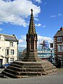 Town Cross, Malpas - geograph.org.uk - 6263601.jpg 3,888 × 5,184; 3.62 MB
-
 Tudor Cottage, Malpas.jpg 4,000 × 3,000; 988 KB
-
 United Utilities Site on Dog Lane - geograph.org.uk - 3723567.jpg 5,184 × 3,456; 6.02 MB
-
 View across the fields - geograph.org.uk - 3638174.jpg 7,439 × 2,884; 3.71 MB
-
 View across the fields - geograph.org.uk - 3723554.jpg 5,184 × 3,456; 2.21 MB
-
 View from Malpas - geograph.org.uk - 3638066.jpg 8,371 × 3,287; 5.12 MB
-
 View towards Kidnal Hill - geograph.org.uk - 3637903.jpg 5,184 × 3,456; 4.57 MB
-
 View towards Simmonds Green - geograph.org.uk - 3638182.jpg 5,184 × 3,456; 4.69 MB
-
 View towards St Oswald's Church - geograph.org.uk - 4395257.jpg 2,500 × 1,875; 1.55 MB
-
 View towards Wales - geograph.org.uk - 3723562.jpg 5,184 × 3,456; 2.73 MB
-
 Well Street, Malpas - geograph.org.uk - 4143287.jpg 4,000 × 3,000; 2.12 MB
-
 White Cottage, Malpas.jpg 4,103 × 3,138; 882 KB
-
 Whitewood Lane near Scar Farm - geograph.org.uk - 3637679.jpg 5,184 × 3,456; 3.93 MB
-
 Window, "Crown Hotel", Malpas - geograph.org.uk - 2359557.jpg 2,792 × 1,869; 940 KB
-
 Winter crop north of The Hough - geograph.org.uk - 329252.jpg 640 × 441; 109 KB
-
 Wych Brook at Higher Wych - geograph.org.uk - 336672.jpg 493 × 640; 171 KB
-
 Wycherleys.jpg 4,000 × 2,078; 1.01 MB
-
 Band of woodland by Bradley Lane - geograph.org.uk - 330183.jpg 507 × 640; 178 KB
-

-
 High Street in Malpas - geograph.org.uk - 232717.jpg 640 × 498; 87 KB
-
 Higher Wych - geograph.org.uk - 336703.jpg 640 × 428; 144 KB
-
 Horses by Ivy House Farm - geograph.org.uk - 330032.jpg 640 × 439; 157 KB
-
 Hough Bridge - geograph.org.uk - 329996.jpg 543 × 640; 140 KB
-
 Houses in Malpas - geograph.org.uk - 232640.jpg 640 × 480; 90 KB
-
 Iscoyd Brook - geograph.org.uk - 336595.jpg 640 × 480; 144 KB
-
 Iscoyd Wood and bridge over Iscoyd Brook - geograph.org.uk - 337589.jpg 640 × 480; 164 KB
-
 Lane between The Hough and Higher Wych - geograph.org.uk - 330044.jpg 595 × 640; 125 KB
-
 Line of disused railway, Bradley Common - geograph.org.uk - 330167.jpg 522 × 640; 129 KB
-
 Meadows south of Malpas - geograph.org.uk - 441063.jpg 640 × 480; 95 KB
-
 Oak tree and Welsh hills - geograph.org.uk - 130877.jpg 640 × 484; 82 KB
-
 On Cuddington footpath 15 - geograph.org.uk - 239340.jpg 640 × 480; 127 KB
-
 Pasture south east of Hough Bridge - geograph.org.uk - 330022.jpg 640 × 441; 157 KB
-
 Ploughed field adjacent to the A41 - geograph.org.uk - 393541.jpg 640 × 433; 127 KB
-
 Rabbit country - geograph.org.uk - 337565.jpg 640 × 480; 146 KB
-
 Road towards Lower Wych - geograph.org.uk - 197039.jpg 640 × 480; 109 KB
-
 Road, hedge and field - geograph.org.uk - 197048.jpg 640 × 480; 128 KB
-
 Simmonds Green Farm - geograph.org.uk - 117991.jpg 640 × 427; 115 KB
-
 Stables near Ebnal - geograph.org.uk - 232635.jpg 640 × 480; 93 KB
-
 Start of byway... - geograph.org.uk - 108728.jpg 640 × 480; 132 KB
-
 Stream north of Hough Bridge - geograph.org.uk - 329134.jpg 480 × 640; 166 KB
-
 T-junction - geograph.org.uk - 197043.jpg 640 × 480; 118 KB
-
 The Hough - geograph.org.uk - 329280.jpg 640 × 499; 130 KB


_-_geograph.org.uk_-_2360059.jpg)
_-_geograph.org.uk_-_2360072.jpg)


_at_Overton_Heath_-_geograph.org.uk_-_3637936.jpg)


.jpg)
_-_geograph.org.uk_-_4340991.jpg)


.jpg)


_-_geograph.org.uk_-_4600214.jpg)
_-_geograph.org.uk_-_4600217.jpg)
_-_geograph.org.uk_-_4600221.jpg)
_-_geograph.org.uk_-_4600223.jpg)
_-_geograph.org.uk_-_4600227.jpg)
_-_geograph.org.uk_-_4600231.jpg)
_-_geograph.org.uk_-_4600189.jpg)
_-_geograph.org.uk_-_4600211.jpg)


_at_Ebnal_-_geograph.org.uk_-_3638222.jpg)
_at_Ebnal_-_geograph.org.uk_-_3638229.jpg)
_near_The_Hough_-_geograph.org.uk_-_4143362.jpg)


