Category:Malamot
Jump to navigation
Jump to search
|
Malamot has an entry on OpenStreetMap (show). |
mountain of the Cottian Alps  | |||||
| Upload media | |||||
| Instance of | |||||
|---|---|---|---|---|---|
| Location | Savoie, Auvergne-Rhône-Alpes, Metropolitan France, France | ||||
| Mountain range | |||||
| Topographic prominence |
| ||||
| Topographic isolation |
| ||||
| Elevation above sea level |
| ||||
 | |||||
Subcategories
This category has only the following subcategory.
C
Media in category "Malamot"
The following 6 files are in this category, out of 6 total.
-
 Col du Mont Cenis.jpg 2,592 × 1,944; 4.2 MB
-
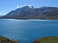
 Lago Moncenisio e monte Malamot.JPG 3,072 × 2,304; 1.15 MB
-
 Monte Malamot.JPG 4,608 × 3,456; 4.98 MB
-
 Monti Giusalet e Malamot.JPG 4,608 × 3,456; 5.11 MB
-
 Strada Malamot km 7,5.JPG 6,000 × 4,000; 12.21 MB
-
 Strada Malamot.JPG 6,000 × 4,000; 12.88 MB


