Category:Maiden Way (Roman road)
Jump to navigation
Jump to search
Roman road in the north of England  | |||||
| Upload media | |||||
| Instance of | |||||
|---|---|---|---|---|---|
| Location |
| ||||
| Has part(s) |
| ||||
 | |||||
Media in category "Maiden Way (Roman road)"
The following 15 files are in this category, out of 15 total.
-

-

-

-
 Course of Maiden Way Roman Road east of Kellah - geograph.org.uk - 4674816.jpg 1,024 × 767; 226 KB
-
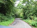
 Maiden Way (Roman Road) - geograph.org.uk - 2032169.jpg 640 × 480; 64 KB
-
 Maiden Way - geograph.org.uk - 2032246.jpg 640 × 480; 118 KB
-
 Maiden Way - geograph.org.uk - 898081.jpg 640 × 389; 64 KB
-
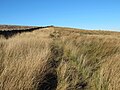
 Maiden Way on Lambley Common - geograph.org.uk - 3351578.jpg 640 × 480; 84 KB
-
 Maiden Way on Lambley Common - geograph.org.uk - 3380706.jpg 640 × 480; 100 KB
-
 Maiden Way on Lambley Common - geograph.org.uk - 3381690.jpg 640 × 480; 84 KB
-
 Maiden Way opposite Eals - geograph.org.uk - 3351560.jpg 640 × 480; 80 KB
-
 The Maiden way. - geograph.org.uk - 4148333.jpg 640 × 394; 50 KB
-
 Wall and gate, Maiden Way - geograph.org.uk - 4585816.jpg 3,264 × 2,448; 2.04 MB
-
 Maiden Way - geograph.org.uk - 282371.jpg 640 × 416; 85 KB
-
 Maiden Way - geograph.org.uk - 621822.jpg 640 × 480; 149 KB
_Maiden_Way_around_Glendue_Burn_-_geograph.org.uk_-_3379661.jpg)
_Maiden_Way_around_Glendue_Burn_-_geograph.org.uk_-_3380684.jpg)
_Maiden_Way_north_of_Glendue_Burn_-_geograph.org.uk_-_3380700.jpg)

_-_geograph.org.uk_-_2032169.jpg)


