Category:Maerdy, Rhondda Cynon Taf
Jump to navigation
Jump to search
village in Rhondda Cynon Taf, Wales, UK   | |||||
| Upload media | |||||
| Pronunciation audio | |||||
|---|---|---|---|---|---|
| Instance of | |||||
| Location |
| ||||
 | |||||

Brezhoneg: Maerdy, pe Y Maerdy zo un anv-lec'h kembraek:
English: Maerdy is a village and community in the county borough of Rhondda Cynon Taf, and within the historic county boundaries of Glamorgan, Wales, lying at the head of the Rhondda Fach Valley.
Türkçe: Maerdy, Birleşik Krallık'ta Rhondda Cynon Taff'ta küçük bir kasabadır. Glamorgan ve Güney Wales'in tarihi sınırları arasında yer alır. Rhondda Fach Vadisi'nin yanında kurulmuştur.
Media in category "Maerdy, Rhondda Cynon Taf"
The following 195 files are in this category, out of 195 total.
-
 05.01.85 Maerdy Colliery 6L 1017 & 1032 (6870641733).jpg 1,526 × 947; 244 KB
-
 2010 Wales Rhondda Cynon Taf Community Maerdy map.svg 512 × 737; 416 KB
-
 2024 Wales Rhondda Cynon Taf Community Maerdy map.svg 512 × 737; 369 KB
-
 A4233 approaches Maerdy - geograph.org.uk - 2412469.jpg 640 × 529; 68 KB
-
 A4233 heads away from Maerdy - geograph.org.uk - 2412445.jpg 640 × 480; 77 KB
-
 A4233 junction, Maerdy - geograph.org.uk - 2412434.jpg 640 × 438; 54 KB
-

-

-

-
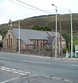 All Saints, Maerdy - geograph.org.uk - 2412583.jpg 605 × 640; 80 KB
-
 Ambulances above Maerdy - geograph.org.uk - 6142716.jpg 3,071 × 2,037; 3.64 MB
-
 Amerena House, Ferndale - geograph.org.uk - 2413651.jpg 640 × 429; 64 KB
-
 Anemometer on Cawrnant y Fforch - geograph.org.uk - 693630.jpg 480 × 640; 36 KB
-

-
 Bedrock on track - geograph.org.uk - 6161701.jpg 1,536 × 2,048; 1.34 MB
-
 Bend on the A4233 above Cwm Rhondda-fach - geograph.org.uk - 3980372.jpg 4,000 × 3,000; 3.42 MB
-
 Blake Street, Maerdy - geograph.org.uk - 2412702.jpg 640 × 480; 68 KB
-
 Bowling green and pavilion, Maerdy - geograph.org.uk - 2412385.jpg 640 × 480; 80 KB
-
 Brook Street, Maerdy - geograph.org.uk - 2412676.jpg 599 × 640; 86 KB
-
 Bryn Gelli - geograph.org.uk - 4991925.jpg 640 × 480; 48 KB
-
 Bryn Llechwendiddos - geograph.org.uk - 5004144.jpg 640 × 480; 71 KB
-
 Bus stop - geograph.org.uk - 6142726.jpg 3,264 × 2,448; 2.44 MB
-
 Bus stop - geograph.org.uk - 6142729.jpg 2,048 × 1,536; 996 KB
-
 Castell Nos Reservoir - geograph.org.uk - 3980524.jpg 4,000 × 3,000; 2.72 MB
-
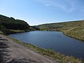 Castell Nos Reservoir - geograph.org.uk - 3980533.jpg 4,000 × 3,000; 3.08 MB
-
 Cefn Craig Amos - geograph.org.uk - 5016776.jpg 640 × 480; 97 KB
-
 Cefn Craig Amos - geograph.org.uk - 6142690.jpg 2,048 × 1,536; 1.35 MB
-
 Children's play area, Maerdy Park - geograph.org.uk - 2411874.jpg 640 × 480; 72 KB
-
 Cleared forest above Lluest-wen Reservoir - geograph.org.uk - 3981607.jpg 4,000 × 3,000; 3.13 MB
-
 Cronfa Ddwr Castell Nos Reservoir - geograph.org.uk - 5016888.jpg 640 × 480; 78 KB
-
 Cwm Rhondda - geograph.org.uk - 57873.jpg 640 × 323; 67 KB
-
 Cwm Rhondda - geograph.org.uk - 57878.jpg 640 × 416; 64 KB
-
 Cwm Rhondda Fach - geograph.org.uk - 1018017.jpg 640 × 427; 175 KB
-
 Cwm Rhondda Fach - geograph.org.uk - 6142695.jpg 2,985 × 2,131; 1.68 MB
-

-
 Derelict building below Castell Nos - geograph.org.uk - 3980420.jpg 4,000 × 3,000; 3.5 MB
-
 Derelict building in Cwm Rhondda-fach - geograph.org.uk - 3980426.jpg 4,000 × 3,000; 3.01 MB
-
 Derelict tramway bridge and steps in Cwm Rhondda-fach - geograph.org.uk - 3980435.jpg 4,000 × 3,000; 3.46 MB
-
 Disused tramway bridge in Cwm Rhondda-fach - geograph.org.uk - 3980457.jpg 4,000 × 3,000; 3.79 MB
-
 DJI 0718-2.jpg 4,048 × 3,032; 2.2 MB
-
 Edge of moorland near Maerdy - geograph.org.uk - 2411309.jpg 640 × 480; 92 KB
-
 Edward Street - geograph.org.uk - 497461.jpg 640 × 480; 97 KB
-
 Edward Street, Maerdy - geograph.org.uk - 2794793.jpg 1,024 × 690; 110 KB
-
 Electricity substation, Maerdy - geograph.org.uk - 2411593.jpg 640 × 412; 64 KB
-
 Entrance to Ferndale Cemetery - geograph.org.uk - 2412981.jpg 640 × 480; 117 KB
-
 Entrance to Ferndale Cemetery - geograph.org.uk - 5035184.jpg 4,608 × 3,456; 3.86 MB
-
 Entrance to Maerdy - geograph.org.uk - 6143224.jpg 3,264 × 2,448; 2.67 MB
-
 Entrance to Maerdy Junior School - geograph.org.uk - 2412869.jpg 640 × 446; 49 KB
-
 Ferndale Cemetery - geograph.org.uk - 2413000.jpg 640 × 618; 124 KB
-
 Ferndale Cemetery - geograph.org.uk - 5035191.jpg 4,608 × 3,456; 3.89 MB
-
 Ferndale Comprehensive School - geograph.org.uk - 2412937.jpg 640 × 473; 66 KB
-
 Football ground, Maerdy - geograph.org.uk - 2412691.jpg 640 × 459; 72 KB
-
 Forest clearing on Bryn Llechwenddiddos - geograph.org.uk - 3981613.jpg 4,000 × 3,000; 3.68 MB
-
 Forestry track - geograph.org.uk - 6142484.jpg 1,536 × 2,048; 1.51 MB
-
 Forestry track on Bryn Llechwenddiddos - geograph.org.uk - 3981605.jpg 4,000 × 3,000; 3.36 MB
-
 Forestry track on Bryn y Gelli Uchaf - geograph.org.uk - 3981610.jpg 4,000 × 3,000; 3.23 MB
-
 Forestry track on Bryn y Gelli Uchaf - geograph.org.uk - 3981611.jpg 4,000 × 3,000; 3.01 MB
-
 Former church, Porth - geograph.org.uk - 5035171.jpg 4,608 × 3,456; 3.86 MB
-
 Former quarry on Tarren Maerdy - geograph.org.uk - 4413533.jpg 3,900 × 2,925; 5.48 MB
-
 Former tramway bridge in Cwm Rhondda-fach - geograph.org.uk - 3980431.jpg 4,000 × 3,000; 3.63 MB
-
 Former tramway bridge in Cwm Rhondda-fach - geograph.org.uk - 3980448.jpg 4,000 × 3,000; 4.01 MB
-

-
 Frank Owen memorial - geograph.org.uk - 693568.jpg 640 × 480; 64 KB
-
 Frank Owen memorial bridge - geograph.org.uk - 693565.jpg 640 × 480; 148 KB
-
 Griffith St, Maerdy (27463469185).jpg 5,082 × 3,421; 5.13 MB
-

-
 Houses resume, North Road, Ferndale - geograph.org.uk - 2404658.jpg 640 × 412; 59 KB
-

-
 James Street, Maerdy - geograph.org.uk - 2411811.jpg 640 × 480; 70 KB
-
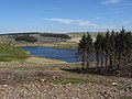
 Lleust-wen Reservoir - geograph.org.uk - 2293293.jpg 640 × 480; 45 KB
-
 Lluest Wen Reservoir - geograph.org.uk - 6161710.jpg 2,048 × 1,536; 821 KB
-
 Lluest Wen reservoir - geograph.org.uk - 6162186.jpg 3,264 × 2,448; 2.64 MB
-
 Lluest-wen Reservoir - geograph.org.uk - 3981600.jpg 3,622 × 2,717; 2.98 MB
-
 Lluest-Wen reservoir - geograph.org.uk - 4882662.jpg 3,264 × 1,824; 1.83 MB
-
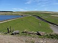 Lluest-wen Reservoir dam - geograph.org.uk - 3981602.jpg 4,000 × 3,000; 3.37 MB
-
 Looking towards Afon Rhondda Fach - geograph.org.uk - 2303383.jpg 640 × 480; 81 KB
-

-
 Maerdy (geograph 6142699).jpg 2,048 × 1,536; 1.04 MB
-

-
 Maerdy - geograph.org.uk - 226585.jpg 640 × 480; 56 KB
-
 Maerdy - geograph.org.uk - 5016759.jpg 640 × 480; 101 KB
-
 Maerdy bus terminus - geograph.org.uk - 2411659.jpg 640 × 480; 57 KB
-
 Maerdy Community Centre - geograph.org.uk - 2411898.jpg 640 × 377; 53 KB
-

-
 Maerdy Ex-Servicemen's Club - geograph.org.uk - 2412839.jpg 640 × 465; 63 KB
-
 Maerdy Gateway Miner's Memorial.jpg 5,152 × 3,864; 5.93 MB
-
 Maerdy Hall, Maerdy - geograph.org.uk - 357806.jpg 640 × 480; 76 KB
-
 Maerdy Park Paddling Pool - geograph.org.uk - 2411842.jpg 640 × 480; 79 KB
-
 Maerdy post office - geograph.org.uk - 2412604.jpg 640 × 503; 71 KB
-
 Maerdy public library - geograph.org.uk - 2411963.jpg 640 × 551; 85 KB
-
 Maerdy Road houses, Maerdy - geograph.org.uk - 2412655.jpg 640 × 574; 80 KB
-

-
 Maerdy Social Club - geograph.org.uk - 2412547.jpg 640 × 480; 70 KB
-
 Maerdy Surgery - geograph.org.uk - 2412008.jpg 640 × 504; 75 KB
-
 Maerdy War Memorial - geograph.org.uk - 2412374.jpg 640 × 484; 93 KB
-
 Maerdy water treatment works - geograph.org.uk - 2411599.jpg 640 × 472; 71 KB
-
 Maerdy Wind Farm - geograph.org.uk - 6161209.jpg 2,048 × 1,536; 945 KB
-

-
 Mardy Colliery memorial text, Maerdy - geograph.org.uk - 2412383.jpg 640 × 512; 96 KB
-
 Mardy Colliery memorial, Maerdy - geograph.org.uk - 2412379.jpg 640 × 475; 81 KB
-
 North Road Motors, Ferndale - geograph.org.uk - 2413669.jpg 640 × 480; 72 KB
-
 North Terrace, Maerdy - geograph.org.uk - 2412369.jpg 640 × 388; 59 KB
-

-
 On Lluest-wen reservoir dam - geograph.org.uk - 3980602.jpg 4,000 × 3,000; 3.89 MB
-
 On Lluest-wen Reservoir dam - geograph.org.uk - 3981598.jpg 4,000 × 3,000; 3.12 MB
-
 Ordnance Survey Cut Mark - geograph.org.uk - 4435847.jpg 480 × 640; 104 KB
-
 Ordnance Survey Cut Mark - geograph.org.uk - 4435850.jpg 480 × 640; 100 KB
-
 Ordnance Survey Cut Mark - geograph.org.uk - 5430932.jpg 432 × 640; 91 KB
-
 Ordnance Survey Cut Mark - geograph.org.uk - 5430940.jpg 415 × 640; 63 KB
-
 Ordnance Survey Cut Mark - geograph.org.uk - 5430943.jpg 470 × 640; 121 KB
-
 Ordnance Survey Cut Mark - geograph.org.uk - 5430948.jpg 411 × 640; 115 KB
-
 Ordnance Survey Cut Mark - geograph.org.uk - 5430953.jpg 640 × 422; 102 KB
-
 Ordnance Survey Cut Mark - geograph.org.uk - 5430957.jpg 441 × 640; 111 KB
-
 Ordnance Survey Cut Mark - geograph.org.uk - 5430961.jpg 640 × 354; 95 KB
-
 Ordnance Survey Cut Mark - geograph.org.uk - 5430966.jpg 640 × 357; 95 KB
-
 Ordnance Survey Rivet - geograph.org.uk - 4435845.jpg 640 × 480; 143 KB
-
 Ordnance Survey Rivet - geograph.org.uk - 4435846.jpg 480 × 640; 139 KB
-
 Outflow from Lluest Wen - geograph.org.uk - 6161952.jpg 2,048 × 1,536; 1.03 MB
-
 Outflow from the Lluest-wen Reservoir - geograph.org.uk - 3980595.jpg 4,000 × 3,000; 3 MB
-
 Oxford Street - geograph.org.uk - 6142722.jpg 2,048 × 1,536; 950 KB
-
 Park Place houses, Maerdy - geograph.org.uk - 2411863.jpg 640 × 450; 61 KB
-

-
 Path across burnt land near Tarren Maerdy - geograph.org.uk - 4413510.jpg 4,000 × 3,000; 4.58 MB
-
 Path beside Castell Nos reservoir - geograph.org.uk - 3980529.jpg 4,000 × 3,000; 2.67 MB
-
 Path beside the Rhondda Fach - geograph.org.uk - 3980537.jpg 4,000 × 3,000; 3.27 MB
-
 Path descending towards Cwm Rhondda-fach - geograph.org.uk - 3980381.jpg 4,000 × 3,000; 2.86 MB
-
 Path into woodland near Maerdy - geograph.org.uk - 2411385.jpg 640 × 480; 101 KB
-
 Path to the Rhondda Fach river - geograph.org.uk - 2412965.jpg 640 × 606; 120 KB
-
 Pen y Waun Fawr - geograph.org.uk - 4991912.jpg 640 × 480; 131 KB
-
 Pond on Twyn y Bloedd - geograph.org.uk - 2295826.jpg 640 × 480; 49 KB
-
 Pont Lluest-wen - geograph.org.uk - 2523962.jpg 640 × 480; 132 KB
-
 Pont Lluest-wen - geograph.org.uk - 3980572.jpg 3,703 × 2,777; 3.8 MB
-
 Public toilets, Maerdy - geograph.org.uk - 2411998.jpg 640 × 480; 84 KB
-
 Reflections in woodland - geograph.org.uk - 6142655.jpg 1,536 × 2,048; 1.41 MB
-
 Remains of buildings at the site of Maerdy Colliery - geograph.org.uk - 3980401.jpg 4,000 × 3,000; 4.77 MB
-
 Rhondda - gem of the valleys, Maerdy - geograph.org.uk - 2412357.jpg 640 × 528; 119 KB
-
 Rhondda Fach - geograph.org.uk - 6142687.jpg 5,446 × 2,830; 6.45 MB
-

-
 Rhondda Fach flows towards Maerdy - geograph.org.uk - 2411356.jpg 640 × 420; 87 KB
-

-
 Richard St, Maerdy - geograph.org.uk - 5035177.jpg 4,608 × 3,456; 3.47 MB
-
 Riverside path approaches Maerdy - geograph.org.uk - 2411360.jpg 640 × 480; 80 KB
-

-
 Road out of Maerdy - geograph.org.uk - 828696.jpg 640 × 480; 91 KB
-
 Rocky outcrops on scorched hillside - geograph.org.uk - 6142709.jpg 2,048 × 1,536; 1.67 MB
-

-
 SE edge of Maerdy - geograph.org.uk - 2413017.jpg 640 × 580; 128 KB
-
 Seion Baptist Chapel, Maerdy - geograph.org.uk - 2412666.jpg 640 × 545; 70 KB
-
 Seion Chapel, Maerdy - geograph.org.uk - 5035163.jpg 4,608 × 3,456; 3.96 MB
-
 Sheppard's Chemists, Maerdy - geograph.org.uk - 2412392.jpg 640 × 480; 64 KB
-

-
 Spillway from the Castell Nos reservoir - geograph.org.uk - 3980517.jpg 4,000 × 3,000; 2.83 MB
-
 Springfield Road, Maerdy - geograph.org.uk - 2411636.jpg 640 × 454; 59 KB
-
 Steps up to Maerdy Junior School - geograph.org.uk - 2412877.jpg 640 × 480; 98 KB
-
 Storage tanks - geograph.org.uk - 6162132.jpg 2,048 × 1,536; 1.4 MB
-
 Storm damaged trees - geograph.org.uk - 6162181.jpg 2,048 × 1,536; 1.23 MB
-
 Storm damaged woodland - geograph.org.uk - 6142681.jpg 2,048 × 1,536; 1.61 MB
-
 Tanybryn houses, Maerdy - geograph.org.uk - 2412885.jpg 640 × 554; 77 KB
-
 Tarren Maerdy - Cairn I - geograph.org.uk - 5382129.jpg 640 × 327; 65 KB
-
 Tarren y Maerdy - geograph.org.uk - 5016861.jpg 640 × 480; 88 KB
-
 Teify House, Maerdy - geograph.org.uk - 2412626.jpg 640 × 467; 71 KB
-
 Telegraph Poles - geograph.org.uk - 6142479.jpg 1,536 × 2,048; 931 KB
-
 Terminal power poles near Maerdy - geograph.org.uk - 2411374.jpg 640 × 480; 76 KB
-
 The A4233, entering Maerdy - geograph.org.uk - 5035189.jpg 4,608 × 3,456; 4.06 MB
-

-
 The Hotel pub and wine bar, Maerdy - geograph.org.uk - 2412638.jpg 640 × 450; 60 KB
-

-

-
 Track above the Lluest-wen Reservoir - geograph.org.uk - 3981604.jpg 4,000 × 3,000; 3.26 MB
-
 Track and turbines - geograph.org.uk - 6161697.jpg 2,048 × 1,536; 1.1 MB
-

-
 Track junction - geograph.org.uk - 6161187.jpg 2,048 × 1,536; 1.55 MB
-
 Track on Bryn Gelli - geograph.org.uk - 2293319.jpg 640 × 480; 50 KB
-
 Track through Cwm Rhondda-fach - geograph.org.uk - 3980412.jpg 4,000 × 3,000; 4.34 MB
-
 Track towards Maerdy - geograph.org.uk - 6142704.jpg 1,536 × 2,048; 1.62 MB
-
 Trees and track on Bryn Llechwenddiddos - geograph.org.uk - 3981615.jpg 4,000 × 3,000; 4.21 MB
-

-
 Twyn Croesffordd - geograph.org.uk - 5016669.jpg 640 × 480; 81 KB
-
 Ty's fish and chip shop, Maerdy - geograph.org.uk - 2412736.jpg 640 × 449; 65 KB
-

-
 View across Cwm Rhondda-fach - geograph.org.uk - 3980390.jpg 4,000 × 3,000; 3.65 MB
-
 View across Cwm Rhondda-fach - geograph.org.uk - 3980545.jpg 4,000 × 3,000; 3.47 MB
-
 View from Tarren Maerdy over the Rhondda Fach valley - geograph.org.uk - 4413517.jpg 4,000 × 2,532; 2.44 MB
-
 View from the Lleust-wen Reservoir - geograph.org.uk - 2292924.jpg 4,000 × 3,000; 2.82 MB
-
 View over the Rhondda Fach valley - geograph.org.uk - 4413526.jpg 4,000 × 3,000; 3.45 MB
-
 View towards Maerdy from an abandoned quarry - geograph.org.uk - 4413536.jpg 3,909 × 2,932; 5.28 MB
-
 Walking the dogs near Maerdy - geograph.org.uk - 2411317.jpg 640 × 497; 83 KB
-
 Walking to Ferndale - geograph.org.uk - 2412973.jpg 640 × 551; 107 KB
-
 Wall beside the Rhondda Fach - geograph.org.uk - 3980553.jpg 4,000 × 3,000; 3.2 MB
-
 Waterfall on Rhondda Fach - geograph.org.uk - 693598.jpg 640 × 480; 111 KB
-
 Wind turbine - geograph.org.uk - 6161248.jpg 2,048 × 1,536; 576 KB
-
 Wind turbines seen across Cwm Rhondda-fach - geograph.org.uk - 3980418.jpg 4,000 × 3,000; 2.98 MB
-
 Woodland footpath - geograph.org.uk - 6162136.jpg 1,536 × 2,048; 1.86 MB
-
 A wet afternoon in Maerdy - geograph.org.uk - 993369.jpg 640 × 480; 61 KB
-

.jpg)


.jpg)


.jpg)


_end_of_Wood_Street,_Maerdy_-_geograph.org.uk_-_2411799.jpg)


