Category:Maelor South
Jump to navigation
Jump to search

community in Wrexham, North Wales, UK  | |||||
| Upload media | |||||
| Instance of | |||||
|---|---|---|---|---|---|
| Location | Wrexham County Borough, Wales | ||||
| Population |
| ||||
| Area |
| ||||
 | |||||
Subcategories
This category has the following 3 subcategories, out of 3 total.
Media in category "Maelor South"
The following 130 files are in this category, out of 130 total.
-

-
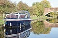
 'Pipedream' at Bettisfield - geograph.org.uk - 5951329.jpg 1,280 × 851; 356 KB
-
 A495 passing The Rookery, Bettisfield Park - geograph.org.uk - 4269177.jpg 1,600 × 1,202; 1.29 MB
-
 Approaching Bettisfield Hall farm - geograph.org.uk - 6355530.jpg 640 × 480; 67 KB
-
 Approaching Penley from the east - geograph.org.uk - 6032509.jpg 4,288 × 3,216; 3.66 MB
-
 Barn on Burgess Lane - geograph.org.uk - 6367514.jpg 4,000 × 3,000; 2.99 MB
-
 Bettisfield Bridge (No 48), from the west - geograph.org.uk - 5213025.jpg 1,024 × 768; 159 KB
-
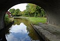
 Bettisfield Bridge, Llangollen Canal - geograph.org.uk - 5951354.jpg 1,280 × 851; 433 KB
-
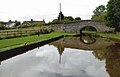
 Bettisfield Bridge, Wrexham - geograph.org.uk - 5244609.jpg 1,280 × 901; 843 KB
-
 Bettisfield Bridge, Wrexham - geograph.org.uk - 5244642.jpg 1,280 × 960; 931 KB
-
 Bettisfield from the west - geograph.org.uk - 5213057.jpg 1,024 × 768; 107 KB
-
 Bettisfield Hall farm - geograph.org.uk - 6355541.jpg 640 × 480; 129 KB
-
 Bettisfield old railway station - geograph.org.uk - 6356080.jpg 640 × 480; 74 KB
-
 Bettisfield Village Hall - geograph.org.uk - 6356083.jpg 640 × 480; 54 KB
-
 Bettisfield Village Hall - geograph.org.uk - 6356084.jpg 640 × 480; 65 KB
-
 Blasted Oak - geograph.org.uk - 4377660.jpg 534 × 800; 98 KB
-
 Bridge 47 Llangollen Canal - geograph.org.uk - 4246313.jpg 3,264 × 2,448; 2.37 MB
-
 Bridge 48 Llangollen Canal - geograph.org.uk - 4246317.jpg 3,264 × 2,448; 2.78 MB
-
 Bridge 49 Llangollen Canal - geograph.org.uk - 4246322.jpg 3,264 × 2,448; 2.04 MB
-
 Busy Bridge - geograph.org.uk - 4377639.jpg 800 × 465; 86 KB
-
 Canal and pasture near Bettisfield, Wrexham - geograph.org.uk - 5245708.jpg 1,024 × 1,024; 684 KB
-
 Canal and pasture near Bettisfield, Wrexham - geograph.org.uk - 5245710.jpg 1,024 × 1,024; 798 KB
-
 Canal and pasture near Bettisfield, Wrexham - geograph.org.uk - 5245712.jpg 1,024 × 1,024; 834 KB
-
 Canalside house near Bettisfield - geograph.org.uk - 6355083.jpg 640 × 480; 51 KB
-
 Cattle grazing, east of Bettisfield - geograph.org.uk - 5212991.jpg 1,024 × 768; 431 KB
-
 Cattle pasture, west of New House Farm - geograph.org.uk - 5213083.jpg 1,024 × 768; 131 KB
-
 Charolais bull at Stryt Lydan Farm - geograph.org.uk - 6032484.jpg 4,288 × 3,216; 3.61 MB
-
 Clapping Gate Bridge (No 49), from the west - geograph.org.uk - 5213064.jpg 1,024 × 768; 126 KB
-
 Clapping Gate Bridge near Bettisfield, Wrexham - geograph.org.uk - 5260205.jpg 1,280 × 911; 825 KB
-
 Coleg Derwen, Ashdale House - geograph.org.uk - 6367521.jpg 4,000 × 3,000; 2.41 MB
-
 Cornhill Bridge (No 47), from the west - geograph.org.uk - 5213006.jpg 1,024 × 768; 159 KB
-
 Cornhill Bridge east of Bettisfield, Wrexham - geograph.org.uk - 5260240.jpg 1,280 × 887; 945 KB
-
 Cornhill Bridge east of Bettisfield, Wrexham - geograph.org.uk - 5260246.jpg 1,280 × 909; 890 KB
-

-
 Cornhill Bridge, Llangollen Canal - geograph.org.uk - 5867939.jpg 1,280 × 851; 506 KB
-
 Cornhill Bridge, Llangollen Canal - geograph.org.uk - 5951369.jpg 1,280 × 851; 496 KB
-
 Cornhill, east of Bettisfield - geograph.org.uk - 5213018.jpg 1,024 × 768; 194 KB
-
 Cow sheds on a farm on Lon Cadney - geograph.org.uk - 6355019.jpg 640 × 480; 63 KB
-
 Dead Tree, but green with ivy - geograph.org.uk - 6367518.jpg 4,000 × 3,000; 2.58 MB
-
 Down the hill to England - geograph.org.uk - 6032471.jpg 4,288 × 3,216; 3.71 MB
-
 Dragons guarding the gateway, Shady Oaks - geograph.org.uk - 6367538.jpg 4,000 × 3,000; 2.68 MB
-
 Dymock Arms, Penley - geograph.org.uk - 6032459.jpg 4,288 × 3,216; 4.09 MB
-
 Ebenezer Primitive Methodist Chapel - geograph.org.uk - 6032454.jpg 4,200 × 2,736; 2.57 MB
-
 Entrance to Little Hall - geograph.org.uk - 4436992.jpg 640 × 328; 46 KB
-
 Equestrian property near Bettisfield - geograph.org.uk - 6355510.jpg 640 × 480; 89 KB
-
 Farm buildings, Burgess Lane - geograph.org.uk - 6367516.jpg 4,000 × 3,000; 2.75 MB
-
 Farm east of Penley on the A539 - geograph.org.uk - 6032495.jpg 4,288 × 3,216; 3.51 MB
-
 Farmland east of Taraloka (formerly Cornhill) - geograph.org.uk - 5212999.jpg 1,024 × 768; 187 KB
-
 Farmland near Bettisfield, Wrexham - geograph.org.uk - 5244698.jpg 1,280 × 750; 876 KB
-
 Field at Cadney - geograph.org.uk - 5019974.jpg 640 × 480; 69 KB
-

-
 Footbridge with some Style. - geograph.org.uk - 1124554.jpg 427 × 640; 117 KB
-

-
 Gateway on Lon Cadney, Bettisfield - geograph.org.uk - 6356220.jpg 640 × 480; 91 KB
-
 Greenways, Grange Road - geograph.org.uk - 6032474.jpg 4,288 × 3,216; 3.39 MB
-
 Hidden Footbridge - geograph.org.uk - 1124541.jpg 640 × 427; 113 KB
-
 Higher Penley Farm - geograph.org.uk - 6367532.jpg 4,000 × 3,000; 2.77 MB
-
 Junction near Lane Farm - geograph.org.uk - 4438695.jpg 640 × 328; 48 KB
-
 Llangollen Canal at Bettisfield, Wrexham - geograph.org.uk - 5244618.jpg 1,280 × 825; 574 KB
-
 Llangollen Canal at Bettisfield, Wrexham - geograph.org.uk - 5244650.jpg 1,280 × 877; 746 KB
-
-
 Llangollen Canal east of Bettisfield, Wrexham - geograph.org.uk - 5260219.jpg 1,280 × 899; 892 KB
-
 Llangollen Canal, Bettisfield - geograph.org.uk - 5951288.jpg 1,280 × 851; 516 KB
-
 Llangollen Canal, Bettisfield - geograph.org.uk - 5951304.jpg 1,280 × 851; 455 KB
-
 Madras Voluntary Aided School, Penley - geograph.org.uk - 6032528.jpg 4,288 × 3,216; 3.75 MB
-
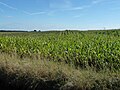
 Maize to the horizon, west of Bettisfield - geograph.org.uk - 5213059.jpg 1,024 × 768; 205 KB
-
 Mature Trees - geograph.org.uk - 4377725.jpg 800 × 533; 146 KB
-
 Muscovy Duck - geograph.org.uk - 6032482.jpg 4,288 × 3,216; 3.58 MB
-
 National Grid - geograph.org.uk - 4377673.jpg 800 × 529; 74 KB
-
 New House Farm, near Bettisfield - geograph.org.uk - 5213074.jpg 1,024 × 768; 146 KB
-
 New Lane junction with A495 - geograph.org.uk - 2899845.jpg 640 × 462; 118 KB
-
 Newly erected - geograph.org.uk - 4377694.jpg 800 × 532; 151 KB
-
 Old barn - geograph.org.uk - 5020041.jpg 640 × 480; 81 KB
-
 Old blueberry farm near Bettisfield - geograph.org.uk - 6355504.jpg 640 × 480; 123 KB
-
 Old chapel in Bettisfield - geograph.org.uk - 6356214.jpg 640 × 480; 58 KB
-
 Old chapel in the village - geograph.org.uk - 5020015.jpg 640 × 480; 82 KB
-
 Old cottage in Bettisfield - geograph.org.uk - 6356211.jpg 640 × 480; 66 KB
-
 Old cottage in the village - geograph.org.uk - 5020026.jpg 640 × 480; 93 KB
-
 Old Milepost by the A539, Penley - geograph.org.uk - 6048917.jpg 732 × 1,143; 290 KB
-
-
 Old stable block - geograph.org.uk - 5019996.jpg 640 × 480; 69 KB
-

-

-

-
 Ordnance Survey Cut Mark - geograph.org.uk - 5142988.jpg 638 × 640; 161 KB
-
 Over the Hill - geograph.org.uk - 4377577.jpg 717 × 1,024; 159 KB
-

-
 Park Lane Farm, near Penley - geograph.org.uk - 6032502.jpg 4,288 × 3,216; 3.52 MB
-
 Part of the canal at Bettisfield - geograph.org.uk - 6356207.jpg 640 × 480; 57 KB
-

-
 Pond at Tait's Farm Cottage - geograph.org.uk - 6032478.jpg 4,184 × 3,072; 4.23 MB
-
 Premier store, Penley - geograph.org.uk - 6032534.jpg 4,288 × 3,216; 3.71 MB
-
 Rainbow Centre, Penley - geograph.org.uk - 6032445.jpg 2,853 × 2,138; 1.88 MB
-
 Road junction east of Little Hall - geograph.org.uk - 2899839.jpg 640 × 466; 81 KB
-
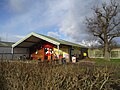
 Roadside farm sign in Maelor South, Wales - geograph.org.uk - 498721.jpg 640 × 427; 120 KB
-

-

-
 Rural property near Bettisfield - geograph.org.uk - 6355512.jpg 640 × 480; 78 KB
-
 Sandy Lane - geograph.org.uk - 4377622.jpg 1,024 × 665; 172 KB
-

-

-
-
 Scene on Lon Cadney - Cadney Lane - geograph.org.uk - 5019954.jpg 640 × 480; 55 KB
-

-
 Scrape Wood - geograph.org.uk - 5957911.jpg 5,184 × 3,888; 5.44 MB
-
 Sign for Stryt Llydan Farm, near Penley - geograph.org.uk - 6032498.jpg 4,288 × 3,216; 3.64 MB
-

-
 Small Farm - geograph.org.uk - 6032475.jpg 4,288 × 3,216; 3.44 MB
-
 Stables at The Yews, near Penley - geograph.org.uk - 6032505.jpg 4,288 × 3,216; 4.12 MB
-
 Starlings in a tree at sunset - geograph.org.uk - 6355499.jpg 640 × 480; 126 KB
-
 Stryt Lydan Farmhouse - geograph.org.uk - 6032486.jpg 4,288 × 3,216; 3.57 MB
-
 Taits Farm Cottage - geograph.org.uk - 6032481.jpg 4,288 × 3,216; 3.57 MB
-
 The Beaten Track - geograph.org.uk - 4377618.jpg 683 × 1,024; 129 KB
-
 The Croft, Red Hall lane - geograph.org.uk - 5135750.jpg 4,934 × 3,289; 2.47 MB
-
 The Elaborate Post box - geograph.org.uk - 4377628.jpg 1,024 × 683; 228 KB
-
 The Grange, Penley - geograph.org.uk - 6032465.jpg 4,288 × 3,216; 3.74 MB
-
 The Maelor School, Penley - geograph.org.uk - 6032446.jpg 4,178 × 3,064; 3.5 MB
-
 Tractor and Forage Wagon - geograph.org.uk - 6367531.jpg 3,637 × 2,727; 2.08 MB
-
 Tree in fields near Bettisfield - geograph.org.uk - 6355488.jpg 640 × 480; 56 KB
-
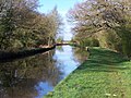
 Tree on the towpath, west of Whixall Moss - geograph.org.uk - 5212993.jpg 1,024 × 768; 247 KB
-
 Unexpected Ford - geograph.org.uk - 4377686.jpg 800 × 495; 73 KB
-
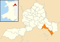 Wales Wrexham Community Maelor South map.svg 512 × 362; 495 KB
-

-

-

-
 Well Defined - geograph.org.uk - 4377590.jpg 1,024 × 737; 243 KB
-
 Well used bridleway - geograph.org.uk - 4377703.jpg 800 × 502; 118 KB
-
 Welsh maize, east of Bettisfield - geograph.org.uk - 5213015.jpg 1,024 × 768; 182 KB
-
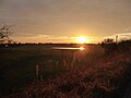
 Winter Sun - geograph.org.uk - 1124583.jpg 640 × 427; 101 KB
-
 Winter Walkway - geograph.org.uk - 1124609.jpg 427 × 640; 103 KB


,_from_the_west_-_geograph.org.uk_-_5213025.jpg)


,_from_the_west_-_geograph.org.uk_-_5213064.jpg)


,_from_the_west_-_geograph.org.uk_-_5213006.jpg)


_-_geograph.org.uk_-_5212999.jpg)


