Category:Machynlleth Loop
Jump to navigation
Jump to search
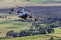
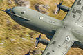
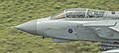
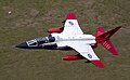
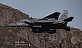
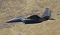
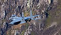
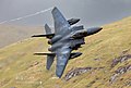
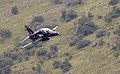
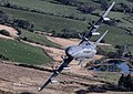
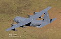
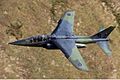
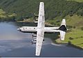
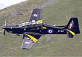
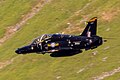
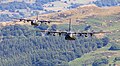
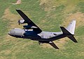
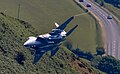
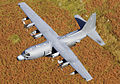
English: Mach Loop is a flying route in Wales, United Kingdom that is used to train pilots in low level flying. The route takes in several deep, steeply sided valleys, typical of the Welsh topography. The route is used mainly by Royal Air Force, Royal Navy and United States Air Force pilots, but is also used during NATO training exercises. The route is named for the town of Machynlleth which lies at the south end of the route, which is known by locals as Mach.
Deutsch: Mach Loop, ein für Tiefflugübungen genutztes Talsystem in Wales.
Low-level training area  Mach Loop | |||||
| Upload media | |||||
 | |||||
Media in category "Machynlleth Loop"
The following 166 files are in this category, out of 166 total.
-
 1Mach Loop (36391528351).jpg 4,647 × 3,098; 933 KB
-
 20180501173821!RAF Eurofighter EF-2000 Typhoon F2 (cropped).jpg 1,280 × 849; 400 KB
-
 2Mach Loop (36361144382).jpg 6,123 × 4,082; 429 KB
-
 3Mach Loop (36391528941).jpg 5,472 × 3,648; 728 KB
-
 BAe Hawk CAD West Mach Loop (52086248142).jpg 4,312 × 3,068; 8.92 MB
-
 BAe Hawk CAD West Mach Loop (52087282326).jpg 3,697 × 2,785; 7.21 MB
-
 BAe Hawk T1 XX339 - CK (9315523325).jpg 3,198 × 2,132; 2.52 MB
-
 British Army Westland WAH-64D Longbow Apache AH1 Lofting-1.jpg 1,280 × 851; 743 KB
-
 Bwlch (43163746530).jpg 1,000 × 667; 907 KB
-
 C130 LOOP (14014256031).jpg 1,900 × 1,266; 1.72 MB
-
 Close up (Tornado) (14513968651).jpg 1,595 × 707; 723 KB
-
 Eagle in mach loop, Wales, UK (8000183684).jpg 1,600 × 1,067; 1.15 MB
-
 ETPS Sepecat Jaguar T2 Lofting-1.jpg 1,600 × 993; 801 KB
-
 French Air Force Dassault-Dornier Alpha Jet E Lofting-1.jpg 1,280 × 897; 466 KB
-
 HERCULES (14271114908).jpg 1,400 × 842; 677 KB
-
 Lakenheath F-15 Strike CAD East Mach Loop (52019030712).jpg 3,058 × 1,901; 3.95 MB
-
 Lakenheath F-15 Strike CAD East Mach Loop (52019031497).jpg 2,805 × 1,594; 3.03 MB
-
 Lakenheath F-15 Strike CAD East Mach Loop (52019032942).jpg 5,495 × 3,296; 9.2 MB
-
 Lakenheath F-15 Strike CAD East Mach Loop (52019039482).jpg 6,215 × 3,862; 10.63 MB
-
 Lakenheath F-15 Strike CAD East Mach Loop (52020067286).jpg 3,433 × 2,383; 5.73 MB
-
 Lakenheath F-15 Strike CAD East Mach Loop (52020067481).jpg 3,211 × 2,008; 4.19 MB
-
 Lakenheath F-15 Strike CAD East Mach Loop (52020067576).jpg 2,214 × 2,755; 3.76 MB
-
 Lakenheath F-15 Strike CAD East Mach Loop (52020068231).jpg 3,487 × 2,253; 4.93 MB
-
 Lakenheath F-15 Strike CAD East Mach Loop (52020072511).jpg 5,587 × 3,257; 9.15 MB
-
 Lakenheath F-15 Strike CAD East Mach Loop (52020075821).jpg 5,985 × 3,502; 11.86 MB
-
 Lakenheath F-15 Strike CAD East Mach Loop (52020114508).jpg 3,173 × 1,862; 3.57 MB
-
 Lakenheath F-15 Strike CAD East Mach Loop (52020114648).jpg 3,211 × 1,901; 3.87 MB
-
 Lakenheath F-15 Strike CAD East Mach Loop (52020115008).jpg 4,966 × 3,065; 10.71 MB
-
 Lakenheath F-15 Strike CAD East Mach Loop (52020115383).jpg 5,249 × 3,226; 9.73 MB
-
 Lakenheath F-15 Strike CAD East Mach Loop (52020117073).jpg 8,192 × 5,464; 24.01 MB
-
 Lakenheath F-15 Strike CAD East Mach Loop (52020118543).jpg 5,809 × 3,640; 10.26 MB
-
 Lakenheath F-15 Strike CAD East Mach Loop (52020319044).jpg 3,387 × 2,322; 5.18 MB
-
 Lakenheath F-15 Strike CAD East Mach Loop (52020319609).jpg 2,123 × 1,173; 1.76 MB
-
 Lakenheath F-15 Strike CAD East Mach Loop (52020321584).jpg 5,303 × 3,272; 8.75 MB
-
 Lakenheath F-15 Strike CAD East Mach Loop (52020324539).jpg 5,571 × 3,379; 8.07 MB
-
 Lakenheath F-15 Strike CAD East Mach Loop (52020328034).jpg 5,809 × 3,709; 12.12 MB
-
 Lakenheath F-15 Strike CAD East Mach Loop (52020590735).jpg 3,188 × 1,870; 3.87 MB
-
 Lakenheath F-15 Strike CAD East Mach Loop (52020591260).jpg 3,908 × 2,513; 6.47 MB
-
 Lakenheath F-15 Strike CAD East Mach Loop (52020594660).jpg 6,077 × 3,931; 12 MB
-
 Lakenheath F-15 Strike CAD East Mach Loop (52020595120).jpg 6,506 × 3,334; 11.04 MB
-
 Lakenheath F-15 Strike CAD East Mach Loop (52020597885).jpg 5,793 × 3,870; 13.79 MB
-
 Lakenheath F-15 Strike CAD East Mach Loop (52020598510).jpg 6,935 × 4,468; 16.19 MB
-
 Lakenheath F-15 Strike CAD West Mach Loop (52019036662).jpg 2,048 × 1,366; 1.11 MB
-
 Lakenheath F-15 Strike CAD West Mach Loop (52019037207).jpg 2,048 × 1,427; 1.67 MB
-
 Lakenheath F-15 Strike CAD West Mach Loop (52020073741).jpg 2,048 × 1,328; 1.65 MB
-
 Lakenheath F-15 Strike CAD West Mach Loop (52020119118).jpg 2,048 × 1,420; 1.87 MB
-
 Lakenheath F-15 Strike CAD West Mach Loop (52020119838).jpg 2,048 × 1,119; 1.3 MB
-
 Lakenheath F-15 Strike CAD West Mach Loop (52020119908).jpg 2,048 × 1,366; 1.12 MB
-
 Lakenheath F-15 Strike CAD West Mach Loop (52020324584).jpg 2,048 × 1,262; 1.24 MB
-
 Lakenheath F-15 Strike CAD West Mach Loop (52020324694).jpg 2,048 × 1,246; 1.04 MB
-
 Lakenheath F-15 Strike CAD West Mach Loop (52020596380).jpg 2,048 × 1,360; 1.23 MB
-
 Lakenheath F-15 Strike CAD West Mach Loop (52020596695).jpg 2,048 × 1,303; 1.46 MB
-
 Lakenheath F-15 Strike CAD West Mach Loop (52020596795).jpg 2,048 × 1,473; 1.84 MB
-
 Lakenheath F-15 Strike CAD West Mach Loop (52020596965).jpg 2,048 × 1,388; 1.87 MB
-
 Lakenheath F-15 Strike CAD West Mach Loop (52020597045).jpg 2,048 × 1,486; 1.66 MB
-
 Lakenheath F-15 Strike CAD West Mach Loop (52020597180).jpg 1,609 × 1,042; 1.21 MB
-
 Mach Loop, Cad East RAF Hawk (52230937681).jpg 5,246 × 3,874; 1.35 MB
-
 Mach Loop, Cad West, RAF Hawk ZX013 (52366624980).jpg 2,944 × 1,808; 514 KB
-
 MC-130 CAD East Mach Loop (52019041917).jpg 7,694 × 4,560; 14.89 MB
-
 MC-130 CAD East Mach Loop (52019043477).jpg 3,349 × 2,062; 3.61 MB
-
 MC-130 CAD East Mach Loop (52020082316).jpg 5,947 × 3,771; 11.65 MB
-
 MC-130 CAD East Mach Loop (52020084641).jpg 6,437 × 4,721; 17.63 MB
-
 MC-130 CAD East Mach Loop (52020129488).jpg 6,008 × 3,786; 12.21 MB
-
 MC-130 CAD East Mach Loop (52020331494).jpg 6,698 × 4,736; 18.24 MB
-
 MC-130 CAD East Mach Loop (52020333979).jpg 5,709 × 4,085; 12.85 MB
-
 MC-130 CAD East Mach Loop (52020334434).jpg 5,533 × 3,541; 9.41 MB
-
 MC-130 CAD East Mach Loop (52020334919).jpg 5,993 × 4,184; 13.9 MB
-
 MC-130 CAD East Mach Loop (52020604005).jpg 5,747 × 3,900; 12.06 MB
-
 MC-130 CAD East Mach Loop (52020605345).jpg 2,378 × 1,724; 2.41 MB
-
 Mile Marker - Mach Loop.jpg 3,737 × 2,497; 7.2 MB
-
 Need for speed (8000181275).jpg 1,600 × 1,066; 1.17 MB
-
 RAF BAE Systems Hawk T2 Lofting-1.jpg 1,280 × 849; 597 KB
-
 RAF Boeing Chinook HC2 (352) Lofting-1.jpg 1,280 × 849; 859 KB
-
 RAF British Aerospace Harrier GR9 Lofting-1.jpg 1,600 × 1,097; 842 KB
-
 RAF British Aerospace Harrier GR9 Lofting-2.jpg 1,280 × 849; 574 KB
-
 RAF British Aerospace Hawk T1 Lofting-1.jpg 1,600 × 997; 533 KB
-
 RAF British Aerospace Hawk T2 Lofting.jpg 1,280 × 853; 413 KB
-
 RAF Dassault-Dornier Alpha Jet A Lofting-1.jpg 1,280 × 849; 591 KB
-
 RAF Eurofighter EF-2000 Typhoon F2 Lofting-1.jpg 1,280 × 849; 458 KB
-
 RAF Eurofighter EF-2000 Typhoon F2 Lofting-2.jpg 1,280 × 849; 597 KB
-
 RAF Eurofighter EF-2000 Typhoon FGR4 Lofting-1.jpg 1,280 × 897; 665 KB
-
 RAF Hawker Siddeley Hawk Lofting-1.jpg 1,280 × 897; 690 KB
-
 RAF Hawker Siddeley HS-125-2 Dominie T1 Lofting-1.jpg 1,280 × 899; 535 KB
-
 RAF Hawker Siddeley HS-780 Andover C1 Lofting-1.jpg 1,280 × 849; 896 KB
-
 RAF Lockheed C-130K Hercules C3P (L-382) Lofting-1.jpg 1,280 × 897; 514 KB
-
 RAF Lockheed Martin C-130J-30 Hercules C4 (L-382) Lofting-1.jpg 1,280 × 849; 817 KB
-
 RAF Panavia Tornado GR1(T) Lofting-1.jpg 1,600 × 1,143; 1,009 KB
-
 RAF Panavia Tornado GR4 (tone).jpg 1,280 × 849; 367 KB
-
 RAF Panavia Tornado GR4 Lofting-1.jpg 1,280 × 849; 427 KB
-
 RAF Panavia Tornado GR4 Lofting-2.jpg 1,600 × 1,097; 905 KB
-
 RAF Raytheon B200 King Air Lofting-1.jpg 1,280 × 849; 481 KB
-
 RAF Sepecat Jaguar GR3A Lofting-1.jpg 1,280 × 899; 732 KB
-
 RAF Sepecat Jaguar T2A Lofting-1.jpg 1,280 × 897; 982 KB
-
 RAF Short S-312 Tucano T1 Lofting-1.jpg 1,280 × 849; 439 KB
-
 RAF Short S-312 Tucano T1 Lofting-2.jpg 1,280 × 899; 449 KB
-
 RAF Texan II CAD East Mach Loop (52020077646).jpg 4,000 × 2,835; 6.65 MB
-
 RAF Texan II CAD East Mach Loop (52020123698).jpg 3,916 × 2,774; 5.97 MB
-
 RAF Texan II CAD East Mach Loop (52020123828).jpg 3,173 × 2,453; 4.06 MB
-
 RAF Texan II CAD East Mach Loop (52020600160).jpg 2,843 × 2,069; 3.52 MB
-
 RAF Texan II CAD East Mach Loop (52020601125).jpg 1,624 × 2,245; 1.73 MB
-
 Royal Air Force Panavia Tornado GR4 ZA607 EB-X Corris Corner 2018 01.jpg 6,016 × 3,384; 9.76 MB
-
 UK Low Flying Area Action 2023 6WAL1319 (52978717962).jpg 4,280 × 3,310; 13.76 MB
-
 UK Low Flying Area Action 2023 6WAL1335 (52978717467).jpg 3,874 × 2,574; 9 MB
-
 UK Low Flying Area Action 2023 6WAL1336 (52979774323).jpg 3,769 × 2,529; 9.05 MB
-
 UK Low Flying Area Action 2023 6WAL1344 (52979317216).jpg 3,041 × 1,996; 6.09 MB
-
 UK Low Flying Area Action 2023 6WAL1345 (52978716867).jpg 3,049 × 1,832; 4.25 MB
-
 UK Low Flying Area Action 2023 6WAL1352 (52978716782).jpg 2,733 × 1,839; 4.1 MB
-
 UK Low Flying Area Action 2023 6WAL1353 (52978716697).jpg 2,936 × 1,869; 4.56 MB
-
 UK Low Flying Area Action 2023 6WAL1356 (52979691715).jpg 2,418 × 1,614; 3.02 MB
-
 UK Low Flying Area Action 2023 6WAL1361 (52979316691).jpg 2,395 × 1,659; 3.3 MB
-
 UK Low Flying Area Action 2023 6WAL1369 (52979691510).jpg 1,907 × 1,246; 2.17 MB
-
 UK Low Flying Area Action 2023 6WAL1369-2 (52979691485).jpg 1,907 × 1,246; 2.17 MB
-
 UK Low Flying Area Action 2023 6WAL1633 (52979773348).jpg 4,385 × 2,822; 9.7 MB
-
 UK Low Flying Area Action 2023 6WAL1643 (52979773113).jpg 3,657 × 2,109; 5.85 MB
-
 UK Low Flying Area Action 2023 6WAL1850 (52979472949).jpg 5,474 × 3,295; 14.61 MB
-
 UK Low Flying Area Action 2023 6WAL1858 (52978725427).jpg 5,834 × 3,790; 18.83 MB
-
 UK Low Flying Area Action 2023 6WAL1859 (52979325566).jpg 6,187 × 3,798; 20.11 MB
-
 UK Low Flying Area Action 2023 6WAL1865 (52979472229).jpg 6,653 × 3,678; 19.94 MB
-
 UK Low Flying Area Action 2023 6WAL1866 (52979781178).jpg 6,390 × 3,865; 19.76 MB
-
 UK Low Flying Area Action 2023 6WAL1867-2 (52979471074).jpg 5,909 × 3,865; 18.62 MB
-
 UK Low Flying Area Action 2023 6WAL1872 (52979698570).jpg 6,029 × 4,083; 15.05 MB
-
 UK Low Flying Area Action 2023 6WAL1878 (52979779278).jpg 4,971 × 3,370; 12.25 MB
-
 UK Low Flying Area Action 2023 6WAL1882 (52979469804).jpg 4,475 × 3,205; 10.32 MB
-
 UK Low Flying Area Action 2023 6WAL1883 (52978722452).jpg 4,670 × 3,422; 11.55 MB
-
 UK Low Flying Area Action 2023 6WAL1898 (52979697985).jpg 6,382 × 4,353; 18.98 MB
-
 UK Low Flying Area Action 2023 6WAL1920 (52979475904).jpg 5,106 × 3,670; 11.2 MB
-
 UK Low Flying Area Action 2023 6WAL1921 (52979785468).jpg 5,474 × 3,873; 12.49 MB
-
 UK Low Flying Area Action 2023 6WAL1948 (52979328551).jpg 6,397 × 4,233; 15.16 MB
-
 UK Low Flying Area Action 2023 6WAL1949 (52978728567).jpg 6,045 × 4,241; 17.56 MB
-
 UK Low Flying Area Action 2023 6WAL1950 (52979328196).jpg 6,014 × 4,203; 16.04 MB
-
 UK Low Flying Area Action 2023 6WAL1955 (52978727982).jpg 6,067 × 4,451; 18.91 MB
-
 UK Low Flying Area Action 2023 6WAL1968 (52979702560).jpg 7,043 × 4,518; 19.17 MB
-
 UK Low Flying Area Action 2023 6WAL1971 (52979783718).jpg 6,803 × 4,458; 18.32 MB
-
 UK Low Flying Area Action 2023 6WAL1981 (52978727182).jpg 6,916 × 4,714; 20.81 MB
-
 UK Low Flying Area Action 2023 6WAL1998 (52979701605).jpg 6,548 × 4,106; 15.6 MB
-
 UK Low Flying Area Action 2023 6WAL2107 (52979794893).jpg 4,100 × 2,642; 6.75 MB
-
 UK Low Flying Area Action 2023 6WAL2132 (52979794773).jpg 3,319 × 1,989; 3.74 MB
-
 UK Low Flying Area Action 2023 6WAL2534 (52979713435).jpg 2,958 × 1,944; 3.76 MB
-
 UK Low Flying Area Action 2023 6WAL2548 (52979484954).jpg 3,446 × 2,356; 5.99 MB
-
 UK Low Flying Area Action 2023 6WAL2574 (52979484919).jpg 4,610 × 2,972; 9.39 MB
-
 UK Low Flying Area Action 2023 6WAL2742 (52979338181).jpg 5,632 × 3,400; 15.84 MB
-
 UK Low Flying Area Action 2023 6WAL2744 (52979485039).jpg 5,564 × 3,648; 15.96 MB
-
 UK Low Flying Area Action 2023 6WAL2749 (52979483964).jpg 5,857 × 4,173; 14.95 MB
-
 UK Low Flying Area Action 2023 6WAL2756 (52979711480).jpg 6,225 × 4,368; 17.57 MB
-
 UK Low Flying Area Action 2023 6WAL2757 (52979711590).jpg 6,150 × 4,121; 18.25 MB
-
 UK Low Flying Area Action 2023 6WAL2762 (52979484329).jpg 7,051 × 4,909; 33.17 MB
-
 UK Low Flying Area Action 2023 6WAL2763 (52978734927).jpg 6,750 × 4,503; 24.12 MB
-
 UK Low Flying Area Action 2023 6WAL2764 (52979709780).jpg 5,999 × 4,203; 17.81 MB
-
 UK Low Flying Area Action 2023 6WAL2764-2 (52979334621).jpg 5,999 × 4,203; 17.81 MB
-
 UK Low Flying Area Action 2023 6WAL2766 (52979333401).jpg 1,697 × 1,328; 1.91 MB
-
 UK Low Flying Area Action 2023 6WAL2770 (52979480804).jpg 5,459 × 4,113; 20.86 MB
-
 UK Low Flying Area Action 2023 6WAL2771 (52979708270).jpg 5,579 × 3,648; 18.07 MB
-
 UK Low Flying Area Action 2023 6WAL2818 (52979788633).jpg 3,349 × 2,079; 4.49 MB
-
 UK Low Flying Area Action 2023 6WAL2839-Enhanced-NR (52979788523).jpg 3,769 × 2,792; 9.41 MB
-
 UK Low Flying Area Action 2023 6WAL2892 (52979787808).jpg 1,945 × 1,434; 2.25 MB
-
 UK Low Flying Area Action 2023 6WAL2896 (52979789323).jpg 6,540 × 4,263; 27.03 MB
-
 UK Low Flying Area Action 2023 6WAL2908 (52978731572).jpg 4,535 × 3,302; 13.76 MB
-
 UK Low Flying Area Action 2023 6WAL2923 (52979787713).jpg 4,310 × 2,837; 10.01 MB
-
 UK Low Flying Area Action 2023 6WAL2995 (52978730617).jpg 2,988 × 1,996; 3.72 MB
-
 UK Low Flying Area Action 2023 6WAL3055 (52978730642).jpg 3,244 × 2,162; 3.79 MB
-
 UK Low Flying Area Action 2023 6WAL9074 (52872458092).jpg 4,575 × 3,086; 7.9 MB
-
 UK Low Flying Area Action 2023 6WAL9145 (52873208994).jpg 4,840 × 3,102; 13.87 MB
-
 UK Low Flying Area Action 2023 6WAL9200 (52873413725).jpg 5,659 × 3,617; 10.41 MB
-
 USAF Boeing F-15E Strike Eagle Lofting-1.jpg 1,280 × 897; 489 KB
-
 USAF Lockheed MC-130H Hercules flying thru Mach Loop.jpg 1,280 × 900; 1.14 MB
-
 ZK558 Boeing Chinook HC.6 RAF Corris Corner 2018 01.jpg 4,479 × 2,990; 9.42 MB
.jpg)
.jpg)
.jpg)
.jpg)
.jpg)
.jpg)
.jpg)

.jpg)
.jpg)
_(14513968651).jpg)
.jpg)


.jpg)
.jpg)
.jpg)
.jpg)
.jpg)
.jpg)
.jpg)
.jpg)
.jpg)
.jpg)
.jpg)
.jpg)
.jpg)
.jpg)
.jpg)
.jpg)
.jpg)
.jpg)
.jpg)
.jpg)
.jpg)
.jpg)
.jpg)
.jpg)
.jpg)
.jpg)
.jpg)
.jpg)
.jpg)
.jpg)
.jpg)
.jpg)
.jpg)
.jpg)
.jpg)
.jpg)
.jpg)
.jpg)
.jpg)
.jpg)
.jpg)
.jpg)
.jpg)
.jpg)
.jpg)
.jpg)
.jpg)
.jpg)
.jpg)
.jpg)
.jpg)
.jpg)
.jpg)
.jpg)
.jpg)

.jpg)

_Lofting-1.jpg)


_Lofting-1.jpg)
_Lofting-1.jpg)
_Lofting-1.jpg)
.jpg)


.jpg)
.jpg)
.jpg)
.jpg)
.jpg)

.jpg)
.jpg)
.jpg)
.jpg)
.jpg)
.jpg)
.jpg)
.jpg)
.jpg)
.jpg)
.jpg)
.jpg)
.jpg)
.jpg)
.jpg)
.jpg)
.jpg)
.jpg)
.jpg)
.jpg)
.jpg)
.jpg)
.jpg)
.jpg)
.jpg)
.jpg)
.jpg)
.jpg)
.jpg)
.jpg)
.jpg)
.jpg)
.jpg)
.jpg)
.jpg)
.jpg)
.jpg)
.jpg)
.jpg)
.jpg)
.jpg)
.jpg)
.jpg)
.jpg)
.jpg)
.jpg)
.jpg)
.jpg)
.jpg)
.jpg)
.jpg)
.jpg)
.jpg)
.jpg)
.jpg)
.jpg)
.jpg)
.jpg)
.jpg)
.jpg)
.jpg)
.jpg)


