Category:MacDonnell Ranges
Jump to navigation
Jump to search
mountain range and bioregion in central Australia   | |||||
| Upload media | |||||
| Instance of |
| ||||
|---|---|---|---|---|---|
| Part of | |||||
| Location | Northern Territory, AUS | ||||
| Length |
| ||||
| Highest point |
| ||||
| Elevation above sea level |
| ||||
 | |||||
Media in category "MacDonnell Ranges"
The following 61 files are in this category, out of 61 total.
-
 (1)Emily Gap.jpg 6,191 × 4,080; 3.08 MB
-
 (1)Jesse Gap.jpg 4,064 × 6,191; 3.26 MB
-
 AUS wallaby.jpg 1,160 × 1,552; 713 KB
-
 Australia - West MacDonnell Ranges - Ochre Pits.jpg 1,352 × 1,005; 744 KB
-
 Corroboree rock.JPG 1,024 × 768; 158 KB
-
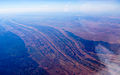
 CSIRO ScienceImage 1215 Aerial view of Central Australian Landscape.jpg 2,657 × 1,751; 4.67 MB
-
 CSIRO ScienceImage 1216 Aerial view of Central Australian landscape.jpg 1,735 × 2,657; 4.46 MB
-
 CSIRO ScienceImage 1217 Aerial view of Central Australian landscape.jpg 2,657 × 1,745; 5.55 MB
-
 CSIRO ScienceImage 1218 Aerial view of Central Australian Landscape.jpg 2,657 × 1,747; 4.52 MB
-
 CSIRO ScienceImage 1744 Central Australian Waterhole.jpg 2,657 × 1,745; 4.87 MB
-
 East Macdonells IMG 2007 NT (38528688104).jpg 2,147 × 2,864; 2.29 MB
-
 East Macdonnells IMG 2001 NT (38528685994).jpg 2,448 × 3,264; 2.99 MB
-
 East Macdonnells IMG 2004 NT (27460217349).jpg 3,264 × 2,448; 3.42 MB
-
 Ellery Creek.jpg 800 × 600; 115 KB
-
 Endless Stations 43 - Into the Bright Lands.jpg 5,120 × 1,468; 8.47 MB
-
 Endless Stations 44 - Red Pebbles.jpg 5,120 × 2,346; 13.59 MB
-
 GlenHelenGorge NorthernTerritory Panorama.jpg 10,609 × 2,340; 17.6 MB
-
 Haast's Bluff, MacDonnell Ranges(GN03696).jpg 1,850 × 1,414; 287 KB
-
 Honeymoon Gap B 1409 (from State Library of South Australia).jpg 1,024 × 715; 406 KB
-
 IBRA 6.1 MacDonnell Ranges.png 1,257 × 986; 83 KB
-
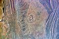 ISS007 Gosses Bluff.jpg 3,900 × 2,582; 9.23 MB
-
 Larapinta Trail Panorama.jpg 6,000 × 2,221; 11.05 MB
-
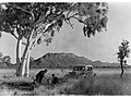
 MacDonnell Range Showing Automobile(GN05889).jpg 3,264 × 2,448; 1.13 MB
-
 MacDonnell Range Showing Automobile(GN05891).jpg 3,264 × 2,448; 1.09 MB
-

-
 MacDonnell Range(GN05875).jpg 3,264 × 2,448; 1.04 MB
-
 MacDonnell Range(GN05878).jpg 3,264 × 2,448; 961 KB
-
 MacDonnell Ranges Banner.jpg 2,657 × 380; 1.2 MB
-
 MacDonnell Ranges Camp Fire(GN05750).jpg 3,264 × 2,448; 1.01 MB
-
 MacDonnell Ranges(GN05766).jpg 2,448 × 3,264; 974 KB
-
 MacDonnell Ranges(GN05869).jpg 3,264 × 2,448; 1.14 MB
-
 MacDonnell Ranges, NT (3364270274).jpg 2,860 × 1,787; 2.4 MB
-
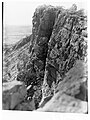
 Man Climbing on MacDonnell Range(GN05822).jpg 3,264 × 2,448; 1.03 MB
-
 Northern Territory, MacDonnell Ranges (MODIS 2018-06-04).jpg 3,979 × 2,839; 1.31 MB
-
 Ochre Pits.jpg 800 × 600; 119 KB
-
 Red Centre Itinerary (GlenHelenGorge) WV banner.jpg 10,609 × 1,519; 13.1 MB
-
 Rock Art in McDonnellEast.JPG 1,024 × 768; 436 KB
-

-

-
 West MacDonnell National Park.JPG 1,024 × 768; 876 KB
-
 West Macdonnell Ranges, Mt Sonder.jpg 6,336 × 2,525; 4.34 MB
-
 West MacDonnell Ranges.jpg 5,797 × 3,865; 17.02 MB
-
 Western MacDonald Ranges (2049609185).jpg 2,048 × 1,536; 1.3 MB
-
 Western MacDonald Ranges (2049609441).jpg 2,048 × 1,536; 1.21 MB
-
 Western MacDonald Ranges (2049609689).jpg 2,048 × 1,536; 1.43 MB
-
 Western MacDonald Ranges (2049609931).jpg 2,048 × 1,536; 908 KB
-
 Western MacDonald Ranges (2049610545).jpg 2,048 × 1,536; 1.53 MB
-
 Western MacDonald Ranges (2049611055).jpg 2,048 × 1,536; 1.24 MB
-
 Western MacDonald Ranges (2049611301).jpg 2,048 × 1,536; 1.07 MB
-
 Western MacDonald Ranges (2049611947).jpg 2,048 × 1,536; 1.03 MB
-
 Western MacDonald Ranges (2049612207).jpg 2,048 × 1,536; 1.41 MB
-
 Western MacDonald Ranges (2049612427).jpg 2,048 × 1,536; 1.23 MB
-
 Western MacDonald Ranges (2049612635).jpg 2,048 × 1,536; 1.04 MB
-
 Western MacDonald Ranges (2049613155).jpg 2,048 × 1,536; 1.48 MB
-
 Western MacDonald Ranges (2049613315).jpg 2,048 × 1,536; 831 KB
-
 Western MacDonald Ranges (2049613703).jpg 2,048 × 1,536; 1.06 MB
-
 Western MacDonald Ranges (2050394040).jpg 2,048 × 1,536; 1.19 MB
-
 Western MacDonald Ranges (2050394558).jpg 2,048 × 1,536; 1.39 MB
-
 Western MacDonald Ranges (2050395396).jpg 2,048 × 1,536; 1.2 MB
-
 Western MacDonald Ranges (2050395628).jpg 2,048 × 1,536; 1.23 MB
-
 Western MacDonald Ranges (2050396690).jpg 2,048 × 1,536; 766 KB
Emily_Gap.jpg)
Jesse_Gap.jpg)


.jpg)
.jpg)
.jpg)


.jpg)
.jpg)

.jpg)
.jpg)
.jpg)
.jpg)
.jpg)
.jpg)
.jpg)
.jpg)
.jpg)
.jpg)
.jpg)


(GN02703A).jpg)
(GN02703B).jpg)


.jpg)
.jpg)
.jpg)
.jpg)
.jpg)
.jpg)
.jpg)
.jpg)
.jpg)
.jpg)
.jpg)
.jpg)
.jpg)
.jpg)
.jpg)
.jpg)
.jpg)
.jpg)
.jpg)
_WV_banner.jpg)