Category:Mabe, Cornwall
Jump to navigation
Jump to search
village and civil parish in Cornwall, England  | |||||
| Upload media | |||||
| Instance of | |||||
|---|---|---|---|---|---|
| Location | Cornwall, South West England, England | ||||
 | |||||
Brezhoneg: Rummad:Kêrioù Breizh-Veur
English: Mabe is a village and civil parish in Cornwall, England, United Kingdom. The civil parish is bounded by Stithians and St. Gluvias to the north, Budock to the east, Mawnan and Constantine to the south and Wendron to the west.
Subcategories
This category has the following 4 subcategories, out of 4 total.
A
- Argal Reservoir (8 F)
M
- Mabe Burnthouse (1 F)
- Mabe churchyard (5 F)
- St Laud's Church, Mabe (9 F)
Media in category "Mabe, Cornwall"
The following 121 files are in this category, out of 121 total.
-
 A host of golden daffodils - geograph.org.uk - 3902128.jpg 640 × 480; 113 KB
-
 A39 crossroads southwest of Penvose Farm - geograph.org.uk - 3215938.jpg 3,182 × 2,048; 1.09 MB
-
 A39 heading north, Treliever - geograph.org.uk - 4238696.jpg 640 × 480; 100 KB
-
 A39 roundabout with A394 - geograph.org.uk - 3215934.jpg 3,446 × 1,986; 1.11 MB
-
 A39, Treliever Roundabout - geograph.org.uk - 4238690.jpg 640 × 480; 63 KB
-
 A394 passes Carveth Waste Recycling Facility - geograph.org.uk - 3220562.jpg 3,648 × 2,048; 1.31 MB
-
 A394 southeast of Calamankey Farm - geograph.org.uk - 3220554.jpg 3,648 × 2,048; 1.51 MB
-
 Antron Hill approaches junction with Gweal Darras - geograph.org.uk - 3185128.jpg 3,257 × 2,580; 1.35 MB
-
 Antron Hill Mabe Burnthouse - geograph.org.uk - 5449919.jpg 640 × 480; 64 KB
-
 Approaching Treliever Roundabout - geograph.org.uk - 4238689.jpg 640 × 480; 122 KB
-
 Argal Reservoir - geograph.org.uk - 2642479.jpg 480 × 640; 80 KB
-
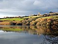 Argal Reservoir - geograph.org.uk - 3255311.jpg 640 × 480; 76 KB
-
 Avenue of trees leading to Mabe Church - geograph.org.uk - 2863972.jpg 640 × 426; 133 KB
-
 B ^ Q - geograph.org.uk - 2022571.jpg 3,648 × 2,736; 3.95 MB
-
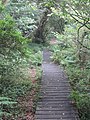 Boardwalk beside College Reservoir - geograph.org.uk - 906344.jpg 480 × 640; 139 KB
-
 Bridge on Unnamed Road - geograph.org.uk - 2021825.jpg 800 × 600; 329 KB
-
 Building of The New Inn at Mabe, Cornwall.jpg 1,632 × 1,224; 910 KB
-
 Bus shelter, Treliever Road, Mabe Burnthouse - geograph.org.uk - 4708912.jpg 1,600 × 1,198; 1.34 MB
-

-
 Cafe in the car park for Argal Reservoir - geograph.org.uk - 4800639.jpg 2,016 × 1,500; 845 KB
-
 Celtic cross outside porch of Mabe church and the churchyard - geograph.org.uk - 4706468.jpg 1,600 × 1,200; 1.62 MB
-
 Cereal crop, Helland - geograph.org.uk - 5468868.jpg 640 × 480; 67 KB
-
 Church Road passes The New Inn - geograph.org.uk - 3215920.jpg 3,648 × 2,048; 1.7 MB
-
 Church road west of Antron Farm - geograph.org.uk - 3215909.jpg 3,648 × 2,048; 1.61 MB
-
 Cliftures Farm in snow - geograph.org.uk - 1192783.jpg 640 × 480; 58 KB
-
 College Reservoir - geograph.org.uk - 906337.jpg 480 × 640; 122 KB
-
 College Reservoir - geograph.org.uk - 906341.jpg 640 × 480; 80 KB
-
 Copse near centre of grid square - geograph.org.uk - 1227509.jpg 640 × 427; 54 KB
-
 Cornwall , Approaching Treliever Roundabout - geograph.org.uk - 4610027.jpg 4,288 × 2,848; 5.54 MB
-
 Cornwall , The A39 - geograph.org.uk - 4610029.jpg 4,288 × 2,848; 5.68 MB
-
 Cornwall , The A394 - geograph.org.uk - 4610017.jpg 4,288 × 2,848; 6.15 MB
-
 Cornwall , The A394 - geograph.org.uk - 4610021.jpg 4,288 × 2,848; 5.68 MB
-
 Cornwall , The A394 - geograph.org.uk - 4610022.jpg 4,288 × 2,848; 6.28 MB
-
 Cornwall , The A394 - geograph.org.uk - 5384766.jpg 5,834 × 3,890; 5.18 MB
-
 Crop field and hedgerow, Helland - geograph.org.uk - 5468867.jpg 640 × 480; 70 KB
-
 Crop field, Treliever - geograph.org.uk - 4238694.jpg 640 × 480; 76 KB
-
 Daffodil field at Roskrow - geograph.org.uk - 2309274.jpg 480 × 640; 104 KB
-

-

-
 Dilapidated barns at Argal Home Farm - geograph.org.uk - 811508.jpg 640 × 480; 85 KB
-
 DSCN0727Mabe Church from Treverva.JPG 1,632 × 1,224; 932 KB
-
 Entering Penryn - geograph.org.uk - 4969140.jpg 640 × 480; 200 KB
-
 Entrance to Carnsew granite quarry - geograph.org.uk - 4687066.jpg 1,600 × 1,200; 1.17 MB
-
 Falmouth University - geograph.org.uk - 5910734.jpg 1,600 × 1,057; 466 KB
-
 Field of daffodils at Roskrow - geograph.org.uk - 2316531.jpg 480 × 640; 122 KB
-
 Field of daffodils at Roskrow - geograph.org.uk - 2316996.jpg 640 × 480; 129 KB
-

-
 Fields at Treliever - geograph.org.uk - 2317005.jpg 640 × 480; 111 KB
-
 Fields below St Laudus church, Mabe - geograph.org.uk - 4706465.jpg 1,600 × 1,200; 1.41 MB
-
 Gate and footpath opposite the church, Mabe - geograph.org.uk - 4800592.jpg 2,048 × 1,536; 755 KB
-
 Gated farm track near Mentone - geograph.org.uk - 5468864.jpg 640 × 480; 123 KB
-
 Gated farm track near Treverva - geograph.org.uk - 5468871.jpg 640 × 480; 105 KB
-
 Gateway and track at Higher Spargo - geograph.org.uk - 4705974.jpg 1,600 × 1,200; 1.84 MB
-
 Goodagrane Farm - geograph.org.uk - 1337317.jpg 640 × 480; 95 KB
-
 Gravestone to Spargo family, St Laudus church, Mabe - geograph.org.uk - 4705987.jpg 1,200 × 1,600; 1.72 MB
-
 Gweal Darras, Mabe Burnthouse - geograph.org.uk - 4708909.jpg 1,600 × 1,067; 1.1 MB
-
 Helland House Cornish Cross - geograph.org.uk - 2067553.jpg 3,664 × 2,748; 1.76 MB
-
 House at road junction south of Antron - geograph.org.uk - 4706478.jpg 1,600 × 1,200; 1.28 MB
-
 Longdowns rainbow - geograph.org.uk - 1022693.jpg 640 × 480; 46 KB
-
 Longdowns Village Sign A394 - geograph.org.uk - 5018719.jpg 640 × 480; 52 KB
-

-

-
 Low water levels in College Reservoir - geograph.org.uk - 4517949.jpg 2,560 × 1,920; 3.04 MB
-
 Mabe Burnthouse , Antron Hill - geograph.org.uk - 5381351.jpg 6,000 × 4,000; 7.14 MB
-
 Mabe Burnthouse , Treliever Road - geograph.org.uk - 5381353.jpg 6,000 × 4,000; 5.43 MB
-
 Mabe Burnthouse Village Sign - geograph.org.uk - 5449923.jpg 640 × 480; 107 KB
-
 Mabe Burnthouse, postbox № TR10 57 - geograph.org.uk - 3707679.jpg 480 × 640; 87 KB
-
 Mabe Burnthouse, red phone box - geograph.org.uk - 3707681.jpg 640 × 480; 87 KB
-
 Mabe Burnthouse, the post office - geograph.org.uk - 3707677.jpg 640 × 480; 65 KB
-
 Mabe Church - geograph.org.uk - 4714874.jpg 720 × 540; 106 KB
-
 Mabe Parish Church - geograph.org.uk - 2015861.jpg 800 × 600; 233 KB
-
 Maen Cottage - geograph.org.uk - 371070.jpg 640 × 480; 80 KB
-
 Minor road approaching Treverva - geograph.org.uk - 5468875.jpg 640 × 480; 76 KB
-
 Minor road heading west - geograph.org.uk - 4238682.jpg 640 × 480; 123 KB
-
 Minor road near Mentone - geograph.org.uk - 5468862.jpg 640 × 480; 90 KB
-
 Minor road through greenery at Helland Mill - geograph.org.uk - 4705955.jpg 1,600 × 1,200; 1.88 MB
-
 Narrow road towards Falmouth - geograph.org.uk - 5468865.jpg 640 × 480; 71 KB
-
 Not really a lay-by, A39 at Treliever - geograph.org.uk - 4708924.jpg 1,600 × 1,198; 1.34 MB
-

-

-
-
 Outcrop or spoil heap^ - geograph.org.uk - 418586.jpg 640 × 480; 65 KB
-
 Pasture at Treverva - geograph.org.uk - 831629.jpg 480 × 640; 78 KB
-
 Penryn campus - the shop - geograph.org.uk - 3677573.jpg 640 × 478; 46 KB
-
 Penryn Campus, Falmouth University - geograph.org.uk - 4238687.jpg 640 × 480; 69 KB
-
 Performance Centre, Falmouth University (15896159567).jpg 2,893 × 2,277; 5.84 MB
-
 Rabbit holes in a Cornish Hedge - geograph.org.uk - 1201443.jpg 640 × 480; 143 KB
-
 Red Campion flowers (Silene dioica) - geograph.org.uk - 2435643.jpg 480 × 640; 93 KB
-
 Reseeding grazing land - geograph.org.uk - 1277212.jpg 640 × 427; 73 KB
-
 Road to Tresahor Veor - geograph.org.uk - 371074.jpg 640 × 480; 142 KB
-
 Road towards Treliever - geograph.org.uk - 4238683.jpg 640 × 480; 101 KB
-
 Rosewithian House and holiday lets, Lower Spargo - geograph.org.uk - 4706474.jpg 1,600 × 1,200; 1.56 MB
-
 Silage field, Mentone - geograph.org.uk - 5468859.jpg 640 × 430; 55 KB
-
 St Laudus church, Mabe - geograph.org.uk - 4705994.jpg 1,600 × 1,200; 1.5 MB
-
 Sunshine on Antron Farm - geograph.org.uk - 3255324.jpg 640 × 480; 64 KB
-
 The field behind Mabe Church - geograph.org.uk - 4800612.jpg 2,048 × 1,536; 927 KB
-
 The gateway for St Laudus church, Mabe - geograph.org.uk - 4706469.jpg 1,600 × 1,200; 1.86 MB
-
 The New Inn, Mabe Burnthouse - geograph.org.uk - 4708904.jpg 1,600 × 1,199; 1.17 MB
-
 The outflow at Argal Dam - geograph.org.uk - 2642470.jpg 480 × 640; 120 KB
-
 The south doorway of St Laud's Church, Mabe - geograph.org.uk - 4800601.jpg 1,536 × 2,048; 752 KB
-
 The spillway at Argal Reservoir - geograph.org.uk - 2642465.jpg 640 × 481; 93 KB
-
 The west (tower) doorway of St Laud's Church, Mabe - geograph.org.uk - 4800596.jpg 1,536 × 2,048; 744 KB
-
 Track to Trevone - geograph.org.uk - 4705969.jpg 1,600 × 1,200; 1.63 MB
-

-
 Tremough Campus Library - geograph.org.uk - 3369325.jpg 2,056 × 1,536; 714 KB
-
 Tremough House (8331166726).jpg 2,359 × 1,682; 2.11 MB
-
 Treverva chapel - geograph.org.uk - 371026.jpg 640 × 480; 90 KB
-
 Trewarton Road - geograph.org.uk - 4238680.jpg 640 × 480; 96 KB
-
 University residences - geograph.org.uk - 4969137.jpg 640 × 480; 182 KB
-
 Unnamed Road Near Argal Lake - geograph.org.uk - 2021869.jpg 800 × 600; 301 KB
-

-

-
 View down Trenoweth Lane - geograph.org.uk - 1227502.jpg 640 × 427; 56 KB
-
-
 Welcome to Mabe - geograph.org.uk - 4705945.jpg 1,600 × 1,200; 1.91 MB
-
 Lane by Bosvathick - geograph.org.uk - 418534.jpg 640 × 480; 131 KB
-
 Lane junction north of Eathorne - geograph.org.uk - 418555.jpg 640 × 480; 152 KB
-
 Road to Argal - geograph.org.uk - 371012.jpg 640 × 480; 153 KB
-
 Track and bridleway to Trevone Farm - geograph.org.uk - 418560.jpg 640 × 480; 85 KB
-
 Vean Cottage - geograph.org.uk - 418582.jpg 640 × 480; 62 KB
-
 View north from Eathorne Bridge - geograph.org.uk - 371082.jpg 640 × 480; 159 KB


_at_Goodygrane_-_geograph.org.uk_-_2435627.jpg)


.jpg)

_-_geograph.org.uk_-_2435643.jpg)


_doorway_of_St_Laud%27s_Church,_Mabe_-_geograph.org.uk_-_4800596.jpg)


.jpg)


