Category:Lutherse Kerk (Groningen)
Jump to navigation
Jump to search
| Object location | | View all coordinates using: OpenStreetMap |
|---|
 | |||||
| Upload media | |||||
| Instance of | |||||
|---|---|---|---|---|---|
| Location | Groningen, Netherlands | ||||
| Street address |
| ||||
| Heritage designation |
| ||||
| Inception |
| ||||
| official website | |||||
 | |||||
|
This is a category about rijksmonument number 18483
|
| Address |
|
Media in category "Lutherse Kerk (Groningen)"
The following 28 files are in this category, out of 28 total.
-
 Groningen Gedenksteen Hinsz.JPG 1,434 × 1,431; 929 KB
-
 Groningen Haddingestraat 23.jpg 2,448 × 3,264; 3.82 MB
-
 Groningen Haddingestraat 25-25B.jpg 2,448 × 3,264; 3.71 MB
-
 GroningenGasthuisJufferMargaretha.jpg 4,160 × 2,340; 3.13 MB
-
 GroningenLutherseKerk1.jpg 2,340 × 4,160; 2.96 MB
-
 GroningenLutherseKerk2.jpg 2,340 × 2,995; 3.04 MB
-
 GroningenLutherseKerk3.jpg 2,340 × 3,144; 3.26 MB
-
 GroningenLutherseKerk4.jpg 2,340 × 4,160; 3.63 MB
-
 GroningenLutherseKerk5.jpg 2,579 × 1,789; 1,017 KB
-
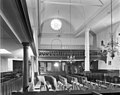 Interieur - Groningen - 20093201 - RCE.jpg 1,200 × 953; 183 KB
-
 Interieur - Groningen - 20093202 - RCE.jpg 1,200 × 954; 181 KB
-
 Interieur, aanzicht orgel, orgelnummer 557 - Groningen - 20417255 - RCE.jpg 901 × 1,200; 182 KB
-
 Luthers Bach Ensemble 1.jpg 1,000 × 667; 109 KB
-
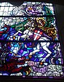
 Lutherse kerk Groningen - gebrandschilderd glas (1).jpg 2,486 × 3,978; 4.64 MB
-
 Lutherse kerk Groningen - gebrandschilderd glas (2).jpg 4,896 × 3,264; 10.38 MB
-
 Lutherse kerk Groningen - kerkenraadskamer.jpg 4,834 × 3,223; 12.15 MB
-
 Lutherse kerk Groningen - kroonluchter.jpg 2,887 × 4,331; 4.73 MB
-
 Lutherse kerk Groningen - Lutherzaaltje (1).jpg 4,857 × 3,238; 10.07 MB
-
 Lutherse kerk Groningen - Lutherzaaltje (2).jpg 4,871 × 3,247; 10.39 MB
-
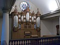
 Lutherse kerk Groningen - orgel.jpg 4,080 × 2,914; 9.72 MB
-
 Lutherse kerk Groningen - preekstoel.jpg 3,264 × 3,264; 7.79 MB
-
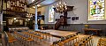 Lutherse Kerk Groningen kerkzaal.jpg 1,372 × 590; 154 KB
-
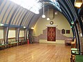 Lutherzaaltje.jpg 2,048 × 1,536; 629 KB
-
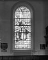
 Raam - Groningen - 20093203 - RCE.jpg 955 × 1,200; 185 KB
-
 Raam - Groningen - 20093204 - RCE.jpg 955 × 1,200; 166 KB
-
 Schnitger orgel reconstructie 2017 Lutherse Kerk Groningen.jpg 2,000 × 1,494; 425 KB
-
-
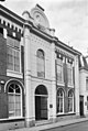
 Voorgevel, Haddingestr.23 - Groningen - 20093199 - RCE.jpg 813 × 1,200; 195 KB


.jpg)
.jpg)


.jpg)
.jpg)


