Category:Ludham
Jump to navigation
Jump to search
English: Ludham is a village and civil parish in the English county of Norfolk, in The Broads, at the end of a dyke leading to Womack Water and flowing into the River Thurne. It lies 1.5 miles to the East of Ludham Bridge, which is on the River Ant.
village in Norfolk, England, UK  | |||||
| Upload media | |||||
| Instance of | |||||
|---|---|---|---|---|---|
| Location | North Norfolk, Norfolk, East of England, England | ||||
| Area |
| ||||
 | |||||
Subcategories
This category has the following 12 subcategories, out of 12 total.
B
- Boardman's Mill (8 F)
C
- Clayrack Drainage Windmill (5 F)
E
- Environs of Ludham (1 F)
F
- Fritton, North Norfolk (6 F)
H
- Ludham Hall (4 F)
L
- Ludham Bridge Mills (3 F)
- Ludham War Memorial (1 F)
R
- RAF Ludham (13 F)
W
- Womack Water (3 F)
Media in category "Ludham"
The following 200 files are in this category, out of 526 total.
(previous page) (next page)-

-

-
 A row of tall poplars, Ludham Bridge - geograph.org.uk - 2812421.jpg 640 × 480; 217 KB
-
 A view of Boardman's Broad and Turf Fen Mill.JPG 2,275 × 1,597; 1.82 MB
-
 A view of Boardman's Broad.JPG 2,304 × 1,728; 1.71 MB
-
 Access road to Horse Fen Mill Cottage - geograph.org.uk - 4211408.jpg 640 × 480; 198 KB
-
 Access track to Ludham airfield - geograph.org.uk - 2811937.jpg 601 × 640; 186 KB
-
 Airfield remains, Ludham - geograph.org.uk - 196334.jpg 479 × 640; 269 KB
-
 Angling Store by Ludham Bridge - geograph.org.uk - 5540847.jpg 4,000 × 2,667; 4.61 MB
-

-
 Barley crop field beside Long Lane - geograph.org.uk - 4068325.jpg 640 × 480; 157 KB
-
 Barley crop field by Fritton House Farm - geograph.org.uk - 4068354.jpg 640 × 480; 164 KB
-
 Barn conversion at The Laurels, Ludham - geograph.org.uk - 2812415.jpg 640 × 480; 171 KB
-
 BM Funnell, 1959 Ludham Borehole @ RG West.jpg 830 × 1,221; 205 KB
-
 Boardman's Drainage Mill - geograph.org.uk - 2079160.jpg 800 × 531; 82 KB
-
 Boardman's Drainage Mill - geograph.org.uk - 3722224.jpg 480 × 640; 69 KB
-
 Boardman's Drainage Mill - geograph.org.uk - 4507677.jpg 640 × 426; 70 KB
-
 Boardman's drainage windpump - geograph.org.uk - 5900473.jpg 800 × 600; 160 KB
-

-
 Boardman's Mill - geograph.org.uk - 2079164.jpg 800 × 531; 114 KB
-
 Boardman's Mill - geograph.org.uk - 2079169.jpg 800 × 531; 95 KB
-
 Boardman's Mill - geograph.org.uk - 2079174.jpg 800 × 531; 66 KB
-
 Boardman's Mill - geograph.org.uk - 2079178.jpg 800 × 531; 171 KB
-
 Boardman's Mill, How Hill - geograph.org.uk - 1929122.jpg 1,024 × 768; 158 KB
-
 Boardman's Windpump - geograph.org.uk - 2079181.jpg 800 × 531; 93 KB
-
 Boardman's Windpump - geograph.org.uk - 2079183.jpg 800 × 531; 70 KB
-
 Boardmans Mill - geograph.org.uk - 5540866.jpg 3,456 × 5,184; 7.3 MB
-
 Boardmans Mill - geograph.org.uk - 5540868.jpg 4,000 × 3,000; 3.77 MB
-
 Boardman’s Drainage Mill - geograph.org.uk - 4032927.jpg 640 × 480; 64 KB
-
 Boat house by River Ant - geograph.org.uk - 5540873.jpg 4,800 × 3,200; 6.86 MB
-

-
 Boats on the River Ant at How Hill (geograph 5979439).jpg 1,600 × 1,200; 433 KB
-
 Bridleway south of Hall Common, Ludham - geograph.org.uk - 2540713.jpg 640 × 480; 215 KB
-

-
 Bridleway, Ludham - geograph.org.uk - 197938.jpg 640 × 479; 321 KB
-

-
 Broads Authority vessel on the River Ant - geograph.org.uk - 5900443.jpg 800 × 600; 145 KB
-
 Broken up perimeter track - geograph.org.uk - 4068399.jpg 640 × 480; 214 KB
-
 Bullocks in Horse Fen - geograph.org.uk - 4211397.jpg 578 × 640; 304 KB
-
 Bullocks in marsh pasture - geograph.org.uk - 4211394.jpg 640 × 480; 205 KB
-
 Bundles of reeds stacked for drying - geograph.org.uk - 5900453.jpg 800 × 600; 175 KB
-
 Bungalow beside the River Thurne - geograph.org.uk - 4621559.jpg 572 × 640; 373 KB
-
 Bungalows beside the River Thurne - geograph.org.uk - 4621557.jpg 640 × 480; 329 KB
-
 Byway to Horse Fen - geograph.org.uk - 972296.jpg 640 × 427; 203 KB
-
 Byway to Ludham - geograph.org.uk - 972293.jpg 640 × 427; 254 KB
-

-
 Car park by How Hill House - geograph.org.uk - 2812387.jpg 640 × 480; 208 KB
-

-
 Cattle grazing in Horse Fen - geograph.org.uk - 4211482.jpg 640 × 480; 163 KB
-
 Cattle in the marshes - geograph.org.uk - 4211392.jpg 640 × 480; 174 KB
-
 Cattle pastures in Horse Fen - geograph.org.uk - 4211479.jpg 640 × 480; 152 KB
-
 Chalets beside the River Thurne - geograph.org.uk - 4211436.jpg 640 × 480; 180 KB
-

-
 Clayrack Drainage Mill - geograph.org.uk - 2079224.jpg 800 × 531; 171 KB
-
 Clayrack Drainage Pump - geograph.org.uk - 2079220.jpg 800 × 531; 81 KB
-
 Clayrack Drainage Pump - geograph.org.uk - 2079228.jpg 800 × 531; 152 KB
-
 Clayrack Drainage Pump - geograph.org.uk - 2079233.jpg 800 × 531; 92 KB
-
 Clayrack Pump on the River Ant - geograph.org.uk - 2079190.jpg 800 × 531; 112 KB
-
 Clayracks Drainage Pump - geograph.org.uk - 2079214.jpg 800 × 531; 89 KB
-
 Common Darter (Sympetrum striolatum) - geograph.org.uk - 4211362.jpg 640 × 572; 248 KB
-
 Common Darter (Sympetrum striolatum) - geograph.org.uk - 4211363.jpg 640 × 605; 284 KB
-

-
 Concessionary path, near Catfield - geograph.org.uk - 197401.jpg 640 × 479; 288 KB
-
 Control towers at Ludham airfield - geograph.org.uk - 2811872.jpg 640 × 480; 192 KB
-

-
 Cottages, Norwich Road, Ludham - geograph.org.uk - 197950.jpg 640 × 479; 285 KB
-
 Crop field near Starkings Farm - geograph.org.uk - 4068323.jpg 640 × 480; 207 KB
-
 Crop field south of Malthouse Lane - geograph.org.uk - 4068321.jpg 640 × 480; 223 KB
-
 Cruiser on the River Ant - geograph.org.uk - 5900437.jpg 800 × 600; 134 KB
-
 Cruiser on the River Ant - geograph.org.uk - 5900457.jpg 800 × 600; 133 KB
-
 Cruiser on the River Ant - geograph.org.uk - 5900460.jpg 800 × 600; 131 KB
-
 Cruisers moored at How Hill staithe - geograph.org.uk - 5900466.jpg 800 × 600; 139 KB
-

-
 Depot west of Long Lane - geograph.org.uk - 4068314.jpg 640 × 480; 150 KB
-
 Depot west of Long Lane - geograph.org.uk - 4068315.jpg 640 × 480; 154 KB
-
 Derelict Drainage mill, Ludham Bridge - geograph.org.uk - 1862977.jpg 914 × 1,280; 400 KB
-
 District Nurse's house, School Road, Ludham - geograph.org.uk - 4132948.jpg 1,064 × 1,600; 523 KB
-
 District Nurse's house, School Road, Ludham, detail - geograph.org.uk - 4132952.jpg 1,064 × 1,600; 610 KB
-

-
 Drain sluice off the River Ant - geograph.org.uk - 883040.jpg 640 × 480; 134 KB
-
 Drainage ditch by Ludham Bridge - geograph.org.uk - 2812429.jpg 640 × 480; 194 KB
-
 Drainage ditch north of the River Thurne - geograph.org.uk - 4211422.jpg 640 × 480; 197 KB
-
 Drainage ditch separating marsh pastures - geograph.org.uk - 4211390.jpg 640 × 480; 269 KB
-

-
 Drainage pump in fields near Ludham - geograph.org.uk - 2540721.jpg 640 × 480; 257 KB
-

-
 Enjoying the river - geograph.org.uk - 3001798.jpg 2,272 × 1,704; 1.81 MB
-
 Entering Thurne on Church Road - geograph.org.uk - 403342.jpg 640 × 480; 50 KB
-
 Entrance to How Hill House, Ludham - geograph.org.uk - 2812007.jpg 640 × 480; 196 KB
-
 Evening at Womac Water - geograph.org.uk - 5251471.jpg 2,366 × 1,588; 441 KB
-

-
 Farm buildings - geograph.org.uk - 400090.jpg 640 × 480; 141 KB
-

-
 Fen Turf Windpump and River Ant - geograph.org.uk - 5540853.jpg 3,944 × 2,958; 3.29 MB
-
 Field and reed bed at How Hill - geograph.org.uk - 3723131.jpg 640 × 480; 50 KB
-
 Fields on the edge of Ludham airfield - geograph.org.uk - 2811941.jpg 640 × 480; 146 KB
-

-
 Footpath along the edge of Horse Fen - geograph.org.uk - 4211480.jpg 640 × 480; 155 KB
-
 Footpath along the River Thurne - geograph.org.uk - 4211428.jpg 640 × 480; 200 KB
-
 Footpath along the River Thurne - geograph.org.uk - 4211485.jpg 640 × 480; 203 KB
-

-
 Footpath by River Ant - geograph.org.uk - 5540559.jpg 5,184 × 3,456; 7.15 MB
-

-
 Footpath to Dyke End - geograph.org.uk - 4211382.jpg 640 × 480; 204 KB
-
 Footpath to Market Road, Ludham - geograph.org.uk - 2811942.jpg 640 × 480; 141 KB
-
 Footpath to the River Ant, How Hill - geograph.org.uk - 2812389.jpg 640 × 480; 274 KB
-
 Footpath to the River Thurne - geograph.org.uk - 4211386.jpg 640 × 480; 193 KB
-

-
 Footpath to Womack Water - geograph.org.uk - 4211377.jpg 640 × 480; 243 KB
-
 Former Arms and Ammunitions store - geograph.org.uk - 4068238.jpg 640 × 480; 180 KB
-
 Fritton House Farm (farmhouse) - geograph.org.uk - 4068349.jpg 640 × 480; 216 KB
-
 Fritton Lane - geograph.org.uk - 4211335.jpg 640 × 480; 159 KB
-

-
 Fritton Lane past Lower Farm - geograph.org.uk - 930329.jpg 480 × 640; 188 KB
-
 Garage and Car Showroom, Ludham - geograph.org.uk - 1428718.jpg 640 × 480; 69 KB
-
 Gate into a marsh pasture - geograph.org.uk - 930317.jpg 480 × 640; 150 KB
-
 Gate into pasture at Dyke End - geograph.org.uk - 4211346.jpg 640 × 480; 223 KB
-
 Gate to the river walk at How Hill - geograph.org.uk - 4397946.jpg 1,000 × 750; 312 KB
-
 Gated track to Horse Fen - geograph.org.uk - 930325.jpg 640 × 480; 179 KB
-
 Gatepost with speed restriction sign - geograph.org.uk - 947159.jpg 480 × 640; 160 KB
-

-
 Hall Common Cottages - geograph.org.uk - 1428767.jpg 640 × 480; 79 KB
-
 Hangar on Ludham airfield - geograph.org.uk - 2811931.jpg 640 × 480; 154 KB
-
 Heavy Traffic on Womack Water - geograph.org.uk - 4386590.jpg 1,599 × 2,399; 557 KB
-

-

-
 Heron, Ludham Bridge - geograph.org.uk - 1881009.jpg 1,280 × 914; 235 KB
-
 Hidden in shrubbery - geograph.org.uk - 4068223.jpg 640 × 480; 231 KB
-
 Highland cow at Ludham, Norfolk - geograph.org.uk - 972302.jpg 640 × 427; 182 KB
-
 Holly plantation.JPG 2,304 × 1,728; 1.77 MB
-
 Holly sculpture.JPG 2,304 × 1,728; 1.7 MB
-
 Horse Fen - geograph.org.uk - 972283.jpg 640 × 427; 190 KB
-
 Horse Fen - geograph.org.uk - 972287.jpg 640 × 427; 188 KB
-
 Horsefen Road - geograph.org.uk - 3602459.jpg 1,600 × 1,200; 610 KB
-
 Horsefen Road, Ludham, and The Maltings - geograph.org.uk - 961513.jpg 640 × 480; 105 KB
-
 How Hill - geograph.org.uk - 960650.jpg 640 × 480; 47 KB
-
 How Hill Car Park - geograph.org.uk - 4032948.jpg 640 × 480; 83 KB
-
 How Hill House - geograph.org.uk - 1862794.jpg 1,280 × 914; 396 KB
-
 How Hill House - geograph.org.uk - 3590505.jpg 2,592 × 1,944; 1.29 MB
-
 How Hill House - geograph.org.uk - 5541516.jpg 4,800 × 3,200; 6.56 MB
-
 How Hill House from the garden - geograph.org.uk - 1928461.jpg 768 × 1,024; 188 KB
-
 How Hill House, Ludham - chimney - geograph.org.uk - 2812018.jpg 480 × 640; 144 KB
-
 How Hill House, Ludham - geograph.org.uk - 2812010.jpg 640 × 480; 244 KB
-
 How Hill House, Ludham - geograph.org.uk - 2812011.jpg 640 × 480; 151 KB
-
 How Hill House, Ludham - geograph.org.uk - 2812013.jpg 640 × 480; 194 KB
-
 How Hill House, Ludham - geograph.org.uk - 2812014.jpg 640 × 512; 138 KB
-
 How Hill info board.JPG 2,304 × 1,728; 1.62 MB
-
 How Hill Road - geograph.org.uk - 5979443.jpg 1,600 × 1,200; 279 KB
-
 How Hill Staithe - geograph.org.uk - 5900748.jpg 800 × 600; 111 KB
-
 How Hill tower mill, Ludham - geograph.org.uk - 2811986.jpg 640 × 480; 210 KB
-
 How Hill tower mill, Ludham - geograph.org.uk - 2811988.jpg 480 × 640; 171 KB
-
 How Hill Trust gardens - geograph.org.uk - 3001802.jpg 2,272 × 1,704; 1.91 MB
-
 How Hill Water Gardens - geograph.org.uk - 3001789.jpg 1,704 × 2,272; 3.17 MB
-
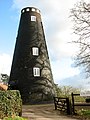
 How Hill Windmill - geograph.org.uk - 4032935.jpg 480 × 640; 70 KB
-
 Hunter's Boatyard by Womack Water - geograph.org.uk - 947177.jpg 640 × 480; 136 KB
-
 Hunter's Yard, Womack Water - geograph.org.uk - 3155275.jpg 1,549 × 1,037; 682 KB
-
 Interior of St. Catherine's, Ludham, Norfolk - geograph.org.uk - 2430287.jpg 1,600 × 1,200; 367 KB
-

-

-
 Lawn to the Car Park - geograph.org.uk - 2079264.jpg 800 × 531; 93 KB
-
 Line of trees, Ludham Bridge - geograph.org.uk - 1862964.jpg 1,280 × 914; 396 KB
-
 Lover's Lane, Ludham - geograph.org.uk - 1428702.jpg 640 × 480; 146 KB
-
 Lovers Lane Ludham - geograph.org.uk - 1122032.jpg 640 × 482; 121 KB
-
 Ludham airfield - geograph.org.uk - 2811936.jpg 640 × 480; 128 KB
-
 Ludham airfield - geograph.org.uk - 2811957.jpg 640 × 480; 165 KB
-
 Ludham airfield - geograph.org.uk - 2811958.jpg 640 × 480; 128 KB
-
 Ludham airfield - geograph.org.uk - 2811960.jpg 640 × 480; 172 KB
-
 Ludham airfield - geograph.org.uk - 2811961.jpg 640 × 480; 135 KB
-
 Ludham Bridge (North) wind drainage pump - geograph.org.uk - 2812436.jpg 640 × 480; 194 KB
-
 Ludham Bridge - geograph.org.uk - 1862961.jpg 1,280 × 853; 476 KB
-
 Ludham Bridge - geograph.org.uk - 2257635.jpg 1,500 × 977; 192 KB
-
 Ludham Bridge - geograph.org.uk - 2257638.jpg 1,500 × 1,000; 227 KB
-
 Ludham Bridge - geograph.org.uk - 885247.jpg 640 × 418; 130 KB
-
 Ludham Bridge - geograph.org.uk - 961545.jpg 640 × 480; 121 KB
-
 Ludham Bridge 1980 - geograph.org.uk - 2793207.jpg 640 × 402; 76 KB
-
 Ludham Bridge Boatyard - geograph.org.uk - 2257642.jpg 1,500 × 1,000; 220 KB
-
 Ludham Bridge Boatyard - geograph.org.uk - 961536.jpg 640 × 480; 118 KB
-

-

-

-

-

-

-
 Ludham Bridge Services - geograph.org.uk - 1014548.jpg 640 × 480; 102 KB
-
 Ludham Bridge Stores - geograph.org.uk - 3721817.jpg 640 × 480; 78 KB
-

-
 Ludham GP Surgery - geograph.org.uk - 1428755.jpg 640 × 480; 124 KB
-
 Ludham How Hill Mill - geograph.org.uk - 2079147.jpg 800 × 531; 157 KB
-
 Ludham Methodist Chapel - geograph.org.uk - 1428727.jpg 480 × 640; 101 KB
-
 Ludham Norfolk Seahorse.JPG 2,304 × 1,728; 1.56 MB
-
 Ludham Post Office, Throwers of Ludham - geograph.org.uk - 6058611.jpg 5,933 × 3,955; 4.72 MB
-
 Ludham Primary School - geograph.org.uk - 1428731.jpg 640 × 480; 82 KB
-
 Ludham Primary School - geograph.org.uk - 1428733.jpg 640 × 480; 82 KB
-
 Ludham St Catherine's church - geograph.org.uk - 2199563.jpg 640 × 480; 138 KB
-
 Ludham Staithe - geograph.org.uk - 4386633.jpg 1,462 × 977; 253 KB
-
 Ludham Staithe - geograph.org.uk - 5251478.jpg 2,399 × 1,599; 516 KB
-
 Ludham Village - geograph.org.uk - 3330838.jpg 2,592 × 1,944; 1.87 MB
-
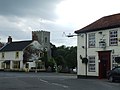 Ludham village centre - geograph.org.uk - 3684915.jpg 1,600 × 1,200; 328 KB
-
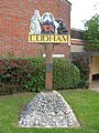
 Ludham Village Sign - geograph.org.uk - 5251481.jpg 2,051 × 1,369; 334 KB
-
 Ludham Village Sign - geograph.org.uk - 5587860.jpg 480 × 640; 118 KB


.jpg)


_-_geograph.org.uk_-_4211362.jpg)
_-_geograph.org.uk_-_4211363.jpg)
_and_his_shadow_-_geograph.org.uk_-_4211358.jpg)


_-_geograph.org.uk_-_4068349.jpg)

_-_geograph.org.uk_-_930295.jpg)


_beside_the_River_Thurne_-_geograph.org.uk_-_4211453.jpg)
_beside_the_River_Thurne_-_geograph.org.uk_-_4211456.jpg)


,_Ludham_-_geograph.org.uk_-_5587823.jpg)


_wind_drainage_pump_-_geograph.org.uk_-_2812436.jpg)


