Category:Ludgeruskerk (Oldehove)
Jump to navigation
Jump to search
| Object location | | View all coordinates using: OpenStreetMap |
|---|
church building in Zuidhorn, Netherlands  | |||||
| Upload media | |||||
| Instance of | |||||
|---|---|---|---|---|---|
| Dedicated to | |||||
| Location | Oldehove, Groningen, Netherlands | ||||
| Street address |
| ||||
| Located on street |
| ||||
| Heritage designation |
| ||||
| Inception |
| ||||
| Significant event |
| ||||
| official website | |||||
 | |||||
Nederlands: Ludgeruskerk, Oldehove
|
This is a category about rijksmonument number 31395
|
| Address |
|
Media in category "Ludgeruskerk (Oldehove)"
The following 27 files are in this category, out of 27 total.
-
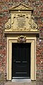 20080801 Church Oldehove (Gn) NL (entrance).jpg 1,531 × 3,000; 812 KB
-
 20080801 Church Oldehove (Gn) NL.jpg 2,466 × 3,000; 1.24 MB
-
 Dorpsgezicht vanaf de stelling van korenmolen De Leeuw - Oldehove - 20172467 - RCE.jpg 1,186 × 1,200; 233 KB
-
 Graf in noord-oost hoek - Oldehove - 20172465 - RCE.jpg 803 × 1,200; 163 KB
-
 Interieur naar het westen en naar het oosten - Oldehove - 20172460 - RCE.jpg 831 × 1,200; 146 KB
-
 Interieur naar het westen en naar het oosten - Oldehove - 20172461 - RCE.jpg 1,200 × 829; 138 KB
-
 Inwendig - Oldehove - 20172462 - RCE.jpg 829 × 1,200; 108 KB
-
 Kerk vanuit het noord-oosten - Oldehove - 20172452 - RCE.jpg 877 × 1,200; 290 KB
-
 Kerk vanuit het noord-oosten - Oldehove - 20172455 - RCE.jpg 824 × 1,200; 226 KB
-
 Kerk vanuit het noord-oosten - Oldehove - 20172456 - RCE.jpg 1,200 × 839; 284 KB
-

-

-
 Kerk vanuit het zuid-westen - Oldehove - 20172457 - RCE.jpg 1,200 × 828; 280 KB
-
 Koperen collectebus - Oldehove - 20172463 - RCE.jpg 833 × 1,200; 167 KB
-
 Liudgertsjerke (Aldehou).jpg 1,600 × 1,118; 1.61 MB
-
 Noord-oost hoek - Oldehove - 20172470 - RCE.jpg 1,200 × 797; 238 KB
-
 Noord-oost hoek bij fundering - Oldehove - 20172464 - RCE.jpg 1,200 × 800; 262 KB
-
 Noordgevel oost travee - Oldehove - 20172471 - RCE.jpg 801 × 1,200; 276 KB
-
 Oldehove - 't Oestertje met kerk.jpg 4,000 × 3,000; 4.1 MB
-
 Oldehove, de Ludgeruskerk RM31395 foto7 2013-08*04 15.38.jpg 3,137 × 4,183; 2.96 MB
-
 Oldehove, de Ludgeruskerk RM31395 foto8 2013-085-04 15.38.jpg 3,312 × 4,416; 10.68 MB
-
 Oldehove, Ludgeruskerk foto2 2008-07-05 16.30.JPG 2,304 × 3,072; 4.05 MB
-
 Oude vloer bij triomphboogpijler - Oldehove - 20172466 - RCE.jpg 1,200 × 781; 208 KB
-
 Toreningang - Oldehove - 20172458 - RCE.jpg 830 × 1,200; 266 KB
-
 Torenportaal inwendig naar het noord-westen - Oldehove - 20172459 - RCE.jpg 850 × 1,200; 110 KB
-
 Zuid-zijde, exterieur - Oldehove - 20172468 - RCE.jpg 788 × 1,200; 278 KB
-
 Zuid-zijde, exterieur - Oldehove - 20172469 - RCE.jpg 1,200 × 788; 293 KB
_NL_(entrance).jpg)
_NL.jpg)


.jpg)


