Category:Lucton
Jump to navigation
Jump to search
village in Herefordshire, England, UK  | |||||
| Upload media | |||||
| Instance of | |||||
|---|---|---|---|---|---|
| Location | Herefordshire, West Midlands, England | ||||
 | |||||
English: Lucton is a village near the town of Leominster in the county of Herefordshire, England. It is best known for being the location of Lucton School, an independent, mixed-gender day and boarding school. (→Lucton)
Nederlands: Lucton is een plaats en civil parish in het bestuurlijke gebied Herefordshire council, in het Engelse graafschap Herefordshire. (→Lucton)

Subcategories
This category has the following 2 subcategories, out of 2 total.
L
- Lucton School (3 F)
- Lucton War Memorial (1 F)
Media in category "Lucton"
The following 83 files are in this category, out of 83 total.
-

-
 A narrow field, Lucton - geograph.org.uk - 2935540.jpg 640 × 480; 276 KB
-
 A ploughed field in Herefordshire - geograph.org.uk - 2346742.jpg 640 × 480; 110 KB
-
 A warning to English Heritage members^ - geograph.org.uk - 2920706.jpg 4,752 × 3,168; 4.03 MB
-
 Access To Stocken Farm - geograph.org.uk - 1759020.jpg 640 × 480; 178 KB
-
 Across The Fields To Stocking Barn Farm - geograph.org.uk - 1759015.jpg 640 × 480; 176 KB
-

-
 Barn conversion - geograph.org.uk - 6300094.jpg 1,024 × 768; 235 KB
-
 Beef in pasture - geograph.org.uk - 5632233.jpg 1,600 × 901; 606 KB
-
 Bridge over the River Lugg at Mortimer's Cross - geograph.org.uk - 2920684.jpg 4,752 × 3,168; 4.49 MB
-
 Bridge, Mortimer's Cross - geograph.org.uk - 2010494.jpg 640 × 480; 127 KB
-
 Cottage near Hill Farm - geograph.org.uk - 1178102.jpg 640 × 480; 105 KB
-
 Covered reservoir - geograph.org.uk - 6211642.jpg 1,024 × 1,024; 333 KB
-
 Croft Wood - geograph.org.uk - 5136704.jpg 800 × 600; 372 KB
-
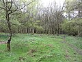
 Drumlin, Lucton - geograph.org.uk - 2935544.jpg 640 × 360; 210 KB
-
 Entrance to School Wood - geograph.org.uk - 1178105.jpg 640 × 480; 160 KB
-

-
 Field above Mortimer's Cross - geograph.org.uk - 2346774.jpg 640 × 480; 101 KB
-
 Footpath along the field edge - geograph.org.uk - 2346781.jpg 640 × 480; 82 KB
-
 Footpath beside the River Lugg - geograph.org.uk - 2346739.jpg 640 × 480; 155 KB
-
 Footpath Junction - geograph.org.uk - 6211711.jpg 1,024 × 1,024; 499 KB
-
 Footpath north towards Lucton - geograph.org.uk - 5632220.jpg 1,600 × 901; 704 KB
-
 Footpath south from Lucton - geograph.org.uk - 5632217.jpg 1,600 × 901; 756 KB
-
 Footpath south from New House Farm - geograph.org.uk - 5632225.jpg 1,600 × 901; 653 KB
-
 Ford at Lucton - geograph.org.uk - 4294400.jpg 3,872 × 2,592; 5.14 MB
-
 Grazing land at Lucton Common - 2 - geograph.org.uk - 1178080.jpg 640 × 478; 108 KB
-
 Grazing land at Lucton Common - geograph.org.uk - 1178076.jpg 640 × 480; 95 KB
-
 Hedge Maintenance, Lucton - geograph.org.uk - 1759036.jpg 640 × 480; 210 KB
-
 Herefordshire ploughsoil in Spring - geograph.org.uk - 2346747.jpg 640 × 480; 105 KB
-
 Lane Near Stocking Barn Farm - geograph.org.uk - 1759013.jpg 640 × 480; 199 KB
-
 Lane past Lucton Hall - geograph.org.uk - 5632234.jpg 1,600 × 901; 733 KB
-
 Lane to Hill Farm - geograph.org.uk - 1178101.jpg 640 × 480; 164 KB
-
 Lucton - geograph.org.uk - 2935543.jpg 640 × 480; 335 KB
-
 Lucton - geograph.org.uk - 2935546.jpg 640 × 360; 226 KB
-
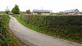
 Lucton Crossroads - geograph.org.uk - 1759032.jpg 640 × 480; 186 KB
-
 Lucton Phone Box - geograph.org.uk - 1759054.jpg 640 × 480; 228 KB
-
 Lucton School - geograph.org.uk - 6300824.jpg 1,024 × 768; 213 KB
-
 Lucton village - geograph.org.uk - 5632214.jpg 1,600 × 901; 691 KB
-
 Mortimer Trail waymarker near Hill Farm - geograph.org.uk - 2346801.jpg 640 × 480; 141 KB
-
 Mortimer's Cross mill - geograph.org.uk - 2920677.jpg 4,752 × 3,168; 5.18 MB
-
 Mortimer's Cross Mill - geograph.org.uk - 3156656.jpg 640 × 427; 107 KB
-
 Mortimer's Cross mill - geograph.org.uk - 3156678.jpg 640 × 427; 116 KB
-
 Mortimer's Cross Water Mill - geograph.org.uk - 1899323.jpg 1,024 × 768; 245 KB
-
-
 Mortimer's Cross watermill - geograph.org.uk - 2206737.jpg 640 × 422; 118 KB
-
 Mortimer's Cross watermill - geograph.org.uk - 2206743.jpg 640 × 418; 114 KB
-
 Mortimer's Cross watermill - geograph.org.uk - 2206748.jpg 421 × 640; 76 KB
-
 Mortimer's Cross watermill - geograph.org.uk - 2206752.jpg 640 × 418; 67 KB
-
 Mortimer's Cross watermill - geograph.org.uk - 2206756.jpg 414 × 640; 70 KB
-
 Mortimer's Cross watermill - geograph.org.uk - 2206761.jpg 640 × 421; 85 KB
-
 Mortimer's Cross Watermill - geograph.org.uk - 3158806.jpg 640 × 413; 102 KB
-
 Mortimer's Cross Watermill - geograph.org.uk - 3158821.jpg 528 × 800; 136 KB
-

-
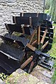
 Mortimer's Cross Watermill - pit gearing - geograph.org.uk - 3158905.jpg 530 × 800; 104 KB
-

-

-
 Mortimer's Cross Watermill - stones - geograph.org.uk - 3158837.jpg 640 × 424; 74 KB
-
 Mortimer's Cross, Former water mill - geograph.org.uk - 4597285.jpg 4,320 × 3,240; 5.46 MB
-
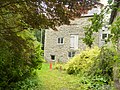
 Mortimer's Cross, Mill Cottage - geograph.org.uk - 4597294.jpg 4,320 × 3,240; 5.28 MB
-
 Mortimer's Cross, Mill House - geograph.org.uk - 4597282.jpg 4,320 × 3,240; 5.75 MB
-
 Oaks and drumlins, 1 - geograph.org.uk - 5632239.jpg 1,600 × 901; 628 KB
-
 Oaks and drumlins, 2 - geograph.org.uk - 5632240.jpg 1,600 × 901; 699 KB
-
 Old barn in School Wood - geograph.org.uk - 1178107.jpg 640 × 480; 169 KB
-
 Old Bridge - geograph.org.uk - 6210013.jpg 1,024 × 1,024; 384 KB
-
 Old stonework each side of the lane - geograph.org.uk - 2346792.jpg 640 × 480; 140 KB
-
 Ordnance Survey Cut Mark - geograph.org.uk - 5329294.jpg 640 × 341; 90 KB
-
 Paddocks at Hill Farm - geograph.org.uk - 1178081.jpg 640 × 483; 143 KB
-
 Pasture land to the south of New House Farm - geograph.org.uk - 5632227.jpg 1,600 × 901; 636 KB
-
 Path and track into Croft Wood - geograph.org.uk - 2346808.jpg 640 × 480; 102 KB
-
 River Lugg - geograph.org.uk - 2010496.jpg 640 × 480; 162 KB
-
 Shed above Lucton - geograph.org.uk - 6211633.jpg 1,024 × 1,024; 271 KB
-
 Small Pool, Lucton - geograph.org.uk - 1759052.jpg 640 × 480; 158 KB
-
 Small Stream Across The Footpath - geograph.org.uk - 1759044.jpg 480 × 640; 216 KB
-
 Statue of John Pierrpont, Lucton School - geograph.org.uk - 6300831.jpg 768 × 1,024; 173 KB
-
 Stile entering Pokeshouse Wood - geograph.org.uk - 1178072.jpg 640 × 480; 182 KB
-
 The Miller's House at Mortimer's Cross mill - geograph.org.uk - 2920699.jpg 4,752 × 3,168; 4 MB
-
 The Quarry Oak - largest sessile oak in England^ Feb 2012 - panoramio.jpg 3,000 × 4,000; 4.2 MB
-
 Towards Tars Wood - geograph.org.uk - 1759046.jpg 640 × 480; 205 KB
-
 Track in School Wood - geograph.org.uk - 1178115.jpg 640 × 480; 173 KB
-
 Track through School Wood - geograph.org.uk - 1178110.jpg 640 × 480; 173 KB
-
 View from first floor of Mortimer's Cross mill - geograph.org.uk - 2920687.jpg 4,752 × 3,168; 3.43 MB
-
 Farmland, Lucton - geograph.org.uk - 388751.jpg 640 × 480; 80 KB
-
 Ripening corn - geograph.org.uk - 62960.jpg 640 × 480; 85 KB


