Category:Lower churchyard of St Michael's, Huyton
Jump to navigation
Jump to search
| Object location | | View all coordinates using: OpenStreetMap |
|---|
The lower churchyard of St Michael's is an expansion from the original and holds the most recent graves.
Subcategories
This category has only the following subcategory.
Media in category "Lower churchyard of St Michael's, Huyton"
The following 2 files are in this category, out of 2 total.
-
 Grave of Stuart Sutcliffe at St Michael's Church, Huyton.jpg 4,716 × 3,345; 21.61 MB
-
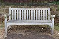 Stuart Sutcliffe memorial bench in St Michael's churchyard, Huyton.jpg 5,008 × 3,324; 23.93 MB

