Category:Lower Ngau Tau Kok Estate Playground No.8
Jump to navigation
Jump to search
| Object location | | View all coordinates using: OpenStreetMap |
|---|
中文:牛頭角下邨(村)8號遊樂場
| Upload media | |||||
| Instance of | |||||
|---|---|---|---|---|---|
| Location | |||||
 | |||||
Media in category "Lower Ngau Tau Kok Estate Playground No.8"
The following 10 files are in this category, out of 10 total.
-
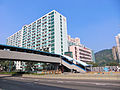
 2004 Ngau Tau Kok (牛頭角) - panoramio - macropolo9914.jpg 594 × 400; 158 KB
-
 2009 Ngau Tau Kok, Hong Kong (牛頭角) - panoramio.jpg 640 × 480; 153 KB
-
 2011 Jan, Ngau Tau Kok (牛頭角) - panoramio - macropolo9914 (2).jpg 3,648 × 2,736; 3.15 MB
-
 CHUN WAH RD NTK.JPG 2,304 × 1,728; 2.18 MB
-
 LNTK Zone 2.jpg 2,592 × 3,036; 7.74 MB
-
 Lower Ngau Tau Kok BK89 2008.jpg 3,072 × 2,304; 1.14 MB
-
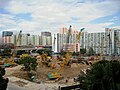 Lower Ngau Tau Kok Estate Redevelopment Site 200811.jpg 1,570 × 1,177; 1.54 MB
-
 Lower NTK Estate BLK08 and 09.jpg 1,024 × 768; 390 KB
-
 NEW DEVE LNTKE FROM AMOY 1006.jpg 3,072 × 2,304; 2.2 MB
-
 ROAD LAYOUT LNTKE 1984-2012.svg 2,491 × 837; 3.55 MB
_-_panoramio_-_macropolo9914.jpg)
_-_panoramio.jpg)
_-_panoramio_-_macropolo9914_(2).jpg)


