Category:Long Whatton and Diseworth
Jump to navigation
Jump to search
civil parish in North West Leicestershire, Leicestershire, England | |||||
| Upload media | |||||
| Instance of | |||||
|---|---|---|---|---|---|
| Location | North West Leicestershire, Leicestershire, East Midlands, England | ||||
 | |||||

Subcategories
This category has the following 4 subcategories, out of 4 total.
Media in category "Long Whatton and Diseworth"
The following 200 files are in this category, out of 386 total.
(previous page) (next page)-
 17-21 Main Street, Long Whatton - geograph.org.uk - 5847910.jpg 1,280 × 960; 370 KB
-
 2 Main Street, Long Whatton - geograph.org.uk - 5847932.jpg 1,280 × 947; 295 KB
-
 22-24 West End, Long Whatton - geograph.org.uk - 5848330.jpg 1,280 × 1,006; 407 KB
-
 22-26 West End, Long Whatton - geograph.org.uk - 5848328.jpg 1,280 × 910; 323 KB
-
 22-26 West End, Long Whatton - geograph.org.uk - 5848351.jpg 1,280 × 960; 411 KB
-
 24 Main Street, Long Whatton - geograph.org.uk - 5847914.jpg 960 × 1,280; 338 KB
-
 53, Main Street, Long Whatton - geograph.org.uk - 5845965.jpg 1,280 × 960; 432 KB
-
 53, Main Street, Long Whatton - geograph.org.uk - 5846042.jpg 1,280 × 1,280; 760 KB
-
 81 Main Street, Long Whatton - geograph.org.uk - 5847242.jpg 1,280 × 960; 360 KB
-
 A black and white house - geograph.org.uk - 6338607.jpg 2,000 × 1,330; 2.49 MB
-
 A drain, a plane and a roadsign - geograph.org.uk - 4367925.jpg 1,200 × 900; 158 KB
-
 A frozen field - geograph.org.uk - 6039519.jpg 2,000 × 1,333; 2.93 MB
-
 A minor road between the M1 and A42 - geograph.org.uk - 6338608.jpg 2,000 × 1,330; 1.18 MB
-
 A sunny but cold morning view - geograph.org.uk - 6039522.jpg 2,000 × 1,333; 3.43 MB
-
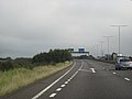
 A wet M1, southbound at Piper Wood - geograph.org.uk - 4682458.jpg 640 × 384; 23 KB
-
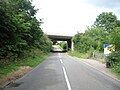
 A42 - Long Mere Lane bridge - geograph.org.uk - 2335360.jpg 640 × 480; 64 KB
-
 A42 - the last hundred yards - geograph.org.uk - 2335371.jpg 640 × 480; 48 KB
-

-
 A42 at Scaffacre Farm lay-by - geograph.org.uk - 2335359.jpg 640 × 480; 51 KB
-
-
 A42 crossing a minor road - geograph.org.uk - 2335358.jpg 640 × 480; 49 KB
-

-
 A42 is gridlocked - geograph.org.uk - 3990033.jpg 1,024 × 695; 146 KB
-
 A42 near Wood Nook Farm - geograph.org.uk - 1890027.jpg 640 × 480; 53 KB
-
-

-

-
 A453 near East Midlands Airport - geograph.org.uk - 3685665.jpg 1,600 × 1,204; 452 KB
-
 A6 looking south near South Lodge - geograph.org.uk - 3604111.jpg 640 × 480; 63 KB
-
 Airfield equipment and signs - geograph.org.uk - 4903617.jpg 3,264 × 2,448; 1.79 MB
-
 Airport Trail - geograph.org.uk - 6173686.jpg 1,280 × 960; 605 KB
-
 Airport Trail at East Midlands Airport - geograph.org.uk - 3685699.jpg 1,600 × 1,200; 596 KB
-
 Airport Trail at East Midlands Airport - geograph.org.uk - 3685733.jpg 1,600 × 1,263; 579 KB
-
 Airport Trail on the southern perimeter - geograph.org.uk - 6187087.jpg 1,280 × 960; 430 KB
-
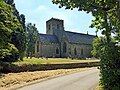
 All Saints Church Long Whatton - geograph.org.uk - 6338600.jpg 2,000 × 1,330; 2.69 MB
-
 All Saints Church, Long Whatton - geograph.org.uk - 3069120.jpg 640 × 480; 81 KB
-
 Approaching Diseworth - geograph.org.uk - 6338612.jpg 2,000 × 1,330; 2.33 MB
-
 Ashby Road (A453) - geograph.org.uk - 5046813.jpg 640 × 480; 72 KB
-
 Ashby Road (B5324) - geograph.org.uk - 3069112.jpg 640 × 480; 52 KB
-
-
 Ashby Road-Hallamford Road junction - geograph.org.uk - 2086511.jpg 640 × 480; 60 KB
-
 Backwater on the River Soar, upstream of Devil's Elbow - geograph.org.uk - 6180421.jpg 1,703 × 1,277; 775 KB
-

-
 Bench mark, All Saints Church, Long Whatton - geograph.org.uk - 5847225.jpg 1,280 × 1,280; 645 KB
-
 Bench mark, The Wheel House, Main Street, Long Whatton - geograph.org.uk - 5847942.jpg 1,280 × 1,280; 663 KB
-
 Bend and speed limit ahead - geograph.org.uk - 5848389.jpg 1,280 × 960; 564 KB
-
 Bridge across Long Whatton Brook - geograph.org.uk - 3684377.jpg 1,600 × 1,197; 553 KB
-
 Bridge over a gridlocked A42 - geograph.org.uk - 3990034.jpg 1,024 × 687; 128 KB
-
 Bridge Over The A42 - geograph.org.uk - 1343004.jpg 640 × 480; 76 KB
-
 Bridge Over The A42 - geograph.org.uk - 1343018.jpg 640 × 480; 77 KB
-
 Car park at Charnwood 2016 - geograph.org.uk - 5119664.jpg 640 × 426; 70 KB
-
 Castle Donington Moto Services - geograph.org.uk - 4842882.jpg 1,600 × 900; 237 KB
-
 Cattle pasture near Diseworth - geograph.org.uk - 3684691.jpg 1,600 × 1,193; 497 KB
-
 Charge Here - geograph.org.uk - 5577881.jpg 640 × 448; 129 KB
-
 Chequer pattern brickwork, Malt Roow - geograph.org.uk - 5847950.jpg 1,280 × 1,280; 703 KB
-
 Chevrons by the M1 - geograph.org.uk - 4682423.jpg 640 × 445; 39 KB
-
 Chinese Garden, Whatton House, fish cauldron - geograph.org.uk - 5846008.jpg 1,280 × 960; 632 KB
-
 Chinese Garden, Whatton House, pagoda - geograph.org.uk - 5846003.jpg 960 × 1,280; 385 KB
-
 Chinese Garden, Whatton House, pagoda - geograph.org.uk - 5846022.jpg 960 × 1,280; 516 KB
-
 Chinese Garden, Whatton House, parasol - geograph.org.uk - 5846012.jpg 960 × 1,280; 559 KB
-
 Chinese Garden, Whatton House, stone bases (geograph 5846017).jpg 960 × 1,280; 649 KB
-
 Chinese Garden, Whatton House, stone seat - geograph.org.uk - 5846015.jpg 960 × 1,280; 574 KB
-

-

-
 Church of All Saints, Long Whatton - geograph.org.uk - 5847159.jpg 1,035 × 1,280; 491 KB
-
 Church of All Saints, Long Whatton - geograph.org.uk - 5847166.jpg 903 × 1,280; 298 KB
-
 Church of All Saints, Long Whatton - geograph.org.uk - 5847171.jpg 1,280 × 1,004; 327 KB
-
 Church of All Saints, Long Whatton - geograph.org.uk - 5847173.jpg 1,280 × 960; 294 KB
-
 Church of All Saints, Long Whatton - geograph.org.uk - 5847179.jpg 960 × 1,280; 321 KB
-
 Church of All Saints, Long Whatton - geograph.org.uk - 5847182.jpg 1,280 × 960; 330 KB
-
 Church of All Saints, Long Whatton - geograph.org.uk - 5847190.jpg 1,280 × 999; 350 KB
-
 Church of All Saints, Long Whatton - geograph.org.uk - 5847192.jpg 884 × 1,280; 319 KB
-
 Church of All Saints, Long Whatton - geograph.org.uk - 5847194.jpg 960 × 1,280; 308 KB
-
 Church of All Saints, Long Whatton - geograph.org.uk - 5847196.jpg 960 × 1,280; 359 KB
-
 Church of All Saints, Long Whatton - geograph.org.uk - 5847197.jpg 960 × 1,280; 356 KB
-
 Church of All Saints, Long Whatton - geograph.org.uk - 5847201.jpg 960 × 1,280; 315 KB
-
 Church of All Saints, Long Whatton - geograph.org.uk - 5847202.jpg 960 × 1,280; 378 KB
-
 Church of All Saints, Long Whatton - geograph.org.uk - 5847204.jpg 960 × 1,280; 331 KB
-
 Church of All Saints, Long Whatton - geograph.org.uk - 5847206.jpg 1,280 × 707; 278 KB
-
 Church of All Saints, Long Whatton - geograph.org.uk - 5847207.jpg 892 × 1,280; 395 KB
-
 Church of All Saints, Long Whatton - geograph.org.uk - 5847209.jpg 960 × 1,280; 313 KB
-
 Church of All Saints, Long Whatton - geograph.org.uk - 5847211.jpg 960 × 1,280; 345 KB
-
 Church of All Saints, Long Whatton - geograph.org.uk - 5847213.jpg 960 × 1,280; 223 KB
-
 Church of All Saints, Long Whatton - geograph.org.uk - 5847217.jpg 1,111 × 1,280; 469 KB
-
 Church of All Saints, Long Whatton - geograph.org.uk - 5847233.jpg 1,280 × 960; 369 KB
-
 Church of All Saints, Long Whatton - geograph.org.uk - 5847236.jpg 960 × 1,280; 452 KB
-
 Church of All Saints, Long Whatton - geograph.org.uk - 5847239.jpg 1,280 × 904; 441 KB
-
 Church of All Saints, Long Whatton - geograph.org.uk - 5847887.jpg 1,280 × 960; 497 KB
-
 Close to Long Whatton - geograph.org.uk - 6338597.jpg 2,000 × 1,330; 1.97 MB
-
 Close to the airport - geograph.org.uk - 6039515.jpg 2,000 × 1,333; 2.12 MB
-
 Converting the Bull and Swan - geograph.org.uk - 4760329.jpg 1,280 × 960; 293 KB
-

-
 Cows near Home Farm - geograph.org.uk - 3684302.jpg 1,600 × 1,022; 487 KB
-
 Crop field off Ashby Road - geograph.org.uk - 3069111.jpg 640 × 480; 62 KB
-
 Curves on the A42 slip road - geograph.org.uk - 2335368.jpg 640 × 480; 56 KB
-
 Damaged hedge along Kegworth Lane - geograph.org.uk - 3684353.jpg 1,600 × 1,200; 689 KB
-
 Diseworth - geograph.org.uk - 3822829.jpg 851 × 1,280; 269 KB
-
 Diseworth Brook - geograph.org.uk - 3841813.jpg 1,200 × 900; 358 KB
-
 Diseworth Brook and a house on Brookside - geograph.org.uk - 3772938.jpg 900 × 1,200; 415 KB
-
 Diseworth Brook and Baptist Chapel Cemetery - geograph.org.uk - 3772920.jpg 1,200 × 900; 300 KB
-
 Diseworth Village - geograph.org.uk - 6338614.jpg 2,000 × 1,330; 2.14 MB
-
 Diseworth Village Hall - geograph.org.uk - 5046800.jpg 640 × 480; 80 KB
-
 Donington Park Services - geograph.org.uk - 4120349.jpg 4,608 × 3,456; 3.11 MB
-
 Donington Park Services - geograph.org.uk - 4838575.jpg 1,600 × 1,200; 465 KB
-
 Donington Park Travelodge - geograph.org.uk - 5577883.jpg 640 × 403; 64 KB
-
 Double 5-barred gate and cornfield - geograph.org.uk - 5848365.jpg 1,280 × 960; 492 KB
-
 Dry Pot Lane - geograph.org.uk - 1342645.jpg 640 × 480; 108 KB
-
 Dry Pot Lane - geograph.org.uk - 5848378.jpg 1,280 × 960; 552 KB
-
 Dry Pot Lane heading west - geograph.org.uk - 3069115.jpg 640 × 480; 89 KB
-
 East gate into the Chinese Garden - geograph.org.uk - 5846000.jpg 960 × 1,280; 647 KB
-
 East Midlands Airport - geograph.org.uk - 3184072.jpg 3,264 × 2,448; 2 MB
-
 East Midlands Airport and the M1 - geograph.org.uk - 3152065.jpg 3,264 × 2,448; 2.96 MB
-
 East Midlands Airport entrance - geograph.org.uk - 3182290.jpg 3,264 × 2,448; 4.73 MB
-
 East Midlands Airport footpath - geograph.org.uk - 3685803.jpg 1,600 × 1,095; 605 KB
-
 East Midlands Airport from the air - geograph.org.uk - 4601052.jpg 480 × 640; 162 KB
-
 East Midlands Airport Trail - geograph.org.uk - 3685845.jpg 1,600 × 1,158; 442 KB
-

-
 East Midlands Gateway – Spine road looking west - geograph.org.uk - 6173620.jpg 1,280 × 960; 265 KB
-

-
 Entering Diseworth - geograph.org.uk - 5046799.jpg 640 × 480; 60 KB
-
 Entrance to field west of Mill Lane - geograph.org.uk - 5119660.jpg 640 × 463; 87 KB
-
 Entrance to Highfields Manor - geograph.org.uk - 1340459.jpg 640 × 480; 92 KB
-
 Exit from Charnwood 2016 this way - geograph.org.uk - 5119665.jpg 640 × 452; 90 KB
-

-
 Far End postbox, Long Whatton, ref LE12 37 - geograph.org.uk - 5847934.jpg 874 × 1,280; 388 KB
-
 Farm buildings - geograph.org.uk - 3775234.jpg 1,200 × 900; 183 KB
-
 Farm track near Windmill Farm - geograph.org.uk - 5845948.jpg 1,280 × 858; 449 KB
-
 Farm Track North of Shepshed - geograph.org.uk - 1340220.jpg 640 × 480; 99 KB
-
 Farmland near Field Farm - geograph.org.uk - 3676901.jpg 1,600 × 1,200; 387 KB
-
 Farmland north of Long Whatton - geograph.org.uk - 3684359.jpg 1,600 × 1,200; 657 KB
-
 Farmland off Kegworth Lane - geograph.org.uk - 3069123.jpg 640 × 480; 69 KB
-
 Farthings, West End, Long Whatton - geograph.org.uk - 5848343.jpg 1,280 × 960; 469 KB
-
 Farthings, West End, Long Whatton - geograph.org.uk - 5848346.jpg 1,280 × 1,280; 678 KB
-
 Field alongside Diseworth Brook - geograph.org.uk - 3684715.jpg 1,600 × 1,200; 734 KB
-

-
 Fields next to Ash Spinney - geograph.org.uk - 3684367.jpg 1,600 × 1,200; 593 KB
-
 Fish fountain - geograph.org.uk - 5845998.jpg 960 × 1,280; 613 KB
-
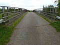
 Footbridge over M1 near Piper Wood - geograph.org.uk - 5895379.jpg 1,024 × 543; 84 KB
-
 Footbridge over Westmeadow Brook - geograph.org.uk - 4368026.jpg 1,200 × 900; 352 KB
-
 Footpath across a sheep pasture to Green Lane - geograph.org.uk - 3772947.jpg 1,200 × 900; 328 KB
-
 Footpath bridge over the M1 - geograph.org.uk - 4736935.jpg 1,280 × 960; 555 KB
-
 Footpath by New Wood - geograph.org.uk - 4367902.jpg 1,200 × 900; 251 KB
-
 Footpath by the A42 - geograph.org.uk - 4367909.jpg 1,200 × 900; 172 KB
-
 Footpath into Piper Wood in autumn - geograph.org.uk - 4736931.jpg 1,280 × 960; 629 KB
-
 Footpath sign - geograph.org.uk - 5119662.jpg 640 × 507; 132 KB
-
 Footpath steps - geograph.org.uk - 3775227.jpg 1,200 × 900; 430 KB
-
 Footpath through Piper Wood in autumn - geograph.org.uk - 4736924.jpg 1,280 × 960; 860 KB
-
 Footpath to Kegworth - geograph.org.uk - 5847867.jpg 1,280 × 863; 436 KB
-
 Footpath to Kegworth from Mills Lane - geograph.org.uk - 5119661.jpg 640 × 478; 75 KB
-

-
 Former Baptist Chapel, Long Whatton - geograph.org.uk - 5848356.jpg 1,280 × 1,280; 538 KB
-
 Former hosiery factory - geograph.org.uk - 3750805.jpg 900 × 1,200; 103 KB
-
 Former hosiery workshop and house, Long Whatton - geograph.org.uk - 5845963.jpg 1,280 × 960; 394 KB
-
 Former section of Ashby Road - geograph.org.uk - 3841766.jpg 1,200 × 900; 379 KB
-
 Former section of the A453 Ashby Road - geograph.org.uk - 3775178.jpg 1,200 × 900; 176 KB
-
 Former trig pillar - geograph.org.uk - 3772965.jpg 900 × 1,200; 258 KB
-
 Fox ornament on a thatched roof - geograph.org.uk - 3841832.jpg 1,200 × 900; 102 KB
-
 From the A42 onto the M1 - geograph.org.uk - 1890031.jpg 640 × 480; 43 KB
-
 Gadds Island by the River Soar, Leicestershire - geograph.org.uk - 5995772.jpg 1,280 × 960; 1.52 MB
-
 Gantry over the M1 - geograph.org.uk - 3856221.jpg 3,435 × 1,847; 2.76 MB
-
 Gate leading onto farmland - geograph.org.uk - 3684320.jpg 1,600 × 1,288; 653 KB
-
 Gatepost with EWS sign, Mill Lane, Long Whatton - geograph.org.uk - 5847877.jpg 960 × 1,280; 608 KB
-
 Gateway to Long Whatton - geograph.org.uk - 5848363.jpg 1,280 × 960; 399 KB
-
 Gelscoe Farm - geograph.org.uk - 5046777.jpg 640 × 480; 63 KB
-
 Glebe Farm - geograph.org.uk - 4367978.jpg 1,200 × 900; 159 KB
-

-
 Grazing near Bleak House - geograph.org.uk - 5046806.jpg 640 × 480; 65 KB
-
 Grazing near Diseworth - geograph.org.uk - 5046785.jpg 640 × 480; 74 KB
-
 Green Lane near the A453 - geograph.org.uk - 3841748.jpg 1,200 × 900; 330 KB
-
 Grimes Gate junction with the A453 - geograph.org.uk - 6187090.jpg 1,280 × 960; 226 KB
-
 Hall Gate, Diseworth - geograph.org.uk - 3818993.jpg 1,280 × 851; 271 KB
-
 Hall Gate, Diseworth - geograph.org.uk - 3818994.jpg 1,280 × 851; 202 KB
-
 Hallamford Road - geograph.org.uk - 1340446.jpg 640 × 480; 78 KB
-
 Hallamford Road - geograph.org.uk - 1340448.jpg 640 × 480; 87 KB
-
 Hallamford Road - geograph.org.uk - 1340452.jpg 640 × 480; 108 KB
-
 Hallamford Road towards the B5324 - geograph.org.uk - 3069110.jpg 640 × 480; 66 KB
-
 Hay bales - geograph.org.uk - 4367945.jpg 1,200 × 900; 164 KB
-

-
 Heading south along Grimes Gate - geograph.org.uk - 3685655.jpg 1,600 × 1,150; 452 KB
-
 Hedgerow and field along Kegworth Lane - geograph.org.uk - 3684362.jpg 1,600 × 1,329; 734 KB
-
 Highfields Manor - geograph.org.uk - 1340456.jpg 640 × 480; 120 KB
-
 Highfields Manor field - geograph.org.uk - 1340461.jpg 640 × 480; 99 KB
-
 Highfields Manor field - geograph.org.uk - 1342623.jpg 640 × 480; 94 KB
-
 Holiday Inn Express - East Midlands Airport - geograph.org.uk - 4597207.jpg 3,012 × 2,966; 2.33 MB
-
 Horses grazing in a ridge and furrow field - geograph.org.uk - 3841870.jpg 1,200 × 900; 252 KB
-
 Hotels at East Midlands Airport - geograph.org.uk - 6187085.jpg 1,280 × 960; 287 KB
-
 House on The Green Diseworth - geograph.org.uk - 1343053.jpg 640 × 480; 140 KB
-
 Houses on Hall Gate, Diseworth - geograph.org.uk - 5046802.jpg 640 × 480; 77 KB
-
 If you are going to do pastiche . . . - geograph.org.uk - 5848358.jpg 1,280 × 998; 396 KB
-

-
 J23a overbridge, M1 - geograph.org.uk - 4682416.jpg 640 × 426; 43 KB
-
 J23a, M1 - geograph.org.uk - 4682418.jpg 640 × 301; 26 KB
-
 Joining the M1 - geograph.org.uk - 1890034.jpg 640 × 480; 49 KB
-

-
 K6 telephone kiosk, Main Street, Long Whatton - geograph.org.uk - 5845976.jpg 1,095 × 1,280; 381 KB
-
 Keep left sign on the Airport Trail - geograph.org.uk - 6187077.jpg 1,280 × 960; 260 KB
-
 Keeper's Cottage - geograph.org.uk - 4784953.jpg 1,280 × 960; 321 KB
-
 Keeper's Lodge, Main Street, Long Whatton - geograph.org.uk - 5845969.jpg 960 × 1,280; 293 KB
-
 Keeper's Lodge, Main Street, Long Whatton - geograph.org.uk - 5845973.jpg 1,280 × 960; 434 KB
-
 Kegworth Lane heading north - geograph.org.uk - 3069124.jpg 640 × 480; 59 KB


_-_geograph.org.uk_-_5046813.jpg)
_-_geograph.org.uk_-_3069112.jpg)


.jpg)


