Category:Long Itchington
Jump to navigation
Jump to search
village in Warwickshire, England, UK   | |||||
| Upload media | |||||
| Pronunciation audio | |||||
|---|---|---|---|---|---|
| Instance of | |||||
| Location | Stratford-on-Avon, Warwickshire, West Midlands, England | ||||
| Population |
| ||||
| Area |
| ||||
| Said to be the same as | Long Itchington (Wikimedia duplicated page, civil parish) | ||||
 | |||||
English: Long Itchington is a large village and civil parish in the Stratford-on-Avon district of Warwickshire, England. In the 2001 census it had a population of 2,161. The village is named after the River Itchen which flows to the south and west of the village.
Subcategories
This category has the following 5 subcategories, out of 5 total.
B
L
- Holy Trinity, Long Itchington (15 F)
P
S
- Stockton Locks (19 F)
T
- Tudor House, Long Itchington (8 F)
Media in category "Long Itchington"
The following 200 files are in this category, out of 584 total.
(previous page) (next page)-

-
 'The Baby Barn' - geograph.org.uk - 1491216.jpg 640 × 432; 86 KB
-

-
 'Tunnel' bridge under A423 - geograph.org.uk - 1305098.jpg 640 × 524; 175 KB
-
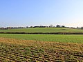
 A field near Bascote Heath - geograph.org.uk - 3940454.jpg 2,592 × 1,944; 1.83 MB
-
 A gap in a hedge - geograph.org.uk - 1305014.jpg 640 × 426; 136 KB
-
 A line of tanks near Lower Farm - geograph.org.uk - 2663782.jpg 2,000 × 1,508; 656 KB
-
 A muckheap in a corner - geograph.org.uk - 1302825.jpg 640 × 402; 138 KB
-
 A rubbish-strewn brook - geograph.org.uk - 1257472.jpg 640 × 466; 182 KB
-
 A shed in a field, Collingham Lane - geograph.org.uk - 1402799.jpg 640 × 460; 129 KB
-
-
 A warning sign beside the A423 road - geograph.org.uk - 1491181.jpg 640 × 425; 141 KB
-

-
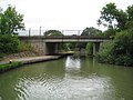
 A423 'tunnel' bridge (2) - geograph.org.uk - 1305135.jpg 640 × 449; 165 KB
-
 A423 north of Long Itchington - geograph.org.uk - 1112337.jpg 640 × 467; 98 KB
-
 A425 towards Royal Leamington Spa - geograph.org.uk - 6240948.jpg 800 × 600; 107 KB
-
 Allotments near Long Itchington (2) - geograph.org.uk - 1126507.jpg 640 × 495; 155 KB
-
 Allotments near Long Itchington - geograph.org.uk - 1111657.jpg 640 × 504; 112 KB
-
 An overgrown pond (3) - geograph.org.uk - 1302162.jpg 600 × 399; 131 KB
-

-
 An unkempt field corner - geograph.org.uk - 1304265.jpg 640 × 460; 171 KB
-
 Approaching Long Itchington - geograph.org.uk - 1257468.jpg 640 × 492; 90 KB
-
-
 Barn at Snowford Hill Barn - geograph.org.uk - 2694287.jpg 2,000 × 1,499; 370 KB
-
 Barn beside the bridleway - geograph.org.uk - 2694305.jpg 2,000 × 1,502; 455 KB
-
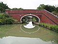
 Bascote Bridge - geograph.org.uk - 3463.jpg 640 × 480; 40 KB
-

-

-
 Bascote Country Lane - geograph.org.uk - 1864304.jpg 640 × 480; 69 KB
-
 Bascote Farmhouse - geograph.org.uk - 1860554.jpg 640 × 480; 66 KB
-
 Bascote Footpath - geograph.org.uk - 1920535.jpg 640 × 480; 96 KB
-
 Bascote Footpath - geograph.org.uk - 1921157.jpg 640 × 480; 148 KB
-
 Bascote Heath Cemetery - geograph.org.uk - 1857223.jpg 640 × 480; 114 KB
-
 Bascote Heath Crossroads - geograph.org.uk - 1860547.jpg 640 × 480; 110 KB
-

-
 Bascote Heath-Welsh Road - geograph.org.uk - 1860571.jpg 640 × 484; 114 KB
-
 Bascote Road Bridge - geograph.org.uk - 1920510.jpg 640 × 480; 98 KB
-
 Bascote-Hill Farm - geograph.org.uk - 1864310.jpg 640 × 480; 60 KB
-
 Beehives near Snowford Hall Farm - geograph.org.uk - 2693879.jpg 2,000 × 1,504; 708 KB
-
 Behind the canal, Long Itchington - geograph.org.uk - 1303541.jpg 640 × 426; 95 KB
-
 Bickley's Bridge - geograph.org.uk - 5198715.jpg 4,677 × 3,041; 7.12 MB
-
 Blue Lias canal bridge - geograph.org.uk - 1126977.jpg 640 × 494; 113 KB
-
 Boats moored in canal arm (3) - geograph.org.uk - 1303225.jpg 640 × 386; 111 KB
-
 Boatyard sign - geograph.org.uk - 1257458.jpg 640 × 497; 128 KB
-
 Brick culvert under dismantled railway - geograph.org.uk - 1306923.jpg 640 × 426; 165 KB
-
 Bridge detail, near Snowford Hill - geograph.org.uk - 1122215.jpg 640 × 537; 138 KB
-
 Bridge over the Grand Union Canal - geograph.org.uk - 2336948.jpg 640 × 480; 110 KB
-
 Bridleway north from Long Itchington (1) - geograph.org.uk - 1126857.jpg 640 × 530; 138 KB
-

-
 Bridleway north from Long Itchington (3) - geograph.org.uk - 1126864.jpg 640 × 466; 140 KB
-
 Bridleway north from Long Itchington (4) - geograph.org.uk - 1126867.jpg 640 × 455; 120 KB
-
 Bridleway north from Long Itchington (5) - geograph.org.uk - 1126870.jpg 640 × 498; 126 KB
-
-
 Bridleway north from Long Itchington (7) - geograph.org.uk - 1126874.jpg 640 × 484; 137 KB
-
 Bridleway north from Long Itchington (8) - geograph.org.uk - 1126879.jpg 640 × 564; 174 KB
-
 Bridleway north of Newfields Farm - geograph.org.uk - 2694258.jpg 2,000 × 1,498; 505 KB
-
 Bridleway to Marton - geograph.org.uk - 2692405.jpg 2,000 × 1,496; 550 KB
-
 Brook Turn Cottages - geograph.org.uk - 3254454.jpg 640 × 480; 74 KB
-
 Camping Boats at Long Itchington - geograph.org.uk - 1506516.jpg 640 × 531; 86 KB
-
 Canal arm, Long Itchington - geograph.org.uk - 1251304.jpg 640 × 507; 147 KB
-
 Canal bank erosion by Splash Bridge - geograph.org.uk - 2694365.jpg 2,000 × 1,398; 363 KB
-
 Canal bridge 24, Long Itchington - geograph.org.uk - 1117238.jpg 640 × 442; 121 KB
-
 Canal dry dock, Long Itchington (1) - geograph.org.uk - 1251313.jpg 640 × 436; 123 KB
-
 Canal dry dock, Long Itchington (2) - geograph.org.uk - 1251321.jpg 640 × 484; 82 KB
-
 Canal lock at dusk, Long Itchington - geograph.org.uk - 1126972.jpg 640 × 462; 103 KB
-
 Canal view east from Bascote - geograph.org.uk - 1344095.jpg 550 × 640; 108 KB
-
 Canalside pollarded willows (1) - geograph.org.uk - 1302304.jpg 640 × 426; 119 KB
-
 Canalside pollarded willows (2) - geograph.org.uk - 1302299.jpg 426 × 640; 132 KB
-
 Canalside rough pasture (2) - geograph.org.uk - 1302292.jpg 640 × 426; 104 KB
-
 Canalside rough pasture - geograph.org.uk - 1302289.jpg 640 × 465; 96 KB
-

-
 Cement works entrance sign - geograph.org.uk - 1305084.jpg 640 × 426; 92 KB
-
 Cement works near Long Itchington - geograph.org.uk - 451836.jpg 640 × 480; 106 KB
-

-
 Church Road, Long Itchington - geograph.org.uk - 1117248.jpg 640 × 479; 79 KB
-
 Collingham Lane - geograph.org.uk - 1774808.jpg 640 × 480; 110 KB
-
 Collingham Lane footpath walk (1) - geograph.org.uk - 1126514.jpg 640 × 467; 77 KB
-
 Collingham Lane footpath walk (2) - geograph.org.uk - 1126520.jpg 640 × 510; 124 KB
-
 Collingham Lane footpath walk (3) - geograph.org.uk - 1126528.jpg 640 × 512; 124 KB
-
 Collingham Lane footpath walk (4) - geograph.org.uk - 1126532.jpg 640 × 431; 77 KB
-
 Collingham Lane footpath walk (5) - geograph.org.uk - 1126539.jpg 640 × 472; 152 KB
-
 Collingham Lane footpath walk (6) - geograph.org.uk - 1126543.jpg 545 × 640; 190 KB
-
 Collingham Lane footpath walk (7) - geograph.org.uk - 1126553.jpg 640 × 479; 162 KB
-
 Collingham Lane footpath walk (8) - geograph.org.uk - 1126557.jpg 537 × 640; 234 KB
-
 Collingham Lane footpath walk (9) - geograph.org.uk - 1126563.jpg 582 × 640; 244 KB
-
-
 Collingham Lane in winter - geograph.org.uk - 1111661.jpg 640 × 463; 138 KB
-
 Collingham Lane, mobile mast - geograph.org.uk - 1111663.jpg 640 × 455; 64 KB
-
 Corner of a field, Long Itchington - geograph.org.uk - 1277020.jpg 640 × 424; 108 KB
-
 Cottage, Collingham Lane - geograph.org.uk - 1126888.jpg 640 × 471; 129 KB
-
 Cottage, Green End - geograph.org.uk - 1305022.jpg 640 × 426; 108 KB
-
 Course of the River Itchen - geograph.org.uk - 2694202.jpg 2,000 × 1,496; 502 KB
-

-
 Cricket pitch south of Model Village - geograph.org.uk - 1491266.jpg 640 × 429; 96 KB
-
 Crop near Long Itchington - geograph.org.uk - 1278086.jpg 640 × 390; 106 KB
-

-
 Cuttle Brook culvert under canal - geograph.org.uk - 1305030.jpg 516 × 640; 172 KB
-
 Cycle Route 51 Near Long Itchington - geograph.org.uk - 117484.jpg 640 × 480; 129 KB
-
 Cycleway sign near Grand Union Canal - geograph.org.uk - 1343656.jpg 640 × 465; 158 KB
-
 Cycleway south of Long Itchington - geograph.org.uk - 1121584.jpg 640 × 498; 146 KB
-
 Dallas Burston Polo Grounds - geograph.org.uk - 2754626.jpg 2,000 × 1,497; 489 KB
-
 Dandelion clocks near Long Itchington - geograph.org.uk - 1305197.jpg 640 × 444; 107 KB
-
 Dandelions behind the towpath hedge - geograph.org.uk - 1303543.jpg 640 × 452; 147 KB
-
 Dismantled Leamington-Weedon Line - geograph.org.uk - 1916991.jpg 640 × 480; 152 KB
-
 Dismantled Leamington-Weedon Line - geograph.org.uk - 1921140.jpg 640 × 480; 138 KB
-

-
 Disused railway bridge near Marton Junction - geograph.org.uk - 2693550.jpg 2,000 × 1,496; 483 KB
-
 Dowdeswell factory east (3) - geograph.org.uk - 1304277.jpg 640 × 473; 171 KB
-
 Dowdeswell factory east (4) - geograph.org.uk - 1304282.jpg 640 × 416; 199 KB
-
 Driveway near Long Itchington - geograph.org.uk - 1122180.jpg 640 × 450; 81 KB
-
 Duck pond, Long Itchington - geograph.org.uk - 3157251.jpg 640 × 427; 103 KB
-
 Early Morning, Grand Union Canal - geograph.org.uk - 4654317.jpg 640 × 480; 143 KB
-

-

-
-

-
 Entering woodland - geograph.org.uk - 4541602.jpg 640 × 480; 85 KB
-
 Entrance driveway to Crabtree Cottage - geograph.org.uk - 2693883.jpg 2,000 × 1,490; 463 KB
-
 Entrance to Dallas Burston Polo Club - geograph.org.uk - 3254529.jpg 640 × 480; 40 KB
-
 Entrance to Dallas Burston Polo Club - geograph.org.uk - 6240945.jpg 800 × 600; 109 KB
-

-
 Entrance to Newfields Farm - geograph.org.uk - 2692399.jpg 2,000 × 1,412; 563 KB
-

-
 Farm drive and bridleway, Newfields - geograph.org.uk - 1293131.jpg 640 × 481; 94 KB
-
 Farm machinery - geograph.org.uk - 4541601.jpg 640 × 480; 63 KB
-
 Farmland north of Bascote Heath - geograph.org.uk - 3940442.jpg 2,592 × 1,944; 1.1 MB
-
 Farmland south of Long Itchington - geograph.org.uk - 3940421.jpg 2,592 × 1,944; 1.82 MB
-
-
 Farmland west of Snowford Hill Farm - geograph.org.uk - 1495397.jpg 600 × 399; 98 KB
-
 Field and sky - geograph.org.uk - 5677870.jpg 1,600 × 900; 306 KB
-
 Field beside canal, Long Itchington - geograph.org.uk - 1302030.jpg 640 × 426; 94 KB
-
 Field beside canal, Long Itchington - geograph.org.uk - 1302036.jpg 640 × 492; 92 KB
-
 Field near Bascote - geograph.org.uk - 2336955.jpg 640 × 480; 97 KB
-
 Field near Stoneythorpe Hall - geograph.org.uk - 3082619.jpg 640 × 480; 85 KB
-
 Field south of Long Itchington - geograph.org.uk - 2336941.jpg 640 × 480; 86 KB
-
 Field south of Stonebridge Lane - geograph.org.uk - 1703610.jpg 2,000 × 1,468; 345 KB
-
 Field view on the Harry Green Way - geograph.org.uk - 4541345.jpg 640 × 480; 56 KB
-
 Field view on the Harry Green Way - geograph.org.uk - 4541346.jpg 480 × 640; 119 KB
-
 Fields near Findle Farm - geograph.org.uk - 2692202.jpg 2,000 × 1,506; 783 KB
-
 Fields near Findle Farm - geograph.org.uk - 2693865.jpg 2,000 × 1,499; 733 KB
-
 Fields near Snowford Lodge - geograph.org.uk - 3254408.jpg 640 × 480; 88 KB
-
 Fields south of Long Itchington - geograph.org.uk - 3940427.jpg 2,592 × 1,944; 1.77 MB
-
 Fishing pond at Blue Lias - geograph.org.uk - 1302283.jpg 640 × 459; 87 KB
-
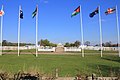 Flagpoles at Dallas Burston Polo Grounds - geograph.org.uk - 2663810.jpg 2,000 × 1,333; 437 KB
-
-

-
-

-

-
-
-
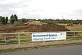
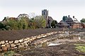
 Flood relief works at Long Itchington - geograph.org.uk - 1491225.jpg 640 × 426; 110 KB
-
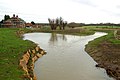
 Flooded Field, near Stockton - geograph.org.uk - 481321.jpg 640 × 480; 87 KB
-
 Flooded trackbed of dismantled railway - geograph.org.uk - 1305104.jpg 530 × 640; 195 KB
-
 Flowers in a field corner - geograph.org.uk - 1304288.jpg 600 × 399; 128 KB
-
 Footpath approaches Leamington Road - geograph.org.uk - 2695285.jpg 2,000 × 1,504; 676 KB
-

-
 Footpath to Bascote Heath - geograph.org.uk - 2310413.jpg 1,280 × 856; 329 KB
-
 Footpath to Southam from Bascote - geograph.org.uk - 2811037.jpg 2,000 × 1,496; 441 KB
-
 Fungus on a tree - geograph.org.uk - 1276927.jpg 640 × 509; 129 KB
-
 Gap in hedge, near Long Itchington - geograph.org.uk - 1277008.jpg 640 × 434; 82 KB
-
 Garages near the canal, Long Itchington - geograph.org.uk - 1305040.jpg 640 × 457; 109 KB
-
 Garden on old railway - geograph.org.uk - 1302842.jpg 555 × 640; 153 KB
-

-
 Gate on cycle route 41 - geograph.org.uk - 2811082.jpg 2,000 × 1,494; 431 KB
-
 Gate on footpath to Ufton - geograph.org.uk - 2656478.jpg 2,000 × 1,504; 355 KB
-
 Gate on Stonebridge Lane - geograph.org.uk - 2639668.jpg 2,000 × 1,498; 456 KB
-
 Grand Union Canal - geograph.org.uk - 2936577.jpg 640 × 480; 98 KB
-
 Grand Union Canal - geograph.org.uk - 2936580.jpg 640 × 480; 73 KB
-
 Grand Union Canal - geograph.org.uk - 3254513.jpg 640 × 480; 73 KB
-
 Grand Union Canal - geograph.org.uk - 4541594.jpg 640 × 480; 82 KB
-

-
 Grand Union Canal bridge No 24 - geograph.org.uk - 5051559.jpg 640 × 427; 97 KB
-
 Grand Union Canal narrowboat in Long Itchington, Warwickshire.jpg 640 × 426; 146 KB
-
 Grand Union Canal near Bascote - geograph.org.uk - 155267.jpg 640 × 480; 300 KB
-
 Grand Union Canal near Long Itchington - geograph.org.uk - 3523084.jpg 640 × 427; 109 KB
-

-
 Grand Union Canal Walk - geograph.org.uk - 5233434.jpg 640 × 480; 72 KB
-
 Grand Union Canal Walk - geograph.org.uk - 5233535.jpg 640 × 480; 88 KB
-
 Grand Union Canal Walk - geograph.org.uk - 5233540.jpg 640 × 480; 84 KB
-

-
-

-
-

-

-

-

-

-

-

-
 Grange Farm north of Long Itchington - geograph.org.uk - 1300783.jpg 640 × 508; 153 KB
-
 Grange Farm, Long Itchington - geograph.org.uk - 5932.jpg 640 × 480; 52 KB
-
 Grazing, Fir Tree Farm - geograph.org.uk - 3906810.jpg 640 × 480; 61 KB
-
 Grazing, Fox Farm - geograph.org.uk - 3906814.jpg 640 × 480; 39 KB
-
 Grove north of Southam - geograph.org.uk - 1112318.jpg 427 × 640; 150 KB
-
-
 Hedgerow near Long Itchington - geograph.org.uk - 1302225.jpg 640 × 426; 94 KB
-
 Hedgerow near Long Itchington school - geograph.org.uk - 1277015.jpg 640 × 431; 129 KB
-
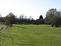
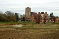
 High Clays Farm and fishing pond - geograph.org.uk - 1277010.jpg 640 × 501; 122 KB


_-_geograph.org.uk_-_1305135.jpg)


_-_geograph.org.uk_-_1126507.jpg)

_-_geograph.org.uk_-_1302162.jpg)


_-_geograph.org.uk_-_1303225.jpg)


_-_geograph.org.uk_-_1126857.jpg)
_-_geograph.org.uk_-_1126858.jpg)
_-_geograph.org.uk_-_1126864.jpg)
_-_geograph.org.uk_-_1126867.jpg)
_-_geograph.org.uk_-_1126870.jpg)
_-_geograph.org.uk_-_1126871.jpg)
_-_geograph.org.uk_-_1126874.jpg)
_-_geograph.org.uk_-_1126879.jpg)


_-_geograph.org.uk_-_1251313.jpg)
_-_geograph.org.uk_-_1251321.jpg)


_-_geograph.org.uk_-_1302304.jpg)
_-_geograph.org.uk_-_1302299.jpg)
_-_geograph.org.uk_-_1302292.jpg)


_-_geograph.org.uk_-_1126514.jpg)
_-_geograph.org.uk_-_1126520.jpg)
_-_geograph.org.uk_-_1126528.jpg)
_-_geograph.org.uk_-_1126532.jpg)
_-_geograph.org.uk_-_1126539.jpg)
_-_geograph.org.uk_-_1126543.jpg)
_-_geograph.org.uk_-_1126553.jpg)
_-_geograph.org.uk_-_1126557.jpg)
_-_geograph.org.uk_-_1126563.jpg)


_-_geograph.org.uk_-_1304277.jpg)
_-_geograph.org.uk_-_1304282.jpg)


_-_geograph.org.uk_-_1491226.jpg)
_-_geograph.org.uk_-_1495134.jpg)
_-_geograph.org.uk_-_1553555.jpg)
_-_geograph.org.uk_-_1561845.jpg)
_-_geograph.org.uk_-_1561848.jpg)
_-_geograph.org.uk_-_1610807.jpg)
_-_geograph.org.uk_-_1610810.jpg)


