Category:Long Bennington
Jump to navigation
Jump to search
village in Lincolnshire, UK  | |||||
| Upload media | |||||
| Instance of | |||||
|---|---|---|---|---|---|
| Location | Long Bennington, South Kesteven, Lincolnshire, East Midlands, England | ||||
 | |||||
English: Long Bennington is a village in South Kesteven, south Lincolnshire, England. It is equidistant from Newark-on-Trent (Notts) and Grantham, and from the villages of Stubton and Orston. It has a population of 1,847.
Subcategories
This category has the following 2 subcategories, out of 2 total.
P
- Pubs in Long Bennington (8 F)
S
Media in category "Long Bennington"
The following 200 files are in this category, out of 250 total.
(previous page) (next page)-
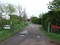
 'Private' road in West Lincolnshire - geograph.org.uk - 1031307.jpg 640 × 425; 43 KB
-
 2013 Transmission tower Long Bennington.jpg 4,608 × 3,456; 7.81 MB
-
 A lay-by on the A1 - geograph.org.uk - 3089638.jpg 800 × 600; 321 KB
-
 A lay-by on the A1 - geograph.org.uk - 3089641.jpg 800 × 600; 222 KB
-
 A1 - a look into Nottinghamshire - geograph.org.uk - 2645149.jpg 640 × 428; 85 KB
-
 A1 - bridge at Long Bennington - geograph.org.uk - 2645129.jpg 640 × 428; 70 KB
-
 A1 - junction for Long Bennington - geograph.org.uk - 2644466.jpg 640 × 428; 79 KB
-

-
 A1 - right turn to Dry Doddington - geograph.org.uk - 2645143.jpg 640 × 428; 68 KB
-
 A1 - Valley Lane bridge - geograph.org.uk - 2645135.jpg 640 × 428; 72 KB
-

-
 A1 enters Nottinghamshire - geograph.org.uk - 3450673.jpg 1,665 × 982; 825 KB
-
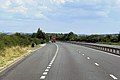
 A1 Foston Bypass - geograph.org.uk - 4216237.jpg 640 × 480; 246 KB
-
 A1 near Dry Doddington - geograph.org.uk - 3450684.jpg 1,620 × 949; 825 KB
-

-
 A1 northbound - geograph.org.uk - 2645140.jpg 640 × 428; 72 KB
-
 A1 northbound - geograph.org.uk - 3614637.jpg 2,256 × 1,504; 1.29 MB
-
 A1 northbound - geograph.org.uk - 5501336.jpg 640 × 428; 101 KB
-
 A1 northbound - geograph.org.uk - 5501340.jpg 640 × 428; 96 KB
-
 A1 northbound near Long Bennington - geograph.org.uk - 2927952.jpg 640 × 480; 55 KB
-
 A1 overbridge at Long Bennington - geograph.org.uk - 3192942.jpg 640 × 430; 34 KB
-
 A1 slip road to the Great North Road - geograph.org.uk - 5132865.jpg 640 × 481; 34 KB
-
 A1 south - geograph.org.uk - 3482730.jpg 640 × 427; 79 KB
-
 A1 southbound - geograph.org.uk - 359203.jpg 640 × 427; 44 KB
-
 A1 southbound approaching Fen Lane junction - geograph.org.uk - 3468308.jpg 1,716 × 928; 911 KB
-
 A1 Southbound near Doddington - geograph.org.uk - 3656623.jpg 640 × 480; 252 KB
-
 A1 southbound near Long Bennington - geograph.org.uk - 2927920.jpg 640 × 480; 59 KB
-
 A1 Southbound, Junction with Fen Lane - geograph.org.uk - 4216151.jpg 640 × 480; 250 KB
-
 A1 traffic - geograph.org.uk - 2974654.jpg 640 × 427; 90 KB
-
 A1 traffic - geograph.org.uk - 3482770.jpg 640 × 427; 109 KB
-
 A1, Long Bennington - geograph.org.uk - 2513220.jpg 640 × 430; 36 KB
-
 A1, Long Bennington turning - geograph.org.uk - 3192939.jpg 640 × 490; 39 KB
-
 A1, Long Bennington turning - geograph.org.uk - 3192948.jpg 640 × 395; 35 KB
-
 A1, northbound - geograph.org.uk - 3192946.jpg 640 × 430; 36 KB
-
 A1, northbound - geograph.org.uk - 3195165.jpg 640 × 430; 42 KB
-
 A1, northbound - geograph.org.uk - 3195168.jpg 640 × 430; 44 KB
-
 A1, northbound - geograph.org.uk - 3195173.jpg 640 × 430; 37 KB
-
-
 Agricultural merchants - geograph.org.uk - 2927955.jpg 640 × 480; 61 KB
-
 Authorpe Farm - geograph.org.uk - 2927930.jpg 640 × 372; 32 KB
-
 Authorpe Farm 2009 - geograph.org.uk - 1282197.jpg 640 × 480; 64 KB
-
 Barn in Long Bennington - geograph.org.uk - 2125090.jpg 1,024 × 768; 184 KB
-
 Barn on Fen Lane - geograph.org.uk - 2927968.jpg 640 × 480; 89 KB
-
 Beck Farm, Sewstern Lane near Foston - geograph.org.uk - 301193.jpg 640 × 480; 78 KB
-
 Bennington Fen - geograph.org.uk - 359247.jpg 640 × 427; 50 KB
-

-
 Church Street, Long Bennington - geograph.org.uk - 2928099.jpg 640 × 480; 75 KB
-
 Costa Hill - geograph.org.uk - 930012.jpg 640 × 427; 64 KB
-
 Costa Hill - geograph.org.uk - 930026.jpg 640 × 427; 71 KB
-
 Costa Row into Long Bennington - geograph.org.uk - 2927923.jpg 640 × 480; 53 KB
-
 Cottages in Long Bennington - geograph.org.uk - 2125104.jpg 1,024 × 768; 151 KB
-
 Cross Lane (track) - geograph.org.uk - 2927905.jpg 640 × 480; 61 KB
-
 Cross Lane - geograph.org.uk - 3482651.jpg 640 × 427; 79 KB
-
 Cross paths - geograph.org.uk - 3483059.jpg 640 × 427; 93 KB
-
 Cycle path beside the A1 southbound - geograph.org.uk - 2927979.jpg 640 × 480; 51 KB
-
 Drain near Middle Farm - geograph.org.uk - 6080349.jpg 1,024 × 768; 183 KB
-

-
 Ease Drain - geograph.org.uk - 4072049.jpg 3,776 × 2,520; 4.03 MB
-
 Eighteenth century house, Long Bennington - geograph.org.uk - 2908589.jpg 1,024 × 768; 173 KB
-
 Electricity pylon in the rain - geograph.org.uk - 2909597.jpg 768 × 1,024; 107 KB
-

-
 Farm building off Sewstern Lane - geograph.org.uk - 2928108.jpg 640 × 342; 37 KB
-
 Farm track and Electricity Pylon - geograph.org.uk - 2730066.jpg 1,280 × 960; 280 KB
-
 Farm track near Long Bennington - geograph.org.uk - 2927915.jpg 640 × 480; 78 KB
-
 Farm track near Middle Farm - geograph.org.uk - 6077134.jpg 1,024 × 768; 137 KB
-
 Farm track near the A1 - geograph.org.uk - 2927926.jpg 640 × 480; 103 KB
-
 Farm track near Witham Mill - geograph.org.uk - 6080328.jpg 1,024 × 768; 126 KB
-
 Farm track off Fen Lane - geograph.org.uk - 2927965.jpg 640 × 480; 76 KB
-
 Farm track off Fen Lane - geograph.org.uk - 2927971.jpg 640 × 480; 91 KB
-

-
 Farm track off the A1 - geograph.org.uk - 2927976.jpg 640 × 480; 83 KB
-
 Farm track on Bennington Fen - geograph.org.uk - 6074948.jpg 1,024 × 768; 147 KB
-
 Farm Track with Pylons beyond - geograph.org.uk - 2974724.jpg 640 × 444; 70 KB
-
 Farmland near Long Bennington - geograph.org.uk - 2927907.jpg 640 × 480; 34 KB
-
 Farmland near Long Bennington - geograph.org.uk - 2927913.jpg 640 × 480; 40 KB
-
 Farmland near Long Bennington - geograph.org.uk - 2928102.jpg 640 × 480; 97 KB
-
 Farmland near Long Bennington - geograph.org.uk - 301722.jpg 640 × 427; 80 KB
-
 Farmland near Normanton - geograph.org.uk - 1734839.jpg 640 × 480; 126 KB
-
 Farmland near Thackson's Well Farm - geograph.org.uk - 301629.jpg 640 × 427; 77 KB
-
 Farmland off Cross Lane - geograph.org.uk - 3482646.jpg 640 × 427; 138 KB
-
 Farmland off Fen Lane - geograph.org.uk - 2927964.jpg 640 × 480; 66 KB
-
 Farmland off Sewstern Lane - geograph.org.uk - 2928112.jpg 640 × 443; 35 KB
-
 Farmland off Valley Lane - geograph.org.uk - 2927959.jpg 640 × 480; 63 KB
-
 Farmland towards Fen Farm - geograph.org.uk - 2927973.jpg 640 × 480; 46 KB
-
 Farmland towards Long Bennington - geograph.org.uk - 2928096.jpg 1,024 × 692; 153 KB
-
 Fen Lane - geograph.org.uk - 2125535.jpg 1,024 × 768; 130 KB
-
 Fen Lane - geograph.org.uk - 2624766.jpg 640 × 428; 44 KB
-
 Fen Lane heading east - geograph.org.uk - 2927970.jpg 640 × 480; 89 KB
-
 Fen Lane heading north - geograph.org.uk - 2927967.jpg 640 × 480; 46 KB
-
 Fen Lane towards the A1 - geograph.org.uk - 2927975.jpg 640 × 480; 56 KB
-
 Field near Three Shire Oak - geograph.org.uk - 6089996.jpg 1,024 × 768; 165 KB
-
 Field of autumn sown cereal off Sewstern Lane - geograph.org.uk - 6077136.jpg 1,024 × 768; 180 KB
-
 Flyover - geograph.org.uk - 930034.jpg 640 × 427; 64 KB
-
 Flyover on A1 - geograph.org.uk - 5992158.jpg 1,024 × 576; 73 KB
-
 Folly Hill - geograph.org.uk - 2974641.jpg 640 × 427; 84 KB
-
 Footpath to Fen Lane - geograph.org.uk - 6074980.jpg 1,024 × 768; 165 KB
-
 Footpath to the county boundary - geograph.org.uk - 6074966.jpg 1,024 × 768; 213 KB
-
 Footpath to Valley Lane - geograph.org.uk - 6080336.jpg 1,024 × 768; 158 KB
-
 Foston by-pass (A1) - geograph.org.uk - 2928106.jpg 640 × 480; 42 KB
-

-
 Gate and derelict building off Sewerston Lane - geograph.org.uk - 2458786.jpg 1,024 × 727; 178 KB
-
 Grassy track and field edge - geograph.org.uk - 6077142.jpg 1,024 × 768; 183 KB
-
 Great North Road - geograph.org.uk - 2629583.jpg 640 × 480; 78 KB
-
 House in Long Bennington - geograph.org.uk - 2125098.jpg 1,024 × 768; 162 KB
-
 Humps and Bumps of Thorpe Parva - geograph.org.uk - 770916.jpg 640 × 480; 97 KB
-
 Industrial units on Fen Lane - geograph.org.uk - 2125550.jpg 1,024 × 768; 183 KB
-
 Lay By Near Doddington, Southbound A1 - geograph.org.uk - 3656603.jpg 640 × 480; 249 KB
-
 Lay-by near Long Bennington A1 south - geograph.org.uk - 1280386.jpg 640 × 467; 42 KB
-
 Layby on Southbound A1 - geograph.org.uk - 4216149.jpg 640 × 427; 212 KB
-
 Layby on the A1 near Doddington - geograph.org.uk - 3656628.jpg 640 × 480; 235 KB
-
-
 Long Bennington Road Junction ahead - geograph.org.uk - 2974733.jpg 640 × 407; 63 KB
-
 Long Bennington view - geograph.org.uk - 3482877.jpg 640 × 427; 114 KB
-
 Looking towards Long Bennington - geograph.org.uk - 2124580.jpg 1,024 × 768; 124 KB
-
 Looking towards White House Farm - geograph.org.uk - 2124585.jpg 1,024 × 768; 140 KB
-
 Main Road, Long Bennington - geograph.org.uk - 2927938.jpg 640 × 480; 81 KB
-
 Main Road, Long Bennington - geograph.org.uk - 4066740.jpg 3,776 × 2,520; 4.16 MB
-
 Main Road, Long Bennington - geograph.org.uk - 4972574.jpg 1,024 × 682; 195 KB
-
 Main Road, Long Bennington - geograph.org.uk - 5132870.jpg 640 × 480; 52 KB
-
 Main Road, Long Bennington - geograph.org.uk - 5132871.jpg 640 × 480; 56 KB
-
 Marshall Way eastwards - geograph.org.uk - 2634576.jpg 640 × 495; 73 KB
-
 Marshall Way towards Long Bennington - geograph.org.uk - 2928097.jpg 640 × 480; 46 KB
-
 Marshall Way westwards - geograph.org.uk - 2634577.jpg 640 × 442; 58 KB
-
 Middle Farm - geograph.org.uk - 6080359.jpg 1,024 × 768; 99 KB
-
 Moor Lane (track) - geograph.org.uk - 2927960.jpg 640 × 480; 58 KB
-
 Moor Lane - geograph.org.uk - 2893239.jpg 1,024 × 768; 182 KB
-
 Moor Lane - geograph.org.uk - 2893248.jpg 1,024 × 768; 225 KB
-
 Moor Lane - geograph.org.uk - 3483715.jpg 640 × 427; 101 KB
-
 Moor Lane heading west - geograph.org.uk - 2927932.jpg 640 × 480; 43 KB
-

-
 Oilseed rape crop off Sewstern Lane - geograph.org.uk - 2928124.jpg 640 × 480; 62 KB
-
 Old route of the Great North Road - geograph.org.uk - 6077132.jpg 1,024 × 768; 174 KB
-
 One Big Pylon - geograph.org.uk - 239839.jpg 480 × 640; 69 KB
-
 Ordnance Survey Cut Mark - geograph.org.uk - 3169550.jpg 3,264 × 2,448; 1.7 MB
-
 Ordnance Survey Cut Mark with Bolt - geograph.org.uk - 3169567.jpg 3,264 × 2,448; 2.42 MB
-
 Overbridge at Long Bennington, A1 - geograph.org.uk - 3192947.jpg 640 × 430; 38 KB
-
 Overbridge near Long Bennington, A1 - geograph.org.uk - 2513212.jpg 640 × 406; 28 KB
-
 Plantation and Scrub - geograph.org.uk - 2894123.jpg 1,024 × 768; 303 KB
-
 Pond off Sewstern Lane - geograph.org.uk - 2928123.jpg 640 × 480; 139 KB
-
 Power line and irrigation ponds - geograph.org.uk - 6080364.jpg 1,024 × 768; 116 KB
-
 Power line near Long Bennington - geograph.org.uk - 6080897.jpg 1,024 × 768; 145 KB
-

-
 Private track near Thackson's Well Farm - geograph.org.uk - 6077139.jpg 1,024 × 768; 137 KB
-
 Pylon by the A1 - geograph.org.uk - 3195162.jpg 640 × 348; 29 KB
-
 Pylons across farmland - geograph.org.uk - 301618.jpg 427 × 640; 93 KB
-
 Pylons and Van - geograph.org.uk - 239838.jpg 640 × 480; 66 KB
-
 Pylons crossing A1 - geograph.org.uk - 4214589.jpg 640 × 480; 41 KB
-
 Pylons crossing the A1 - geograph.org.uk - 2513231.jpg 640 × 430; 33 KB
-
 Pylons taking power south - geograph.org.uk - 407067.jpg 640 × 480; 59 KB
-
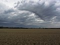
 Rainbow over the Westborough Road - geograph.org.uk - 770907.jpg 480 × 640; 95 KB
-
 River Witham - geograph.org.uk - 3304670.jpg 2,256 × 1,504; 987 KB
-
 River Witham - geograph.org.uk - 3483012.jpg 640 × 427; 98 KB
-
 River Witham - geograph.org.uk - 3483067.jpg 640 × 427; 125 KB
-
 River Witham - geograph.org.uk - 929994.jpg 640 × 427; 92 KB
-
 River Witham, Long Bennington - geograph.org.uk - 2927942.jpg 640 × 480; 86 KB
-

-
 Road towards Long Bennington - geograph.org.uk - 2927910.jpg 640 × 480; 70 KB
-
 Sewstern Lane (track) heading south - geograph.org.uk - 2928128.jpg 640 × 480; 67 KB
-
 Sewstern Lane - 1 - geograph.org.uk - 4072017.jpg 3,776 × 2,520; 3.37 MB
-
 Sewstern Lane - 2 - geograph.org.uk - 4072086.jpg 3,776 × 2,520; 4.12 MB
-
 Sewstern Lane - geograph.org.uk - 3482627.jpg 640 × 427; 84 KB
-
 Sewstern Lane - geograph.org.uk - 3562589.jpg 640 × 427; 75 KB
-
 Sewstern Lane - geograph.org.uk - 6077138.jpg 1,024 × 768; 125 KB
-
 Sewstern Lane heading south - geograph.org.uk - 2928110.jpg 640 × 480; 56 KB
-
 Sewstern Lane heading south - geograph.org.uk - 2928115.jpg 640 × 480; 46 KB
-
 Sewstern Lane heading south - geograph.org.uk - 2928120.jpg 640 × 480; 101 KB
-
 Sewstern Lane near Allington - geograph.org.uk - 180158.jpg 640 × 427; 119 KB
-
 Sewstern Lane near Foston - geograph.org.uk - 301227.jpg 640 × 427; 62 KB
-
 Sewstern Lane, Long Bennington - geograph.org.uk - 2099541.jpg 640 × 478; 190 KB
-
 Sheep in the rain - geograph.org.uk - 2909583.jpg 1,024 × 768; 125 KB
-
 Shelter from the wind - geograph.org.uk - 2909580.jpg 1,024 × 768; 131 KB
-
 Shire Dyke - geograph.org.uk - 2629568.jpg 640 × 480; 134 KB
-
 Shire Dyke looking east - geograph.org.uk - 6074938.jpg 1,024 × 768; 162 KB
-
 Shire Dyke looking west - geograph.org.uk - 6074939.jpg 1,024 × 768; 143 KB
-
 Sienna's, Long Bennington - geograph.org.uk - 2125112.jpg 1,024 × 768; 122 KB
-
 Snowy fields near the A1 - geograph.org.uk - 3304683.jpg 2,256 × 1,504; 2.39 MB
-
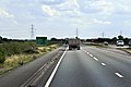
 Southbound A1 - geograph.org.uk - 4216157.jpg 640 × 427; 214 KB
-
 Southbound A1 near Doddington - geograph.org.uk - 3656619.jpg 640 × 480; 241 KB
-

-
-
 Southbound A1, Lincolnshire - geograph.org.uk - 4216147.jpg 640 × 427; 216 KB
-
 St James village hall Long Bennington - geograph.org.uk - 819381.jpg 640 × 480; 44 KB
-
 Storage at Witham Mill - geograph.org.uk - 6080333.jpg 1,024 × 768; 154 KB
-
 Storage hopper - geograph.org.uk - 3483720.jpg 640 × 427; 76 KB
-
-
 Thackson's Well Farm - geograph.org.uk - 301592.jpg 640 × 427; 93 KB
-
 The A1 heading north - geograph.org.uk - 2513226.jpg 640 × 430; 25 KB
-
 The beginning to the footpath to Foston - geograph.org.uk - 2909604.jpg 1,024 × 768; 201 KB
-
 The River Witham - geograph.org.uk - 301643.jpg 640 × 427; 78 KB
-
 The River Witham along the east edge of Long Bennington - geograph.org.uk - 4066746.jpg 3,776 × 2,520; 4.17 MB
-
 The track into Bennington Fen - geograph.org.uk - 2125542.jpg 1,024 × 768; 202 KB
-
 The Viking Way crossing the River Witham at Long Bennington - geograph.org.uk - 3983242.jpg 3,776 × 2,520; 4.22 MB
-
 The Viking Way near Allington - geograph.org.uk - 180183.jpg 640 × 427; 126 KB
-
 Track into the mist - geograph.org.uk - 6074974.jpg 1,024 × 768; 111 KB
-
 Track to Fen Farm - geograph.org.uk - 6074950.jpg 1,024 × 768; 113 KB
-
 Track to Fen Farm - geograph.org.uk - 6074958.jpg 1,024 × 768; 137 KB
-
 Track to Middle Farm - geograph.org.uk - 2927958.jpg 640 × 480; 56 KB
-
 Track to Willow Tree Farm - geograph.org.uk - 2927969.jpg 640 × 480; 68 KB
-
 Track to Willow Tree Farm - geograph.org.uk - 6074955.jpg 1,024 × 768; 140 KB
-
 Track towards The Ashes - geograph.org.uk - 2928118.jpg 640 × 480; 77 KB


_-_geograph.org.uk_-_2927905.jpg)


_-_geograph.org.uk_-_2928106.jpg)


_-_geograph.org.uk_-_2927960.jpg)


_heading_south_-_geograph.org.uk_-_2928128.jpg)


