Category:Lochcarron (civil parish)
Jump to navigation
Jump to search
Scottish parish in Highland, Scotland, UK | |||||
| Upload media | |||||
| Instance of | |||||
|---|---|---|---|---|---|
| Named after | |||||
| Location |
| ||||
| Population |
| ||||
| Area |
| ||||
 | |||||
Subcategories
This category has the following 8 subcategories, out of 8 total.
A
- Achintraid (17 F)
- Ardaneaskan (20 F)
B
- Balnacra (48 F)
L
- Lochcarron (76 F)
S
- Strathan, Ross and Cromarty (5 F)
Media in category "Lochcarron (civil parish)"
The following 200 files are in this category, out of 2,158 total.
(previous page) (next page)-

-

-
 A bend in the track to Coire na h-Eilde - geograph.org.uk - 3484737.jpg 1,024 × 768; 281 KB
-
 A bridge on the Coulin pass - geograph.org.uk - 2335349.jpg 1,600 × 1,072; 694 KB
-
 A burn on the lip of the coire - geograph.org.uk - 4672110.jpg 1,142 × 857; 515 KB
-
 A cluster of lochans - geograph.org.uk - 4598828.jpg 1,024 × 768; 156 KB
-
 A corner of the Water Gardens, Attadale - geograph.org.uk - 5401093.jpg 1,600 × 1,066; 689 KB
-
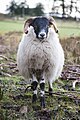 A curious sheep - geograph.org.uk - 4884708.jpg 427 × 640; 297 KB
-

-
 A gully line above Strath Carron - geograph.org.uk - 2945724.jpg 530 × 800; 146 KB
-
 A long plod uphill - geograph.org.uk - 4660063.jpg 1,142 × 857; 409 KB
-
 A new deer fence - geograph.org.uk - 4670949.jpg 1,142 × 857; 443 KB
-

-
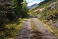
 A section of road (A890) between Glencarron Lodge and Craig - geograph.org.uk - 6263382.jpg 4,000 × 3,000; 3.27 MB
-
-
 A slice through glacial debris - geograph.org.uk - 2944841.jpg 800 × 530; 150 KB
-
 A small lochan - geograph.org.uk - 4672120.jpg 1,142 × 857; 524 KB
-
 A small lochan in Glen Torridon - geograph.org.uk - 3379492.jpg 640 × 427; 301 KB
-
 A station with a view, Achnashellach - geograph.org.uk - 2410808.jpg 800 × 530; 214 KB
-
 A steep descent at Attadale - geograph.org.uk - 3885181.jpg 606 × 800; 149 KB
-
 A stretch of minor road between Blackwood and Arineckaig - geograph.org.uk - 6263445.jpg 4,000 × 3,000; 4.43 MB
-
 A summit cairn of Moruisg - geograph.org.uk - 3214963.jpg 640 × 360; 204 KB
-
 A waterfall in Easan Geal - geograph.org.uk - 2411753.jpg 530 × 800; 210 KB
-
 A worthy tramp - geograph.org.uk - 2510279.jpg 640 × 480; 179 KB
-
 A890 above Achnashellach Lodge - geograph.org.uk - 2482144.jpg 3,648 × 2,736; 1.38 MB
-
 A890 above Cuddies Point - geograph.org.uk - 5985537.jpg 1,024 × 683; 315 KB
-
 A890 above the head of Loch Carron - geograph.org.uk - 3523944.jpg 637 × 750; 68 KB
-
 A890 along Strath Carron - geograph.org.uk - 4557809.jpg 640 × 480; 70 KB
-
 A890 and Beinn na Feusaige, Glen Carron - geograph.org.uk - 5780735.jpg 1,600 × 1,060; 385 KB
-
 A890 at Craig - geograph.org.uk - 3241387.jpg 3,456 × 4,608; 5.03 MB
-
 A890 crossing Allt an Fhrangaich - geograph.org.uk - 5277849.jpg 800 × 600; 112 KB
-
 A890 enters Balnacra - geograph.org.uk - 2482108.jpg 3,641 × 2,531; 865 KB
-
 A890 Glen Carron - geograph.org.uk - 4098775.jpg 800 × 600; 167 KB
-
 A890 level-crossing at Balnacra - geograph.org.uk - 2482121.jpg 3,453 × 2,576; 1.12 MB
-
 A890 near Achnashellach - geograph.org.uk - 4709053.jpg 800 × 600; 150 KB
-
 A890 near Balnacra - geograph.org.uk - 3359831.jpg 4,608 × 3,456; 4.84 MB
-
 A890 near Craig - geograph.org.uk - 6073132.jpg 1,024 × 643; 120 KB
-
 A890 north of Glencarron Lodge - geograph.org.uk - 6075520.jpg 1,024 × 768; 109 KB
-
 A890 passing Glencarron Lodge - geograph.org.uk - 3992407.jpg 1,500 × 1,032; 1.31 MB
-
 A890 railway bridge near Achnashellach - geograph.org.uk - 2482149.jpg 3,648 × 2,736; 2.87 MB
-
 A890 road and railway, by Loch Carron - geograph.org.uk - 4921763.jpg 2,971 × 2,000; 1.96 MB
-
 A890 road below steep slopes, by Loch Carron - geograph.org.uk - 4922015.jpg 2,100 × 2,560; 1.92 MB
-
 A890 towards Achnashellach - geograph.org.uk - 3523986.jpg 750 × 540; 63 KB
-
 A890 under Beinn na Feusaige - geograph.org.uk - 4532303.jpg 2,816 × 2,112; 2.35 MB
-
 A890, Glen Carron - geograph.org.uk - 5986236.jpg 1,024 × 683; 244 KB
-
 A890, Glen Carron - geograph.org.uk - 6073744.jpg 1,024 × 576; 87 KB
-
 A890, Glen Carron - geograph.org.uk - 6075183.jpg 1,024 × 768; 211 KB
-
 A890, Glen Carron - geograph.org.uk - 6078988.jpg 1,024 × 768; 129 KB
-
 A896 above Lochcarron - geograph.org.uk - 2482036.jpg 3,593 × 2,551; 1.08 MB
-

-
 A896 by Glen Mòr - geograph.org.uk - 3859476.jpg 800 × 600; 91 KB
-
 A896 goes through Lochcarron - geograph.org.uk - 2482048.jpg 3,648 × 2,736; 1.47 MB
-
 A896 goes through Lochcarron - geograph.org.uk - 2482058.jpg 3,374 × 2,270; 940 KB
-
 A896 goes through Lochcarron - geograph.org.uk - 2482065.jpg 3,644 × 2,559; 1.21 MB
-
 A896 on eastern side of Kishorn Estuary - geograph.org.uk - 2482019.jpg 3,648 × 2,736; 1.47 MB
-
 A896 to Kishorn - geograph.org.uk - 2912592.jpg 1,200 × 803; 312 KB
-
 Abhainn Cumhang a Ghlinne at Achintraid bridge - geograph.org.uk - 6191967.jpg 752 × 1,024; 327 KB
-
 Abhainn Cumhang a' Ghlinne - geograph.org.uk - 3961056.jpg 1,024 × 686; 242 KB
-
 Abhainn Dearg in Srath a’ Bhàthaich - geograph.org.uk - 4393414.jpg 800 × 600; 106 KB
-
 Above Allt a’ Chonais - geograph.org.uk - 4593293.jpg 1,600 × 1,200; 1,005 KB
-
 Above Loch Sgùrr na Feartaig - geograph.org.uk - 4672020.jpg 1,142 × 857; 422 KB
-
 Above the Allt Mòr a’ Bearnais - geograph.org.uk - 4673357.jpg 1,142 × 857; 486 KB
-
 Above the gorge of the Alltan na Feola - geograph.org.uk - 5362890.jpg 1,469 × 1,102; 813 KB
-
 Access road at Craig - geograph.org.uk - 3993021.jpg 1,500 × 1,125; 2.27 MB
-
 Access road for hydro construction, Attadale - geograph.org.uk - 5398288.jpg 1,600 × 1,060; 421 KB
-
 Access road to car park - geograph.org.uk - 3993007.jpg 1,500 × 1,125; 2.06 MB
-
 Access to Portnacrich - geograph.org.uk - 1357019.jpg 640 × 480; 330 KB
-
 Access under the railway - geograph.org.uk - 5362869.jpg 1,469 × 1,102; 755 KB
-
 Achadh na Seileach - geograph.org.uk - 5986181.jpg 1,024 × 683; 220 KB
-
 Achintee - geograph.org.uk - 1777355.jpg 640 × 480; 169 KB
-
 Achintee and Loch Carron - geograph.org.uk - 2945661.jpg 800 × 530; 126 KB
-
 Achintee and Strath Carron - geograph.org.uk - 1981740.jpg 1,000 × 522; 455 KB
-

-
 Achintee path and Loch na Biodaig - geograph.org.uk - 2946561.jpg 800 × 530; 124 KB
-
 Achintee road junction, Strathcarron - geograph.org.uk - 2945628.jpg 800 × 530; 150 KB
-
 Achintrade - geograph.org.uk - 3961086.jpg 1,280 × 857; 1.1 MB
-
-
 Achnashellach Forest track - geograph.org.uk - 4509973.jpg 800 × 532; 144 KB
-
 Achnashellach Forest track - geograph.org.uk - 4509997.jpg 800 × 532; 199 KB
-
 Achnashellach Lodge - geograph.org.uk - 4098763.jpg 800 × 600; 115 KB
-
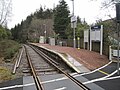
 Achnashellach Railway Station - geograph.org.uk - 4557767.jpg 640 × 480; 121 KB
-
 Achnashellach Railway Station on the 'Kyle Line' - geograph.org.uk - 6263422.jpg 4,000 × 3,000; 4.34 MB
-
 Achnashellach railway station, Highland - geograph.org.uk - 4413961.jpg 1,600 × 1,200; 471 KB
-
 Achnashellach Station - geograph.org.uk - 4506854.jpg 800 × 532; 186 KB
-
 Across boggy ground - geograph.org.uk - 4670974.jpg 1,142 × 857; 490 KB
-
 Across head-waters of Loch Carron above Attadale, 1994 - geograph.org.uk - 4758195.jpg 2,423 × 1,521; 3.41 MB
-
 Across Loch Kishorn - geograph.org.uk - 5782796.jpg 1,600 × 1,060; 530 KB
-
 Across the lower slopes of Sgùrr na Feartaig - geograph.org.uk - 4670954.jpg 1,142 × 857; 421 KB
-
 Aftermath of forestry operations above Loch Dughaill - geograph.org.uk - 2482133.jpg 3,648 × 2,736; 1.77 MB
-
 Agricultural building at Coulags - geograph.org.uk - 2211018.jpg 640 × 480; 93 KB
-
 Agricultural building at Loan - geograph.org.uk - 1865900.jpg 640 × 480; 81 KB
-

-

-
 Allt a' Chaile entering Loch Carron near Kirkton - geograph.org.uk - 6263436.jpg 4,000 × 3,000; 3.19 MB
-
 Allt a' Chaile, Kirkton Wood - geograph.org.uk - 3481863.jpg 1,024 × 768; 361 KB
-
 Allt a' Chnoic Ghlais - geograph.org.uk - 1247503.jpg 640 × 480; 111 KB
-
 Allt a' Choire Odhair - geograph.org.uk - 4485708.jpg 1,024 × 678; 240 KB
-
 Allt a' Choire Odhair - geograph.org.uk - 4486558.jpg 1,024 × 678; 218 KB
-
 Allt a' Chonais - geograph.org.uk - 1581332.jpg 640 × 480; 124 KB
-
 Allt a' Chonais - geograph.org.uk - 1581439.jpg 640 × 480; 192 KB
-
 Allt a' Chonais - geograph.org.uk - 3993292.jpg 1,500 × 1,000; 1.54 MB
-
 Allt a' Chonais - geograph.org.uk - 4234984.jpg 751 × 1,024; 220 KB
-
 Allt a' Ghiubhais, Attadale (2) - geograph.org.uk - 4946477.jpg 1,024 × 678; 229 KB
-
 Allt a' Ghiubhais, Attadale - geograph.org.uk - 4946473.jpg 1,024 × 678; 225 KB
-
 Allt a'Chonais valley - geograph.org.uk - 1873350.jpg 2,272 × 1,704; 760 KB
-
 Allt a'Ghiubhais, Attadale - geograph.org.uk - 4946381.jpg 1,024 × 678; 299 KB
-
 Allt Achadh Beinne Leithe - geograph.org.uk - 4508076.jpg 800 × 532; 150 KB
-
 Allt an Fhithich - geograph.org.uk - 1565867.jpg 640 × 480; 171 KB
-
 Allt an Fhrangaich - geograph.org.uk - 4557874.jpg 480 × 640; 102 KB
-
 Allt an t-Sagairt - geograph.org.uk - 3768337.jpg 1,024 × 691; 232 KB
-
 Allt an t-Searraich - geograph.org.uk - 5387706.jpg 1,024 × 768; 199 KB
-
 Allt a’ Chùirn - geograph.org.uk - 4592088.jpg 1,600 × 1,200; 801 KB
-
 Allt Coire a' Bhàinidh, Achnashellach Forest - geograph.org.uk - 3484718.jpg 1,024 × 768; 250 KB
-
 Allt Coire Crubaidh - geograph.org.uk - 5780756.jpg 1,600 × 1,060; 610 KB
-
 Allt Coire Crubaidh has a new crossing - geograph.org.uk - 2338482.jpg 1,600 × 1,200; 630 KB
-
 Allt Coire Làir - geograph.org.uk - 4003455.jpg 1,500 × 1,125; 1.36 MB
-
 Allt Coire nan Cadhan - geograph.org.uk - 2867759.jpg 426 × 640; 72 KB
-
 Allt Feithe Chaillich - geograph.org.uk - 2948919.jpg 800 × 530; 165 KB
-
 Allt Feithe Chaillich - geograph.org.uk - 4485745.jpg 1,024 × 678; 283 KB
-
 Allt Feithe Chaillich joining Uisge Dubh - geograph.org.uk - 1569822.jpg 640 × 480; 170 KB
-
 Allt Fhearchair - geograph.org.uk - 5781547.jpg 1,600 × 1,060; 606 KB
-
 Allt Frianach - geograph.org.uk - 3256701.jpg 1,500 × 1,125; 1.43 MB
-
 Allt Garadh Ailein - geograph.org.uk - 2946542.jpg 800 × 530; 167 KB
-
 Allt Loch na Bruthaich Ruaidh - geograph.org.uk - 4588542.jpg 1,600 × 1,200; 846 KB
-
 Allt Loch na Caillich - geograph.org.uk - 863417.jpg 640 × 480; 147 KB
-
 Allt Lochain Ghobhlaich - geograph.org.uk - 5017988.jpg 1,024 × 768; 231 KB
-

-
 Allt Lochan Caoin a' Chabair - geograph.org.uk - 1568613.jpg 640 × 480; 192 KB
-
 Allt Mnatha Luadhadair - geograph.org.uk - 4588663.jpg 1,600 × 1,200; 932 KB
-
 Allt na Coiile - geograph.org.uk - 1565794.jpg 640 × 480; 184 KB
-
 Allt na Luib - geograph.org.uk - 2335430.jpg 1,600 × 1,200; 782 KB
-
 Allt na Luib - geograph.org.uk - 2335441.jpg 1,600 × 923; 471 KB
-
 Allt na Luib - geograph.org.uk - 3697544.jpg 768 × 1,024; 325 KB
-
 Allt nan Carnan - geograph.org.uk - 3481828.jpg 1,024 × 768; 216 KB
-
 Allt Slochd na Pein - geograph.org.uk - 1552935.jpg 480 × 640; 127 KB
-
 Allt Slochd na Pein waterfall - geograph.org.uk - 1563509.jpg 480 × 640; 237 KB
-
 Allt Torr nan Daoine - geograph.org.uk - 2948023.jpg 640 × 360; 209 KB
-
 Along the last bit of the ridge - geograph.org.uk - 4672092.jpg 857 × 1,142; 414 KB
-
 Along the path from Bealach Ban to Bealach na Lice - geograph.org.uk - 5685433.jpg 5,472 × 3,648; 3.96 MB
-
 An Argocat track - geograph.org.uk - 4670941.jpg 857 × 1,142; 607 KB
-
 An assortment of vehicles - geograph.org.uk - 2304802.jpg 640 × 480; 96 KB
-
 An old deer fence - geograph.org.uk - 4670951.jpg 1,142 × 857; 403 KB
-
 An Ruadh-Stac from Attadale - geograph.org.uk - 5398862.jpg 1,600 × 1,060; 308 KB
-
 An Ruadh-stac towards Loch a’ Mhadaidh Ruadh - geograph.org.uk - 4588568.jpg 1,600 × 1,200; 999 KB
-
 An Sgurr from Achintraid - geograph.org.uk - 5782800.jpg 1,600 × 1,060; 639 KB
-
 Ancient logging truck - geograph.org.uk - 2138170.jpg 640 × 480; 233 KB
-
 Ancient logging truck near Acnashellach - geograph.org.uk - 2138175.jpg 640 × 480; 244 KB
-
 Another new arrival, Strome Carronach. - geograph.org.uk - 1277155.jpg 480 × 640; 185 KB
-

-
 Approaching Bealach na Lice - geograph.org.uk - 4511977.jpg 800 × 532; 152 KB
-
 Approaching Coire Fionnarach Bothy - geograph.org.uk - 4019027.jpg 500 × 333; 68 KB
-
 Approaching Coire Lair - geograph.org.uk - 5399175.jpg 1,600 × 1,060; 451 KB
-
 Approaching Coire Làir - geograph.org.uk - 2404765.jpg 1,000 × 661; 293 KB
-
 Approaching Strathcarron - geograph.org.uk - 2712274.jpg 1,280 × 856; 134 KB
-
 Approaching the Bealach a' Choire Ghairbh - geograph.org.uk - 4947773.jpg 1,024 × 678; 235 KB
-
 Approaching the Bealach na Lice - geograph.org.uk - 4948984.jpg 1,024 × 678; 229 KB
-

-

-
 Approaching the summit cairn - geograph.org.uk - 4672029.jpg 1,142 × 857; 441 KB
-
-
 Ardaneaskan - geograph.org.uk - 4127487.jpg 4,608 × 3,456; 4.5 MB
-
 Ardaneaskan seen across Loch Carron - geograph.org.uk - 6046889.jpg 1,600 × 900; 318 KB
-
 Ardarroch - geograph.org.uk - 3961046.jpg 1,024 × 686; 247 KB
-
 Ardarroch and Loch Kishorn - geograph.org.uk - 4127501.jpg 4,608 × 3,456; 4.95 MB
-

-
 Ardarroch, from the road into the villages - geograph.org.uk - 3217593.jpg 1,024 × 576; 153 KB
-
 Argocat track above Craig - geograph.org.uk - 4670946.jpg 1,142 × 857; 582 KB
-
 Arinackaig abandoned croft - geograph.org.uk - 1552938.jpg 640 × 480; 170 KB
-
 Arineckaig - geograph.org.uk - 1565842.jpg 640 × 480; 173 KB
-
 Arineckaig - geograph.org.uk - 1565850.jpg 640 × 480; 159 KB
-

-
 At the Bealach a' Choire Ghairbh - geograph.org.uk - 4947782.jpg 1,024 × 678; 201 KB
-
 At the bealach between Coire Lair and Coire Grannda - geograph.org.uk - 5078392.jpg 1,600 × 1,200; 549 KB
-
 At the ford on the Ling Hut track - geograph.org.uk - 5078598.jpg 1,600 × 1,200; 891 KB
-
 At the head of Coire Lair - geograph.org.uk - 5078325.jpg 1,600 × 1,200; 872 KB
-
 At the top of one of the gorges - geograph.org.uk - 5365419.jpg 1,224 × 1,632; 700 KB
-
 Attadale - geograph.org.uk - 4510183.jpg 800 × 532; 96 KB
-
 Attadale from the south - geograph.org.uk - 5398840.jpg 1,600 × 1,060; 337 KB
-
 Attadale from the southwest - geograph.org.uk - 5398830.jpg 1,600 × 1,060; 495 KB
-
 Attadale Gardens - geograph.org.uk - 2565063.jpg 640 × 480; 133 KB
-
 Attadale Gardens - geograph.org.uk - 2565068.jpg 640 × 480; 127 KB
-
 Attadale Gardens - geograph.org.uk - 2565091.jpg 480 × 640; 104 KB
-
 Attadale Gardens - geograph.org.uk - 5781198.jpg 1,280 × 850; 790 KB
-
 Attadale House - geograph.org.uk - 2565053.jpg 640 × 480; 96 KB
-
 Attadale House - geograph.org.uk - 2949479.jpg 800 × 530; 136 KB
-
 Attadale House - geograph.org.uk - 4510117.jpg 800 × 532; 134 KB
-
 Attadale House and gardens - geograph.org.uk - 4498543.jpg 800 × 600; 147 KB
-
 Attadale House and gardens - geograph.org.uk - 5398318.jpg 1,600 × 1,066; 614 KB
-
 Attadale House from the southeast - geograph.org.uk - 5398313.jpg 1,600 × 1,066; 423 KB
-
 Attadale Railway Station - geograph.org.uk - 4557837.jpg 480 × 640; 119 KB
-
 Attadale railway station, Highland - geograph.org.uk - 4413970.jpg 1,600 × 1,200; 436 KB
-
 Attadale station - geograph.org.uk - 4499740.jpg 800 × 600; 122 KB
-
 Attadale Station, Kyle - Inverness line - geograph.org.uk - 2412884.jpg 800 × 530; 181 KB
-
 Attadale Track - geograph.org.uk - 2323090.jpg 3,456 × 2,304; 897 KB
-
 Autumn birches - geograph.org.uk - 1279112.jpg 640 × 544; 112 KB
-
 Autumn colours in Strath Carron - geograph.org.uk - 3219273.jpg 640 × 478; 87 KB
-
 Avalanche shelter - geograph.org.uk - 1094553.jpg 640 × 456; 68 KB
-
 Avalanche Shelter A890 by Loch Carron - geograph.org.uk - 3267866.jpg 2,005 × 1,206; 814 KB
-
 Avalanche Shelter on the A890 - geograph.org.uk - 2954504.jpg 1,200 × 803; 249 KB
-
 Avalanche shelter on the A890 - geograph.org.uk - 4476375.jpg 800 × 584; 104 KB


_between_Glencarron_Lodge_and_Craig_-_geograph.org.uk_-_6263387.jpg)
_between_Glencarron_Lodge_and_Craig_-_geograph.org.uk_-_6263382.jpg)


_-_geograph.org.uk_-_4946477.jpg)


&filefrom=Avalanche+shelter+on+the+A890+-+geograph.org.uk+-+4526867.jpg#mw-category-media)