Category:Loch Leòdamais
Jump to navigation
Jump to search
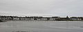
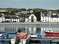
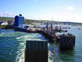
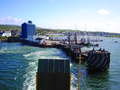
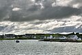
Loch Leòdamais is the semi-circular inner harbor of Port Ellen, Islay. Being open to Kilnaughton Bay, which is open to the Atlantic, it is a sea loch, though well protected. Around its perimeter runs Frederick Crescent, a street of Port Ellen.
Media in category "Loch Leòdamais"
The following 21 files are in this category, out of 21 total.
-
 Ard Foreshore - geograph.org.uk - 1151143.jpg 640 × 427; 39 KB
-

-
 Fishing boats at Port Ellen - geograph.org.uk - 935059.jpg 640 × 410; 94 KB
-

-
 Picnic table, Port Ellen - geograph.org.uk - 1012870.jpg 640 × 359; 66 KB
-
 Port Ellen - geograph.org.uk - 755194.jpg 640 × 244; 19 KB
-
 Port Ellen at Sunset - geograph.org.uk - 1143683.jpg 640 × 426; 53 KB
-
 Port Ellen Ferry Terminal - geograph.org.uk - 470125.jpg 640 × 480; 97 KB
-
 Port Ellen of Islay.jpg 400 × 300; 60 KB
-
 Port Ellen, Islay - geograph.org.uk - 935064.jpg 640 × 430; 100 KB
-
 Port Ellen, Islay.jpg 640 × 475; 131 KB
-
 Port Ellen, Loch Leòdamais - geograph.org.uk - 920006.jpg 640 × 480; 120 KB
-
 Port Ellen, MV Locheil garden - geograph.org.uk - 919996.jpg 640 × 480; 103 KB
-
 Port ellen-islay.jpg 2,000 × 1,500; 3.76 MB
-
 Port Ellen-Islay.tif 5,055 × 3,791; 73.66 MB
-
 Rocks in Loch Leodamais - geograph.org.uk - 1852930.jpg 640 × 480; 96 KB
-
 The Ard - geograph.org.uk - 1012894.jpg 640 × 359; 51 KB
-

-
 The pontoons at Port Ellen in winter - geograph.org.uk - 322768.jpg 640 × 430; 96 KB
-
 View of Port Ellen from ferry.jpg 4,310 × 2,868; 11.02 MB
-


