Category:Locator maps of traditional districts of Scotland (purple scheme)
Jump to navigation
Jump to search
Media in category "Locator maps of traditional districts of Scotland (purple scheme)"
The following 18 files are in this category, out of 18 total.
-
 Annadales Historical Map.png 368 × 456; 16 KB
-
 Atholl 28district29-1.png 368 × 456; 17 KB
-
 Badenoch (district).png 368 × 456; 17 KB
-
 Buchan (district).png 368 × 456; 17 KB
-
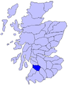
 Carrick (district).PNG 368 × 456; 17 KB
-
 Clydesdale (district).PNG 368 × 456; 17 KB
-
 Cunninghame (district).PNG 387 × 464; 17 KB
-
 Kyle (district).PNG 368 × 456; 17 KB
-
 Lennox (district).PNG 368 × 456; 17 KB
-
 Liddesdale (district).PNG 368 × 456; 17 KB
-
 Lochaber (district).PNG 368 × 456; 17 KB
-
 Lorne (district).PNG 368 × 456; 17 KB
-
 Mar (historical district).PNG 368 × 456; 17 KB
-
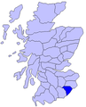
 The Mearns (district).PNG 368 × 456; 17 KB
-
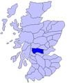 Menteith (district).PNG 368 × 456; 17 KB
-
 Nithsdale (district).PNG 368 × 456; 17 KB
-
 Ross (district).PNG 368 × 456; 17 KB
-
 Strathearn (district).PNG 368 × 456; 17 KB


.png)
.png)
.PNG)
.PNG)
.PNG)
.PNG)
.PNG)
.PNG)
.PNG)
.PNG)
.PNG)
.PNG)
.PNG)
.PNG)
.PNG)
.PNG)