Category:Locator maps of the Northern Territory
Jump to navigation
Jump to search
Media in category "Locator maps of the Northern Territory"
The following 117 files are in this category, out of 117 total.
-
 Aus NT map.png 328 × 352; 25 KB
-
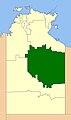
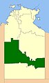
 Barkly location map in Northern Territory.PNG 762 × 1,010; 45 KB
-
 Barrow creek location map in Northern Territory.PNG 762 × 1,010; 45 KB
-
 Blank nt location map in Northern Territory.png 762 × 1,010; 42 KB
-
 Borroloola location map in Northern Territory.PNG 762 × 1,010; 45 KB
-
 Buntime Highway.png 452 × 599; 140 KB
-
 Cape crawford location map in Northern Territory.PNG 762 × 1,010; 45 KB
-
 Daly waters location map in Northern Territory.PNG 762 × 1,010; 45 KB
-
 Darwin city2LGA.png 250 × 327; 13 KB
-
 Darwin cityLGA.JPG 250 × 327; 15 KB
-
 Darwin, Australie.png 452 × 599; 108 KB
-
 Erldunda location map in Northern Territory.PNG 762 × 1,010; 45 KB
-
 Harts range location map in Northern Territory.PNG 762 × 1,010; 45 KB
-
 Jabiru location map in Northern Territory.PNG 762 × 1,010; 45 KB
-
 Kalkirindji location map in Northern Territory.PNG 762 × 1,010; 45 KB
-
 Katherine location map in Northern Territory.PNG 762 × 1,010; 45 KB
-
 Kulgera location map in Northern Territory.PNG 762 × 1,010; 45 KB
-
 Newcastle waters location map in Northern Territory.PNG 762 × 1,010; 45 KB
-
 NT Election 2020 - Arafura.png 3,063 × 4,917; 364 KB
-
 NT Election 2020 - Araluen.png 3,588 × 3,329; 203 KB
-
 NT Election 2020 - Arnhem.png 3,063 × 4,917; 365 KB
-
 NT Election 2020 - Barkly.png 3,063 × 4,917; 362 KB
-
 NT Election 2020 - Blain.png 3,588 × 3,629; 343 KB
-
 NT Election 2020 - Braitling.png 3,588 × 3,329; 201 KB
-
 NT Election 2020 - Brennan.png 3,588 × 3,629; 343 KB
-
 NT Election 2020 - Casuarina.png 3,588 × 3,629; 343 KB
-
 NT Election 2020 - Daly.png 3,063 × 4,917; 366 KB
-
 NT Election 2020 - Drysdale.png 3,588 × 3,629; 343 KB
-
 NT Election 2020 - Fannie Bay.png 3,588 × 3,629; 343 KB
-
 NT Election 2020 - Fong Lim.png 3,588 × 3,629; 342 KB
-
 NT Election 2020 - Goyder.png 3,063 × 4,917; 368 KB
-
 NT Election 2020 - Gwoja.png 3,063 × 4,917; 365 KB
-
 NT Election 2020 - Johnston.png 3,588 × 3,629; 343 KB
-
 NT Election 2020 - Karama.png 3,588 × 3,629; 343 KB
-
 NT Election 2020 - Katherine.png 3,063 × 4,917; 367 KB
-
 NT Election 2020 - Mulka.png 3,063 × 4,917; 367 KB
-
 NT Election 2020 - Namatjira.png 3,063 × 4,917; 365 KB
-
 NT Election 2020 - Nelson.png 3,588 × 3,629; 334 KB
-
 NT Election 2020 - Nightcliff.png 3,588 × 3,629; 343 KB
-
 NT Election 2020 - Port Darwin.png 3,588 × 3,629; 343 KB
-
 NT Election 2020 - Sanderson.png 3,588 × 3,629; 342 KB
-
 NT Election 2020 - Spillett.png 3,588 × 3,629; 342 KB
-
 NT Election 2020 - Wanguri.png 3,588 × 3,629; 343 KB
-
 NT Electoral Boundaries 2020.png 3,423 × 5,542; 452 KB
-
 NT electorates - Arafura.png 1,500 × 2,400; 231 KB
-
 NT electorates - Araluen.png 2,000 × 2,000; 58 KB
-
 NT electorates - Arnhem.png 1,500 × 2,400; 233 KB
-
 NT electorates - Blain.png 2,000 × 2,000; 223 KB
-
 NT electorates - Braitling.png 2,000 × 2,000; 60 KB
-
 NT electorates - Brennan.png 2,000 × 2,000; 249 KB
-
 NT electorates - Casuarina.png 2,000 × 2,000; 223 KB
-
 NT electorates - Daly.png 1,500 × 2,400; 236 KB
-
 NT electorates - Drysdale.png 2,000 × 2,000; 223 KB
-
 NT electorates - Fannie Bay.png 2,000 × 2,000; 223 KB
-
 NT electorates - Fong Lim.png 2,000 × 2,000; 221 KB
-
 NT electorates - Goyder.png 2,000 × 2,000; 220 KB
-
 NT electorates - Greatorex.png 2,000 × 2,000; 59 KB
-
 NT electorates - Johnston.png 2,000 × 2,000; 223 KB
-
 NT electorates - Karama.png 2,000 × 2,000; 223 KB
-
 NT electorates - Katherine.png 1,500 × 2,400; 241 KB
-
 NT electorates - Namatjira.png 1,500 × 2,400; 236 KB
-
 NT electorates - Nelson.png 2,000 × 2,000; 213 KB
-
 NT electorates - Nightcliff.png 2,000 × 2,000; 223 KB
-
 NT electorates - Port Darwin.png 2,000 × 2,000; 222 KB
-
 NT electorates - Sanderson.png 2,000 × 2,000; 223 KB
-
 NT electorates - Stuart.png 1,500 × 2,400; 233 KB
-
 NT electorates - Wanguri.png 2,000 × 2,000; 222 KB
-
 NT Electorates 2016 - Arafura.png 1,680 × 2,400; 180 KB
-
 NT Electorates 2016 - Araluen.png 1,680 × 1,680; 59 KB
-
 NT Electorates 2016 - Arnhem.png 1,680 × 2,400; 181 KB
-
 NT Electorates 2016 - Barkly.png 1,680 × 2,400; 180 KB
-
 NT Electorates 2016 - Blain.png 1,680 × 1,680; 218 KB
-
 NT Electorates 2016 - Braitling.png 1,680 × 1,680; 74 KB
-
 NT Electorates 2016 - Brennan.png 1,680 × 1,680; 218 KB
-
 NT Electorates 2016 - Casuarina.png 1,680 × 1,680; 217 KB
-
 NT Electorates 2016 - Daly.png 1,680 × 2,400; 188 KB
-
 NT Electorates 2016 - Drysdale.png 1,680 × 1,680; 218 KB
-
 NT Electorates 2016 - Fannie Bay.png 1,680 × 1,680; 217 KB
-
 NT Electorates 2016 - Fong Lim.png 1,680 × 1,680; 218 KB
-
 NT Electorates 2016 - Goyder.png 1,680 × 2,400; 189 KB
-
 NT Electorates 2016 - Johnston.png 1,680 × 1,680; 218 KB
-
 NT Electorates 2016 - Karama.png 1,680 × 1,680; 218 KB
-
 NT Electorates 2016 - Katherine.png 1,680 × 2,400; 189 KB
-
 NT Electorates 2016 - Namatjira.png 1,680 × 2,400; 208 KB
-
 NT Electorates 2016 - Nelson.png 1,680 × 2,400; 190 KB
-
 NT Electorates 2016 - Nhulunbuy.png 1,680 × 2,400; 187 KB
-
 NT Electorates 2016 - Nightcliff.png 1,680 × 1,680; 218 KB
-
 NT Electorates 2016 - Port Darwin.png 1,680 × 1,680; 218 KB
-
 NT Electorates 2016 - Sanderson.png 1,680 × 1,680; 218 KB
-
 NT Electorates 2016 - Spillett.png 1,680 × 1,680; 219 KB
-
 NT Electorates 2016 - Stuart.png 1,680 × 2,400; 186 KB
-
 NT Electorates 2016 - Wanguri.png 1,680 × 1,680; 217 KB
-
 NT-electorate-Barkly.png 1,500 × 2,400; 234 KB
-
 NT-electorate-Macdonnell.png 407 × 669; 49 KB
-
 NTerrMap-doton-Alice Springs.png 146 × 205; 2 KB
-
 NTerrMap-doton-Darwin.png 146 × 205; 2 KB
-
 NTerrMap-doton-Jabiru.png 146 × 205; 2 KB
-
 NTerrMap-doton-Katherine.png 146 × 205; 2 KB
-
 NTerrMap-doton-Palmerston.png 146 × 205; 2 KB
-
 NTerrMap-doton-Tennant Creek.png 146 × 205; 2 KB
-
 Numbulwar location map in Northern Territory.PNG 762 × 1,010; 45 KB
-
 Palmerston City LGA.gif 248 × 329; 13 KB
-
 Pine creek location map in Northern Territory.PNG 762 × 1,010; 45 KB
-
 Rabbit flat location map in Northern Territory.PNG 762 × 1,010; 45 KB
-
 Renner springs location map in Northern Territory.PNG 762 × 1,010; 45 KB
-
 Roper bar location map in Northern Territory.PNG 762 × 1,010; 45 KB
-
 Tennant creek location map in Northern Territory.PNG 762 × 1,010; 46 KB
-
 Top End Northern Territory.png 762 × 1,010; 151 KB
-
 Top springs location map in Northern Territory.PNG 762 × 1,010; 45 KB
-
 Uluru location map in Northern Territory.PNG 762 × 1,010; 45 KB
-
 Victoria river location map in Northern Territory.PNG 762 × 1,010; 45 KB
-
 Yuendumu location map in Northern Territory.PNG 762 × 1,010; 45 KB
-
 Графство Барки.jpg 354 × 599; 33 KB
-
 Графство Виктория Дэйли.jpg 354 × 599; 32 KB
-
 Графство Вэгэит.jpg 354 × 599; 30 KB
-
 Графство МокДоннелл.jpg 354 × 599; 32 KB
-
 Графство Сентрал Дезэрт.jpg 354 × 599; 33 KB


