Category:Locator maps of the Canary Islands
Jump to navigation
Jump to search
Autonomous communities of Spain: Andalusia · Aragon · Asturias · Balearic Islands · Basque Autonomous Community · Canary Islands · Cantabria · Castile and León · Castile-La Mancha · Catalonia · Extremadura · Galicia · Community of Madrid · Region of Murcia · Navarre · La Rioja · Valencian Community · Autonomous cities: Ceuta · Melilla
Countries of Africa: Algeria · Angola · Benin · Botswana · Burkina Faso · Burundi · Cameroon · Cape Verde · Central African Republic · Chad · Comoros · Democratic Republic of the Congo · Republic of the Congo · Djibouti · Egypt‡ · Equatorial Guinea · Eritrea · Eswatini · Ethiopia · Gabon · The Gambia · Ghana · Guinea · Guinea-Bissau · Ivory Coast · Kenya · Lesotho · Liberia · Libya · Madagascar · Malawi · Mali · Mauritania · Mauritius · Morocco · Mozambique · Namibia · Niger · Nigeria · Rwanda · São Tomé and Príncipe · Senegal · Seychelles · Sierra Leone · Somalia · South Africa · South Sudan · Sudan · Tanzania · Togo · Tunisia · Uganda · Zambia · Zimbabwe
Limited recognition: Ambazonia · Sahrawi Arab Democratic Republic · Somaliland – Other areas: Canary Islands · Ceuta · Madeira · Mayotte · Melilla · Réunion · Saint Helena, Ascension and Tristan da Cunha · Western Sahara
‡: partly located in Africa
Limited recognition: Ambazonia · Sahrawi Arab Democratic Republic · Somaliland – Other areas: Canary Islands · Ceuta · Madeira · Mayotte · Melilla · Réunion · Saint Helena, Ascension and Tristan da Cunha · Western Sahara
‡: partly located in Africa

Subcategories
This category has the following 13 subcategories, out of 13 total.
!
E
F
G
L
T
Media in category "Locator maps of the Canary Islands"
The following 19 files are in this category, out of 19 total.
-
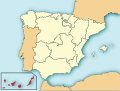
 Localización Canarias.png 467 × 394; 13 KB
-
 Localización de Canarias new.svg 686 × 518; 502 KB
-
 Locator map of Canary.png 250 × 218; 8 KB
-
 Allugu Les Palmes, Spain.png 250 × 218; 11 KB
-
 Canary Islands within Spain.png 1,388 × 972; 117 KB
-
 Canary Islands, Spain (orthographic projection).png 549 × 548; 105 KB
-
 Islas Canarias en 1800.svg 468 × 343; 473 KB
-
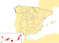
 Localización de Canarias.png 306 × 204; 7 KB
-
 Localización de Canarias.svg 578 × 374; 407 KB
-
 Localización de la Región de Canarias.svg 799 × 745; 638 KB
-
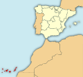
 LocalizaciónCanarias.png 304 × 202; 3 KB
-
 LocalizaciónCanarias2.png 304 × 202; 5 KB
-
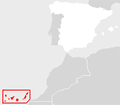
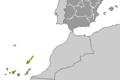
 Location Canary Islands Africa.svg 1,400 × 1,300; 2.16 MB
-
 LocationCanaries.PNG 250 × 115; 5 KB
-
 Canarias mancomunidad de municipios de montaña no costeros.svg 300 × 300; 101 KB
-
 Canary-Islands-locator.png 844 × 368; 4 KB
-
 Mapa de España (alternativo).jpg 1,611 × 1,288; 465 KB
-
 Mapa de España.jpg 2,475 × 1,288; 537 KB
-
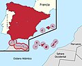
 Mapa territorios España Canarias.svg 800 × 535; 996 KB


.png)


.jpg)

